


June 3, 2025 Tropical Update Tuesday
10% of Southeast coastal low getting name this weekend

We are now in the 2025 Atlantic Hurricane Season [Day 3]. My expectation for this year is 14 named storms, 7 hurricanes, and 3 majors.
Also, thank you to [new] subscribers continuing into this Hurricane Season. My goal is to keep you informed about ongoing extreme weather events inside and outside of the tropics, but also a week (hopefully) heads up on what’s coming. I’ll be using a variety of weather modeling output, some of it may be unfamiliar, but it’s state-of-the-art and industry leading standard.
Also, even if you are not contributing to unlock the posts, you’re still seeing a preview that gives a summary. Posts will be at least daily for the next 5-months!
Tuesday’s Tropical Weather Headlines
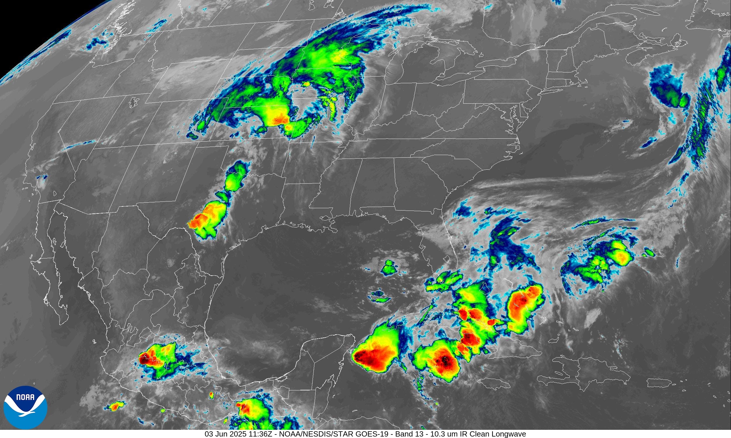
Atlantic tropical update: A 10% chance of tropical storm development expected in next 7-10 days. A frontal boundary with a non-tropical low will develop off the Southeast / Carolinas coast and could acquire tropical characteristics to be briefly named. Gulf Stream waters are quite warm and a convective flare up could be enough to burn a name.
Gulf and Caribbean — no activity expected through 10-days.
Eastern Pacific tropical update: NHC increased to 60% chance of next system in 7-days — Barbara.
Saharan Dust / Air Layer has decreased somewhat but June is almost always inhospitable for tropical storms in the Atlantic past the Lesser Antilles.
Climatology: the lack of a hurricane strength system in the Northern Hemisphere through June 4th — tomorrow — means a record for inactivity, at least since 1973. The Western Pacific usually sees several typhoons by now in early June, but nothing brewing for a while.
ECMWF 00Z | Integrated Vapor Transport | Next 10-days
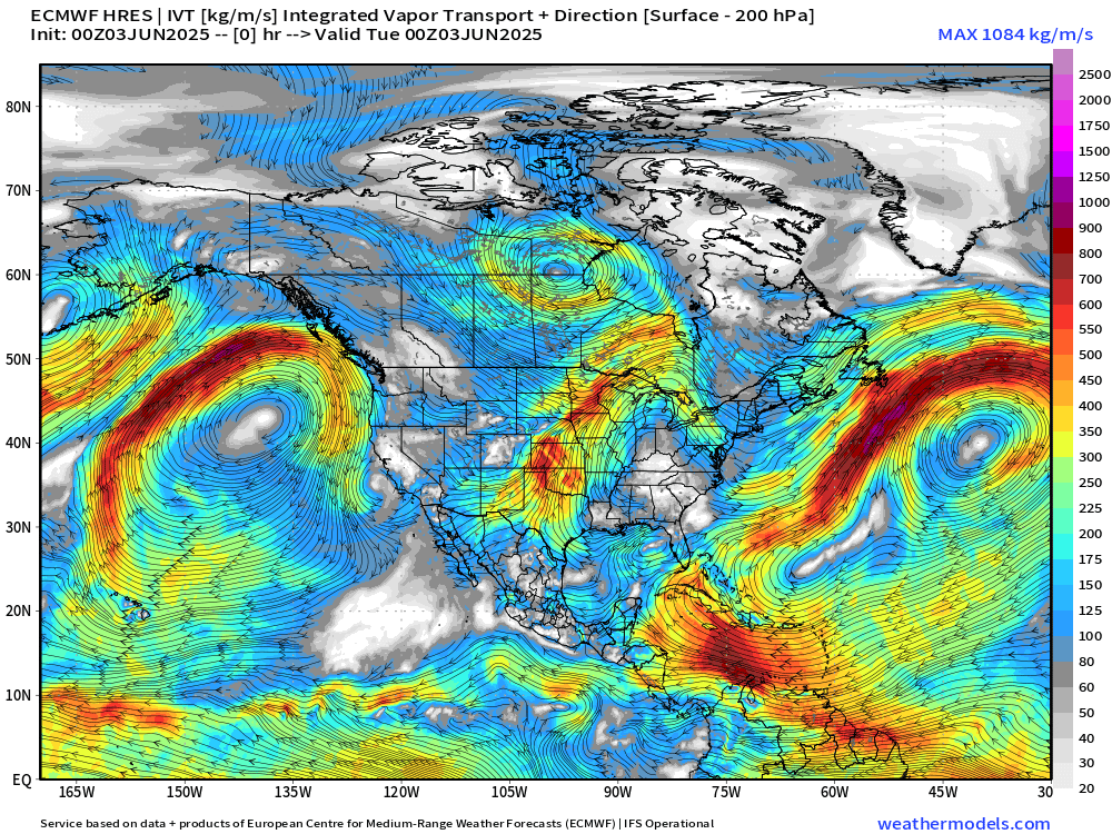
The ECMWF HRES (control) IVT model simulation for the next 10-days does not show anything spinning w/ a likely tropical designation across the Atlantic — unless/except the little swirl off the Southeast coast qualifies.
Development of “Barbara” in the Eastern Pacific still rather slow but now better than a coin flip [NHC at 60%], and the models do agree on a (briefly) named system.
A feature off the Southeast U.S. coast is related to the tail end of a decaying/stationary cold front. It’s likely that a circulation will spin-up over the very warm waters of the Gulf Stream and MAY burst convection long enough to get a 6-12 hour tropical depression or tropical storm (Andrea).
—> Many June storms last less than a day, but count just the same!
We use the ECMWF for medium-range prediction because the GFS can’t be trusted — and more beatings will not improve morale.
Recent GFS (red) vs. ECMWF Skill Scores

The GFS has been dropping-out — or falling on its face — for the past couple months with increasing frequency. While weather model skill at 5 days in the Northern Hemisphere usually decreases in the warm season due to convective scale features contributing much more to the atmospheric circulation, the skill decrease w/GFS is worse than usual.
Precipitation and MSLP Next 7-days
Keep reading with a 7-day free trial
Subscribe to Weather Trader to keep reading this post and get 7 days of free access to the full post archives.