


June 28, 2025 Hurricane Season Saturday
Tropical Depression 02L to become short-lived Tropical Storm Barry in far southern Gulf

2025 Atlantic Hurricane Season [Day 28]. My expectation for this year is 14 named storms, 7 hurricanes, and 3 majors. So far, 1 named storm, 0 hurricanes, and 0 majors.
Saturday’s Tropical Update
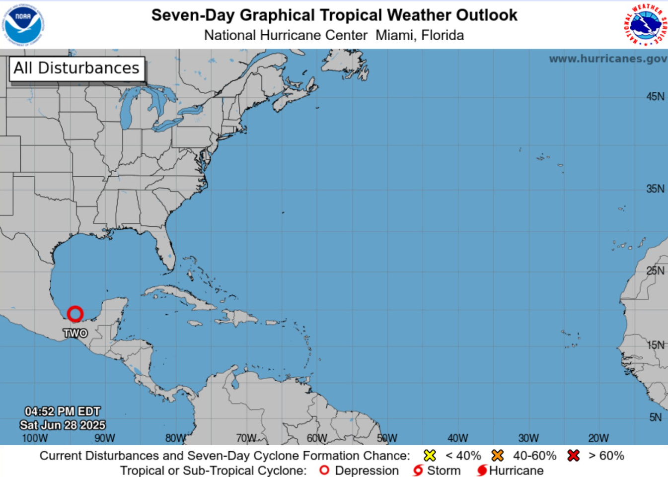
Atlantic Basin: Tropical Depression 02L formed in southern Gulf / Bay of Campeche near land. NHC expects it to become Tropical Storm Barry before making landfall on early morning Monday.
Eastern Pacific Basin: Invest 95E is still expected to become Flossie later this weekend, and satellite imagery is more in line with a tropical depression.
Western Pacific Basin: Monsoon trough could see something develop in 7-days or so, but no coherent signal yet.
Lows for Sunday Morning

70s across the southern Plains, Ohio Valley, and Southeast. 60s stretch into NYC and Boston.
Sunday High Temperatures
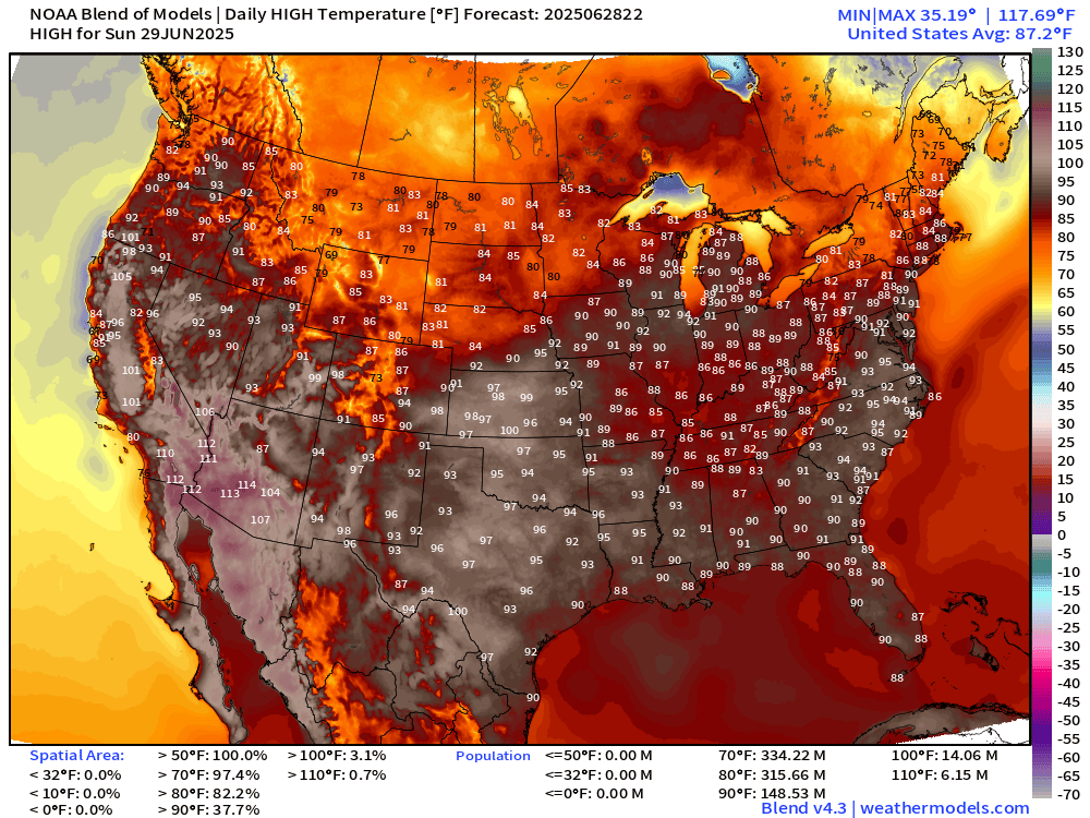
149 million reach 90°F but that’s not out of the ordinary for late-June, and similar to Saturday. Washington D.C. and NYC should be in the lower 90s. Clouds and rain will keep temperatures in check across the Tennessee River Valley.
Weather on Sunday
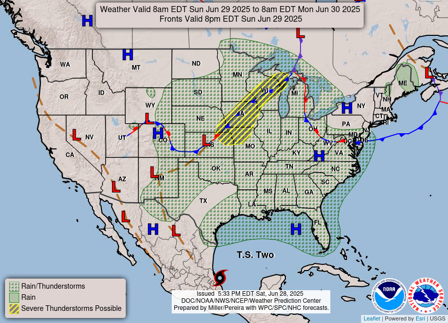
Another day of widely scattered storms across the Eastern U.S. in a typical summer air mass. Could be some severe storms along a frontal boundary in the Midwest and Great Lakes (Slight chance)
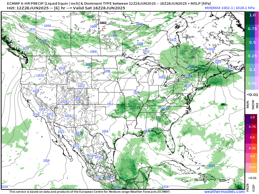
NWS WPC Precipitation Next 7-days

Mexico is quite wet — for what you can see on the map with the progression of plume of moisture containing Flossie (to be) and Barry (to be) …
The tail end of a frontal boundary stalls out along the Gulf coast by end of this next week and something could spin up from non-tropical origins into a system.
ECMWF 12Z | Integrated Vapor Transport | Next 8-days
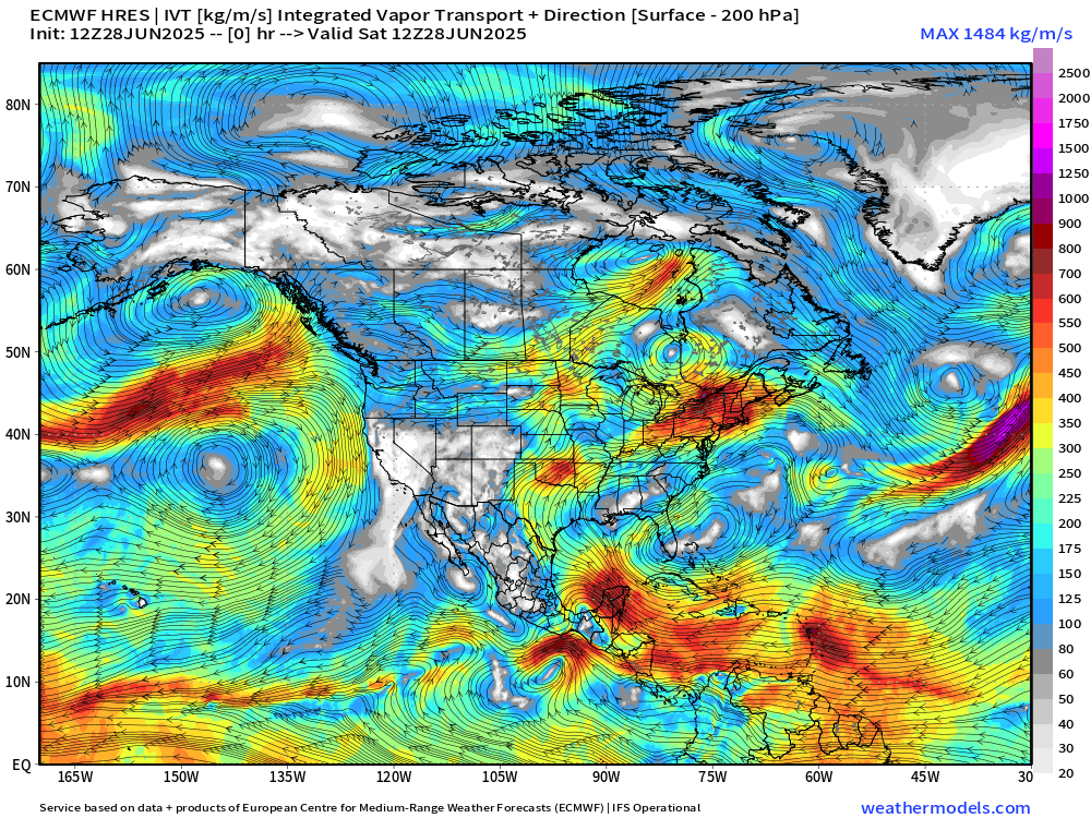
Flossie holds together if it hugs the Mexico coastline as the SST is quite warm. Another weaker system might develop out of a trailing tropical wave.
NHC declared the small area of convection in the far southern Bay of Campeche as Tropical Depression 02L and forecasts it to become Tropical Storm Barry in 12-24 hours.
Note the tail end of the frontal boundary in north Florida by Days 7-8. An area of low pressure could acquire tropical characteristics and meander off the coast. Regardless of development, heavy precipitation amounts will be fueled by the circulation and onshore flow + daytime thunderstorms.
Thank you to readers continuing into this Hurricane Season. My goal is to keep you informed about ongoing extreme weather events inside and outside of the tropics, but also a week (hopefully) heads up on what’s coming. I’ll be using a variety of weather modeling output, some of it may be unfamiliar, but it’s state-of-the-art and industry leading standard.
Next 8-days MSLP + Precipitation | ECMWF 12z
Flossie decays just west of the tip of Baja California over cool water in 7-days.
Barry is tough to see in the precip/MSLP fields as it remains rather weak ~1010 mb prior to landfall.
Otherwise, Lower 48 remains unsettled in a wet/warm pattern conducive for pop-up storms. Not seeing a “heat dome” develop per se, but much above normal temperatures in the Days 6-10 could intensify further into the 2nd week of July.
Days 6-10 Temperature Anomaly

Atlantic Basin Outlook
Tropical Storm Barry expected in 12-24 hours — then landfall around 1 AM CT Monday.
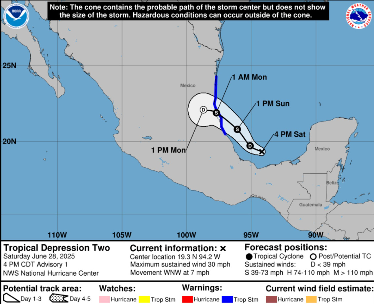
Maximum sustained winds could reach 40-50 mph at landfall with the main threat being heavy rain from the rather slow moving system embedded within deep tropical flow.
Keep reading with a 7-day free trial
Subscribe to Weather Trader to keep reading this post and get 7 days of free access to the full post archives.