


June 28, 2024 Tropical Update: Waiting on Tropical Depression 02L
Likely hurricane by early next week in the Caribbean

Waiting on advisory initiation for TD 02L or TS Beryl in the low-latitude, central tropical Atlantic. Forecasts suggest hurricane strength by early next week as it reaches the southern Lesser Antilles.
U.S. threat? Too soon to completely foreclose the possibility of 95L (Beryl) reaching the Gulf of Mexico, and threading the needle between the Yucatan and Cuba w/o getting shredded by the terrain of Hispaniola.
2. Central Tropical Atlantic (AL95)

A low pressure system located about 1500 miles east-southeast of the Windward Islands is gradually becoming better defined.  Showers and thunderstorms are also showing signs of organization, and a tropical depression or tropical storm will likely form later today or on Saturday. This system is expected to move W at 15 to 20 mph and approach the Lesser Antilles by the end of the weekend.

Interests there should monitor the progress of this system.  For more information, including gale warnings, see High Seas Forecasts issued by the National Weather Service.

* Formation chance through 48 hours...high...90 percent.
* Formation chance through 7 days...high...90 percent.

The wave [Invest 94L] over the Yucatan has a 30% chance of further development mainly in the southern Gulf of Mexico. Meanwhile, the wave following Invest 95L — presumably 96L later this weekend — currently at 20% chance in 7-days, but global models suggest genesis success on a similar track as 95L (Beryl)
Ensemble Tracks Day 3, 6, and 10


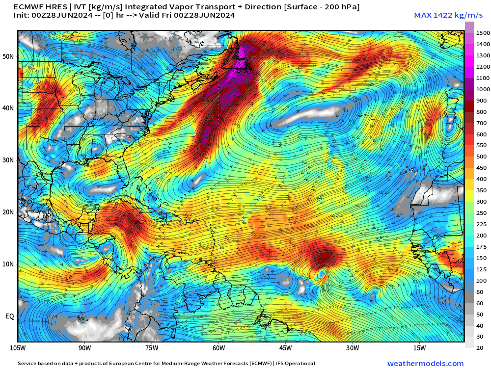
ECMWF 8-day Integrated Vapor Transport Forecast
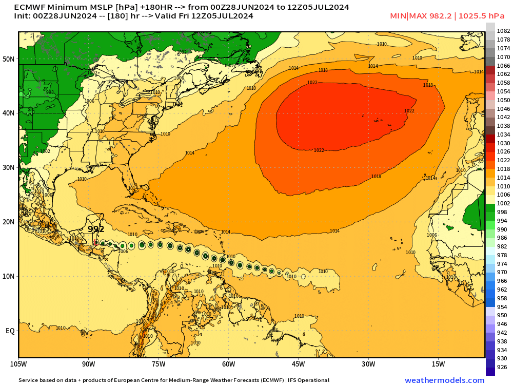
My favorite animation to show the evolution of tropical features including tropical waves. ECMWF HRES races Invest 95L to the west through the Caribbean at a more southerly track with minimum system pressure 982 mb during its lifecycle — which could be a Category 1 or 2 hurricane — with eventual disposition into Central America.
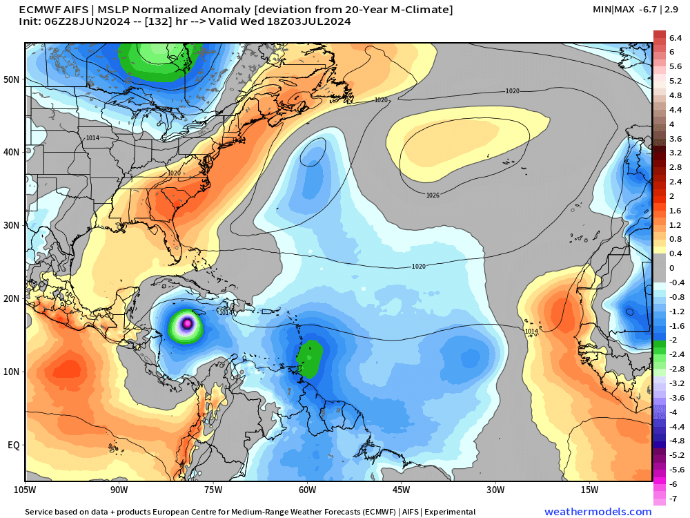
ECMWF AIFS (06z) is on top of HRES (00z) — and awaiting 12z.
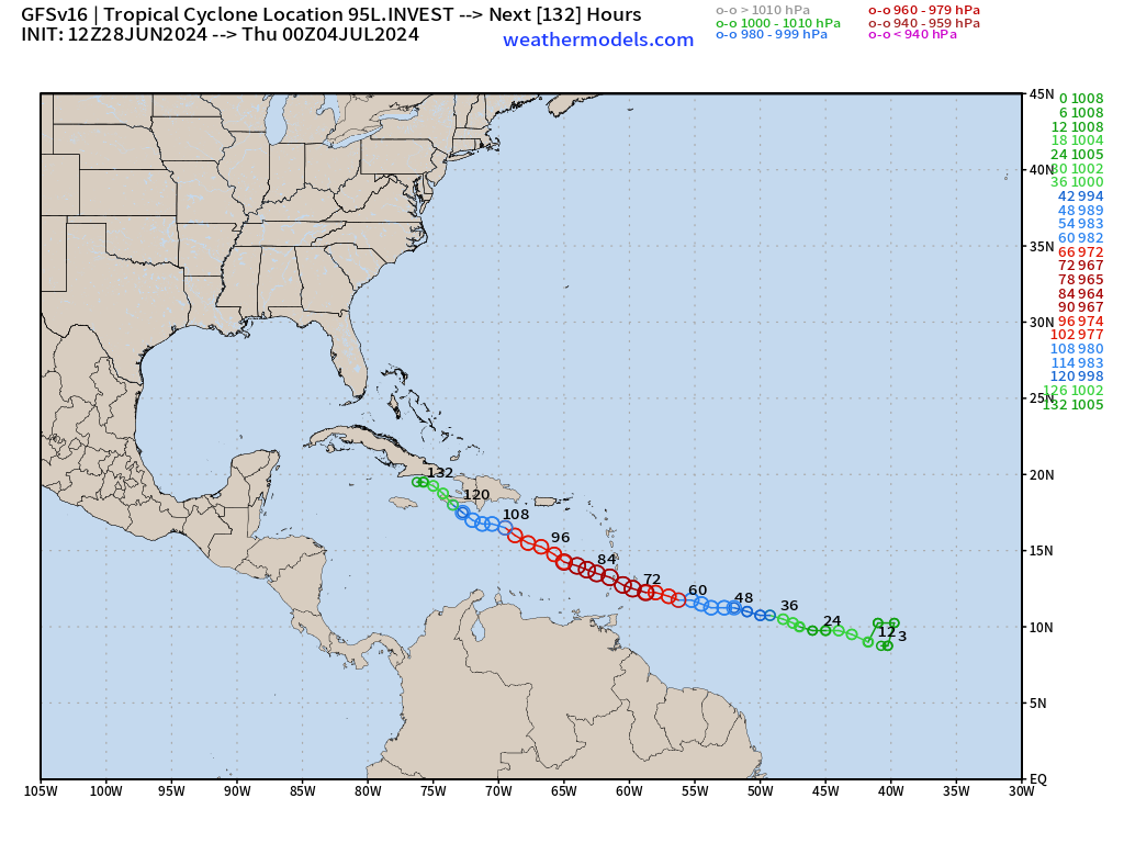
GFS 12z: is more intense with Beryl — and perhaps feels the ridge less allowing a more northerly track.
Weather Trader is a reader-supported, daily newsletter. To receive new posts and support our R&D, consider becoming a free or paid subscriber.
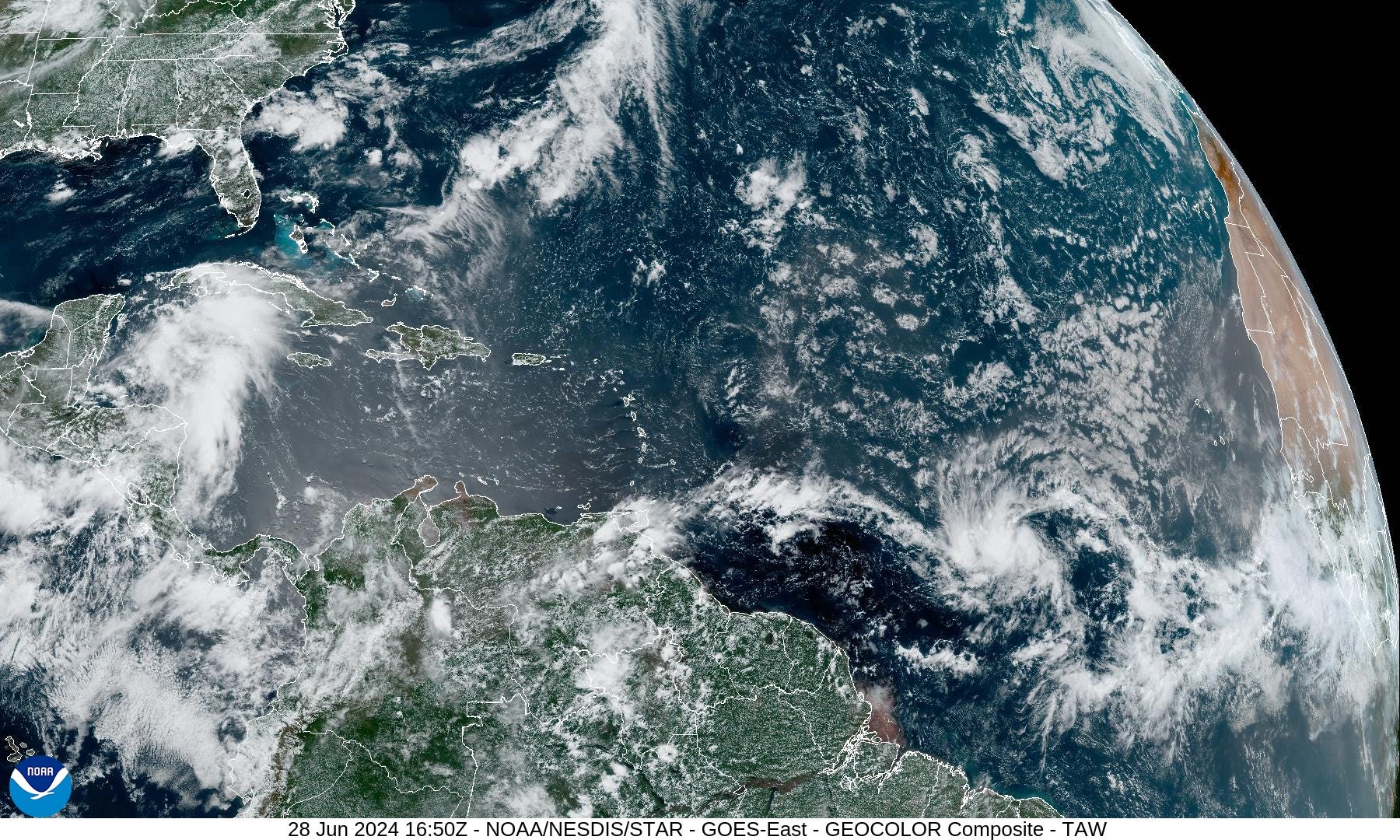
Basin Wide Visible Satellite Imagery
Saharan Dust Layer Forecast | 10 Days

The African dust in the Saharan Dust Layer is not particularly thick but is present across the tropical Atlantic, as seen in GeoColor satellite imagery behind Invest 95L. The dust should not be a major inhibiting factor on the tropical waves (95L & 96L) because of the low latitude.
Ocean Surface Temperatures

Plenty warm 28°C+ along the path of Invest 95L into the Caribbean for a major hurricane, if the system so decides to maximize its potential.
Eastern Pacific Tropical Weather Outlook
No activity expected in the next 48-hours or 7-days, or who knows how long — but the rest of June looks quiet.
Western Pacific Tropical Weather Outlook
No development expected in the next 48-hours to 7-days
Thank you to Subscribers and Supporters!
The investment in my research and development will pay off as A.I. enabled weather forecasts become a normal and indispensable part of our weather forecasting enterprise.
Maps sourced from weathermodels.com designed and innovated by yours truly! I actually create all of my content from scratch.