


June 27, 2025 Hurricane Season Friday
NHC watching Bay of Campeche this weekend but proximity to land limits chances

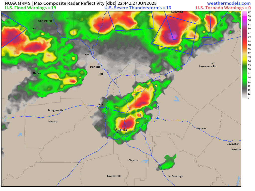
Severe Weather in Atlanta! Major hail core rolled over the airport earlier before 8 PM ET
2025 Atlantic Hurricane Season [Day 27]. My expectation for this year is 14 named storms, 7 hurricanes, and 3 majors. So far, 1 named storm, 0 hurricanes, and 0 majors.
Friday’s Tropical Update
Atlantic Basin: 30% chance of a Tropical Cyclone in the Bay of Campeche as a tropical wave moves through Central America, but I’m not buying it.
Eastern Pacific Basin: Invest 95E is still expected to become Flossie later this weekend with 90% chance within 7-days, but very slow progress.
Western Pacific Basin: Monsoon trough could see something develop in 7-days or so, but no coherent signal yet.
Lows for Saturday Morning
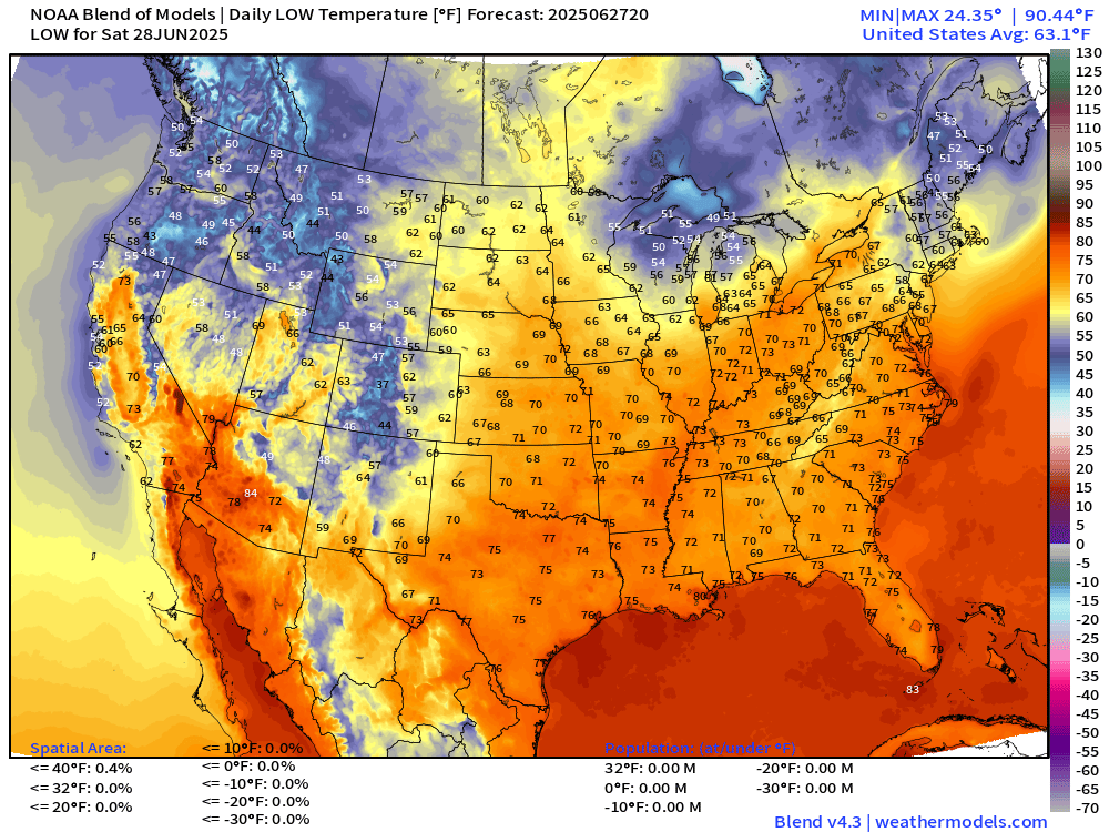
Chilly in the Great Lakes in the 40s and 50s. Similar cool temperatures in New England with 60s into NYC.
Saturday High Temperatures

150 million reach 90°F but that’s not out of the ordinary for late-June. Tolerable heat into D.C. tomorrow around 92°F instead of the low-70s all day with drizzle like today.
Weather on Saturday

NWS WPC Precipitation Next 7-days

ECMWF 12Z | Integrated Vapor Transport | Next 8-days

Invest 95E (to be Flossie) expected to become a hurricane and parallel the coast of Mexico into the Gulf of California. On the other side of Mexico in the Bay of Campeche, a weak circulation will likely stay over land and limit development. Close but no cigar.
Thank you to readers continuing into this Hurricane Season. My goal is to keep you informed about ongoing extreme weather events inside and outside of the tropics, but also a week (hopefully) heads up on what’s coming. I’ll be using a variety of weather modeling output, some of it may be unfamiliar, but it’s state-of-the-art and industry leading standard.
Next 6-days MSLP + Precipitation | ECMWF 18z

You can see the pulsing of daytime showers and storms for the next 6-days across the Lower 48. Flossie and the disturbance in the southern Gulf arrive in tandem by Sun/Mon. Heavy showers continue across the northern Gulf near Florida. Maybe watch the Gulf coast for this stationary front to develop a low pressure next week.
Atlantic Basin Outlook
Keep reading with a 7-day free trial
Subscribe to Weather Trader to keep reading this post and get 7 days of free access to the full post archives.