


June 27, 2024 Tropical Update: Invest 95L
Likely hurricane by early next week in the Caribbean

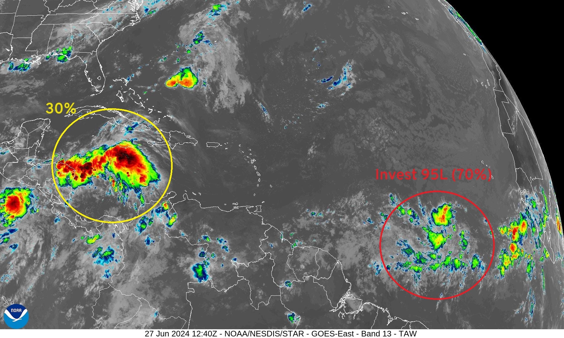
Invest 95L continues to become better organized over the central tropical Atlantic “Main Development Region” still quite a distance from the Lesser Antilles. However, the system is tracking westward rather rapidly and will reach the Caribbean later this weekend into early next week likely as a strong tropical storm or even a hurricane. The next name is Beryl.
Invest 94L in the western Caribbean near the Yucatan is less likely to develop, but a brief window may open in the southern Gulf of Mexico.
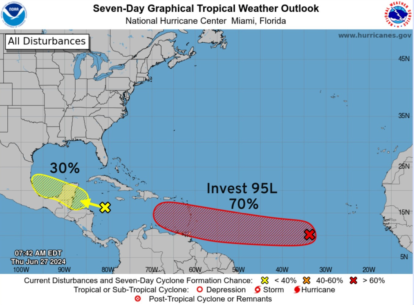
Eastern Tropical Atlantic Invest 95L

A tropical wave located several hundred miles west-southwest of the Cabo Verde Islands continues to produce disorganized shower and thunderstorm activity.

Environmental conditions are forecast to be conducive, and development of this system is anticipated.  A tropical depression or tropical storm is likely to form this weekend several hundred miles east of the Windward Islands while the system moves W at 15 to 20 mph.

* Formation chance through 48 hours...medium...40 percent.
* Formation chance through 7 days...high...70 percent.

The 00Z Ensemble tracks from ECMWF EPS [through 10-days] show wide spread around Day 7-8 in the central Caribbean with significantly stronger members to the north and weaker members (intensity) to the south.
Track is a function of intensity and the steering flow is different for weak or strong hurricanes. The black line is the ensemble mean — which isn’t an individual solution itself — the average lat/lon location. That is typically where we look to determine the “most likely” track location.
This is confirmed by the ATCF global model guidance from the other weather models including GFS, Canadian, and the mesoscales like HWRF and HAFS.
A general WNW track is likely through the Less Antilles in 5-days and then more of a northward component through Day 7 to about 15°N latitude.

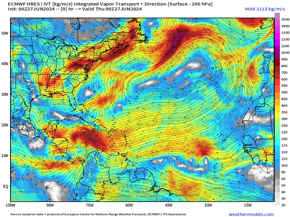
ECMWF 10-day Integrated Vapor Transport Forecast
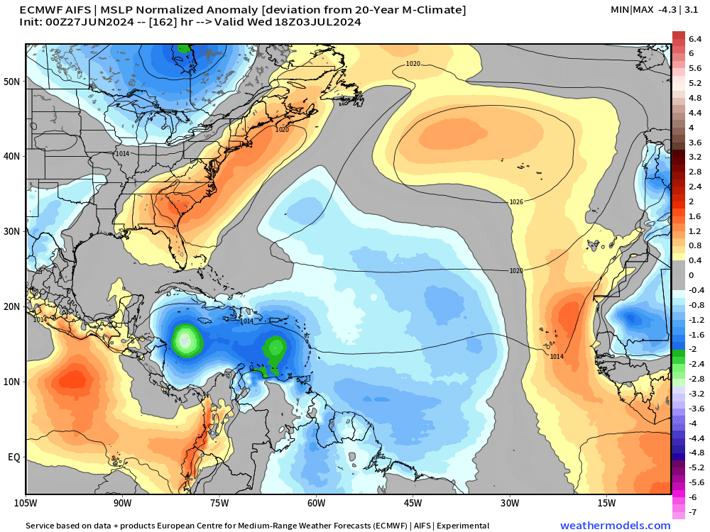
My favorite animation to show the evolution of tropical features including tropical waves. ECMWF HRES zooms Invest 95L to the west through the Caribbean at a more southerly track with minimum system pressure 987 mb — minimal hurricane — into Central America. However, as I’ve noted previously, the HRES is just 1-member out of 52 ensemble member suite. So, until the system is more organized, we shouldn’t focus on the location past Day 7. That means our landfall or potential land impacts is not known.

Worth pointing out that the ECMWF AIFS is similar to the HRES for Invest 95L.
Weather Trader is a reader-supported, daily newsletter. To receive new posts and support our R&D, consider becoming a free or paid subscriber.
Basin Wide IR Satellite Imagery
Next 14-Days EPS Ensemble Tropical Storm Tracks
Active TCs at Days 5, 7, 10, 12 [Spaghetti]

Keep reading with a 7-day free trial
Subscribe to Weather Trader to keep reading this post and get 7 days of free access to the full post archives.