


June 26, 2025 Hurricane Season Thursday
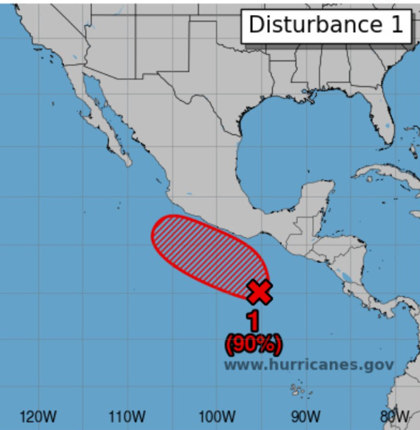
NHC watching Bay of Campeche this weekend for outside shot of tropical system

2025 Atlantic Hurricane Season [Day 26]. My expectation for this year is 14 named storms, 7 hurricanes, and 3 majors. So far, 1 named storm, 0 hurricanes, and 0 majors.
Thursday’s Tropical Update
Atlantic Basin: 20% chance of a Tropical Cyclone in the Bay of Campeche as a tropical wave moves through Central America.
Eastern Pacific Basin: Invest 95E is still expected to become Flossie later this weekend with 90% chance within 7-days.
Western Pacific Basin: Monsoon trough could see something develop in 7-days or so, but nothing imminent as TD 02W and TD 03W weaken.
Lows for Thursday Morning

Comfortable in New England in the 50s and 60s including Boston and NYC. Summer like 70s across much of the eastern U.S.
Thursday High Temperatures

Hot in the 90s in Detroit, and Cincy into the Southeast. However, only in the 70s from Boston to NYC to Washington D.C. with clouds and northeasterly flow behind a backdoor cool front.
Weather on Friday

Severe storms possible in the upper-Midwest / Dakotas, otherwise widely scattered daytime showers and storms across the entire U.S. east of the Rockies.
NWS WPC Precipitation Next 7-days

Aside from Texas and the Western U.S the pattern across the Lower 48 is again wet with unsettled daytime showers and storms in a humid atmosphere. The heat dome was a suppressing influence for 3-days cranking up the heat, but it is now long gone.
ECMWF 12Z | Integrated Vapor Transport | Next 8-days

Flossie (Invest 95E) expected to become a hurricane and parallel the coast of Mexico into the Gulf of California. On the other side of Mexico in the Bay of Campeche, a weak circulation could develop further into brief depression or storm if it can remain over water this weekend. Not much else in the Atlantic to mention.
Thank you to readers continuing into this Hurricane Season. My goal is to keep you informed about ongoing extreme weather events inside and outside of the tropics, but also a week (hopefully) heads up on what’s coming. I’ll be using a variety of weather modeling output, some of it may be unfamiliar, but it’s state-of-the-art and industry leading standard.
Next 10-days MSLP + Precipitation | ECMWF 12z

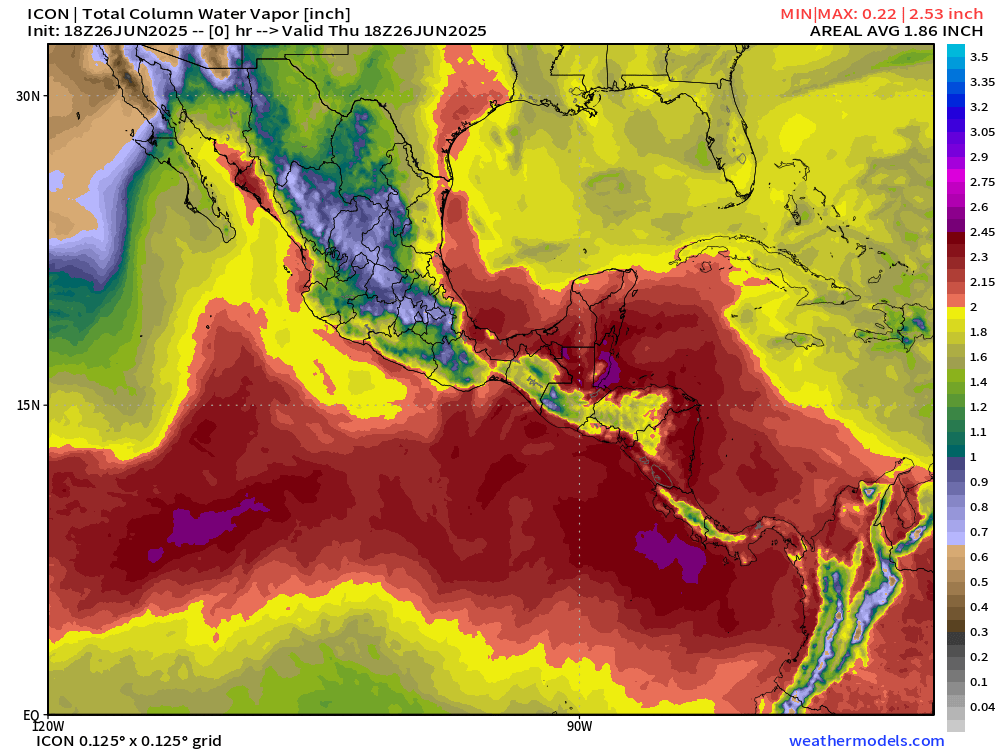
You can see the pulsing of daytime showers and storms for the next 8-days across the Lower 48. Flossie and the disturbance in the southern Gulf arrive in tandem by Sun/Mon. Heavy showers continue across the northern Gulf near Florida.
Atlantic Basin Outlook
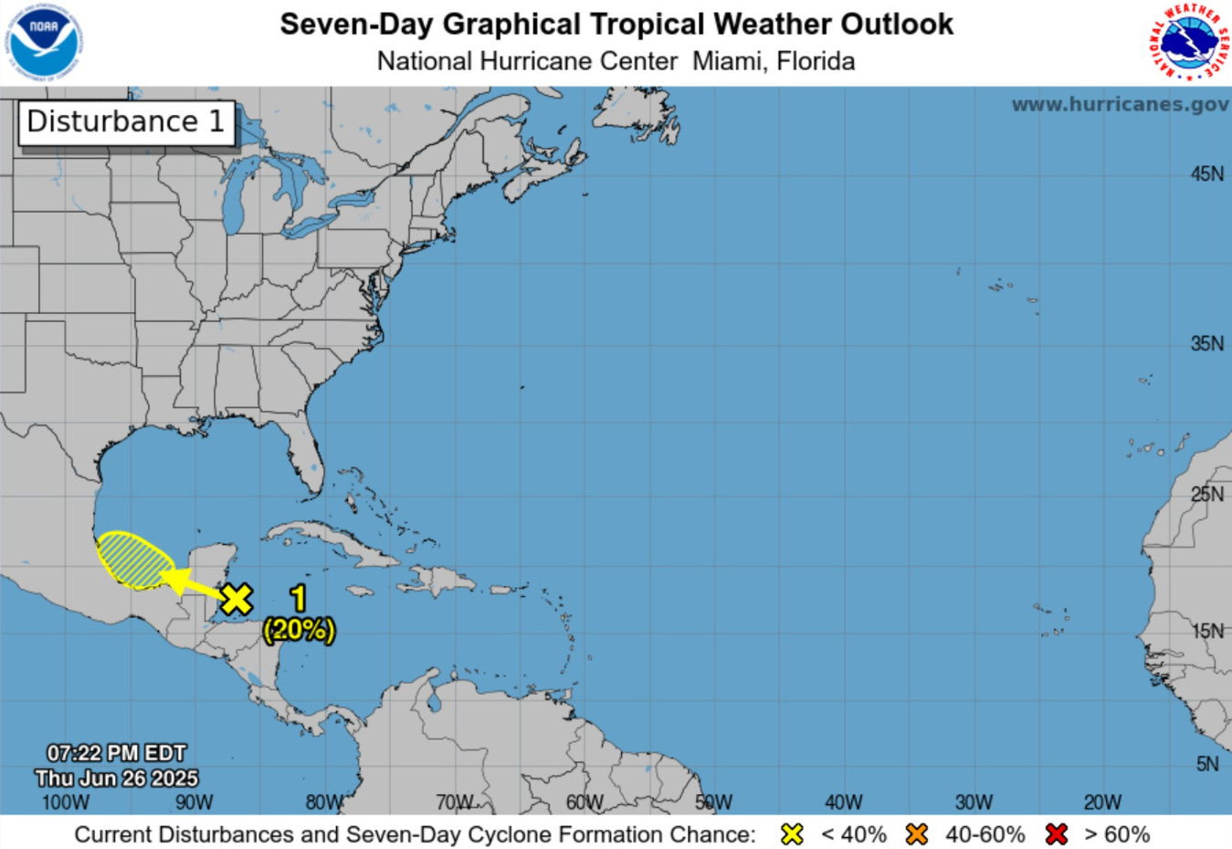
NHC has hatched a 20% for prospective development of this wave in the southern Gulf.
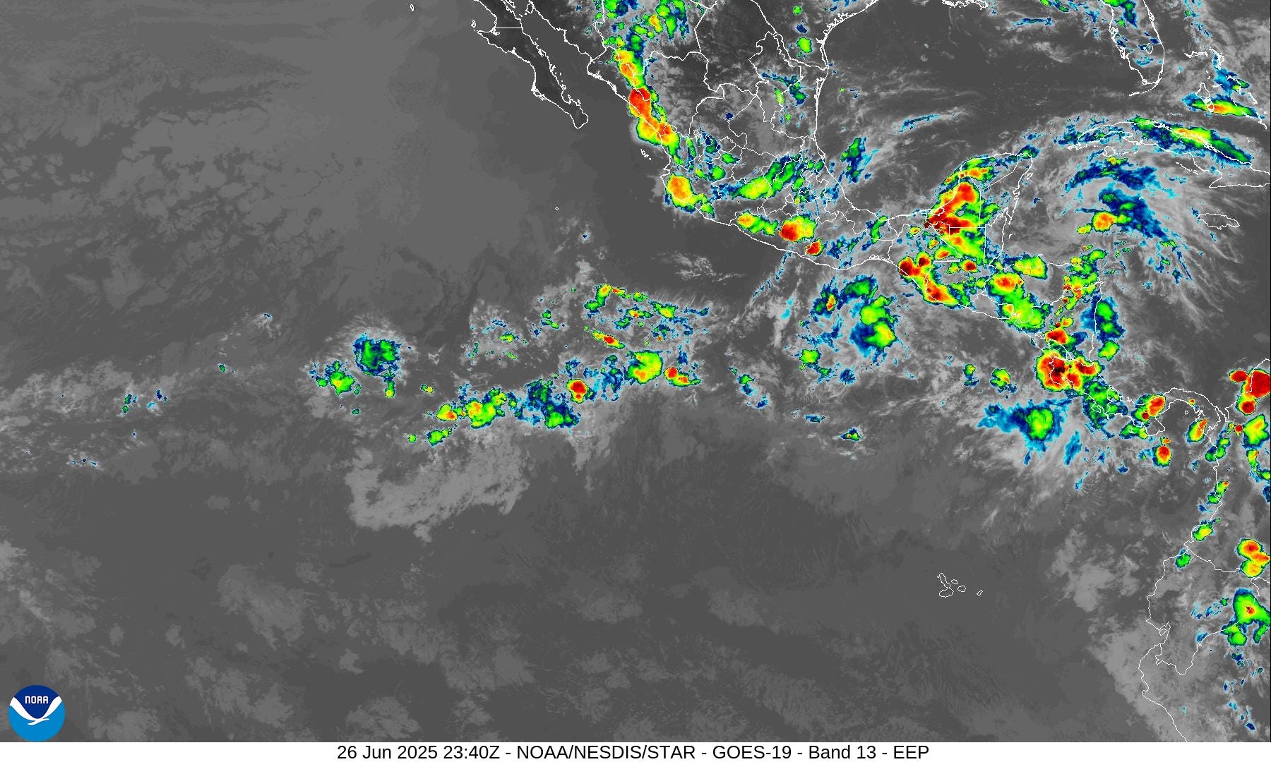
Eastern Atlantic Satellite Image
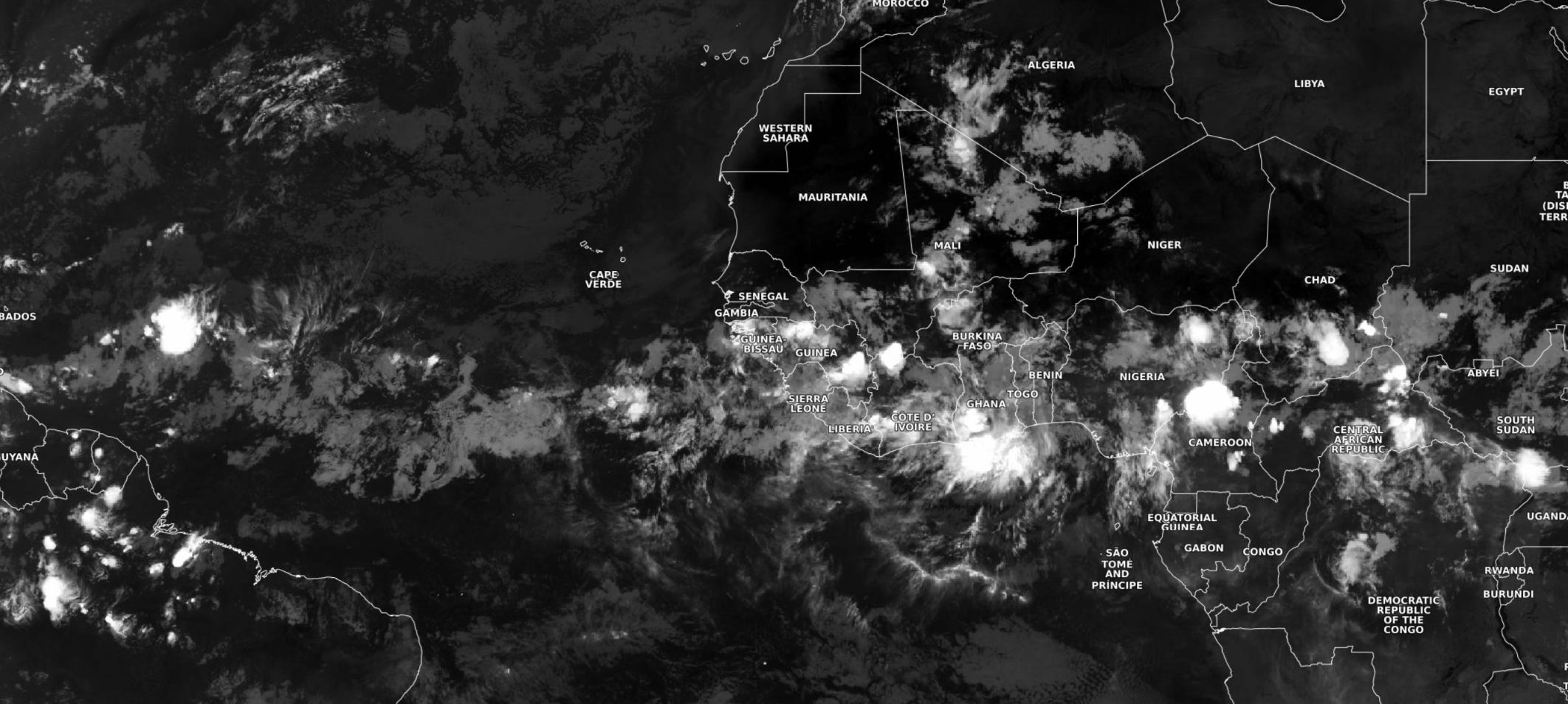
Overnight showers and storms billow over tropical Africa.
NASA GEOS-5 | 00z DUST Aerosol Optical Depth (AOD) | 8-days Forecast
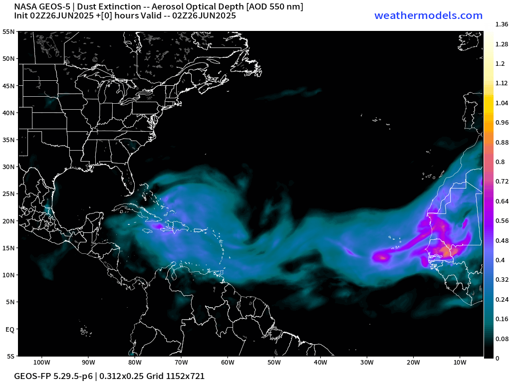
Part of the reason why the Atlantic MDR can’t get going with organized convection is perpetual plumes of dust from the Saharan. These air layers are warm and stable above the surface and inhibit convection. The plumes circulate clockwise (high pressure) with a major amount of dust heading into the Gulf over the next few days in 2 waves.
Atlantic Ocean Surface Temperatures (SST) | Anomaly


Note that ocean temperatures in a narrow band from 7°N to 12°N are 28°C in the East Atlantic MDR, but the tropical waves can’t take advantage.
Tropical Atlantic Satellite Imagery
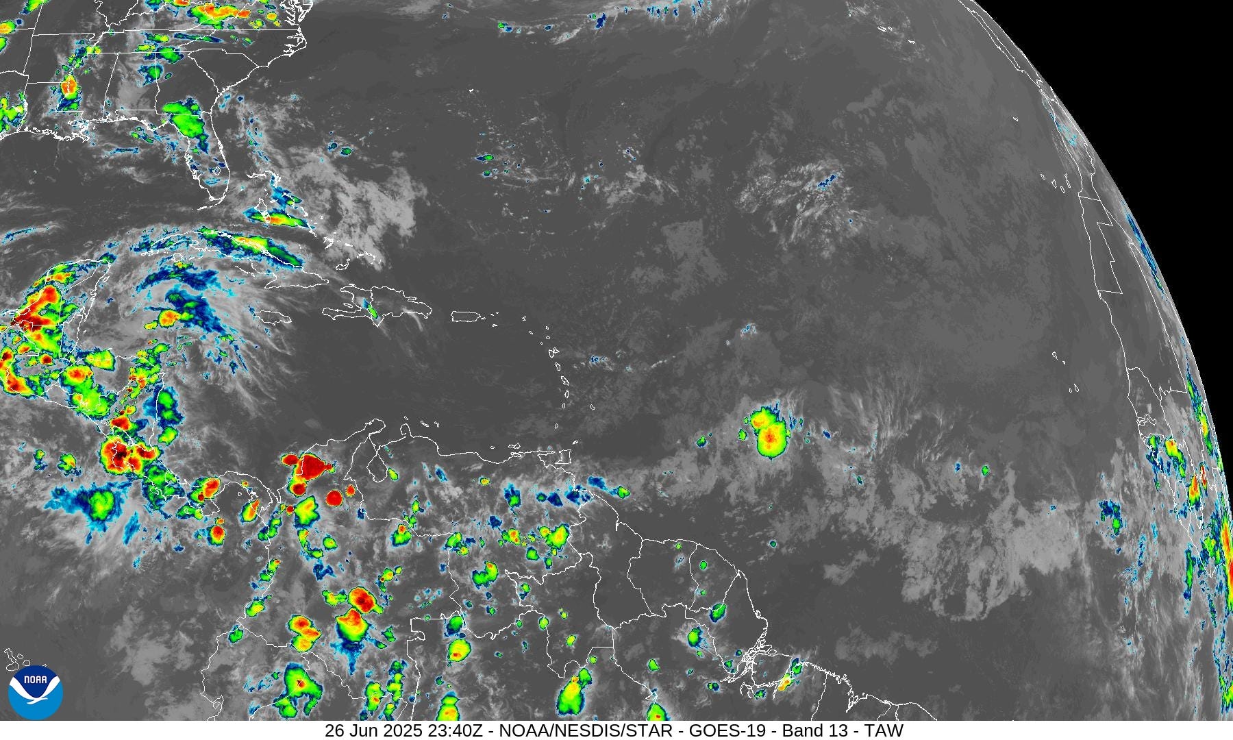
Tropical wave east of the Lesser Antilles has blown up a storm, but not organized.
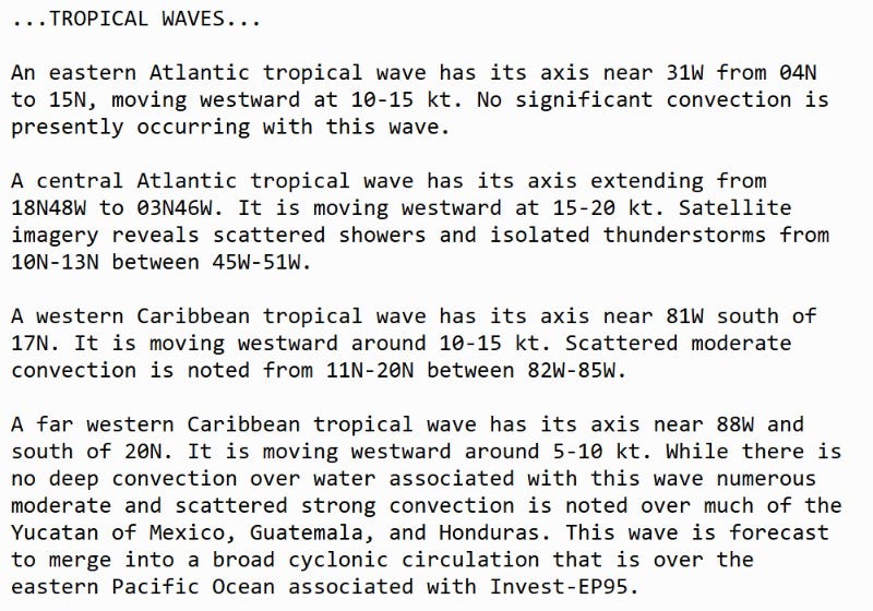
Tropical Surface Analysis | 18Z
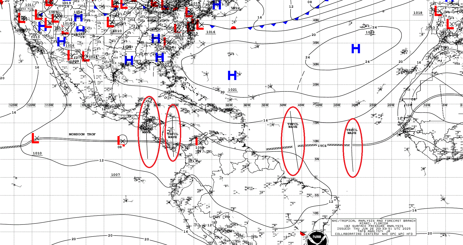
Atlantic Tropical Waves = 4 with the western two in the Caribbean contributing to Flossie and perhaps the Bay of Campeche disturbance
Atlantic Precipitable Water | Next 5 days
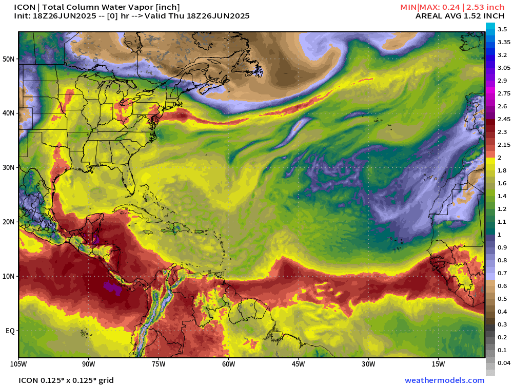
The ITCZ is suppressed to the coast of South America in 5-days with the leading edge of a powerful SAL … the dry air in the central Atlantic generally comes from the NE around the Azores High with some African influence. Two SAL plow through the Caribbean into the Gulf of Mexico in next 3-4 days.
Medium range ensemble model outlook
These are 51-realizations of the same model with different initial conditions. Each ensemble gets equal ~2% weight in a mean calculation.
New ECMWF AIFS-Ensembles 12z | 3-Days | All Storm Tracks
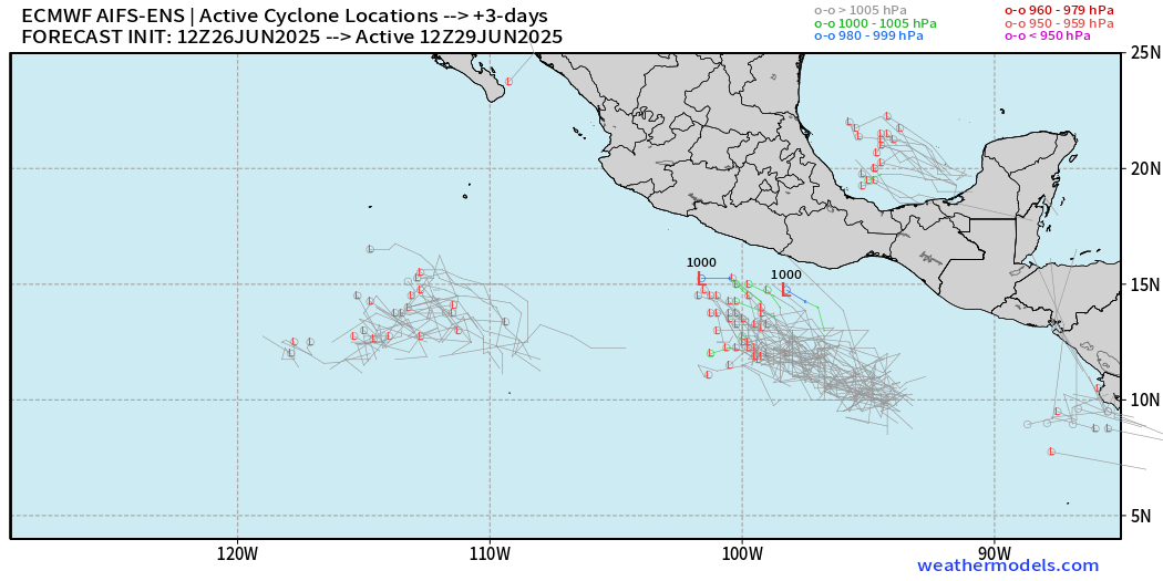
Maybe a weak TD in Bay of Campeche by Sun/Mon
New ECMWF AIFS-Ensembles | 10-Days | Active Storm Tracks

New ECMWF AIFS-Ensembles | 15-Days | Active Storm Tracks

Otherwise, a blank slate through 15-days and July 11th.
Eastern Pacific Tropical Update


NHC has hatched a 90% area for Flossie in 7-days — expected development in the next several days, but I’ve said this for a week now. Ocean temperatures are cool south of the tip of Baja California, so the current ATCF tracks would weaken it quickly to a remnant low — except for HCCA — showing an eastward bias allowing for it to stay over warm water longer into the Gulf of California.

If/when Flossie develops, it will parallel the Mexican coast and could become a hurricane over warmest waters of the EPAC basin.
Precipitable Water Next 5 days
The swirl in the Bay of Campeche west of the Yucatan is not much to look at with ICON 18z, but Flossie develops nicely into a hurricane.
New ECMWF 18z AIFS-Ensembles | Eastern Pacific
5-Days Active Storm Tracks

The AIFS-ENS are not too excited about the intensity of Flossie, but that might be a bias inherent to the trained model based upon ERA5 — still hurricane pressures.
Western Pacific Tropical Update
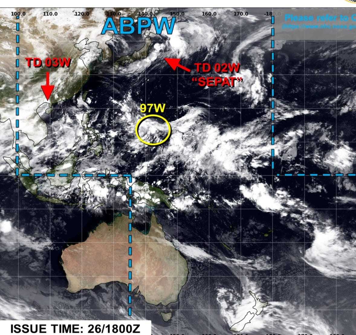
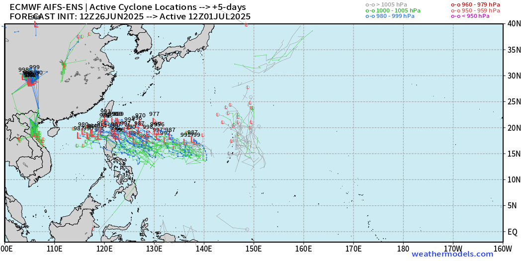
Invest 97W is being watched but LOW chance of development as the global models are not in agreement about what comes out of the monsoon trough.

Eventually toward Day 7-8, ECMWF 12z HRES develops a typhoon and takes it ENE out to sea. The AIFS-ENS tell a different story — suggesting a high uncertainty / low predictability period ahead in the WPAC.
Day 5 Ensembles | Active Storm Tracks
Day 7 Ensembles | Active Storm Tracks
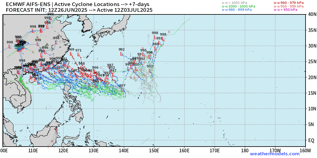
The monsoon trough might spawn a tropical system — or it may not. The area along 20°N seems to be favored, but nothing imminent.
Ryan’s Notes:
June 2025: We use the ECMWF for medium-range prediction because the GFS can’t be trusted due to false-alarm bias, and unrealistic intensification of tropical convection into spurious (ghost) storms. I don’t agree this is a good thing like CNN.
We can look at the GFS every day for weeks and see a modeled tropical storm or hurricane in the Caribbean or Gulf especially after Day 10. However, this is a known bias/false alarm problem with spurious convective — vorticity spin-ups due to the convective parameterization or estimation of vorticity generation due to intense diabatic heating. Perhaps it’s worthwhile to show what will not happen.
Maps sourced from weathermodels.com designed and innovated by yours truly! Please subscribe there for real-time access to the newest maps, charts from all of the weather models including ECMWF.