


June 26, 2024 Tropical Update: Ensemble Watching
Ensembles show likely tropical storm or hurricane in 7-10 days

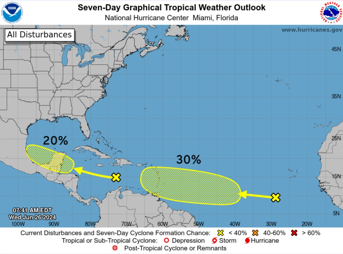
Headlines for Wednesday
X is watching the development of a tropical wave into the central tropical Atlantic Main Development Region (MDR) with a 30% chance according to NHC in the next 7-days. Our main tool for medium/long range hurricane development is weather model ensembles like ECMWF EPS and NOAA GEFS. Both are showing a significant signal (most members) with a tropical storm up to major hurricane. \
ECMWF 10-day Integrated Vapor Transport Forecast

My favorite animation to show the evolution of tropical features including tropical waves. The potential tropical wave to develop — as shown in ensembles — reaches the Greater Antilles in 7-8 day time frame but the ECMWF HRES (00z) did not develop. It is just one ensemble (unperturbed) out of the 52-total members, so we should not put any more than 2% weight.
Weather Trader is a reader-supported, daily newsletter. To receive new posts and support our R&D, consider becoming a free or paid subscriber.
Synoptic Analysis [June 26, 2024 06Z]
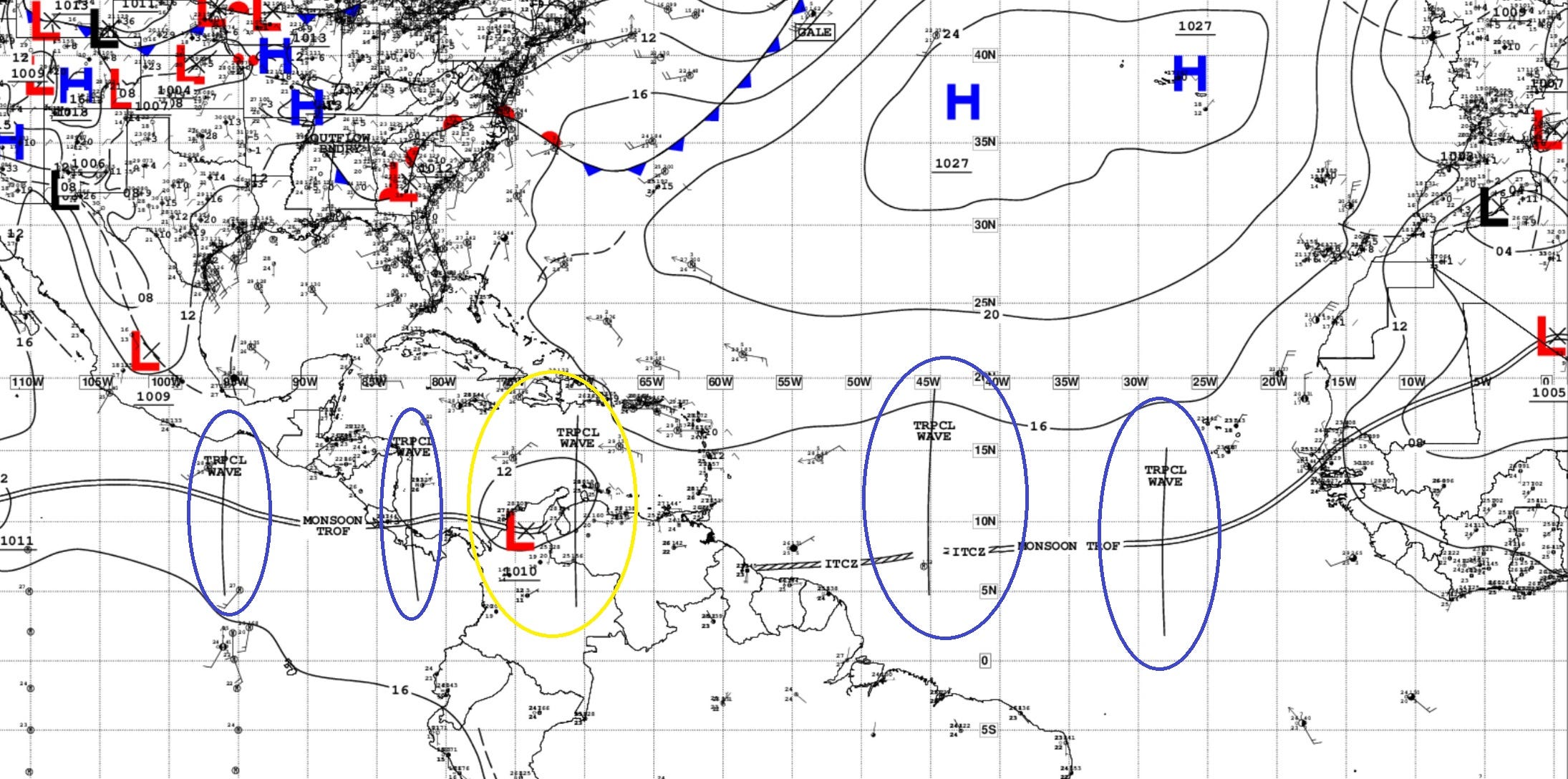
4 ATLANTIC TROPICAL WAVES

28°W:  A tropical wave is in the E Atlantic extending from 3N to 15N with axis near 28W, moving westward at 5 to 10 kt. Scattered moderate convection is noted from 4N to 11N between 23W and 36W.

45°W:  A tropical wave is in the central Atlantic extending from 5N to 19N with axis near 45W, moving westward at 5 to 10 kt. Widely scattered moderate convection is noted from 2N to 10N between 36W and 50W.

71°W:  A tropical wave is moving across the central Caribbean with axis S of 17N near 71W, moving westward around 10 kt. Scattered moderate convection is from 13N to 19N between 67W and 77W.

82°W:  A tropical wave is in the W Caribbean S of 16N with axis near 82W, moving W at 10-15 kt. Scattered moderate isolated strong convection is S of 17N W of 79W.
1.  Western Caribbean/Southwestern Gulf of Mexico (AL94): [10% - 20%]

A tropical wave over the central Caribbean Sea is producing disorganized shower activity while it moves quickly westward at around 25 mph.

Environmental conditions could become more conducive for some gradual development in a couple of days over the western Caribbean Sea or over the southwestern Gulf of Mexico during the weekend.

* Formation chance through 48 hours...low...10 percent.
* Formation chance through 7 days...low...20 percent.
2.  Eastern Tropical Atlantic: [30%]

A tropical wave located a few hundred miles southwest of the Cabo Verde Islands is producing disorganized showers and thunderstorms.  Some slow development of this system is possible during the next several days while it moves generally westward across the central and western tropical Atlantic at 15 to 20 mph.

* Formation chance through 48 hours...low...near 0 percent.
* Formation chance through 7 days...low...30 percent.
Basin Wide IR Satellite Imagery
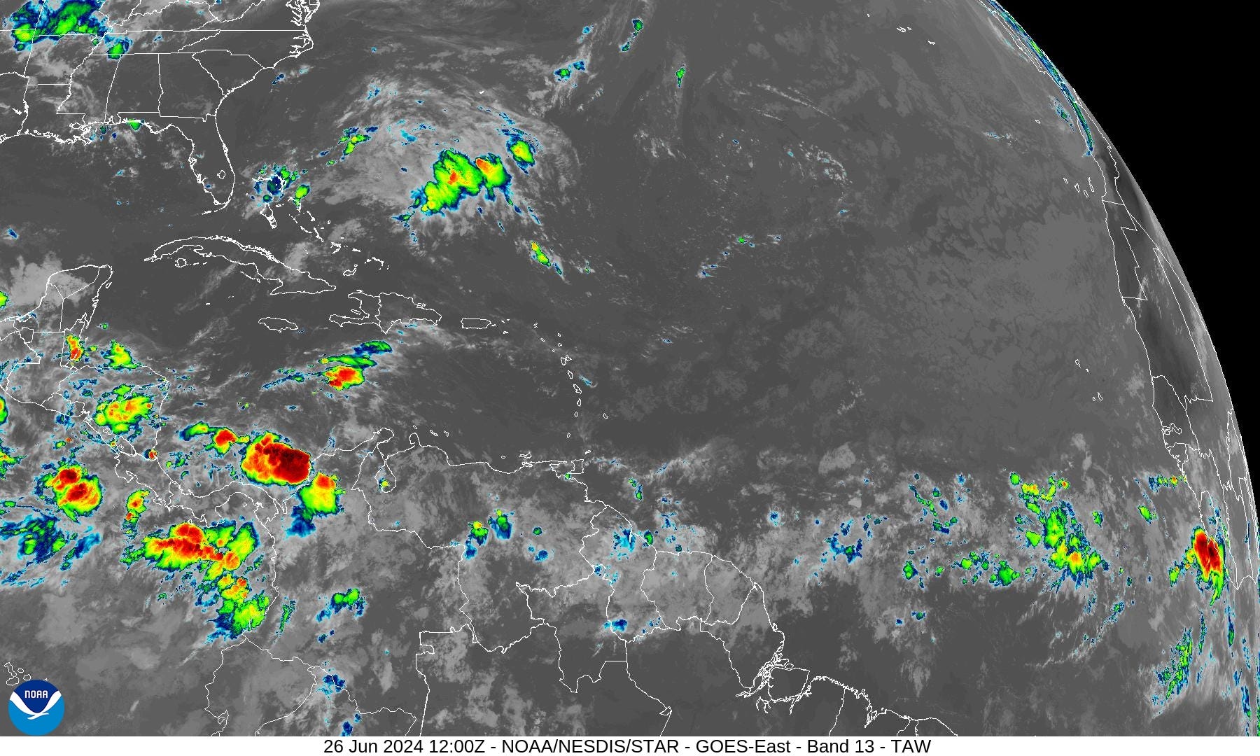
Invest 94L in the central Caribbean does not show much in the way of organization.
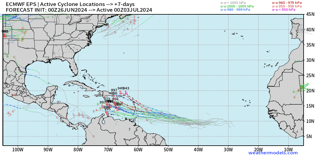
Next 14-Days EPS Ensemble Tropical Storm Tracks
Active TCs at Days 7, 10, and 14 [Spaghetti]
Keep reading with a 7-day free trial
Subscribe to Weather Trader to keep reading this post and get 7 days of free access to the full post archives.