


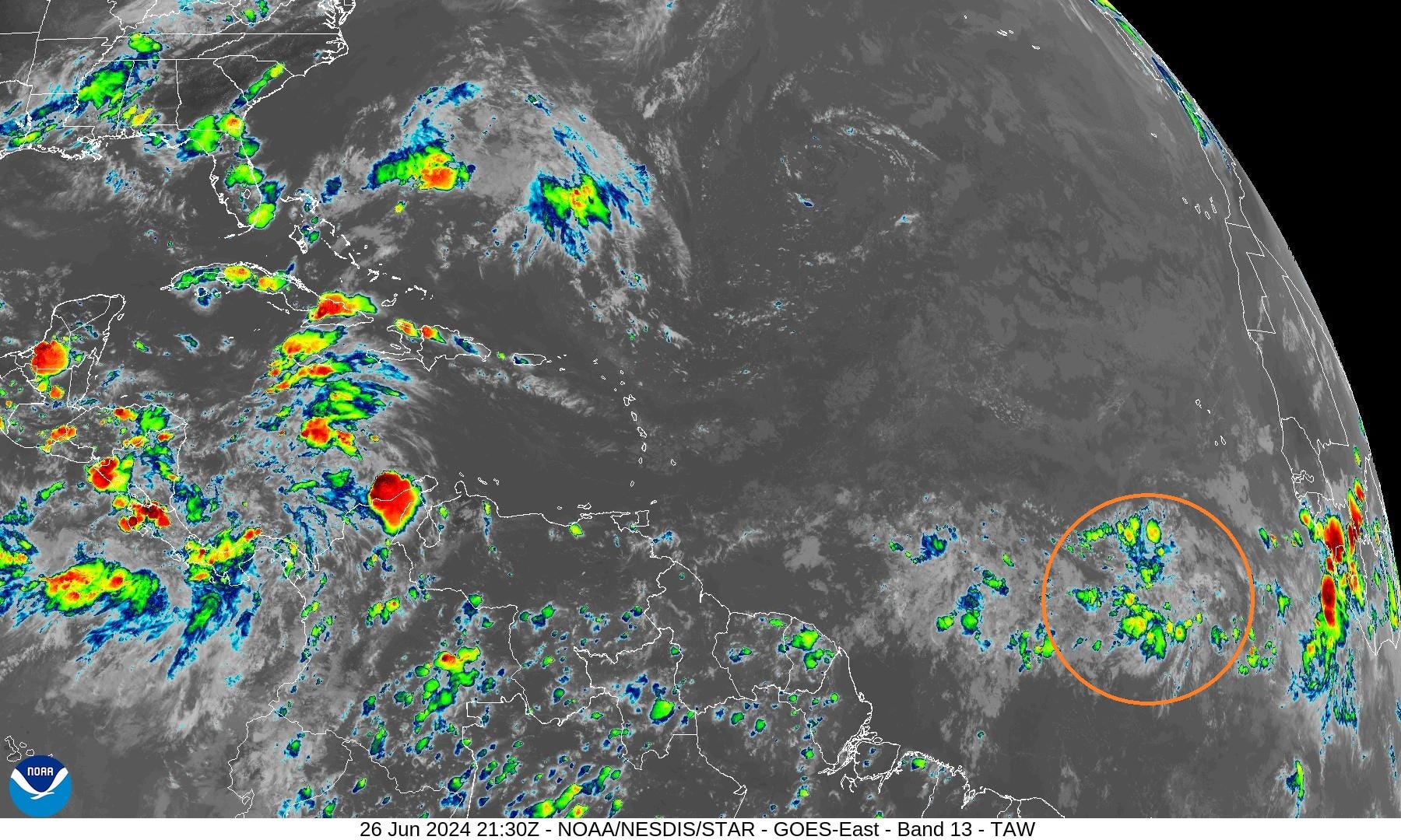
June 26, 2024 Invest 95L Designated
Any U.S. impacts 10-14 days away

Quick evening update to show increasing chance of development with Invest 95L in the far tropical Atlantic.
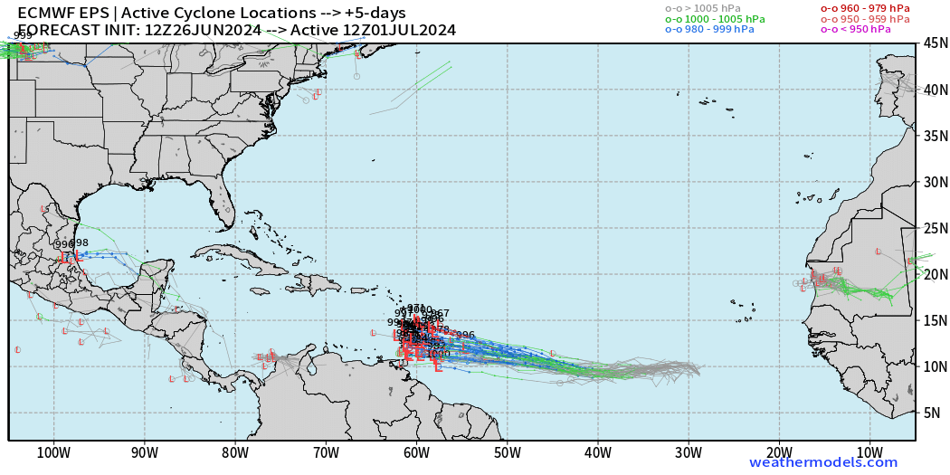
The ECMWF suite of ensembles at 12z including the HRES and the AIFS version all show development of Invest 95L into a tropical storm and in many cases a major hurricane. However, the track is uncertain past the Lesser Antilles. However, interests along the Gulf Coast to Florida Atlantic coastline should monitor the Tropical Update for the next 5-days or so before we figure out where Invest 95L (next name is Beryl) ends up.
ECMWF 10-day Integrated Vapor Transport Forecast
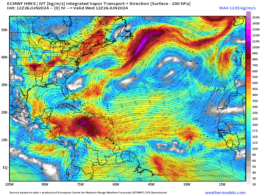
My favorite animation to show the evolution of tropical features including tropical waves. The potential tropical wave to develop — as shown in ensembles — reaches the Greater Antilles in 6-7 day time frame and intensifies into a major hurricane thereafter similar to 2005.
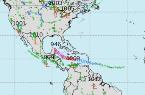
ECMWF HRES 12z down to 946 mb in the Yucatan at Day 10.
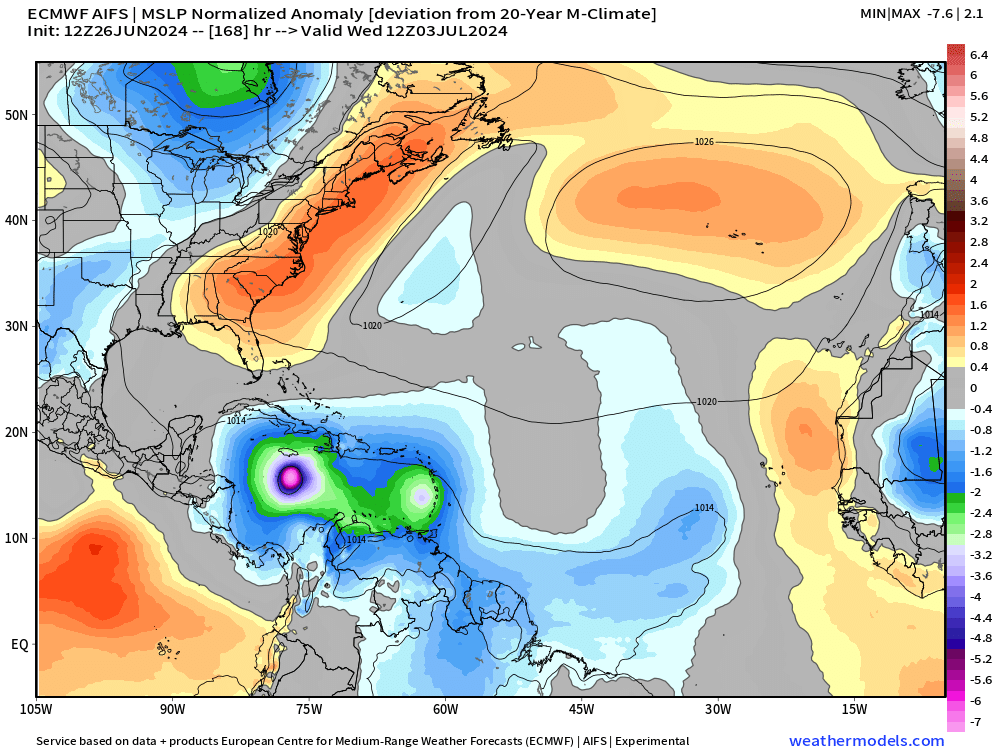
ECMWF AIFS at Day 7 location (intensity is biased low at this coarse model resolution)
Weather Trader is a reader-supported, daily newsletter. To receive new posts and support our R&D, consider becoming a free or paid subscriber.
Basin Wide IR Satellite Imagery
Next 14-Days EPS Ensemble Tropical Storm Tracks
Active TCs at Days 5, 8, 12, 14 [Spaghetti]
Keep reading with a 7-day free trial
Subscribe to Weather Trader to keep reading this post and get 7 days of free access to the full post archives.