


June 24, 2025 Hurricane Season Tuesday
Andrea named but has already sputtered

2025 Atlantic Hurricane Season [Day 24]. My expectation for this year is 14 named storms, 7 hurricanes, and 3 majors. So far, 1 named storms, 0 hurricane, and 0 majors.
Tuesday’s Tropical Update
Atlantic Basin: Tropical Storm Andrea (01L) was named perhaps a little late as the system probably qualified yesterday. It’s now a remnant low.
Eastern Pacific Basin: Invest 95E is expected to become Flossie in 3-4 days, but the process is slow — NHC at 80%.
Western Pacific Basin: Invest 96W high chance of becoming a storm [Mun] before impacting China in 24-36 hours. A powerful typhoon will develop in 7-8 days east of the Philippines and could track near Taiwan.
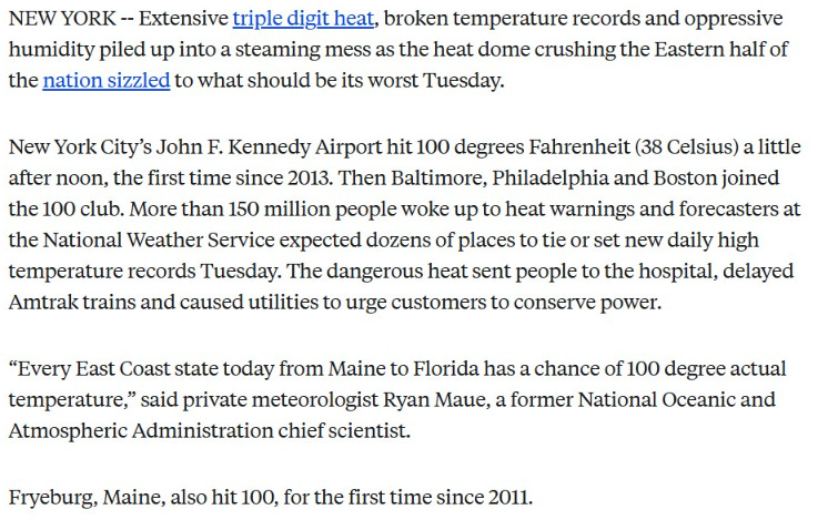
Heat Dome Day 2 was quite amazing with 102°F recorded at Boston Logan with westerly winds shunting the sea breeze offshore. That was a June monthly record. Only 99°F at NYC Central Park while JFK airport hit 102°F.
Today’s news story from AP Wire —> Link with some of my help.
Next 10-days AIFS-Single (18z) | 500 mb Height Anomaly

The ridge will weaken on Wednesday but won’t completely break down across the Northeast until Thursday when a strong backdoor cool front sweeps away the heat instead with 70s — maybe for highs on Friday in NYC, but cloud cover and rainfall.
Lows for Wednesday Morning
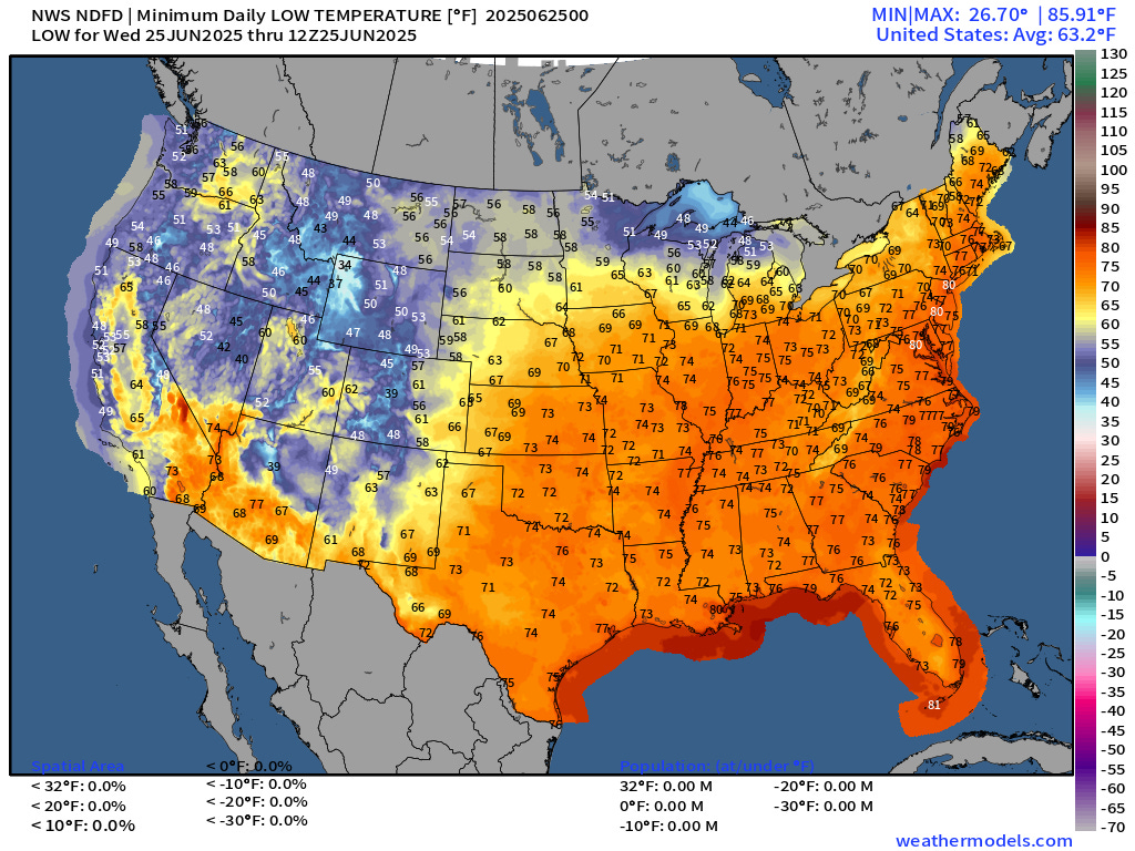
Mostly in the 70s across the Eastern U.S. but folks in the Great Lakes can open the windows. 80s in the big cities yet again for morning lows.
Wednesday High Temperatures

Still well into the 90s tomorrow from Atlanta to Washington D.C. NYC and maybe Boston with 200 million at/above 90°F.


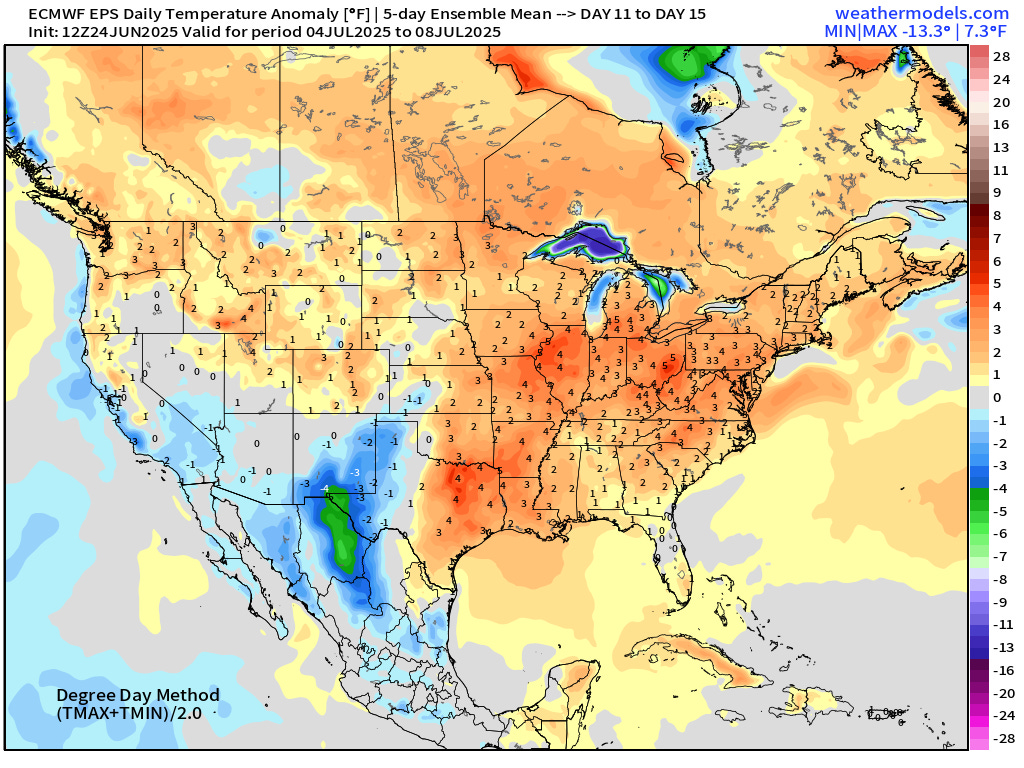
5-Day Temperature Anomaly Chunks | ECMWF Ensemble Mean 12z | Next 15-days check on Lower 48 Temperatures (Energy concerns)
Days 1-5: June 24-28

Days 6-10: June 29 - July 3

Days 11-15: July 3 - 8
NWS WPC Precipitation Next 7-days

ECMWF 12Z | Integrated Vapor Transport | Next 10-days
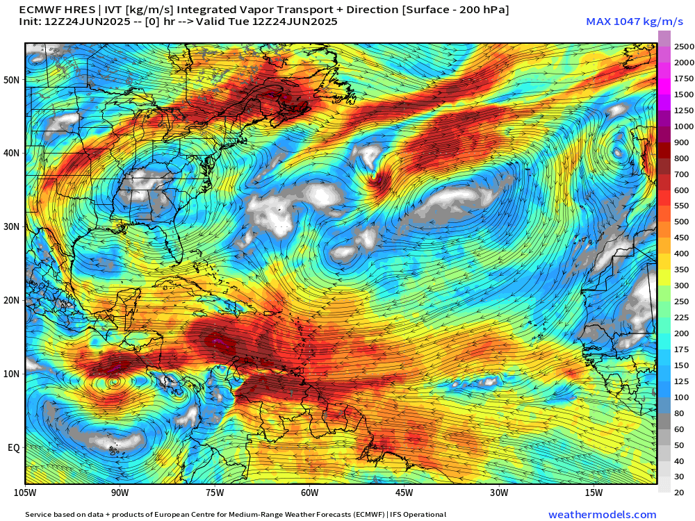
High pressure slides westward out of the Atlantic into the Southeast pushing moisture from the ocean onshore raising the rain/storm chances considerably — and busting the heat wave.
The surge of Caribbean tropical moisture continues but there are some breaks in the intensity due to Saharan Air Layer (SAL) influence.
Flossie is STILL expected to form and parallel the Mexico coast into the weekend.
Thank you to readers continuing into this Hurricane Season. My goal is to keep you informed about ongoing extreme weather events inside and outside of the tropics, but also a week (hopefully) heads up on what’s coming. I’ll be using a variety of weather modeling output, some of it may be unfamiliar, but it’s state-of-the-art and industry leading standard.
No tropical cyclone formation likely in the Atlantic basin in the next 7 days+
Keep reading with a 7-day free trial
Subscribe to Weather Trader to keep reading this post and get 7 days of free access to the full post archives.