


June 24, 2024 Tropical Update
Ensembles show wave development in deep tropics next week

Headlines for Monday
Tropical across the globe remain quiet.
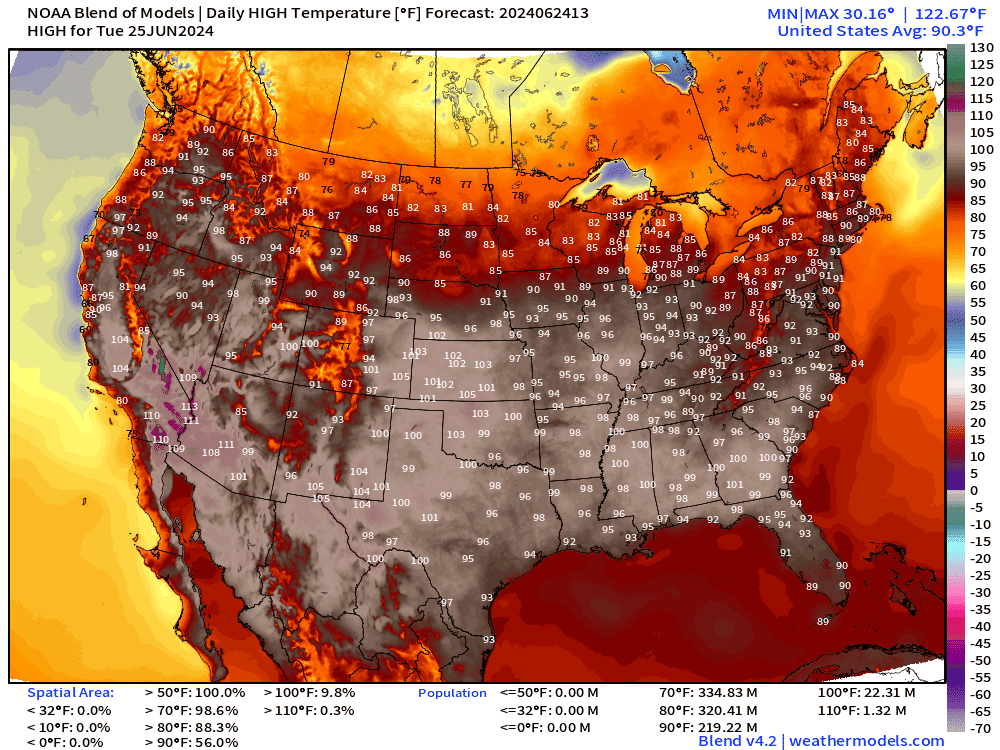
Extreme heat continues across the southern U.S. with a brief burst into the upper-90s again for the Mid-Atlantic on Wednesday before a front cools down back into the 80s.
ECMWF 10-day Integrated Vapor Transport Forecast

My favorite animation to show the evolution of tropical features including tropical waves. The potential tropical wave to develop — as shown in ensembles — reaches the Lesser Antilles in the 8-10 day time frame. Worth watching …
Weather Trader is a reader-supported, daily newsletter. To receive new posts and support our R&D, consider becoming a free or paid subscriber.
Synoptic Analysis [June 24, 2024 06Z]
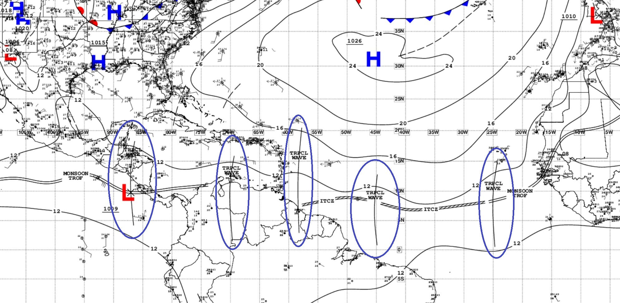
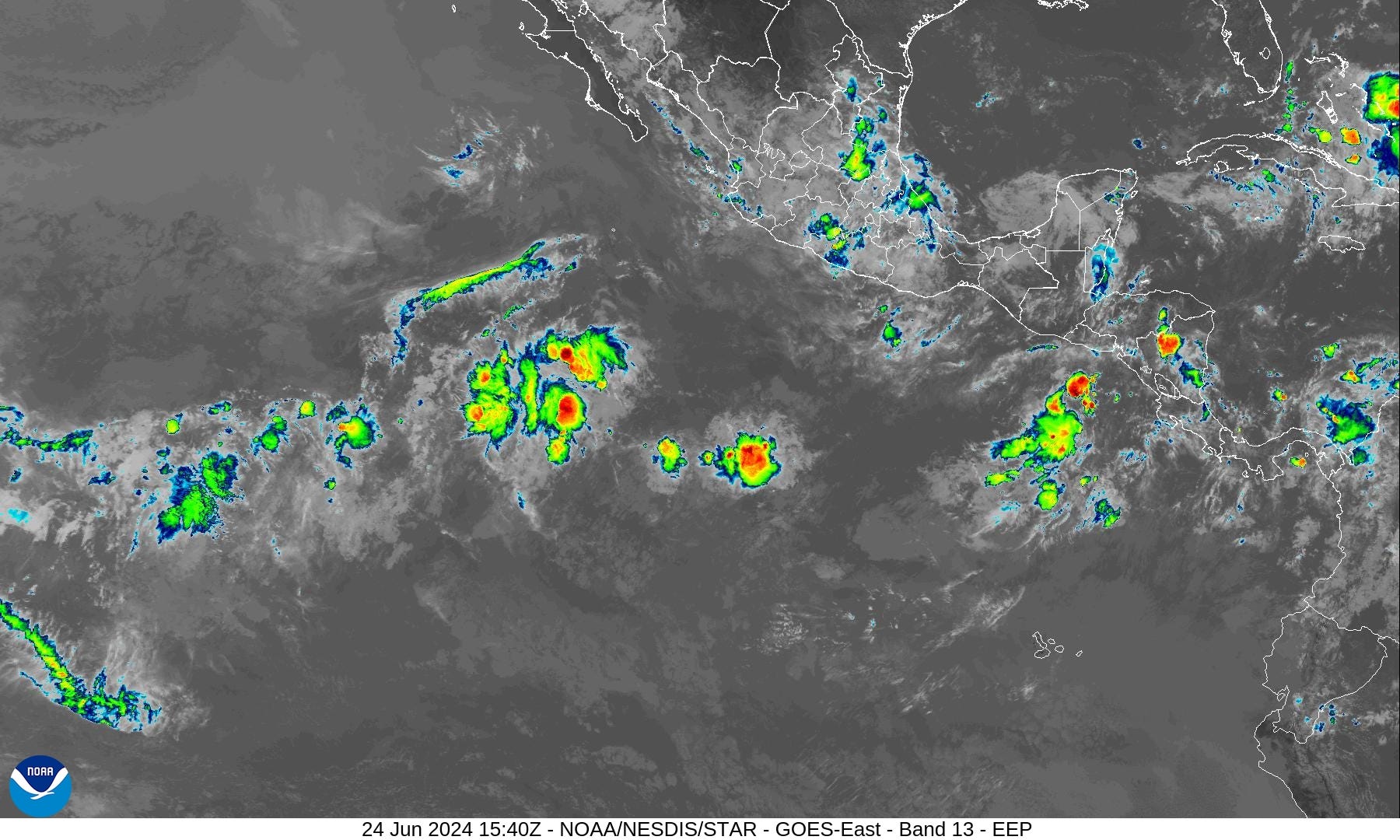
5 TROPICAL WAVES...

An eastern Atlantic tropical wave is along 25W, south of 15N, moving westward at 10-15 kt. Scattered showers are noted along the wave's axis.

A central Atlantic tropical wave has is along 45W, south of 13N, moving westward at 15 kt. Scattered showers are noted along the wave's axis.

Another central Atlantic tropical wave is along 58W, south of 20N, moving westward at 15 kt. Scattered moderate convection is noted along the wave's axis, from 10N-14N.

A central Caribbean tropical wave is along 70W, south of 16N, moving westward at 10-15 kt. No significant convection is noted at this time.

A western Caribbean/EPAC tropical wave is along 87W, south of 18N, moving westward at 10-15 kt. Scattered showers and isolated thunderstorms are within 120 nm W of the wave axis south of 14N, affecting the Gulf of Honduras.
NHC Outlook: No areas of interest in the Tropical Atlantic for the next 7-days
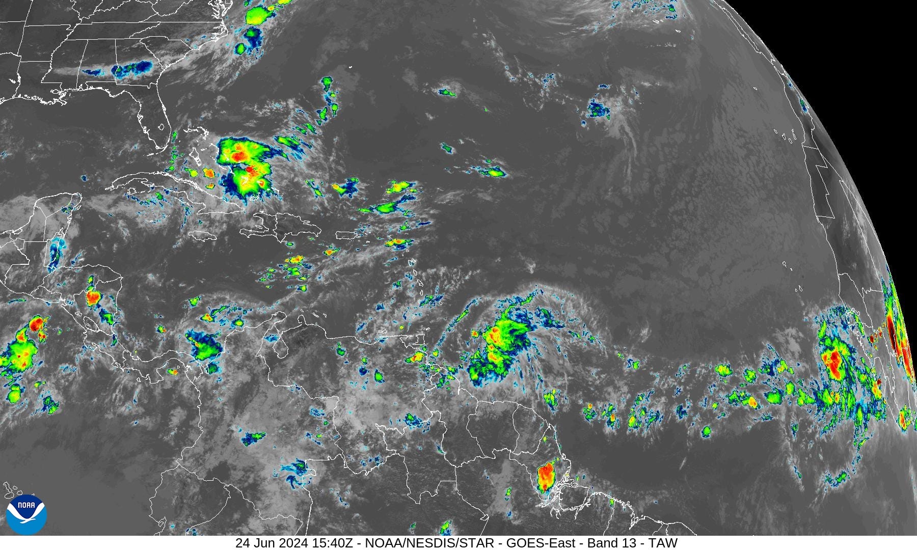
Basin Wide IR Satellite Imagery
Next 15-Days EPS Ensemble Tropical Storm Tracks
Active TCs at Day 8:
Interesting action in the southern Gulf of Mexico + tropical wave development into the Lesser Antilles

More ensembles at Day 11 show development of a tropical wave.

Finally at Day 14, these tracks figure out their destination. Note, there are < 10 ensembles with hurricanes or 20% chance of development through July 8th — close to climatology.

ECMWF AIFS 10-day Weather Pattern

Ridging redevelops across the Southeast into the weekend as cooling troughs circuit the upper-Midwest and Great Lakes.
Precipitation Anomaly Next 10-days [% of normal]

Monday High Temperatures and Weather

Nationwide average high temperature at 89°F with 53% of the Lower 48 at/above 90°F including 157 Million Population.

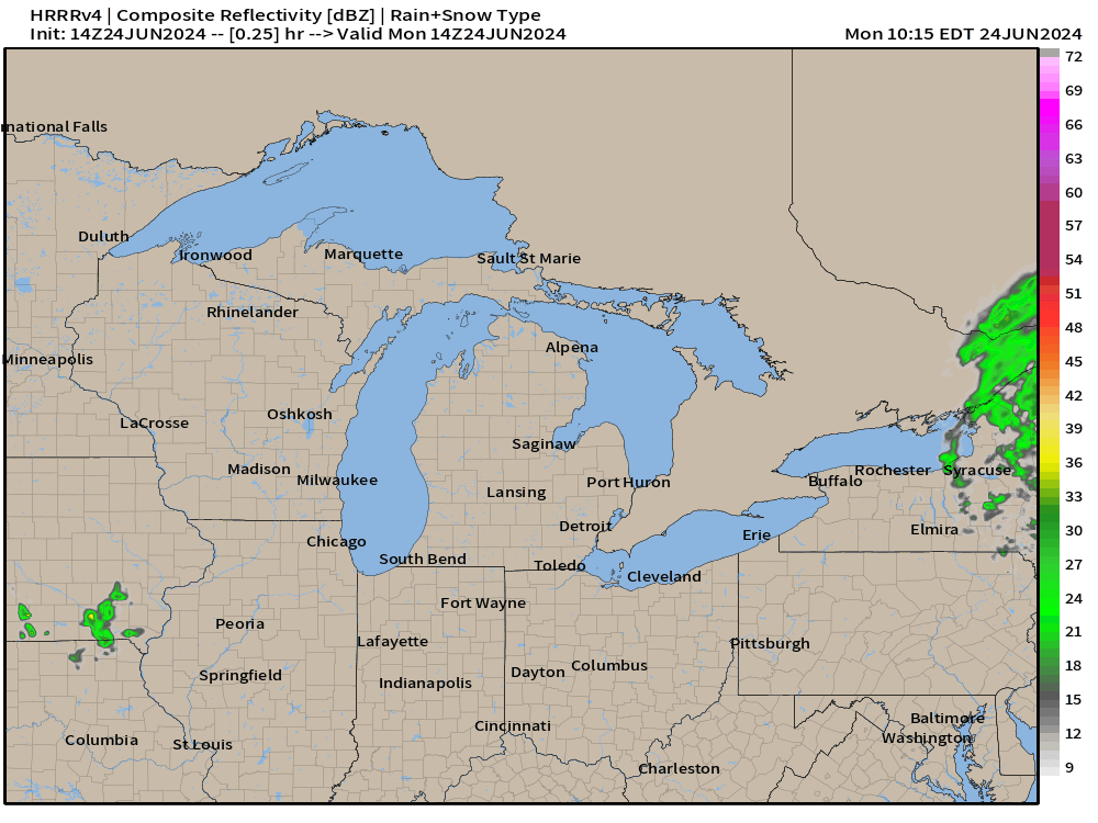
Strong storms possible across the upper-Midwest meaning more rainfall for areas that do not need anymore.
HRRR shows the development of a MCS across Wisconsin potentially reaching Chicago with severe squall-line winds.
NOAA WPC Precipitation Next 7-days

A Texas sized dry spell has opened up with a huge rainfall hole — continues for at least another week. Monsoon moisture into Mexico up into the Southwest around the heat dome.
ECMWF Daily Precipitation | Next 10-days

Eastern Pacific Tropical Weather Outlook
No activity expected in the next 48-hours or 7-days, or who knows how long — but the rest of June looks quiet.
Western Pacific Tropical Weather Outlook
Ghost town — No Suspect Areas areas of interest during the next 48-hours to 7-days from JTWC.
1. WESTERN NORTH PACIFIC AREA (180 TO MALAY PENINSULA):
   A. TROPICAL CYCLONE SUMMARY: NONE.
   B. TROPICAL DISTURBANCE SUMMARY: NONE.
   C. SUBTROPICAL SYSTEM SUMMARY: NONE.
Thank you to Subscribers and Supporters!
The investment in my research and development will pay off as A.I. enabled weather forecasts become a normal and indispensable part of our weather forecasting enterprise.
Maps sourced from weathermodels.com designed and innovated by yours truly! I actually create all of my content from scratch.
Still need rain in the southeast :(
What kind of event is that "dry hole" over Texas? Is there a technical name for it? How long can they persist?