


June 23, 2025 Hurricane Season Monday
Non-tropical system east of Bermuda running out of time

2025 Atlantic Hurricane Season [Day 23]. My expectation for this year is 14 named storms, 7 hurricanes, and 3 majors. So far, 0 named storms, 0 hurricane, and 0 majors.
Monday’s Tropical Update
Atlantic Basin: We have a 40% area hatched east of Bermuda for Invest 90L to develop (burst a thunderstorm) into a named/designated system, however it is running out of time.
Eastern Pacific Basin: Flossie is the next named system likely south of Mexico in 4-5 days. NHC remains at 70% chance of development, but it’s not looking too promising for a powerful system.
Western Pacific Basin: TS Sepat (02W) will move east of Japan. Invest 96W is next up in the South China Sea for likely development into a storm in next 24-48 hours. i
Heat Dome across Lower 48
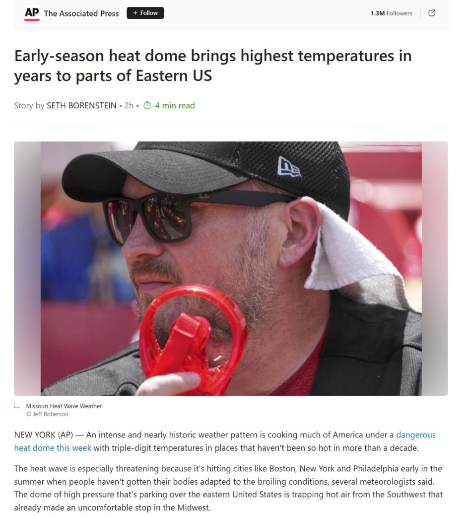
Spoke to AP News Article about the ongoing “heat dome” or ridge of high pressure across the Eastern U.S. long advertised on this newsletter.
Temperatures today might have underachieved by a few degrees due to high dewpoints that instead increased the oppressive heat index.
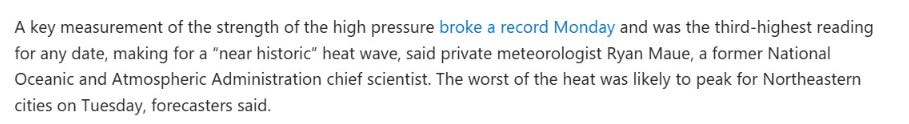
Next 10-days AIFS-Single (12z) | 500 mb Height Anomaly
The ridge weakens but does not break down completely until early next week when a Canadian trough arrives to cool off the Great Lakes and Northeast. Until then, we’ll see the intrusion of Atlantic moisture into the Southeast and that should fire up daytime thunderstorms and temper the highest temperatures — instead creating more heat index concerns.
Lows for Tuesday Morning

Amazing to see 80°F lows in the big cities partly due to the “urban heat island effect” but also the sinking air from the ridge.

Tuesday High Temperatures
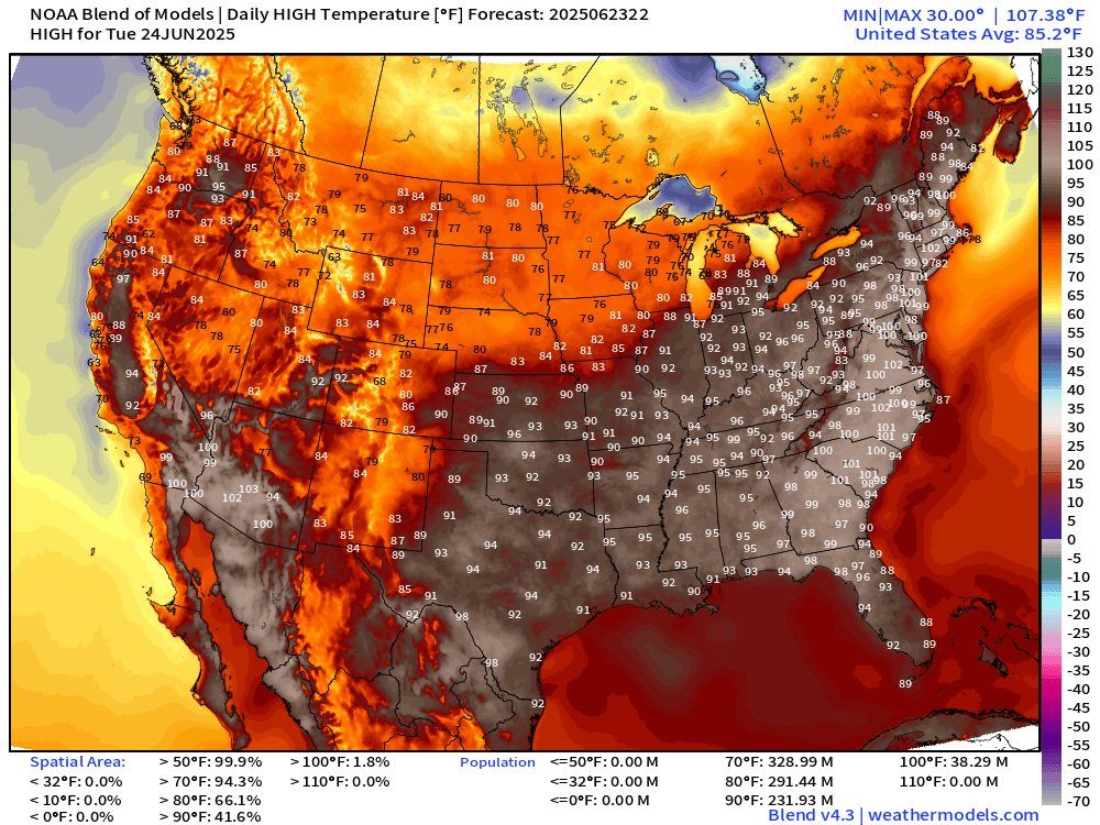
38 million at/above 100°F and 232 million at least 90°F


Every state from Florida to Maine along the Atlantic East Coast could/should hit 100°F
NWS WPC Precipitation Next 7-days

The “ring of fire” around the ridge will be fueled by Caribbean tropics moisture continually flowing northward through New Mexico, the Plains, and into the Midwest.
ECMWF 12Z | Integrated Vapor Transport | Next 10-days

Thank you to readers continuing into this Hurricane Season. My goal is to keep you informed about ongoing extreme weather events inside and outside of the tropics, but also a week (hopefully) heads up on what’s coming. I’ll be using a variety of weather modeling output, some of it may be unfamiliar, but it’s state-of-the-art and industry leading standard.
Keep reading with a 7-day free trial
Subscribe to Weather Trader to keep reading this post and get 7 days of free access to the full post archives.