


June 22, 2025 Hurricane Season Sunday
A 10% chance of non-tropical system developing east of Bermuda

2025 Atlantic Hurricane Season [Day 21]. My expectation for this year is 14 named storms, 7 hurricanes, and 3 majors. So far, 0 named storms, 0 hurricane, and 0 majors.
Sunday’s Tropical Update
Atlantic Basin: We have a 10% area hatched east of Bermuda for a very low chance of a short-lived, weak TD or TS in the next 7-days (June 29) by NHC. The ECMWF ensembles are otherwise blank through end of June.
Eastern Pacific Basin: Flossie is the next named system likely south of Mexico in 4-5 days. NHC remains at 70% chance of development.
Western Pacific Basin: Invest 95W is in the subtropics and JTWC expects it to intensify further into a named storm in next 24-hours.
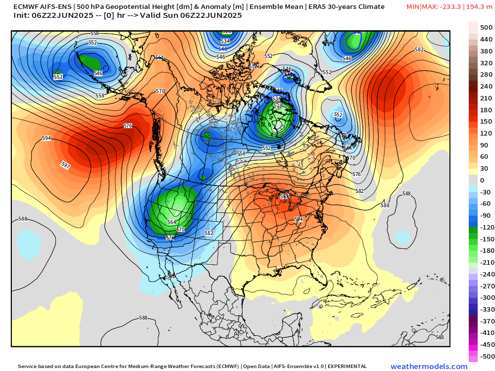
Heat Dome across Lower 48
A ridge has moved from the Plains into the Mid-Atlantic and expanded to encompass much of the U.S. East Coast. The sinking air will be dry and hot with deep layer temperatures well above normal promoting 90s and 100s for a significant population — into next week, but peaking on Tuesday in the big cities.
Next 10-days AIFS-Ensemble (brand new from ECMWF)
High Temperatures Next 3 days (Sunday, Monday, Tuesday)
Sunday
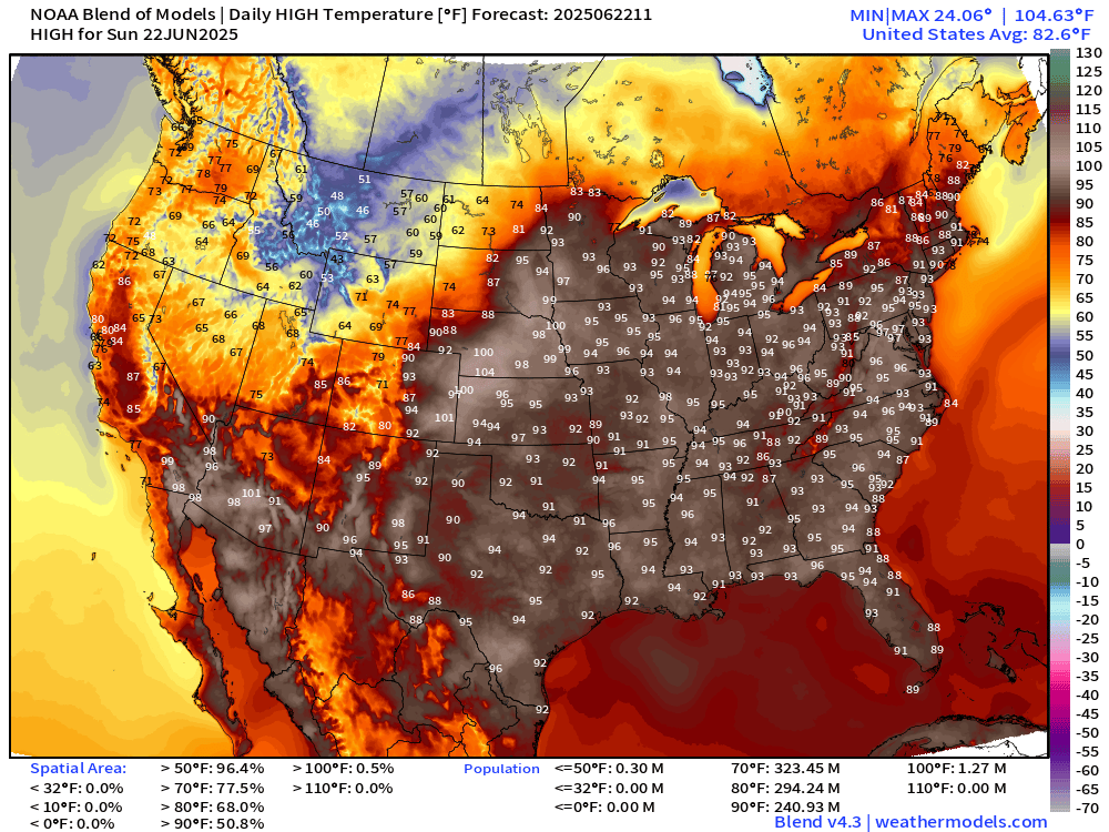
241 million at/above 90°F is a very high number with much of the eastern half of the U.S. quite hot. However, chilly across the northern Rockies with snowfall in Idaho and Montana at highest elevations.
Monday

Now at 10.5 million at/above 100°F
Tuesday

The heat peaks on Tuesday with almost 32 million at least 100°F including Washington D.C. and NYC
Zoom on New England

Zoom on Maryland and D.C.

NWS Next 7-days Forecast High Temperatures | D.C. and NYC


NWS WPC Precipitation Next 7-days

Eventually the ridge will break down and allow for convective daytime thunderstorms to pop again across the Southeast, but the next several days will be hot and dry.
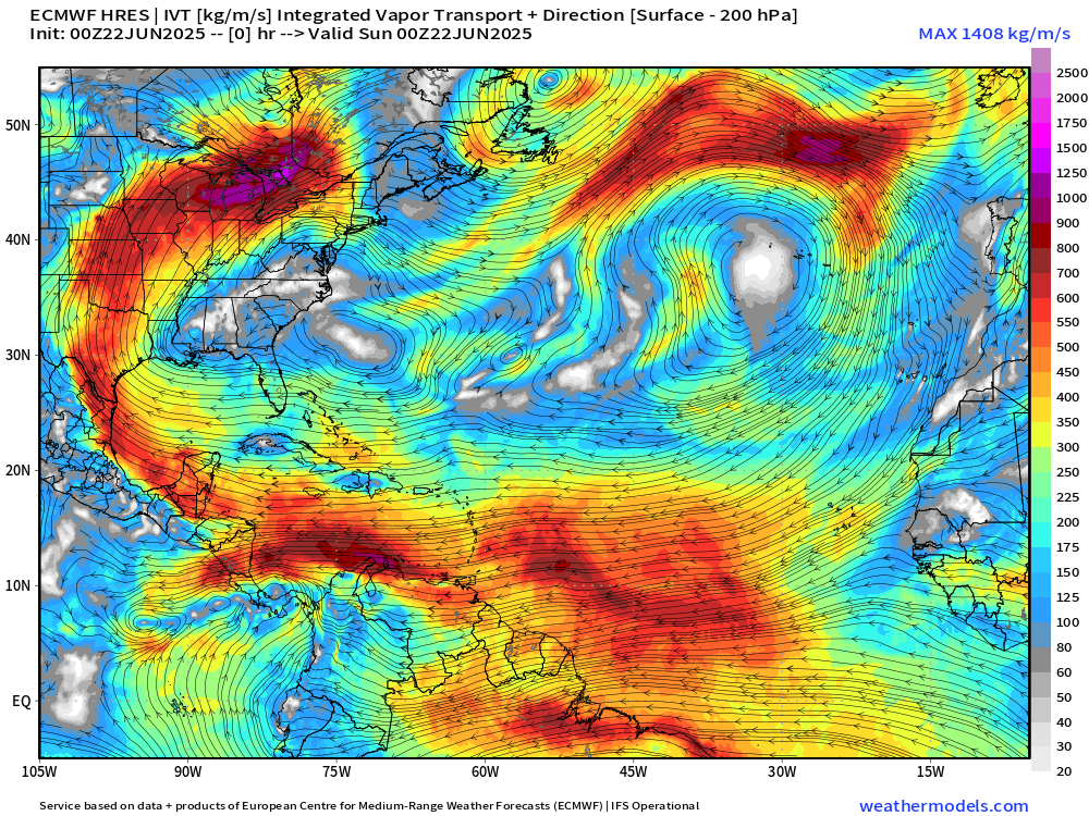
The moisture plume out of the Caribbean rounds the ridge in the Midwest with considerable rainfall for Iowa and Minnesota 2” to 4”+
ECMWF 00Z | Integrated Vapor Transport | Next 10-days
Thank you to readers continuing into this Hurricane Season. My goal is to keep you informed about ongoing extreme weather events inside and outside of the tropics, but also a week (hopefully) heads up on what’s coming. I’ll be using a variety of weather modeling output, some of it may be unfamiliar, but it’s state-of-the-art and industry leading standard.
Keep reading with a 7-day free trial
Subscribe to Weather Trader to keep reading this post and get 7 days of free access to the full post archives.