


June 21, 2025 Hurricane Season Saturday
Atlantic quiet through end of June

2025 Atlantic Hurricane Season [Day 21]. My expectation for this year is 14 named storms, 7 hurricanes, and 3 majors. So far, 0 named storms, 0 hurricane, and 0 majors.
Saturday’s Tropical Update
Atlantic Basin: No areas being watched through the next 7-days (June 28) by NHC and the ECMWF ensembles are (mostly) blank for next 2-weeks — through the end of June without a named storm. Ghost town!
Eastern Pacific Basin: Flossie is the next named system likely south of Mexico in 4-5 days. NHC is at 70% right now.
Western Pacific Basin: Invest 95W is in the subtropics and JTWC expects it to intensify further into a named storm perhaps by Sun/Mon.
ECMWF 12Z | Integrated Vapor Transport | Next 8-days
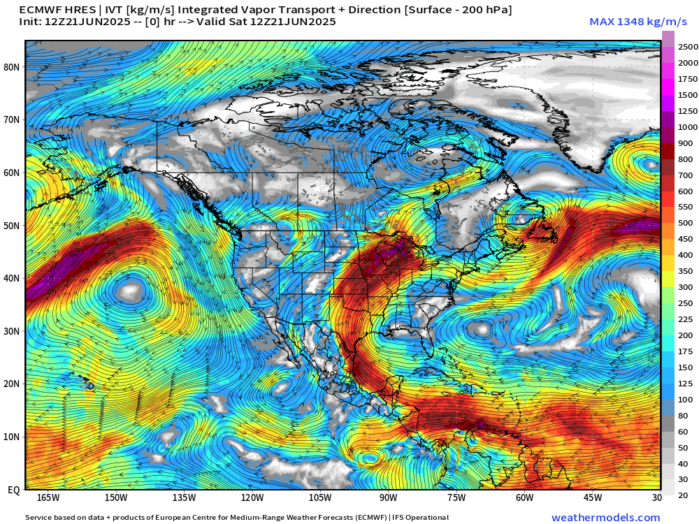
The next storm in the Eastern Pacific is Flossie, and it develops out of the ITCZ/monsoon trough just a bit further ESE of where Erick started out. This storm is yet another triggered by easterly waves arriving from Africa, through the Atlantic, and into the Caribbean where they then cross Central America.
Monster “heat dome” ridge dominates the Eastern U.S. forcing the tropical moisture plumes through Texas into the Plains and around the top into Canada. Need to watch for mesoscale convective complex systems like we saw last night in North Dakota with impacts similar to a hurricane over land.
No tropical cyclone formation likely in the Atlantic basin in the next 7 days+
Tropical Atlantic | Precipitation and MSLP Next 10-days | ECMWF 12z
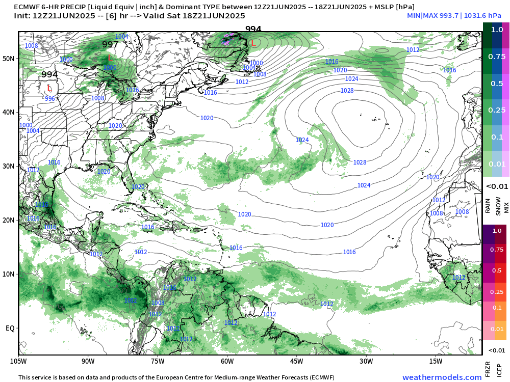
The ITCZ and monsoon trough from Central America, through northern South America, and into the main development region (MDR) of the Atlantic continues to generate plenty of rainfall day after day.
Tropical Atlantic | 24-Hourly Precipitation Next 10-days | ECMWF 12z
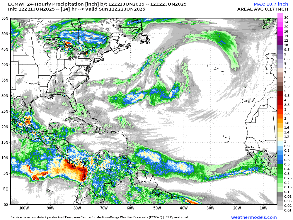
A different view of the rainfall on 24-hour running accumulations. One a given day, the tropics can see 2-4” of rainfall in the heaviest convection, and generally 0.5” to 1” or more depending upon the additional lift or instability provided by tropical waves.
Hurricanes drop significantly more — on the order of 1-2 feet of rain in 24-hours over the ocean.
Atlantic Basin Outlook

Ghost town for the next 7-days — through the end of June without a named storm.
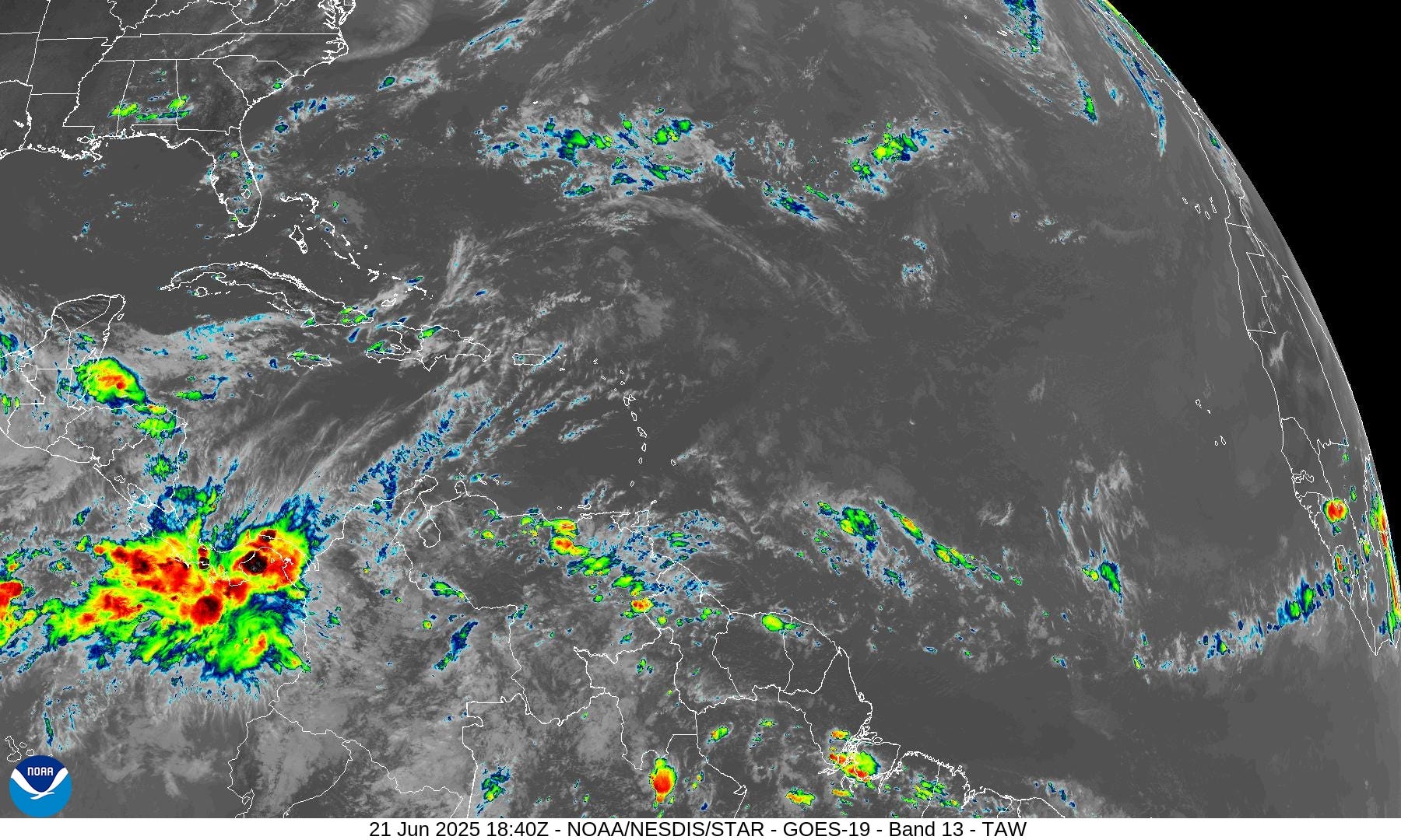
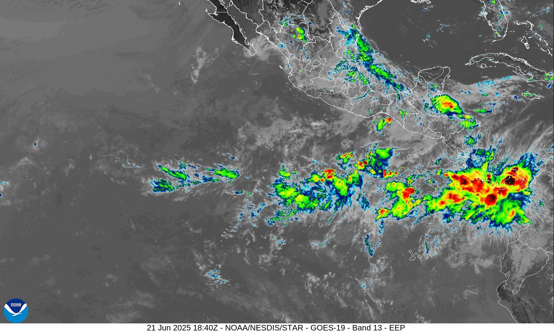
Eastern Atlantic Satellite Image
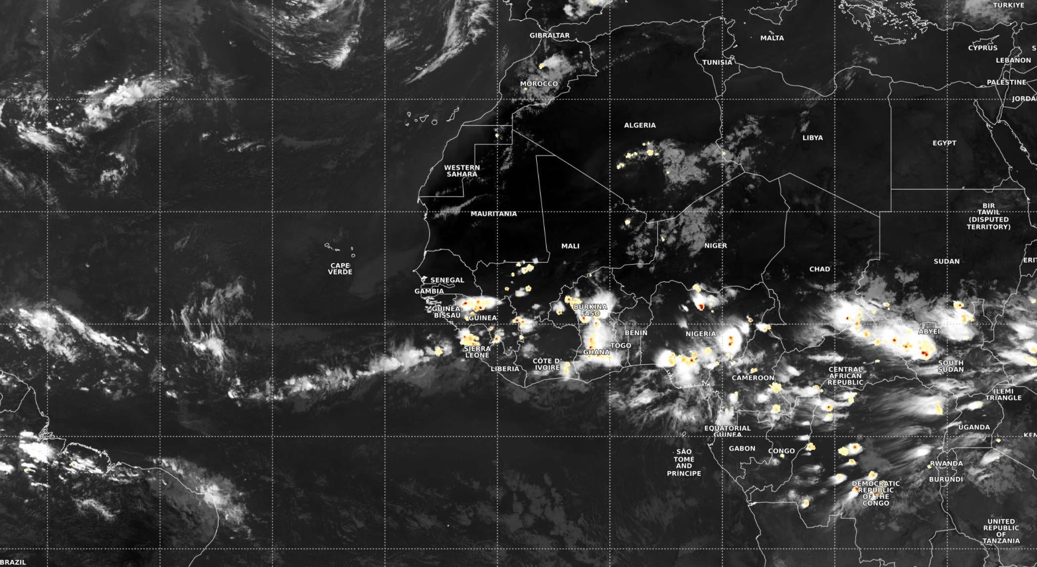
More coverage of scattered storms over Africa.
NASA GEOS-5 | 00z DUST Aerosol Optical Depth (AOD) | 8-days Forecast
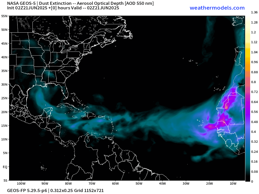
Next plume of Saharan dust holds together through Bahamas and Florida by 8-days.
Atlantic Ocean Surface Temperatures (SST) | Anomaly


Tropical Atlantic Satellite Imagery
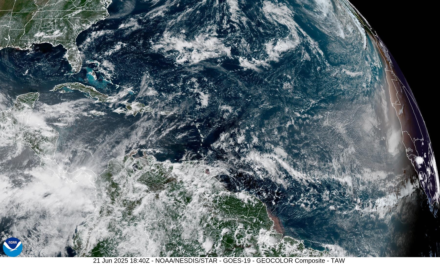
The sunset over the Eastern Atlantic shows the perpetual dust cloud from the Sahara.
Tropical Surface Analysis | 12Z
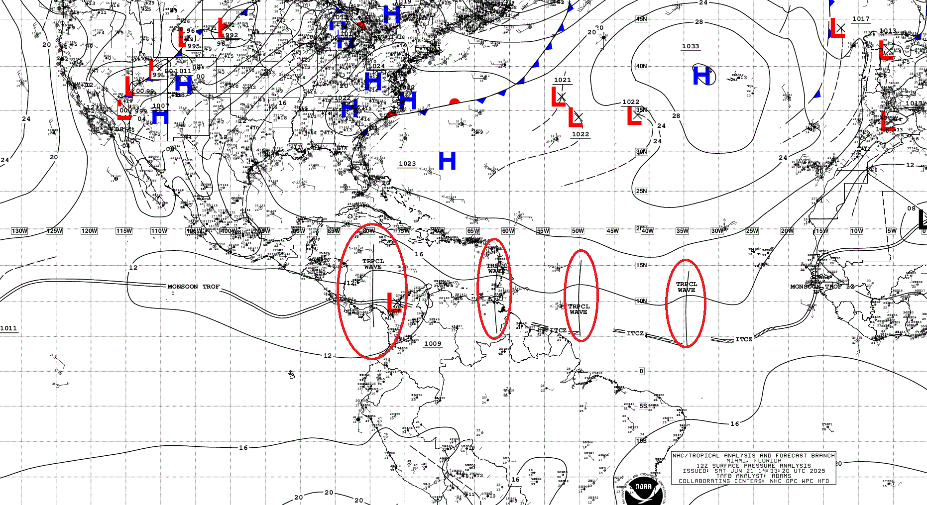
Atlantic Tropical Waves = 4 but no development expected in the Atlantic, but probably Flossie out of the one crossing Central America by middle of next week.
Thank you to readers continuing into this Hurricane Season. My goal is to keep you informed about ongoing extreme weather events inside and outside of the tropics, but also a week (hopefully) heads up on what’s coming. I’ll be using a variety of weather modeling output, some of it may be unfamiliar, but it’s state-of-the-art and industry leading standard.
Atlantic Precipitable Water | Next 7.5 days
The ITCZ is suppressed to the coast of South America in 5-days with the leading edge of a powerful SAL which can be traced with the 20°C T850 isotherm. This is a good way to show the warm near-surface layer (about 1-1.5 km up) = very stable.

The dry air in the central Atlantic generally comes from the NE around the Azores High with some African influence.
Atlantic 850 mb Temperature | Next 7.5 days
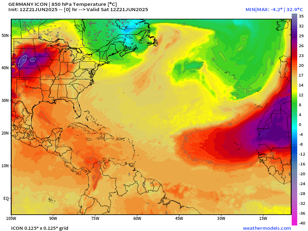
The 20°C isotherm is a great demarcation or boundary of the Saharan Air Layers, which largely hold together across the entire Atlantic before breaking up into segments near northern Caribbean.
GFS Model Update | 18z Atlantic | Next 8-days
GFS has stopped with the false alarms in the Caribbean, thankfully.
Medium range ensemble model outlook
These are 51-realizations of the same model with different initial conditions. Each ensemble gets equal ~2% weight in a mean calculation.
ECMWF Ensembles | 10-Days | All Storm Tracks

Blank slate through July 1st.
ECMWF Ensembles | 15-Days | All Storm Tracks
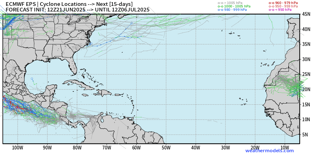
Through July 6th. Nothing happening.
Eastern Pacific Tropical Update
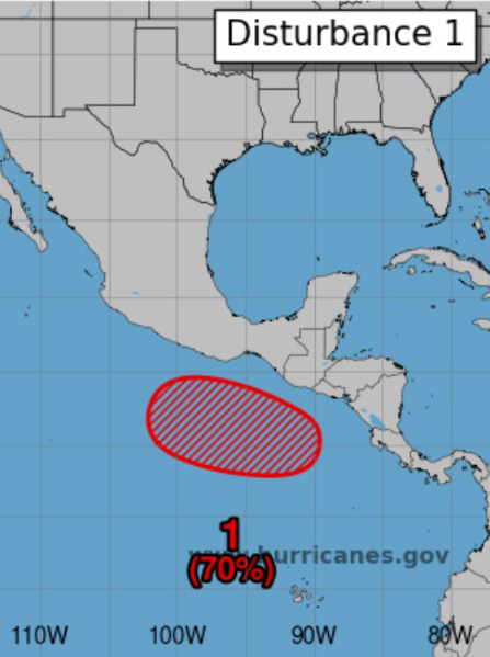
NHC has hatched a 70% area for Flossie in 7-days.
Precipitable Water Next 7.5 days
Flossie should be underway in 4-5 days if all goes to plan.
Note the digging trough off the U.S. West coast yet again. Very persistent pattern due to the high pressure at the surface sprawled across the subtropical and mid-latitude Pacific NE of Hawaii.
The track of Flossie will help push monsoon moisture into Texas and New Mexico, but Arizona will miss out.
ECMWF 12z Ensembles | Eastern Pacific
5-Days Active Storm Tracks

Early formation of Flossie = stronger / longer-lifecycle = more ACE.
10-Days Active Storm Tracks

Can’t entirely discount Flossie affecting the Mexico coastline, but that’s next weekend, plenty of time to watch.
Western Pacific Tropical Update
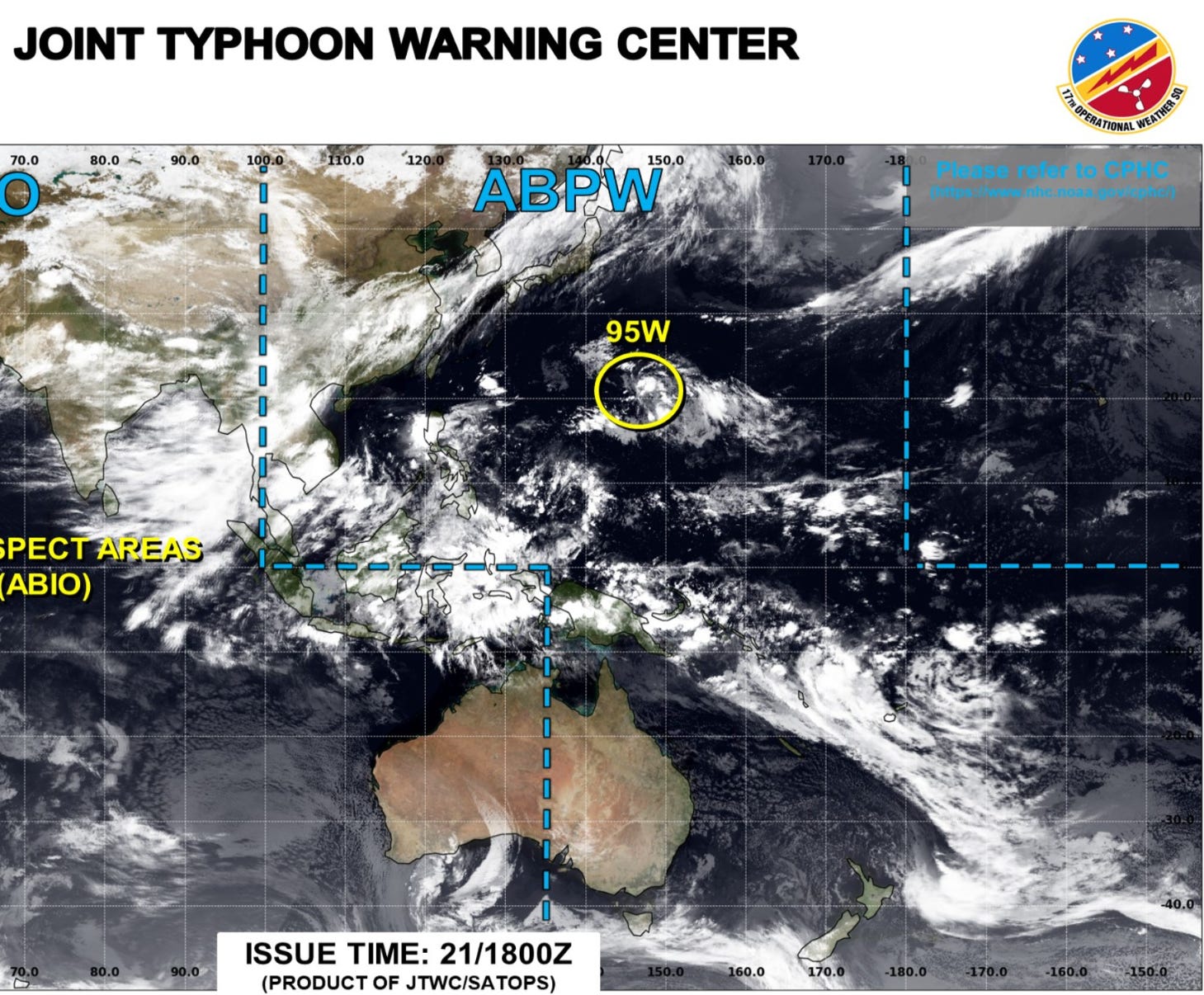
The Interesting spin in the subtropics doesn’t look like it will amount to much but could become a named Tropical Storm briefly.
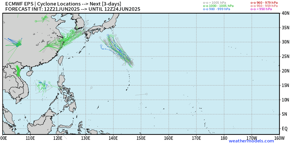
Day 3 Ensembles | Active Cyclone Tracks
Invest 94W will see pressure falls but enough organization for a named TS?
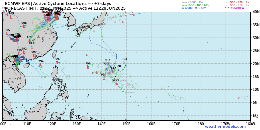
Day 7 Ensembles | Active Storm Tracks
A low chance of something spinning out of the NE side of the monsoon trough, but nothing imminent.
Ryan’s Notes:
June 2025: We use the ECMWF for medium-range prediction because the GFS can’t be trusted due to false-alarm bias, and unrealistic intensification of tropical convection into spurious (ghost) storms. I don’t agree this is a good thing like CNN.
We can look at the GFS every day for weeks and see a modeled tropical storm or hurricane in the Caribbean or Gulf especially after Day 10. However, this is a known bias/false alarm problem with spurious convective — vorticity spin-ups due to the convective parameterization or estimation of vorticity generation due to intense diabatic heating. Perhaps it’s worthwhile to show what will not happen.
Maps sourced from weathermodels.com designed and innovated by yours truly! Please subscribe there for real-time access to the newest maps, charts from all of the weather models including ECMWF.