


June 21, 2020 Tropical Update
GFS model is performing poorly as summer begins with a dust cloud
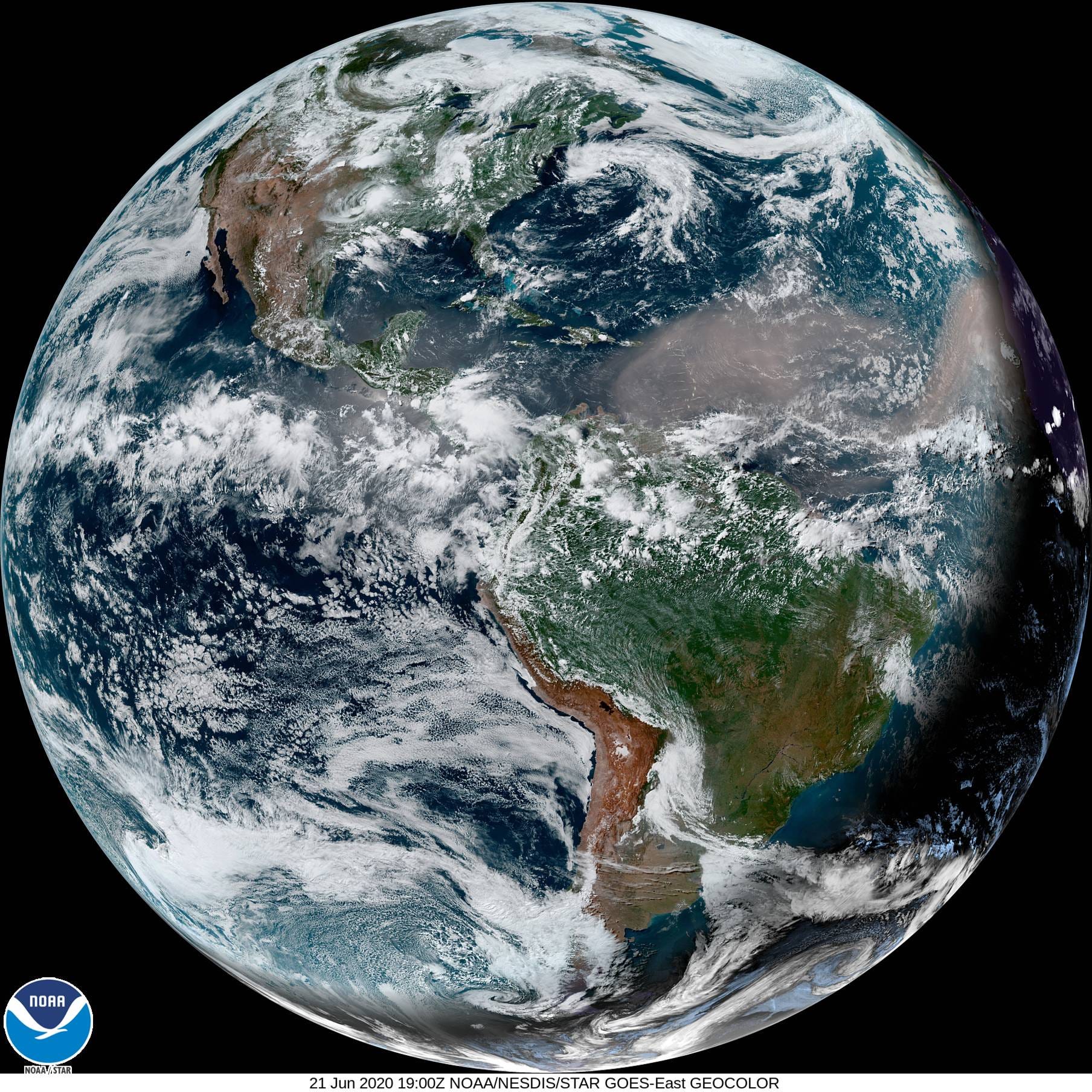
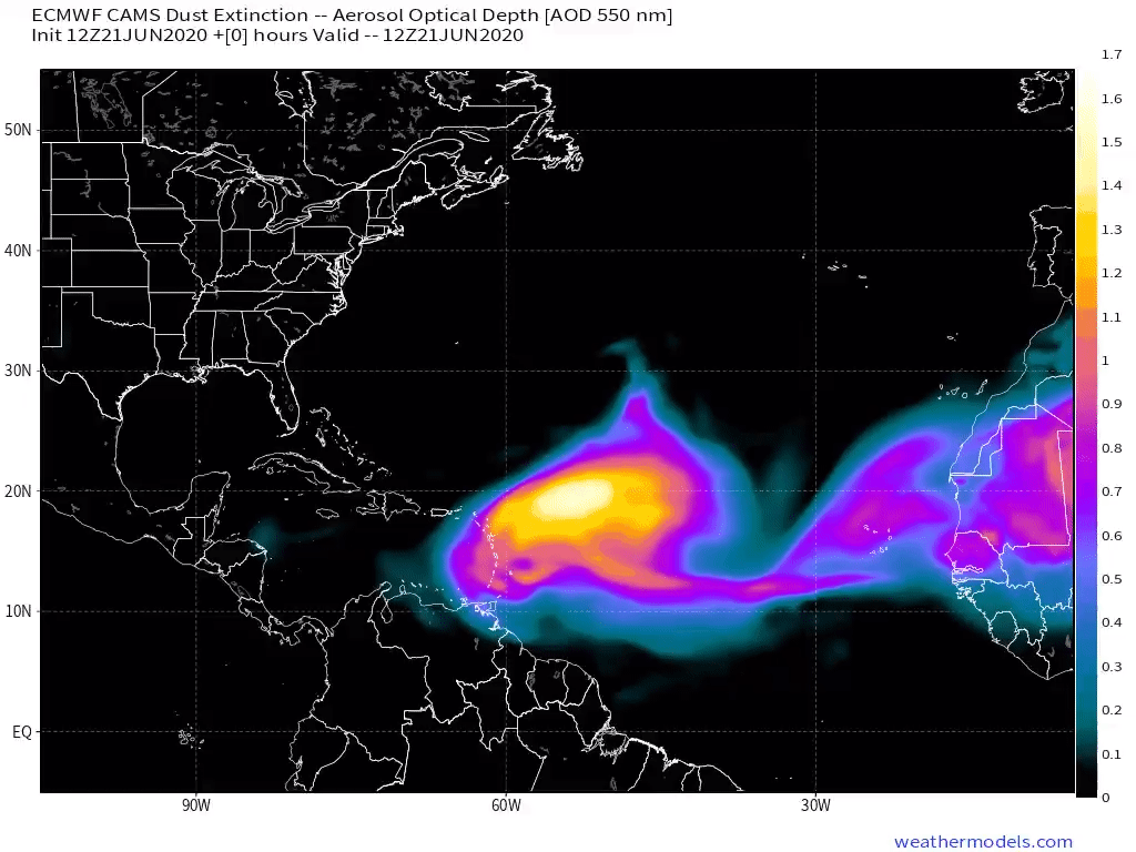
Saharan Dust Layer
Of course you can see it from space and in real-color from the GOES-East satellite 22,230 miles above the Earth. The dust is picked up from the Sahara desert and sent out into the Atlantic where it remains elevated 1-2 kilometres above the ocean surface traveling all the way into the U.S.
But there is concern that the dust will provide nutrients to red tide organisms in the Gulf of Mexico. The dust contains iron needed by the Trichodesmium cyanobacteria to thrive which in turn turns atmospheric nitrogen into ammonium which other critters eat including the Karenia brevis — red tide.

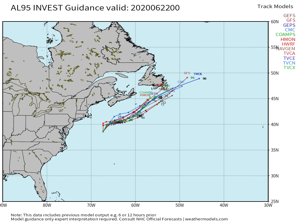
Invest 95L
The National Hurricane Center was watching an area of low pressure well east of Cape Cod, Massachusetts but it failed to develop after crossing over colder water. But, who knows, maybe it will develop subtropical characteristics and waste another name on the 2020 list. From the Sea-Surface Temperature (SST) map, you can see that the Gulf Stream extends off the North Carolina coast but it is still relatively chilly — 24°C to 25°C — too cold for tropical storm development. This is typical in mid-June and any storms that develop off the East Coast this far north are typically hybrid or subtropical in nature.

Garbage NOAA GFS model skill
Weather models are pretty good at predicting the winter atmosphere as there is not too much diabatic or moisture related convection. But, in the summer time, oh boy, the global models still have a lot of trouble with moist convection. This is not a new problem but I am still astounded how bad forecasts can bust in 2020!

The metric that has been used for decades in meteorology is called the anomaly correlation — ranges from -1 to 1 — for 500 hPa height at 5-days (or whatever time horizon). The ECMWF model (the Euro) has been the king since the 1990s. The GFS model has gotten better but never been able to bridge the gap with the Euro. There are a bunch of reasons but I’d chalk them up to bureaucratic inertia failures within NOAA that have not been rectified. Cliff Mass at U of Washington has been the most vocal proponent of changing business-as-usual within NOAA global modeling and thankfully now acting admin Neil Jacobs is spread-heading many important initiatives including better supercomputers.
I couldn’t guarantee that the GFS would get Sandy right using today’s modeling system.
The Euro is consistently better and scores higher in the summer (and winter) because it handles convection so much better partly due to enhanced vertical resolution (L137) and horizontal grid spacing (9-kilometres). About 5-years ago, the GFS was upgraded but only with horizontal grid spacing and that barely budged the needle on the skill scores. The new FV3 core has not amounted to a hill of beans as of yet, but perhaps the new version 16 will finally pay off.
2006-2020 GFS vs ECMWF model skill

I have been downloading ECMWF and GFS data for over 15-years now and verifying each forecast. My data archive of verification statistics allows me to create some pretty interesting time series charts including the 2007-2020 (present) ECMWF vs. GFS 5-day skill scores matchup.
You can see that GFS summer time skill got worse in 2017. The model took a step backwards compared to previous summers. That really stinks.
The ECMWF (blue line) did not dip below 0.90 in the 30-day running mean in 2019. Astounding. I doubt it will do so in 2020. Meanwhile, that drop off with the GFS is real and ugly. Can’t really say the GFS is getting any better even with the millions upon millions of taxpayer dollars dumped into the cause. But, I’m hopeful for the future as talented folks are working hard on improving the model and seem to have the tools finally in place to make strides.
Totally unrelated to the tropics but I was watching the model forecasts for my area last week for total rainfall. A couple days forecast for 2-4”. We missed out on all of it. Had one random storm over our location drop .25” but it was dry 2 miles up the road, otherwise, a bust on the forecast. Mother Nature..