


June 20, 2025 Hurricane Season Friday
Tropics are quiet on first day of summer

2025 Atlantic Hurricane Season [Day 20]. My expectation for this year is 14 named storms, 7 hurricanes, and 3 majors. So far, 0 named storms, 0 hurricane, and 0 majors.
Friday’s Tropical Update
Atlantic Basin: No areas being watched through the next 7-days (June 27) by NHC and the ECMWF ensembles are (mostly) blank for next 2-weeks — through the end of June without a named storm. Ghost town!
Eastern Pacific Basin: Flossie is the next named system likely south of Mexico in 4-5 days. NHC is at 40% right now, but that will rise into the weekend.
Western Pacific Basin: Subtropical spinner, but not sure it will be classified as a system. Otherwise, quiet for a week.
Good evening. This is a very quick update since I’ve been busy with the new AIFS Ensemble system going operational July 1st from ECMWF.
This is a GAME CHANGER in the field of numerical weather prediction. I’m anxious to get the data flowing on a scheduled basis (about 1.1 TB/day) and processed for downstream applications including this newsletter and subscribers.
I’ll be doing “Heat Dome” updates starting tomorrow morning as the tropics are mostly quiet.
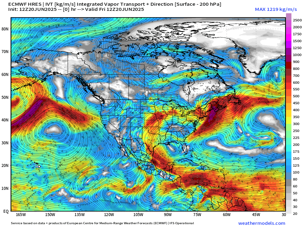
ECMWF 12Z | Integrated Vapor Transport | Next 8-days
Flossie develops out of the ITCZ/monsoon trough in the EPAC just a bit further ESE of where Erick started out.
Monster “heat dome” ridge dominates the Eastern U.S. forcing the tropical moisture plumes through Texas into the Plains and around the top into Canada. Need to watch for mesoscale convective complex systems!
No tropical cyclone formation likely in the Atlantic basin in the next 7 days+
Tropical Atlantic | Precipitation and MSLP Next 10-days | ECMWF 12z
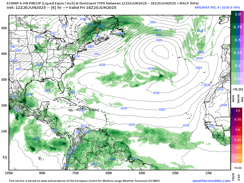
Nothing much besides the diurnal convective cycle. Can’t really pick out an interesting feature in the Atlantic aside from the retrenchment of the subtropical high south of Bermuda.
Atlantic Basin Outlook

Ghost town for the next 7-days — pushing into the end of June without a named storm.
Eastern Atlantic Satellite Image
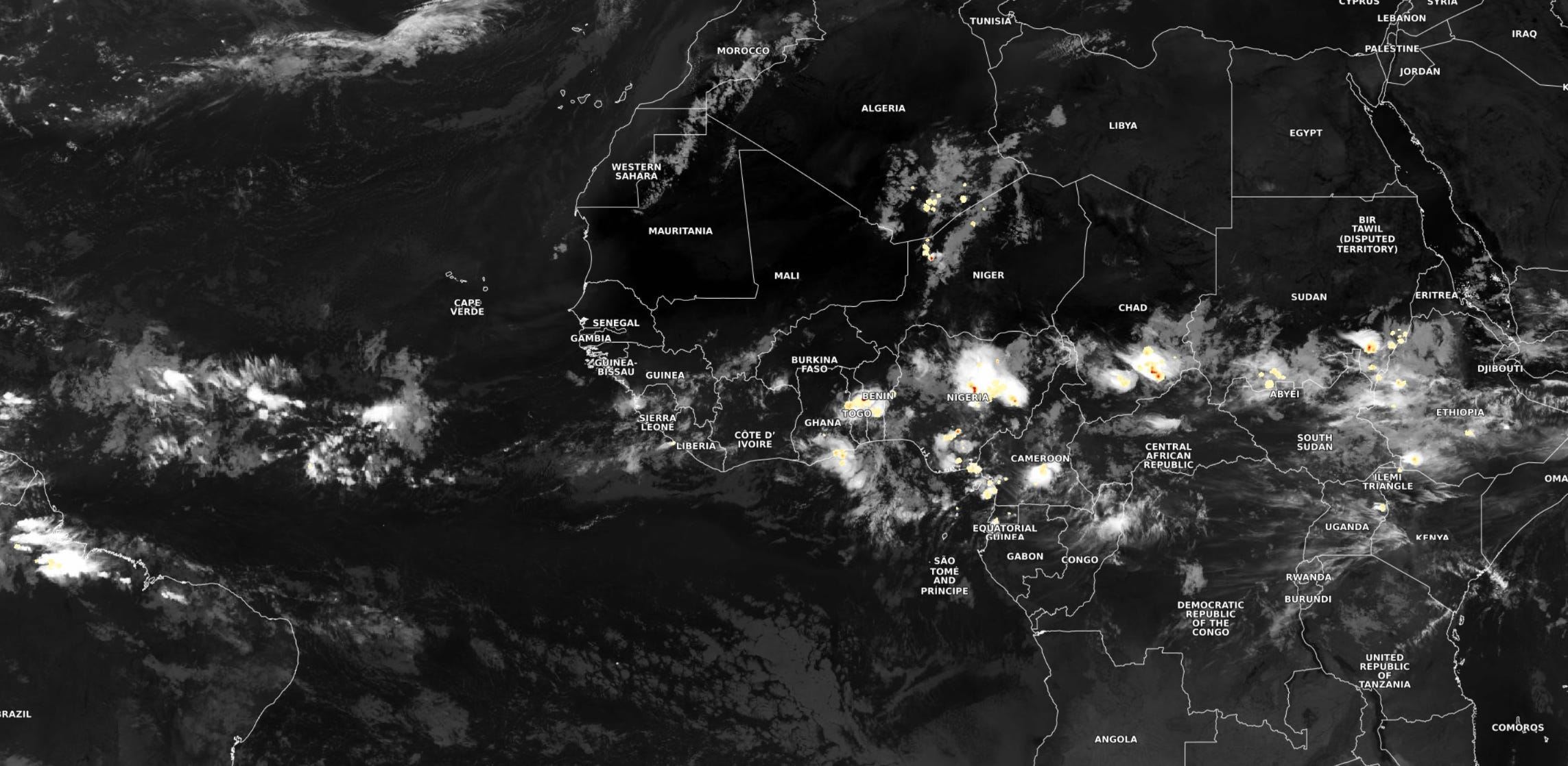
Scattered storms over Africa. The tropical wave that came off the continent sputtered out quickly over the Atlantic.
NASA GEOS-5 | 00z DUST Aerosol Optical Depth (AOD) | 8-days Forecast
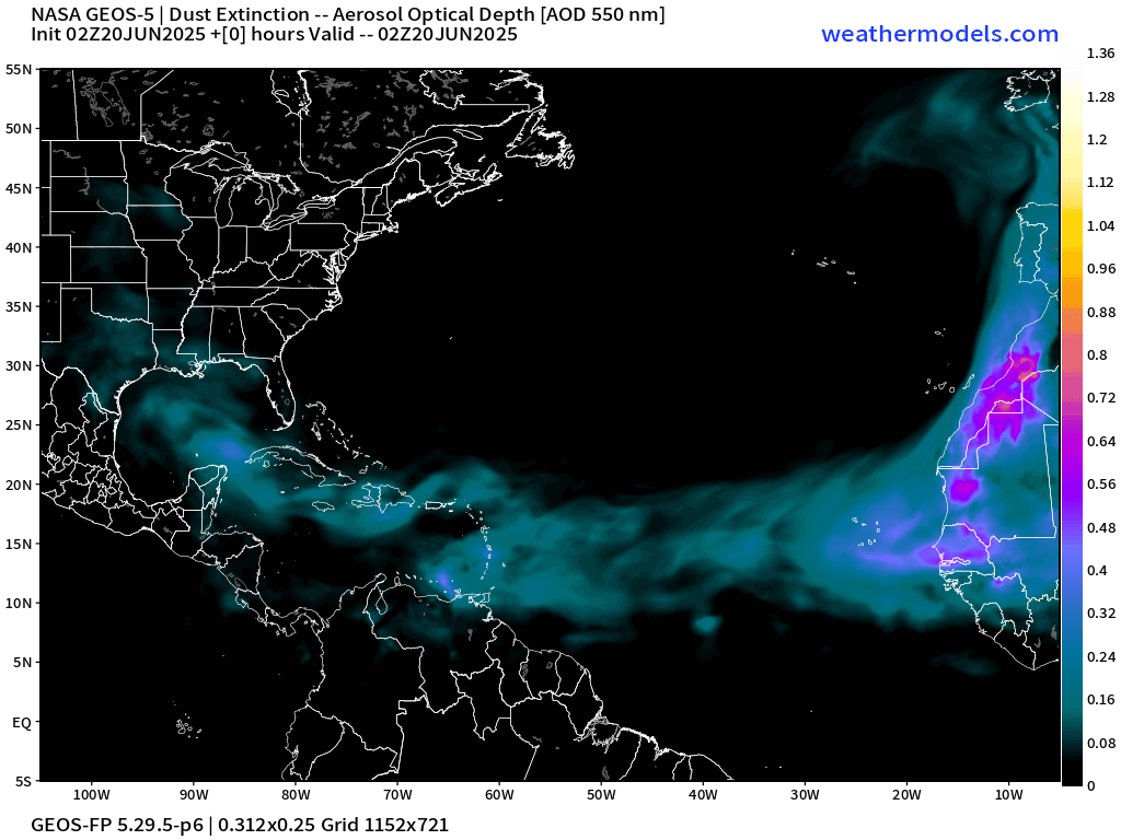
Next plume of Saharan dust holds together nicely through the Bahamas and Florida by 8-days.
Atlantic Ocean Surface Temperatures (SST) | Anomaly


Tropical Atlantic Satellite Imagery
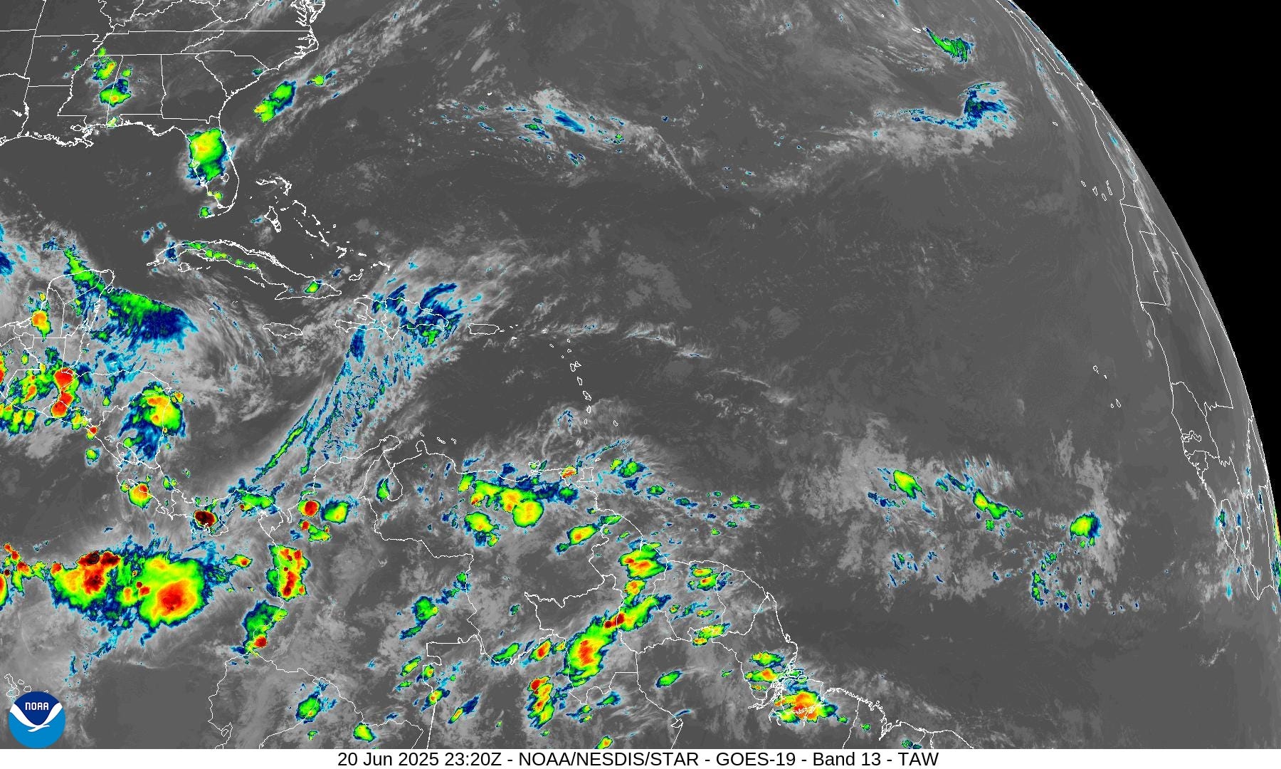
Barely a shower or storm … boring.
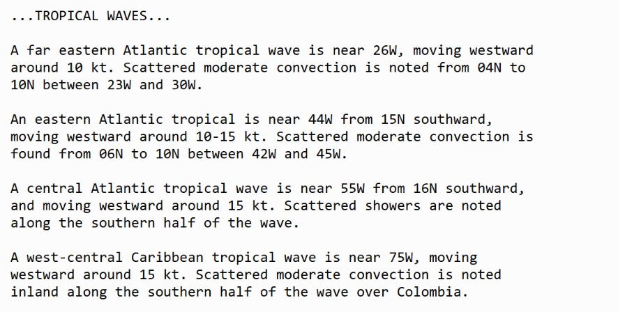
Tropical Surface Analysis | 18Z
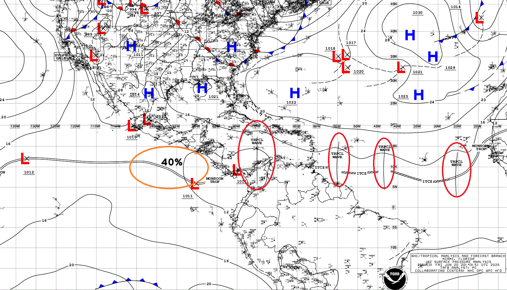
Atlantic Tropical Waves = 4 but no development expected in the Atlantic.
Thank you to readers continuing into this Hurricane Season. My goal is to keep you informed about ongoing extreme weather events inside and outside of the tropics, but also a week (hopefully) heads up on what’s coming. I’ll be using a variety of weather modeling output, some of it may be unfamiliar, but it’s state-of-the-art and industry leading standard.
Atlantic Precipitable Water | Next 5-days
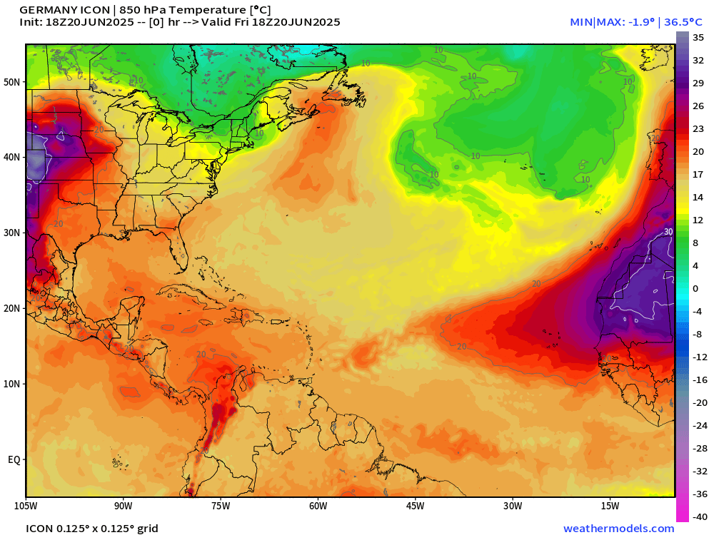
The ITCZ is suppressed to the coast of South America in 5-days with the leading edge of a powerful SAL which can be traced with the 20°C T850 isotherm. This is a good way to show the warm near-surface layer (about 1-1.5 km up) = very stable.
Keep reading with a 7-day free trial
Subscribe to Weather Trader to keep reading this post and get 7 days of free access to the full post archives.