We are now in the 2025 Atlantic Hurricane Season [Day 2]. My expectation for this year is 14 named storms, 7 hurricanes, and 3 majors.
Also, thank you to subscribers continuing into this Hurricane Season. My goal is to keep you informed about ongoing extreme weather events inside and outside of the tropics, but also a week (hopefully) heads up on what’s coming. I’ll be using a variety of weather modeling output, some of it may be unfamiliar.
Also, even if you are not contributing to unlock the posts, you’re still seeing a preview that gives a summary. Posts will be at least daily for the next 5-months!
Monday’s Tropical Weather Headlines
Atlantic tropical update: No tropical storm development expected in next 7-10 days. Any system thereafter would be unlikely (<5%) according to ensembles through Day 14, probably centered in the Gulf or western Caribbean within large gyre circulation.
Eastern Pacific tropical update: No change to the 40% chance of next system in 7-days — Barbara.
Saharan Dust / Air Layer remains in control of the tropical Atlantic with thick plume ready to affect Gulf, again.
The lack of a hurricane strength system in the Northern Hemisphere through June 4th — means a record for inactivity, at least since 1973. The Western Pacific usually sees several typhoons by now in early June, but nothing brewing for a while.
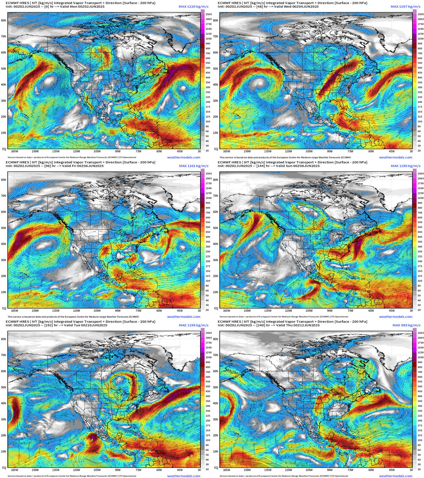
Integrated Vapor Transport | Next 10-days
The ECMWF HRES (control) IVT model simulation for the next 10-days does not show anything spinning w/ a likely tropical designation across the Atlantic. We use the ECMWF for medium-range prediction because the GFS can’t be trusted — and more beatings will not improve morale.
1039 mb high pressure is large and in charge off the U.S. West Coast until early next week when it finally breaks down.
Development of “Barbara” in the Eastern Pacific looks very slow and not guaranteed [NHC at 40%] due to proximity to the Mexico coastline.
A feature off the Southeast U.S. coast is related to the tail end of a cold front. It’s possible that a circulation could briefly emerge over the very warm waters of the Gulf Stream and burst convection long enough to get a 6-12 hour tropical depression or storm. However, models are not showing central pressure < 1020 mb and upper-level conditions (wind shear) are unfavorable. It’s something to watch for conversation and social media but any impacts would be limited to rainfall, which isn’t altogether a bad thing.
Precipitation and MSLP Next 6-days
Keep reading with a 7-day free trial
Subscribe to Weather Trader to keep reading this post and get 7 days of free access to the full post archives.


