


June 19, 2024 Tropical Update: Waiting on Alberto
Still a Potential Tropical Cyclone but expected to be named today


Headlines for Wednesday
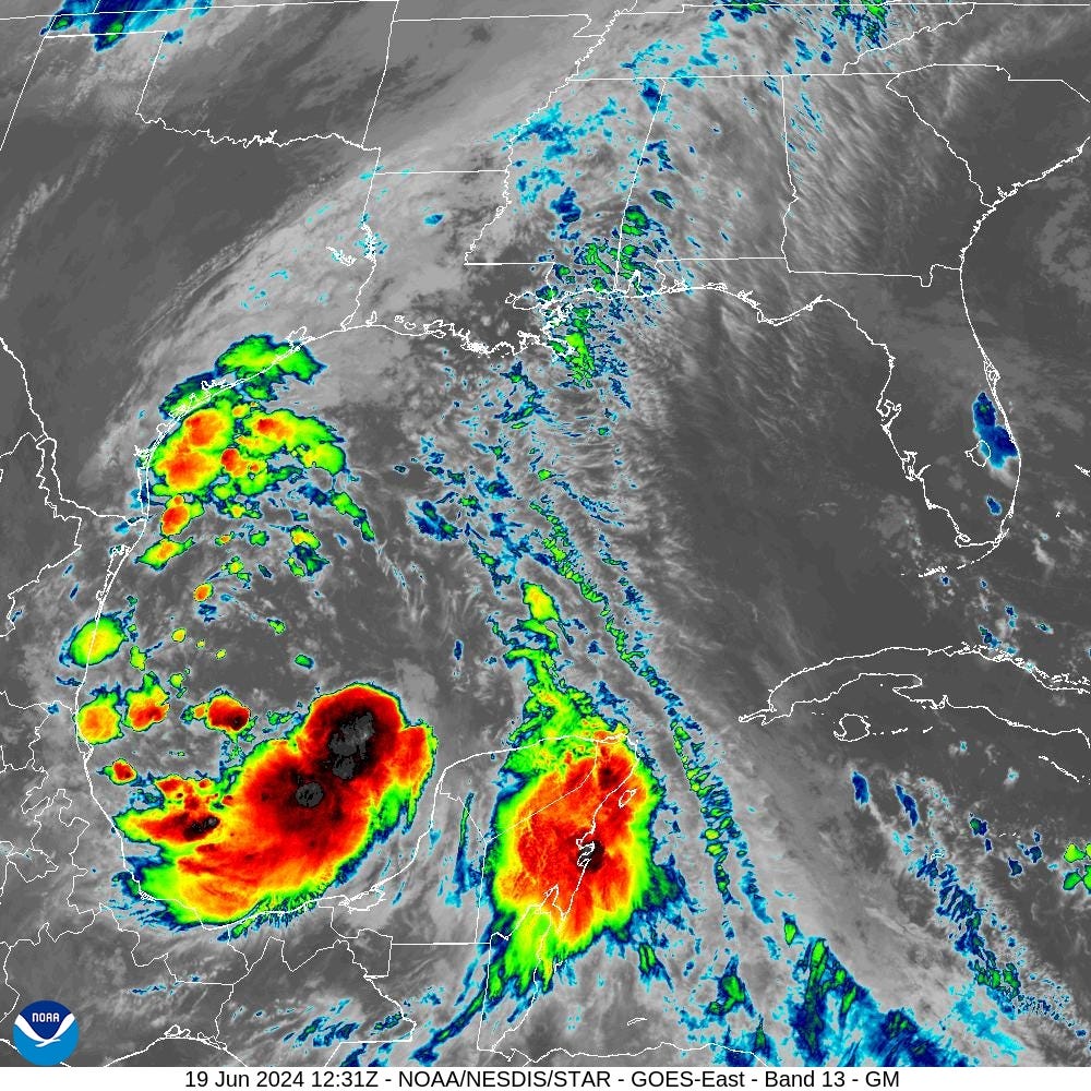
Potential Tropical Cyclone (01L) expected to become Tropical Storm Alberto later today. NHC noted the lack of central convection earlier in their discussion at 4 AM, but since, as seen on the IR satellite, an intense band of thunderstorms have developed on the rear flank of 01L.
Dropsonde observations from an Air Force Reserve Unit Hurricane Hunter aircraft indicate that the circulation of the system is gradually becoming better defined.

However, the central convection remains rather meager and the system's cloud pattern is still not classifiable via the Dvorak technique. Therefore the
disturbance still does not meet the requirements of a tropical cyclone and will continue to be designated as a potential tropical cyclone at this time.

Nonetheless, since the system appears to be on its way to developing a well-defined center, it is expected to become a tropical cyclone later today.
Chance of another system in the southern Gulf of Mexico as the gyre continues circulation over Central America and the Yucatan (30%)
System off the coast of Florida has a 20% chance of tropical cyclone development, but will likely remain too weak to classify.
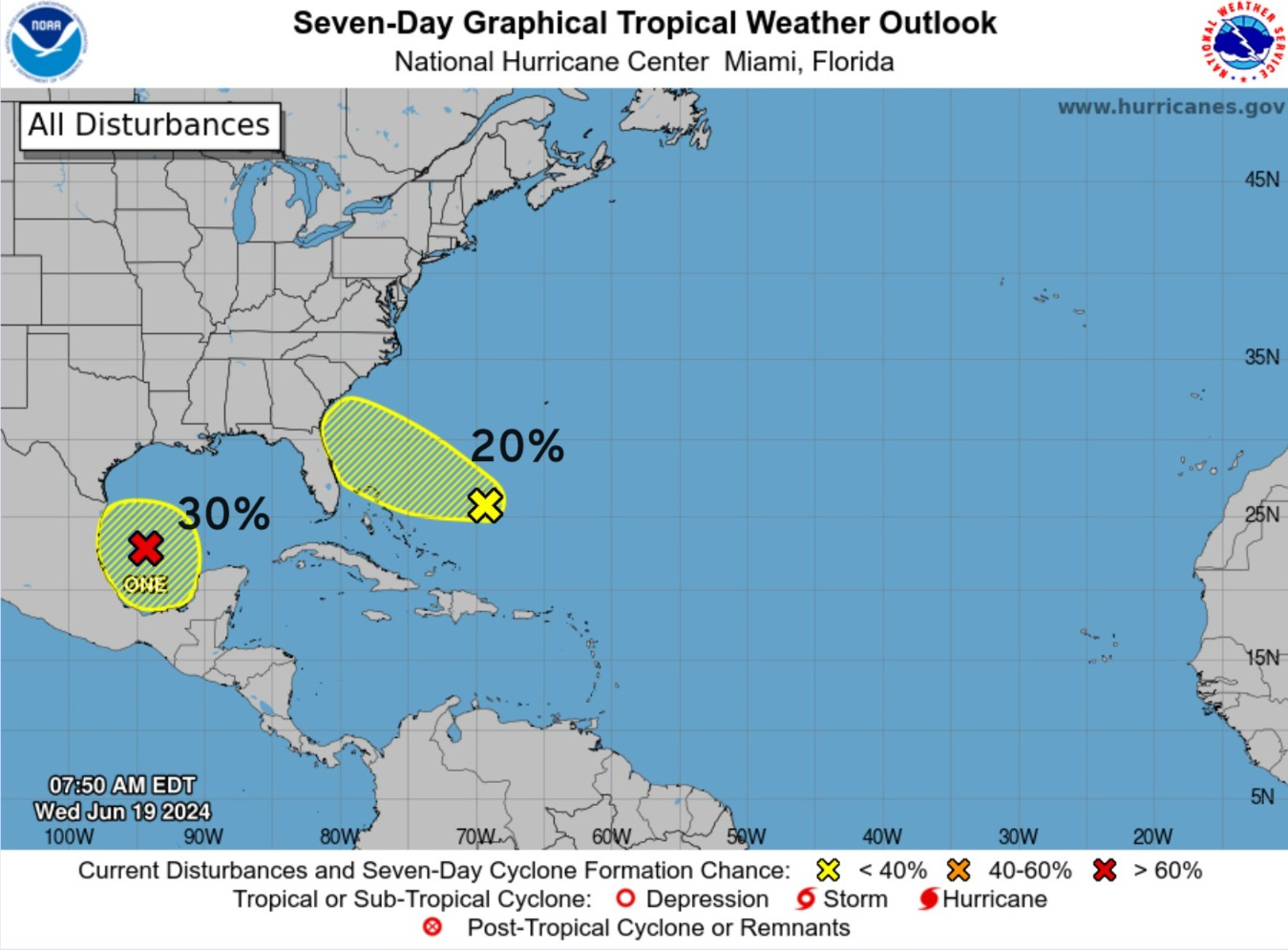

The low-level vorticity late Thursday shows the tiny system off the Florida coast. It may show some interesting spin on visible imagery on Friday morning.
Weather Trader is a reader-supported, daily newsletter. To receive new posts and support our R&D, consider becoming a free or paid subscriber.
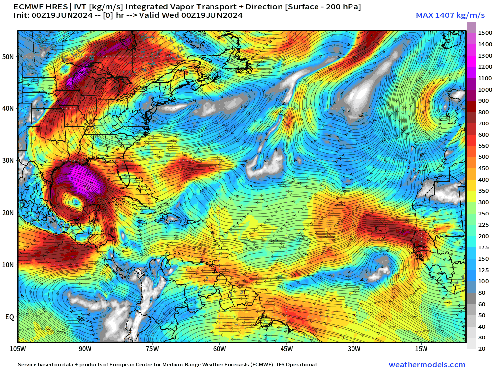
10-Days Integrated Vapor Transport
Keep reading with a 7-day free trial
Subscribe to Weather Trader to keep reading this post and get 7 days of free access to the full post archives.