


June 18, 2025 Major Hurricane Erick
Hurricane Erick continues to rapidly intensify nearing landfall

2025 Atlantic Hurricane Season [Day 18]. My expectation for this year is 14 named storms, 7 hurricanes, and 3 majors. So far, 0 named storms, 0 hurricane, and 0 majors.
Wednesday Evening Tropical Update
Atlantic Basin: No areas being watched through the next 7-days (June 25) by NHC and the ECMWF ensembles are (mostly) blank for next 2-weeks — through the end of June without a named storm.
Eastern Pacific Basin: Hurricane Erick has become a powerful major hurricane and continues to deepen up and until landfall early Thursday.
Western Pacific Basin: No activity expected for the next 7-days.
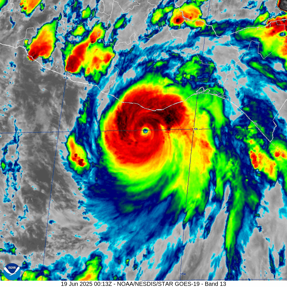
Erick is a major hurricane still intensifying as it moves slowly toward the coast over very warm water (29°C).
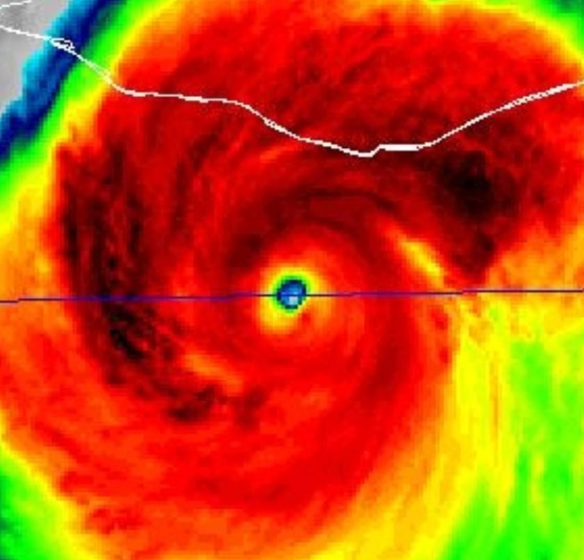
Zooming in on the eye shows the tell-tale warm eye but also some cooler cloud tops (yellow and green) surrounding in the eyewall perhaps indicating an eyewall replacement cycle — or something similar — is plateauing the pressure fall.
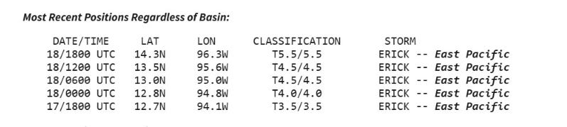
Using the Automated Advanced Dvorak Technique (ADT) we see T 6.5 = 125 knots as the satellite derived intensity. This is a tad bit more intense than the NHC advisory and what has been measured by aircraft recon.

T 5.5 from human analyst (KNES) at NOAA at 18z will probably be up-ed to T 6.0 at 00z, so we should have consensus from satellite and recon that Erick is a major hurricane.
Hurricane Hunter aircraft observed 953 mb central pressure and 105 knot winds.
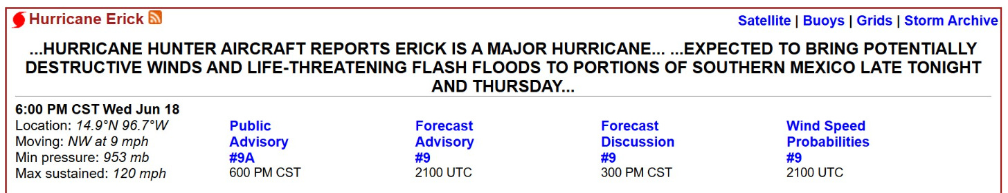
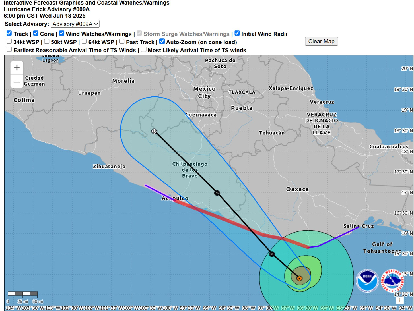
Still another 6-12 hours until landfall depending upon the angle of attack on the coast.
Keep reading with a 7-day free trial
Subscribe to Weather Trader to keep reading this post and get 7 days of free access to the full post archives.