


June 14, 2025 Hurricane Season Weekend
Dalila may become a hurricane today

2025 Atlantic Hurricane Season [Day 14]. My expectation for this year is 14 named storms, 7 hurricanes, and 3 majors. So far, 0 named storms, 0 hurricane, and 0 majors.
Saturday’s Tropical Update
Atlantic Basin: No areas being watched through the next 7-days (June 21) by NHC and the ECMWF ensembles are mostly blank for next 2-weeks with some mischief [<10%] in the far western Gulf.
Eastern Pacific Basin: Tropical Storm Dalila (04E) formed with Invest 94E behind it (40% in 7-days), then the basin quiets into end of June.
Western Pacific Basin: Tropical Storm Wutip (01W) did become a typhoon prior to landfall in China, and is decaying over land heading NE. No other activity through 7-days.
Thank you to readers continuing into this Hurricane Season. My goal is to keep you informed about ongoing extreme weather events inside and outside of the tropics, but also a week (hopefully) heads up on what’s coming. I’ll be using a variety of weather modeling output, some of it may be unfamiliar, but it’s state-of-the-art and industry leading standard.
ECMWF 00Z | Integrated Vapor Transport | Next 10-days
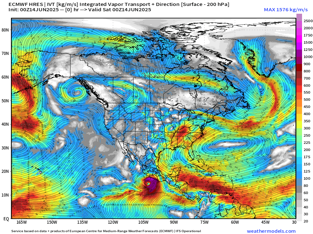
In the Eastern Pacific, 2 systems for the next 10-days including ongoing TS Dalila (04E) and Invest 94E — next name is Erick.
A vigorous moisture stream out of the Caribbean continues across the Yucatan into the western Gulf of Mexico and then northward into the Midwest U.S. potentially fueling powerful severe weather complex later next week.
A strong ridge of high pressure develops over the Southeast U.S. by Days 8-10.
Eastern Pacific: In addition to Tropical Storm Dalila, moderate chance of another storm later next week (40%).
No tropical cyclone formation likely in the Atlantic basin in the next 7-10 days+
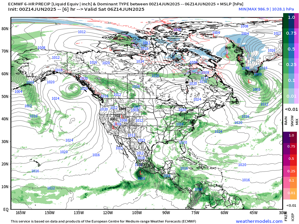
Tropical Atlantic | Precipitation and MSLP Next 10-days | ECMWF 00z
A strong High Pressure cell in control over the subtropical and middle latitude Pacific off the U.S. West coast.
Storm systems out of Canada are coming down ESE into the Midwest U.S. and feasting on the tropical moisture plume out of the Caribbean/Gulf.
Moisture from Invest 94E (maybe Erick) gets pulled across from the EPAC into the Bay of Campeche.
Keep reading with a 7-day free trial
Subscribe to Weather Trader to keep reading this post and get 7 days of free access to the full post archives.