


June 14, 2024 Tropical Update: Central American Gyre
Central American Gyre to develop with potential to spawn a tropical storm in the Gulf of Mexico

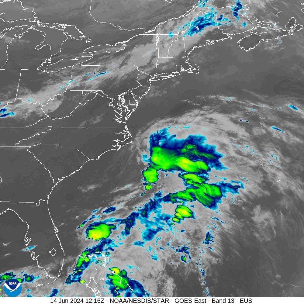
Invest 90L is running out of time to develop into a tropical cyclone as it accelerates NE off the U.S. East Coast. The upper-level winds are hostile with strong wind shear. Cooler ocean temperatures typical in mid-June are also helping to put a lid on the development.
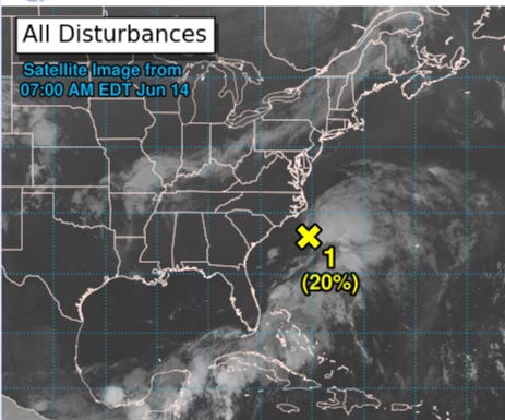
1. Offshore of the Southeastern U.S. (AL90):

Satellite data and surface observations indicate that the low pressure area offshore of the SE U.S. coast has become a little better organized since yesterday.

However, upper-level winds remain strong, and the system is forecast to merge with a front over the W Atlantic Saturday or Sunday. Regardless of
development, heavy rainfall is forecast to continue across portions
of the Florida peninsula through Saturday.
* Formation chance through 48 hours...low...20 percent.
Area being watched in the 7-day range in the southern Gulf of Mexico up to 50%
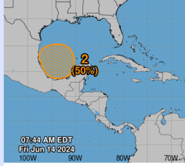
2.  A broad area of low pressure is forecast to form over the SW Gulf of Mexico late this weekend or early next week.

Environmental conditions appear conducive for gradual development of this system, and a tropical depression could form during the early or middle part of next week while it moves slowly W or W-NW.

* Formation chance through 48 hours...low...near 0 percent.
* Formation chance through 7 days...medium...50 percent.
Central American Gyre: Integrated Vapor Transport
The atmospheric river diagnostic called Integrated Vapor Transport (IVT) works nicely in the tropics to highlight the convergence of deep tropical moisture into plumes across the Gulf of Mexico into Florida.
Next 10-days from ECMWF of IVT:

Massive heat dome / high pressure to develop over the eastern U.S. with moisture required to go around into the northern Plains and Midwest — being fueled by the Caribbean / Gulf of Mexico gyre system
The northward extent of the Central American Gyre into Texas including Houston has shifted in recent forecast with exceptional moisture content … could be excessive rainfall across SE Texas.
Note — another system could develop in the Gulf of Mexico in the 10-day range from the same gyre as additional tropical waves or vorticity arrive into the western Caribbean.
850 hPa Low Level Relative Cyclonic Vorticity
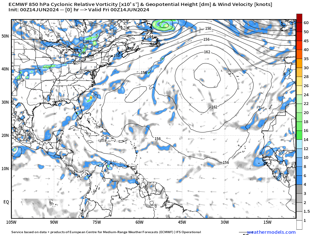
The Central American Gyre shows up nicely with vorticity elements that coalesce into a dominant center of low pressure off the northern Mexican coast south of Texas.
Not much else going on across the wider / open tropical Atlantic, typical for mid- and late-June.
Synoptic Analysis
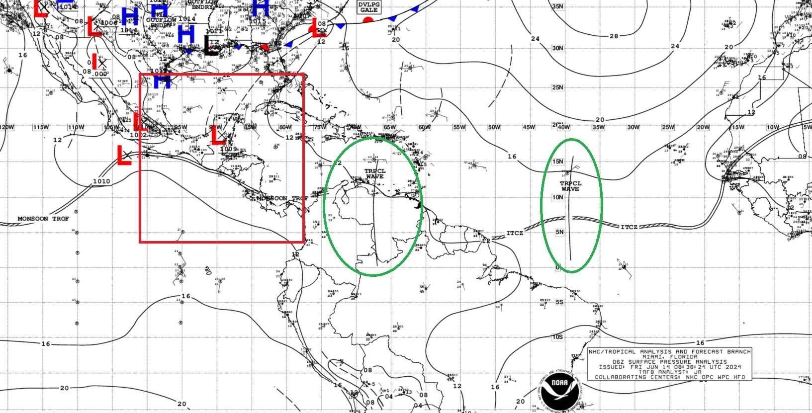
Heavy Rainfall over Central America and Mexico:

A Central American Gyre (CAG) continues to develop. Observations are indicating that heavy rainfall is already occurring before the main event that is forecast to begin this weekend through the morning of Friday June 21. The persistent moist onshore flow in the Pacific basins of Guatemala, Chiapas, Honduras and in El Salvador will favor 3-4 days of intermittent rounds of heavy precipitation.
...TROPICAL WAVES...

The tropical wave analyzed over western Africa on the 00 UTC map
has been removed from the 06 UTC surface analysis and will be re-
introduced once the tropical wave has fully emerged into the far
eastern Atlantic. Active convection associated with this wave is
impacting portions of western Africa, extending offshore to near
20W.

A central Atlantic tropical wave has its axis near 39W from 02N
to 16N, moving westward at 10 to 15 kt. No significant convection
is occurring with this wave as it is moving through a dry and
stable environment.

The Atlantic tropical wave analyzed near 55W on the 00 UTC
surface analysis has been removed from the 06 UTC analysis as it
has become unidentifiable.

A Caribbean tropical wave has its axis near 67W south of 15N to
inland central Venezuela. It is moving westward at 10-15 kt. No
deep convection is noted with this wave over the Caribbean. This
wave is expected to become absorbed into the CAG this weekend.

A western Caribbean tropical wave has been removed from the
surface analysis as it has started to get absorbed into the
developing CAG described under Special Features.
Basin Wide GeoColor Satellite Imagery
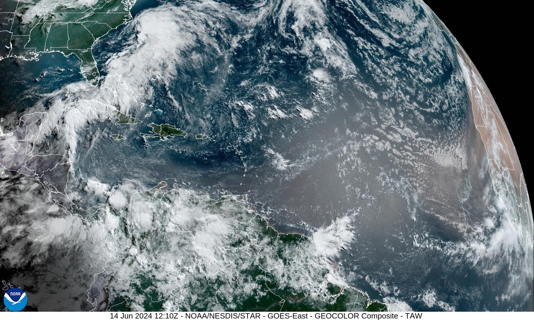
Note the thick sand/dust plume with a new strong SAL / African dust layer coming off the continent — reference ECMWF CAMS dust extinction.
Saharan Dust Layer

A strong SAL will envelope the Eastern Tropical Atlantic putting a lid on tropical development.
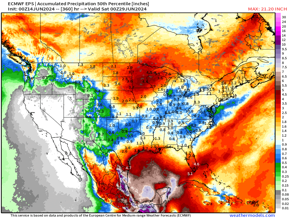
Precipitation Anomaly Next 10-days [inch]

The southern half of the Gulf of Mexico is the focus of exceptional rainfall over the next 10-days associated with tropical moisture feed on periphery of the Caribbean gyre. Rainfall again reaching Texas in the 10-day forecast — but bone dry across the Eastern U.S. —> bad as the “heat dome” intensifies over the eastern U.S.
Ensemble Median Precipitation Next 15-days
The actual (not anomaly) precipitation across the Lower 48 and surrounding areas shows the exceptional amounts across the Gulf of Mexico and the coast including Texas and again Florida. Under 1-inch of rain in the next 2-weeks across much of the Southeast and Ohio Valley.
Next 15-Days | Atlantic EPS Cyclone Tracks

Only one system likely in the next 10-days that would take the first name on the list Alberto in the southern Gulf of Mexico. Additional systems could develop out of the Central American Gyre in Week 2 or toward end of June.
Eastern Pacific Tropical Weather Outlook
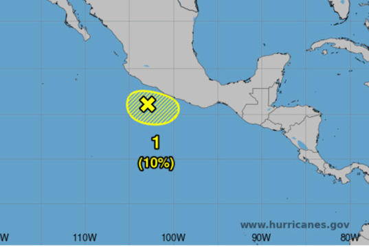
NHC has a 10% area of interest in the TWO in next 7-days south of Mexico that could impact the coast, but nothing imminent.
June is usually a busy month in the Eastern Pacific, but not this year — yet to see a named tropical storm.
Western Pacific Tropical Weather Outlook
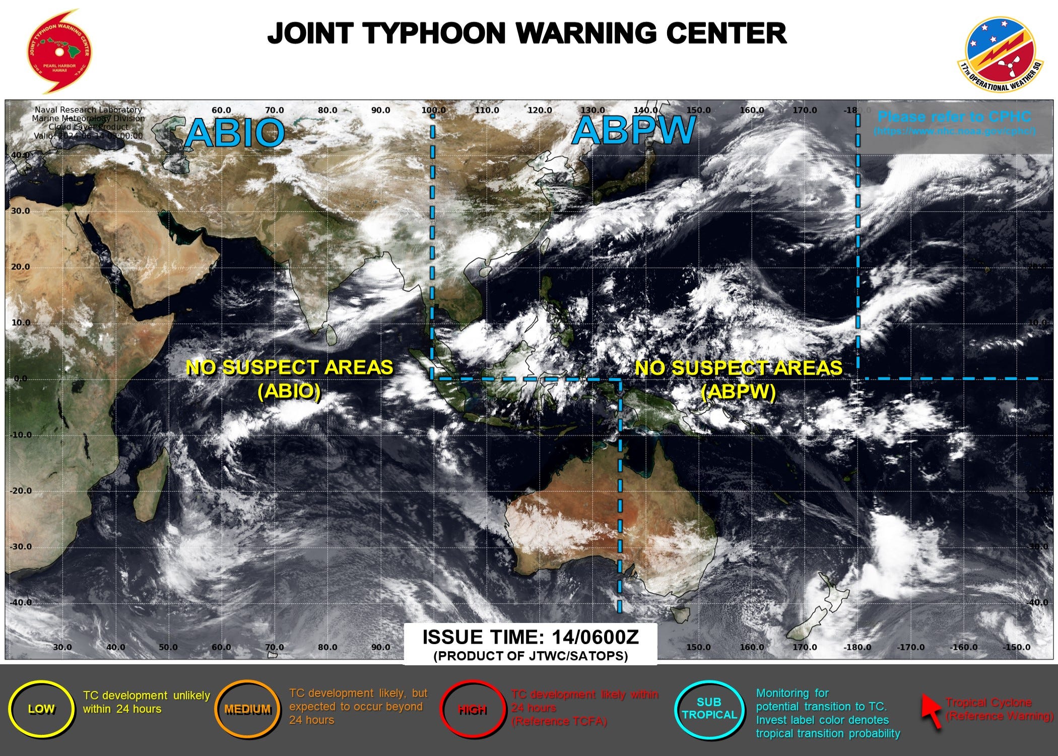
Ghost town — No Suspect Areas areas of interest during the next 48-hours to 7-days from JTWC.

ECMWF EPS ensembles show a few members with a hint of a TC track over the next 10-days in the South China Sea. The last week of June could see development east of the Philippines.
Thank you to Subscribers and Supporters!
The investment in my research and development will pay off as A.I. enabled weather forecasts become a normal and indispensable part of our weather forecasting enterprise.
Maps sourced from weathermodels.com designed and innovated by yours truly! I actually create all of my content from scratch.