


June 12, 2024 Tropical Update: Still waiting on Alberto
NHC watching two areas now for development in Atlantic

Forecasts for the 2024 Atlantic Hurricane Season | Please subscribe for $5/month or upgrade to Yearly for email inbox deliveries every morning — or more often as conditions warrant.
The investment in my research and development will pay off as A.I. enabled weather forecasts become a normal and indispensable part of our weather forecasting enterprise.
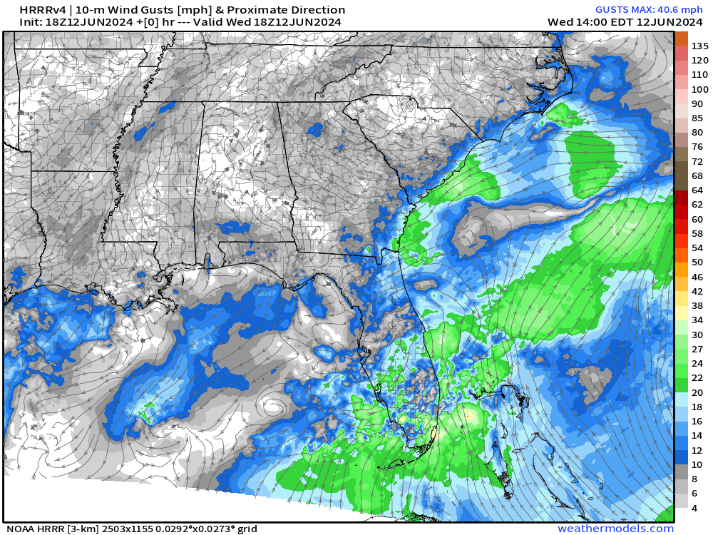
Invest 90L will evolve from an elongated trough of low pressure into a more compact storm in the coming 48-hours. I think that’s plenty enough organization for a tropical storm, although wind shear could make it look so ugly on satellite.
Invest 90L up to 20% in 7-days as system moves off the U.S. Southeast coast
Another area being watched in the 7-day range in the southern Gulf of Mexico up to 30%
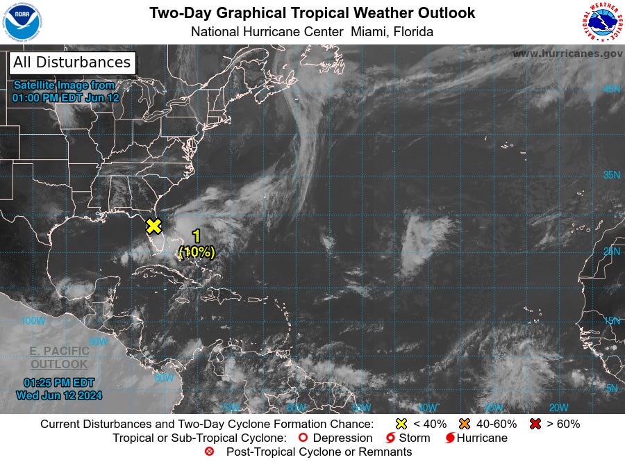
. Florida Peninsula and Offshore Southeast U.S. (AL90):

An elongated area of low pressure over the Florida peninsula continues to produce a large area of disorganized showers and thunderstorms. Although upper-level winds are expected to be only marginally conducive, some slow development is possible while the system moves northeastward offshore of the U.S. Southeast coast tonight through late week.

* Formation chance through 48 hours...low...10 percent.
* Formation chance through 7 days...low...20 percent.
7-Day Tropical Cyclone Outlook
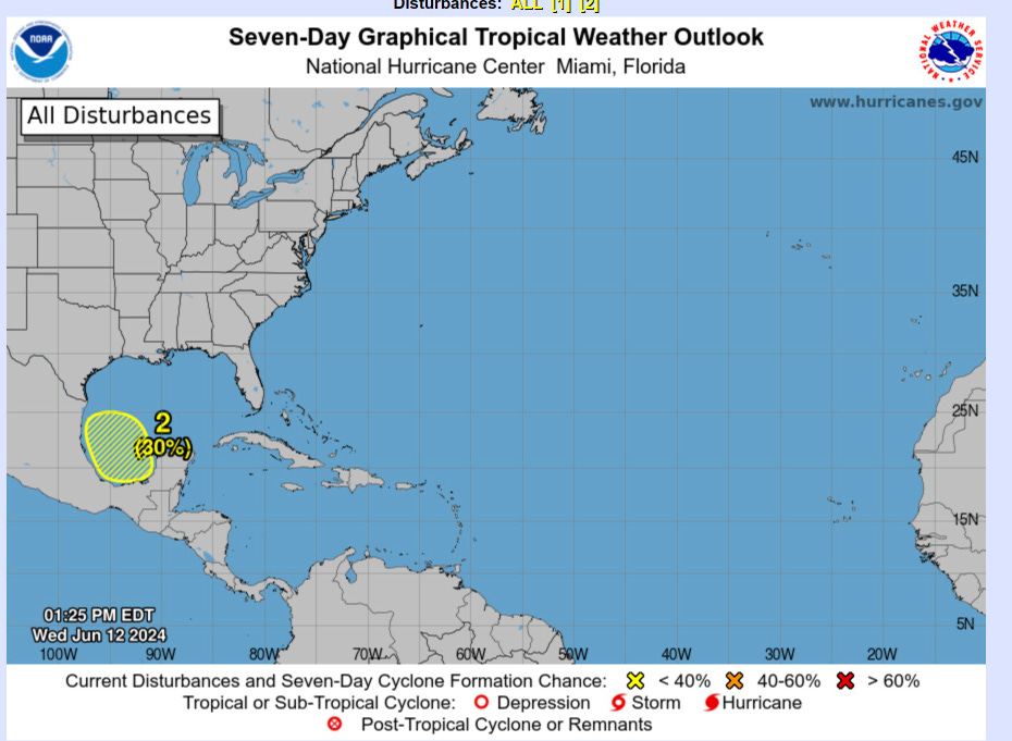
With regards to the southern Gulf of Mexico, the system will be close to land associated with the Central American gyre
Note the tropical waves coming off the coast of Africa in the next 8-days. These have a bit of spin with them but eventually weaken in the central Atlantic. Still early for development out there.

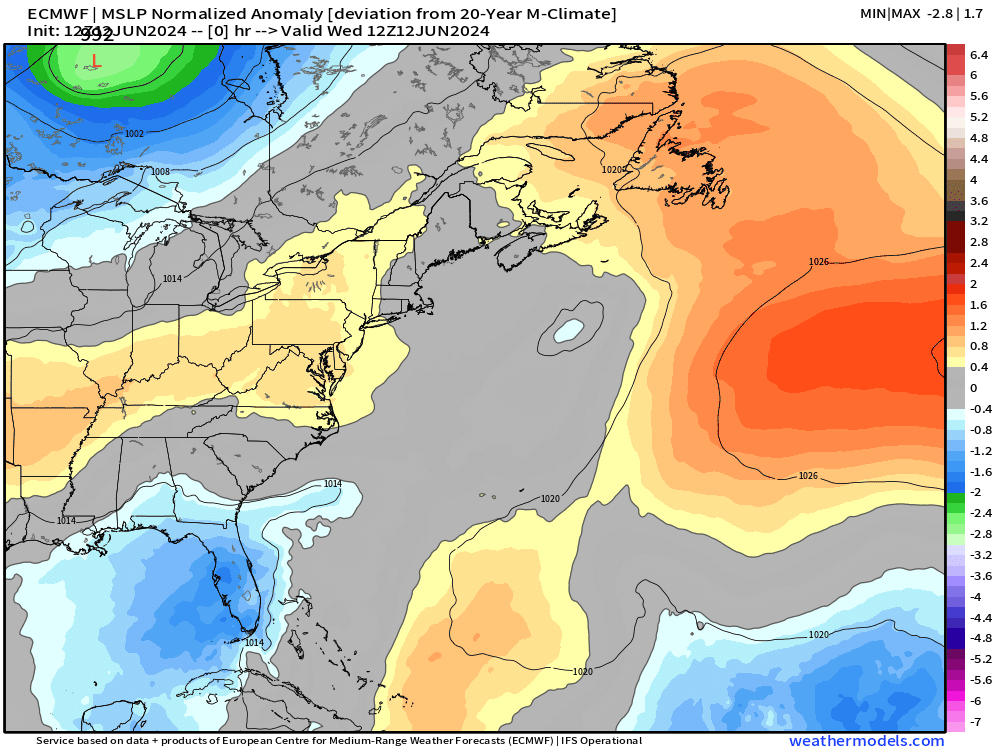
ECMWF MSLP Normalized Anomaly
The surface pressure reaches in the 990s as Invest 90L reaches off Cape Hatteras. I think that’s sufficient for a tropical storm designation. I’d put the chances quite a bit higher on Alberto than the NHC.
Integrated Vapor Transport
The atmospheric river diagnostic called Integrated Vapor Transport (IVT) works nicely in the tropics to highlight the convergence of deep tropical moisture into plumes across the Gulf of Mexico into Florida.
Next 10-days from ECMWF of IVT:
Keep reading with a 7-day free trial
Subscribe to Weather Trader to keep reading this post and get 7 days of free access to the full post archives.