


June 11, 2025 Hurricane Season Wednesday
Atlantic remains quiet for next 1-2 weeks.

2025 Atlantic Hurricane Season [Day 11]. My expectation for this year is 14 named storms, 7 hurricanes, and 3 majors. So far, 0 named storms, 0 hurricane, and 0 majors.
Tuesday’s Tropical Update
Atlantic Basin: No areas being watched through the next 7-days (June 18) by NHC and the ECMWF ensembles are (mostly) blank for next 2-weeks.
Eastern Pacific Basin: Both Barbara and Cosme have decayed to remnant lows. A new system is forming for this weekend (04E —> Dalila)
Western Pacific Basin: Wutip (01W) is the basin’s first tropical depression and is heading to southern China slowly. It may consolidate into a Typhoon.
Thank you to readers continuing into this Hurricane Season. My goal is to keep you informed about ongoing extreme weather events inside and outside of the tropics, but also a week (hopefully) heads up on what’s coming. I’ll be using a variety of weather modeling output, some of it may be unfamiliar, but it’s state-of-the-art and industry leading standard.
ECMWF Simulated Satellite Imagery | Next 8-days

While no tropical storms are on the map, we can see the interactions between upper-level troughs and the convection of the ITCZ/monsoon trough over a week. The movement of the dry areas from the north usually come with vertical wind shear and unfavorable background environment conditions for tropical storm formation, especially in June.
ECMWF 00Z | Integrated Vapor Transport | Next 8-days
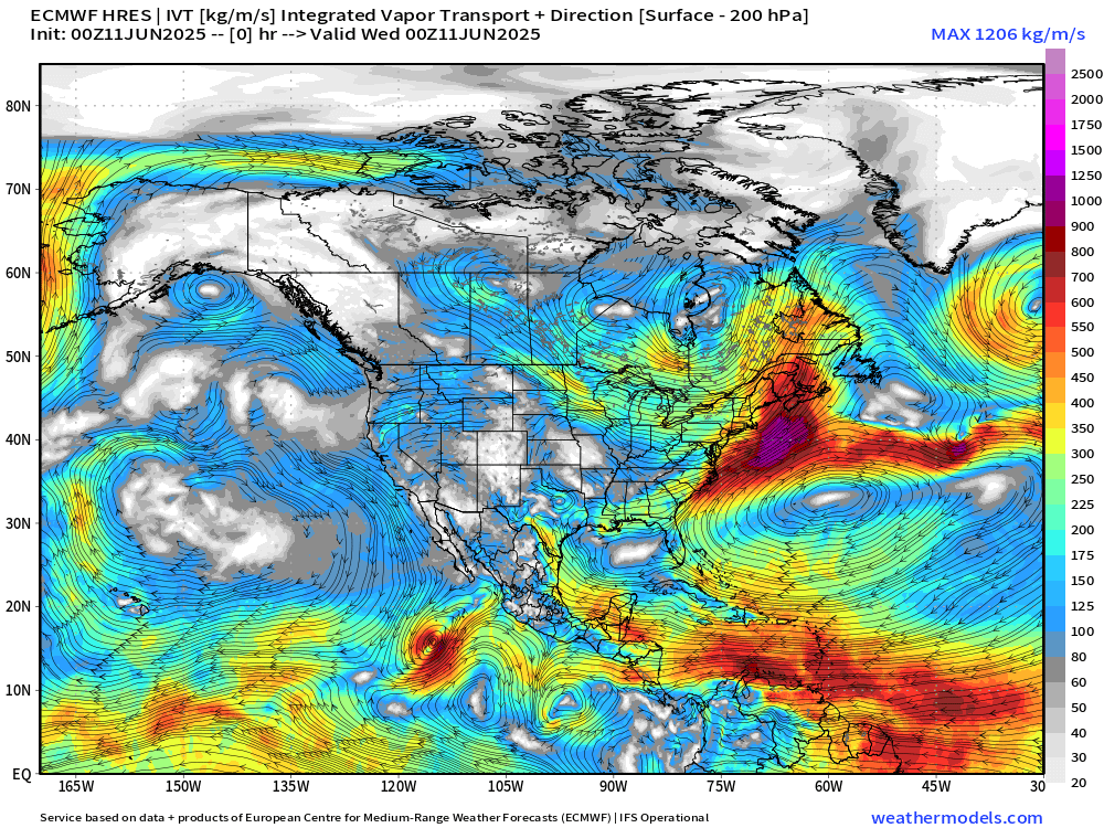
Still watching our mid-June pattern of strong easterly moist flow through the Caribbean into the Eastern Pacific or northward into Gulf of Mexico. The subtropical high off the U.S. Southeast coast is pushed south by Canadian troughs but will eventually restrengthen and expand.
Eastern Pacific: At least 1 more storm / hurricane (Dalila) in 7-days [NHC at 90%], and then another area of disturbed weather to its east by June 18-20 (10-20%)
No tropical cyclone formation likely in the Atlantic basin in the next 7-10 days+
Precipitable Water Next 5-days | Atlantic Basin | ICON 06z
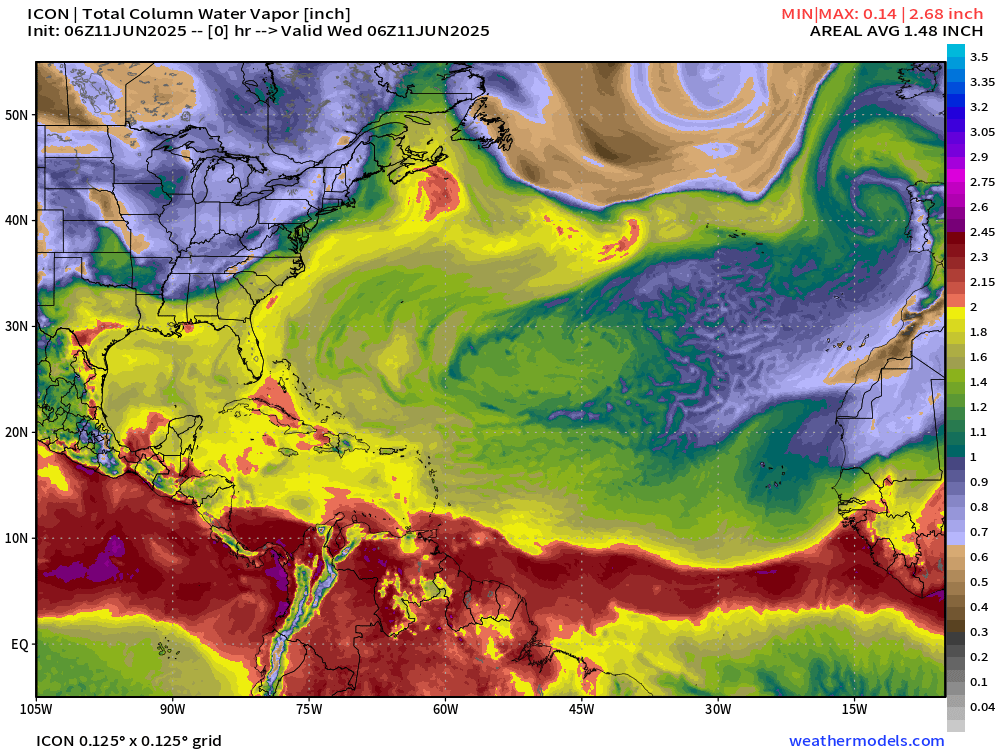
We need > 2” PWAT to fire up a tropical storm or a hurricane.
A tropical early-summer air mass is across the eastern U.S. with unsettled, wet conditions with daytime thunderstorms and convection.
The ITCZ breaks down slightly with some northward undulation due to a weaker Azores High, but conditions are entirely impossible for tropical storm development.
Tropical Atlantic | Precipitation and MSLP Next 8-days
Keep reading with a 7-day free trial
Subscribe to Weather Trader to keep reading this post and get 7 days of free access to the full post archives.