June 10, 2024 Tropical Update: Gulf of Mexico moisture plume
The first named system in each basin possible in next 10-days
Welcome to the 2024 Atlantic Hurricane Season | Please subscribe for $5/month for email inbox deliveries every morning — or more often as conditions warrant.
The investment in my research and development will pay off as A.I. enabled weather forecasts become a normal and indispensable part of our weather forecasting enterprise.
Area off SE USA coast could see a hybrid or tropical storm development by this weekend —> Alberto
Vorticity in the Eastern Pacific south of Mexico could make landfall and enter southern Gulf of Mexico in 7-8 days
Enormous rainfall totals for Florida and then Texas by Day 10
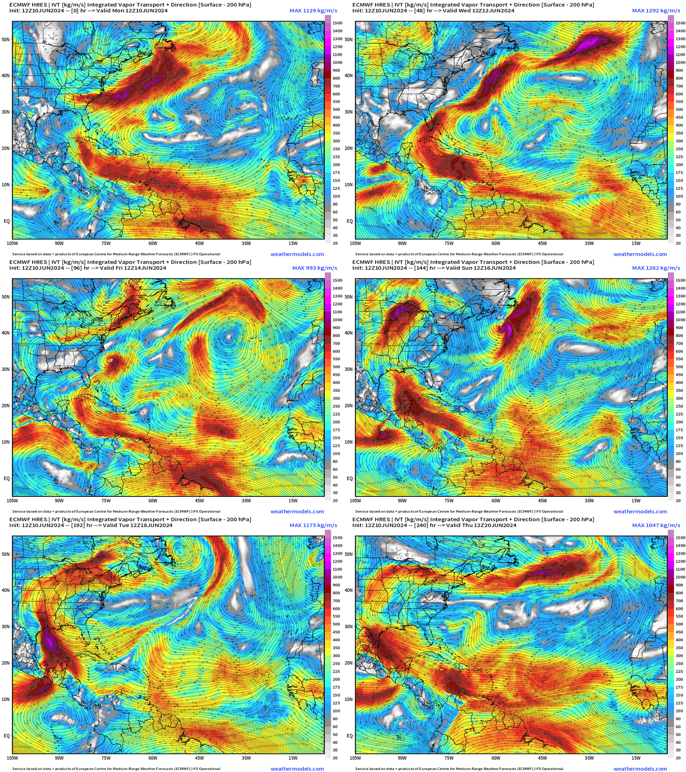
The atmospheric river diagnostic called Integrated Vapor Transport (IVT) works nicely in the tropics to highlight the convergence of deep tropical moisture into plumes across the Gulf of Mexico into Florida.
Next 10-days from ECMWF of IVT:
Watch the development of 2 tropical systems — could be 3 depending upon the survival of the vorticity across Mexico from the Gulf of Tehuantepec to the Bay of Campeche.
First the 850 hPa relative vorticity off the FL/SE USA coast with intensification as it heads NE into the Atlantic before reaching Newfoundland by Day 10.
Keep reading with a 7-day free trial
Subscribe to Weather Trader to keep reading this post and get 7 days of free access to the full post archives.


