June 10, 2020: Tropical update
Tools to understand tropical meteorology
Tropical Depression Cristobal became post-tropical somewhere around Dubuque, Iowa last night but the official determination will have to wait until the post-storm report is released. If the Atlantic remains quiet over the next few weeks, then the NHC will likely release it pretty soon.
During the month of June, the Atlantic is typically very quiet with a storm in the Gulf of Mexico, Caribbean or the southwest Atlantic being the main active zones. It is still a bit too early to see African easterly waves develop into tropical storms.
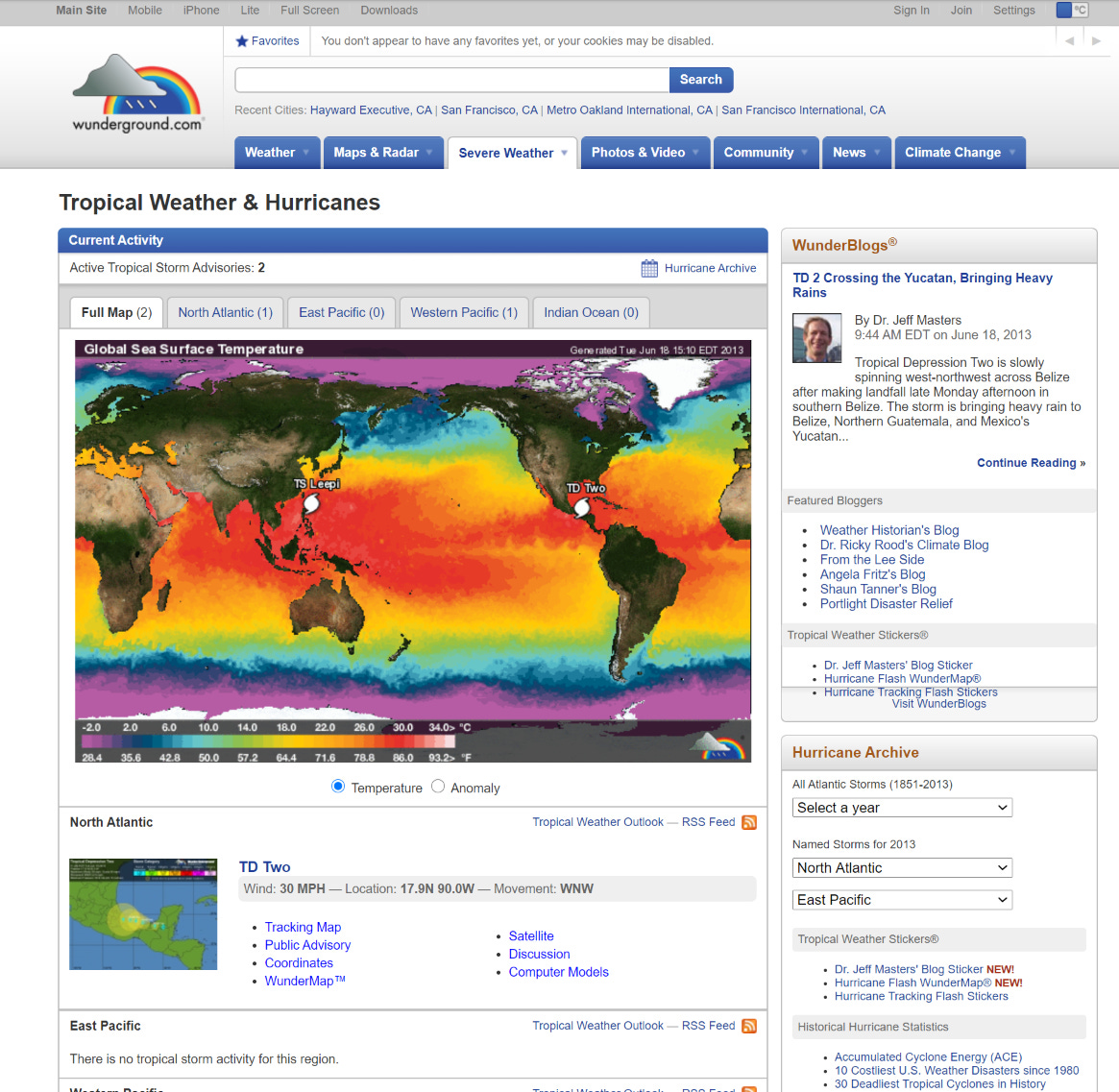
We can look at the sea-surface temperatures to gauge immediately why storms do not develop elsewhere in early June:

Tropical storms and hurricanes require at least 26°C sea-surface temperatures to intensify in earnest. There are exceptions but the general rule is 26°C and for major hurricanes usually 28°C. The water beneath the surface or the cyclone “heat potential” also determines the intensity of a storm if all else is equal e.g. low wind shear, favorable low-level humidity, instability, and low amounts of Saharan dust.
African waves typically come off the coast into the Atlantic at 15°N latitude so they will immediately encounter chilly water limiting convection or showers and thunderstorms. There is also the complication of Saharan Air Layers (dust SAL).
There is a massive plume of African dust coming off the continent. The upper-level winds are also highly unfavorable for tropical development.

But, going back the sea-surface temperature map, there is plenty of real estate at about 45°W longitude heading into the Caribbean and Gulf of Mexico that could sustain a strong hurricane.
Not along the East Coast of the U.S. as water temperatures are very chilly except for the Gulf Stream off the Carolinas. Any storm would need to hug the coast or move perfectly over the Gulf Stream arriving from elsewhere.
The other parameter that is most important is deep-layer wind shear which will tear a storm apart like a shredder.

We typically consider favorable shear to be less than 20-knots not the 60-70 knots expected to impact the Main Development Region (MDR) of the Eastern Tropical Atlantic. So, we must continue to look in the Gulf, Caribbean and Bahamas for any potential storm systems heading through June.
The NHC has given a tropical wave 10% chance of developing east of the Lesser Antilles which is probably generous considering the adverse vertical wind shear just ahead of the disturbance.

On a personal note, I got to take a little trip down memory lane looking at the Web Archive snapshots of the Weather Underground page. A few other graduate students and professional meteorologists reminisced how the WU captured them into the field of meteorology. The layout, tools, and information content was so rich and should really be replicated again. So much about weather in the media was better 5, 10 or 20 years ago. Somebody should do something about that.