We are now in the 2025 Atlantic Hurricane Season. My expectation for this year is 14 named storms, 7 hurricanes, and 3 majors.
Also, thank you to subscribers continuing into this Hurricane Season. My goal is to keep you informed about ongoing extreme weather events inside and outside of the tropics, but also a week (hopefully) heads up on what’s coming. I’ll be using a variety of weather modeling output, some of it may be unfamiliar.
Also, even if you are not contributing to unlock the posts, you’re still seeing a preview that gives a summary. Posts will be at least daily for the next 5-months!
Sunday’s Tropical Weather Headlines
Atlantic tropical update: Hurricane Season starts today June 1st, but no tropical storm development expected in next 7-10 days. Any system thereafter would be unlikely (5%) according to ensembles through Day 14.
Eastern Pacific tropical update: 40% chance of next system in 7-days — Barbara, but recent modeling had leveled off in excitement.
Saharan Dust / Air Layer remains in control of the tropical Atlantic with thick plume ready to affect Gulf, again.
Lack of a hurricane strength system in the Northern Hemisphere through June 4th — means a record for inactivity, at least since 1973.
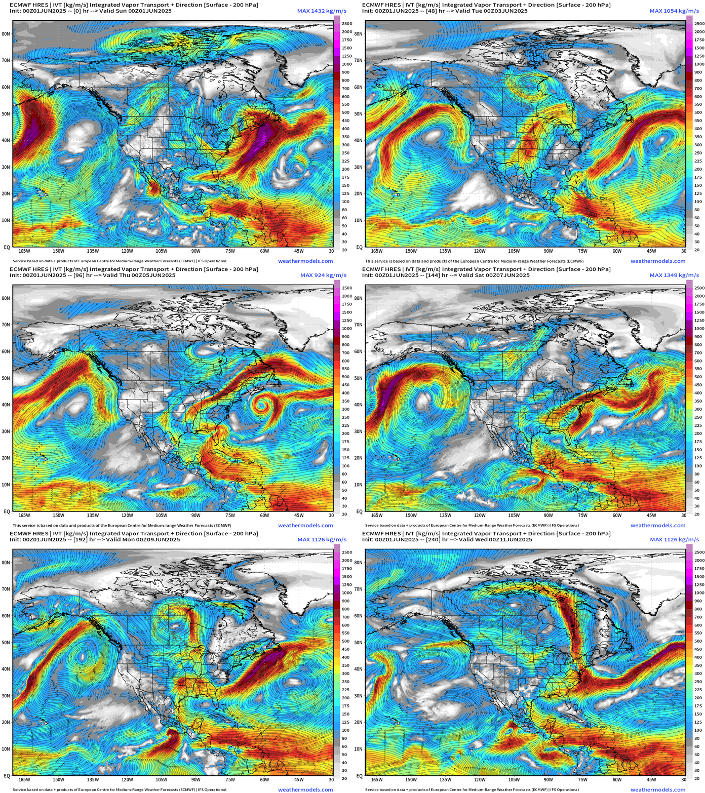
Integrated Vapor Transport | Next 10-days
The ECMWF HRES (control) IVT model simulation for the next 10-days does not show anything spinning w/tropical designation across the Atlantic. We use the ECMWF for medium-range prediction because the GFS can’t be trusted — and more beatings will not improve morale.
High pressure is large and in charge off the U.S. West Coast.
Development of “Barbara” in the Eastern Pacific looks slow and not guaranteed due to proximity to the Mexico coastline.
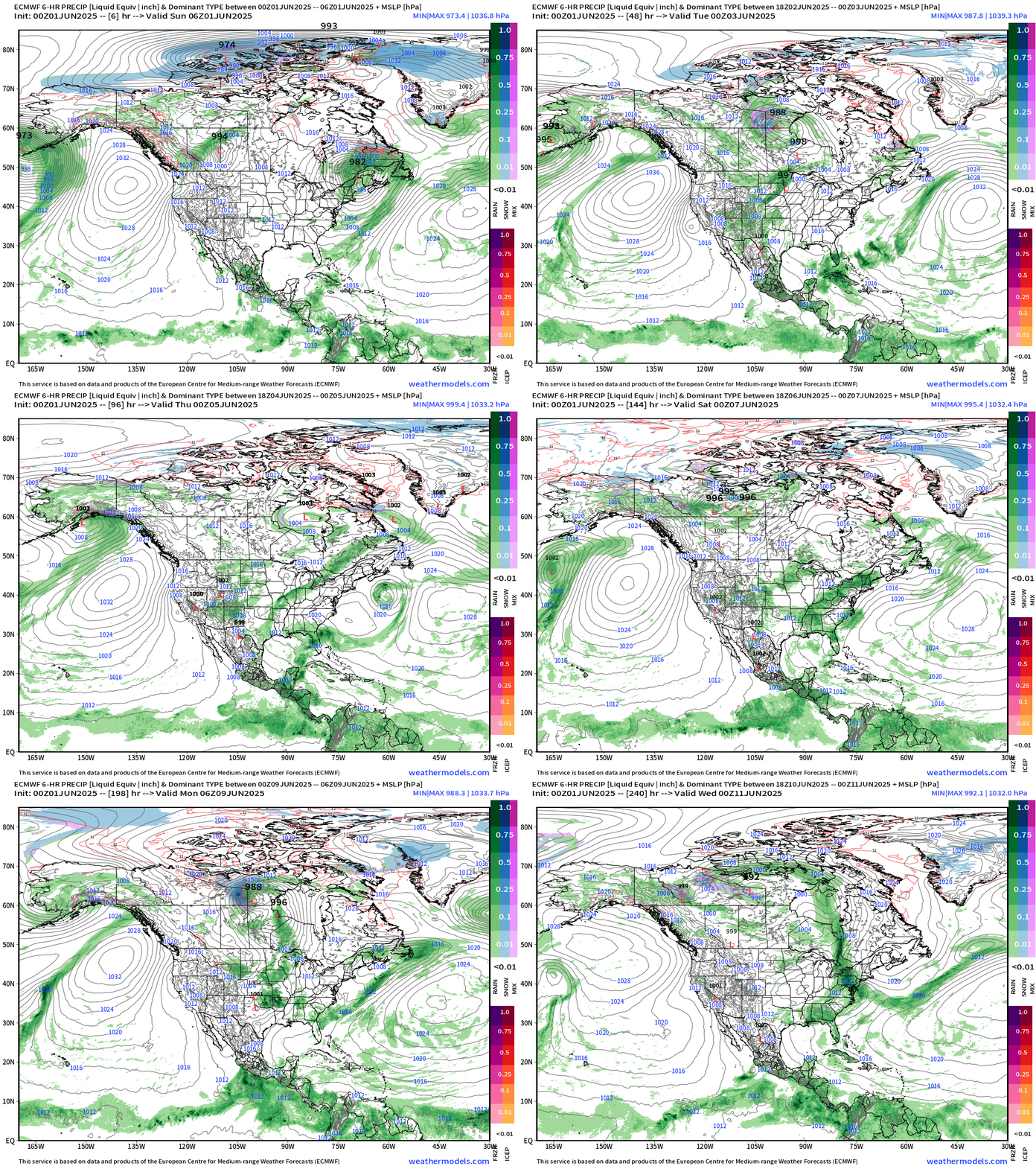
Precipitation and MSLP Next 10-days
Only show in town in the tropics remains the potential EPAC system number 2.
Precipitable Water Next 10-days
My favorite parameter PWAT — next 107-days. You can see the surges of Saharan Air Layers (SAL) from the African continent as wave fronts blasting westward with lower PWAT (yellow) pushing the red (2-inches+) out of the way. A very sharp gradient exists along the periphery of the SAL to the ITCZ/monsoon trough, which is still quite a bit far south along 10°N latitude.
This model has trended away from a Central American gyre with less moisture — considerably so. It’s pretty much abandoned a scenario of a tropical storm in Caribbean or Gulf through 10-days while previous days’ ensembles had 20% chance or so. We’re down to almost zero through 10-days.
Atlantic Basin
First week of Hurricane Season —> June 1-7 no activity expected.
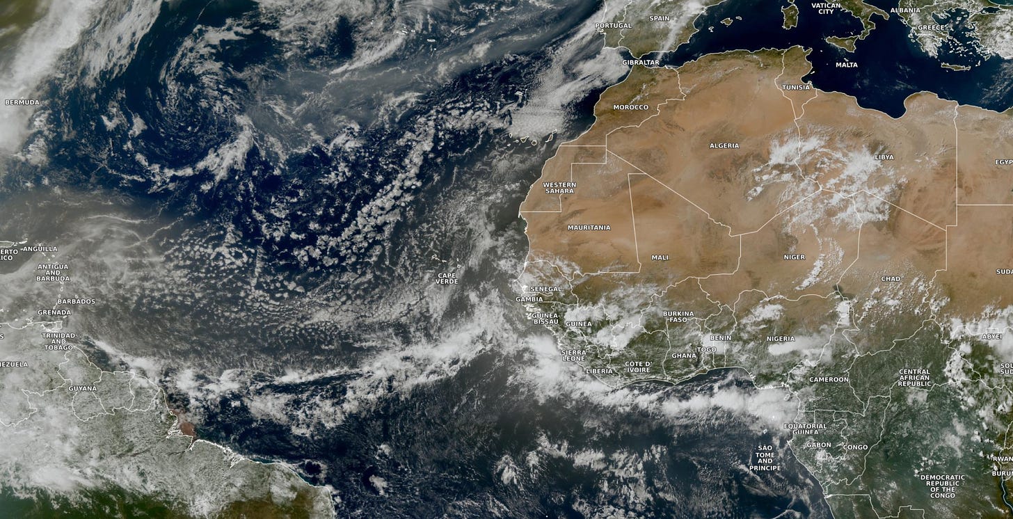
Eastern Atlantic Satellite Image
The tropical Atlantic is covered in a thick milky haze from the SAL (Saharan Air Layer) largely suppressing any convective activity.
A tropical wave that just left the African coast is showing some shower development, but a tropical storm is implausible (not happening).
ECMWF CAMS 00z DUST Aerosol Optical Depth (AOD) | 5-days Forecast
Plume 1 will drift into the Caribbean and Gulf of Mexico — then in 5-days, the next dust cloud will arrive like clockwork. I don’t know why this GIF has the pixelated appearance, but it’s kind of cool.
Keep reading with a 7-day free trial
Subscribe to Weather Trader to keep reading this post and get 7 days of free access to the full post archives.


