


June 1, 2024 Tropical Update
The 2024 Atlantic Hurricane season begins today

Welcome to the 2024 Atlantic Hurricane Season | Please subscribe for $5/month for email inbox deliveries every morning — or more often as conditions warrant.
The investment in my research and development will pay off as A.I. enabled weather forecasts become a normal and indispensable part of our weather forecasting enterprise.
Atlantic Basin Tropical Weather Outlook
No areas of interest in the NHC Tropical Weather Outlook across the Atlantic tropics as we officially start the 2024 Atlantic Hurricane Season.
Synoptic Analysis
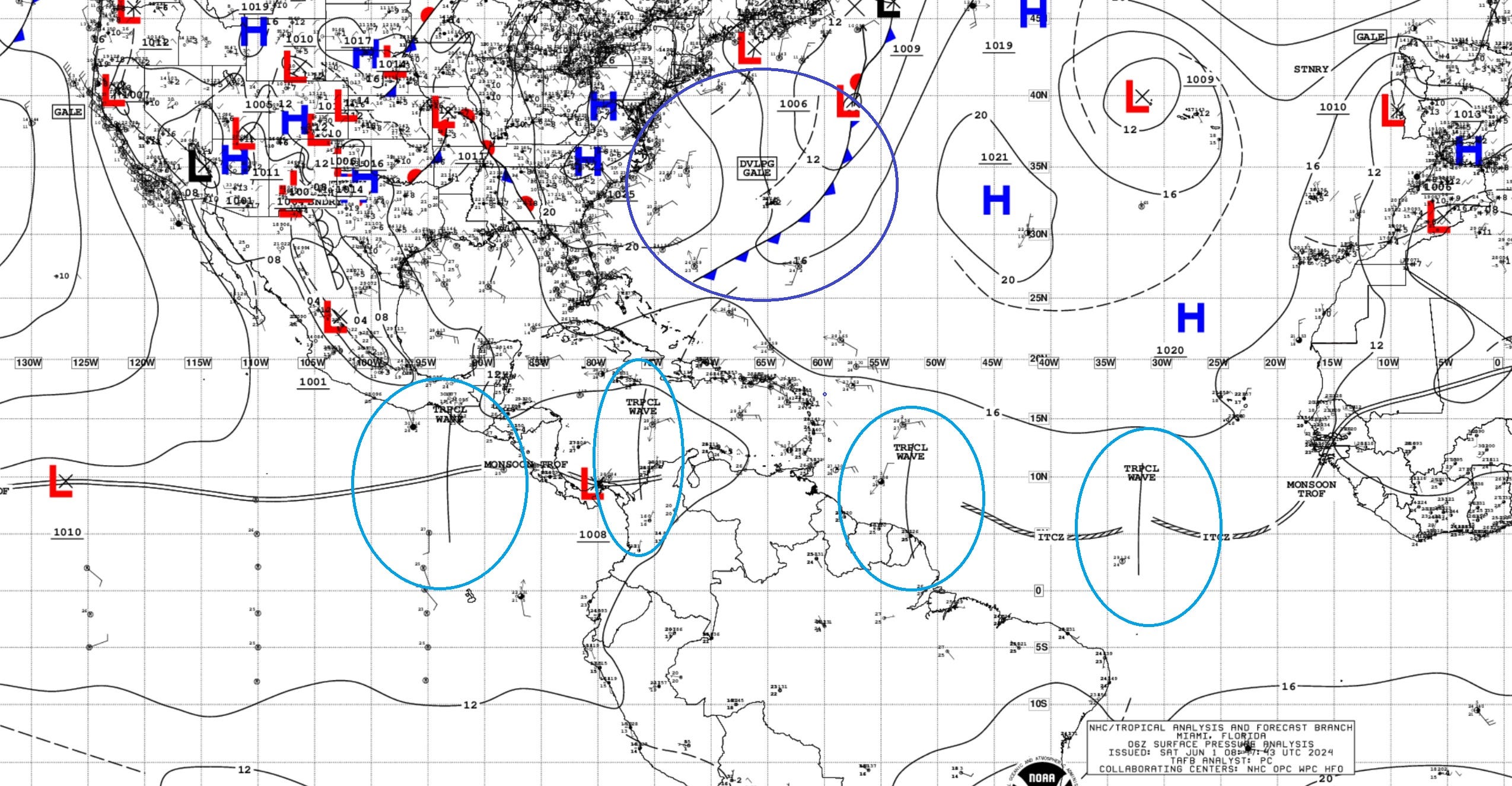
Several tropical waves are lined up from the Eastern Pacific into the central tropical Atlantic. They are spaced out every few days. We watch them emerge off the coast of Africa sometimes already well-organized as they flare convection over the continent. Heading into July, we’ll see some of these “African easterly” tropical waves [AEWs] develop into storms. If the seasonal forecasts are accurate, then we will bat a high average for developing waves.
A powerful late-season cold front has blown through Bermuda off the U.S. East coast. That will mix the ocean surface, cool SSTs and set back the warming for a week or two in the Western subtropical Atlantic.
Basin Wide GeoColor Satellite Imagery
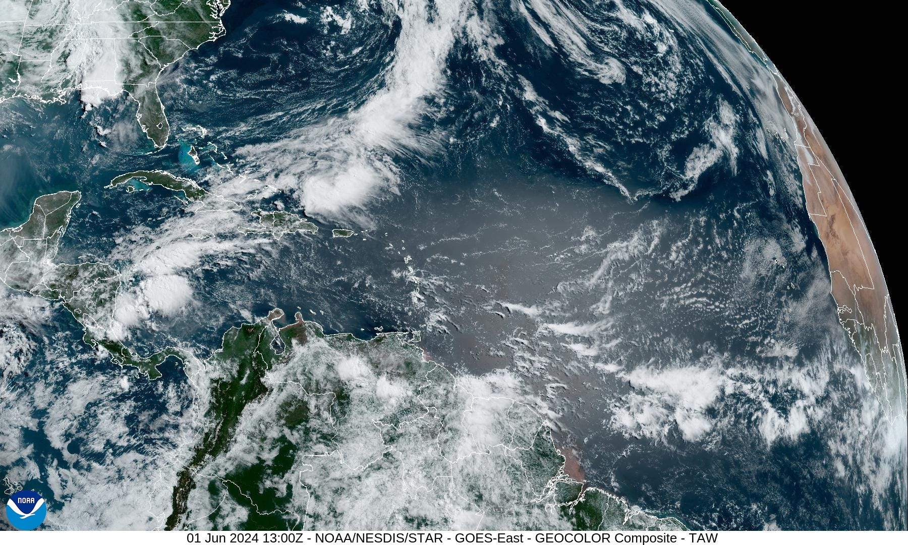
At 9 AM ET, the sun is near solar noon just east of the Lesser Antilles. The African dust usually glows nicely on the GeoColor with the glint of the sun. Some convection is firing showers w/tropical wave around 22°W.
Gulf of Mexico
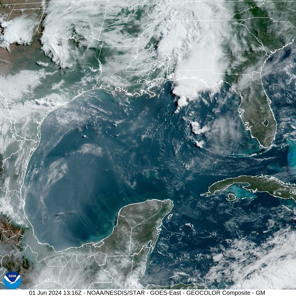
Thunderstorms moving through the Florida panhandle will wash out the beach day on Saturday. Otherwise, the Gulf is clear and sunny.
Caribbean
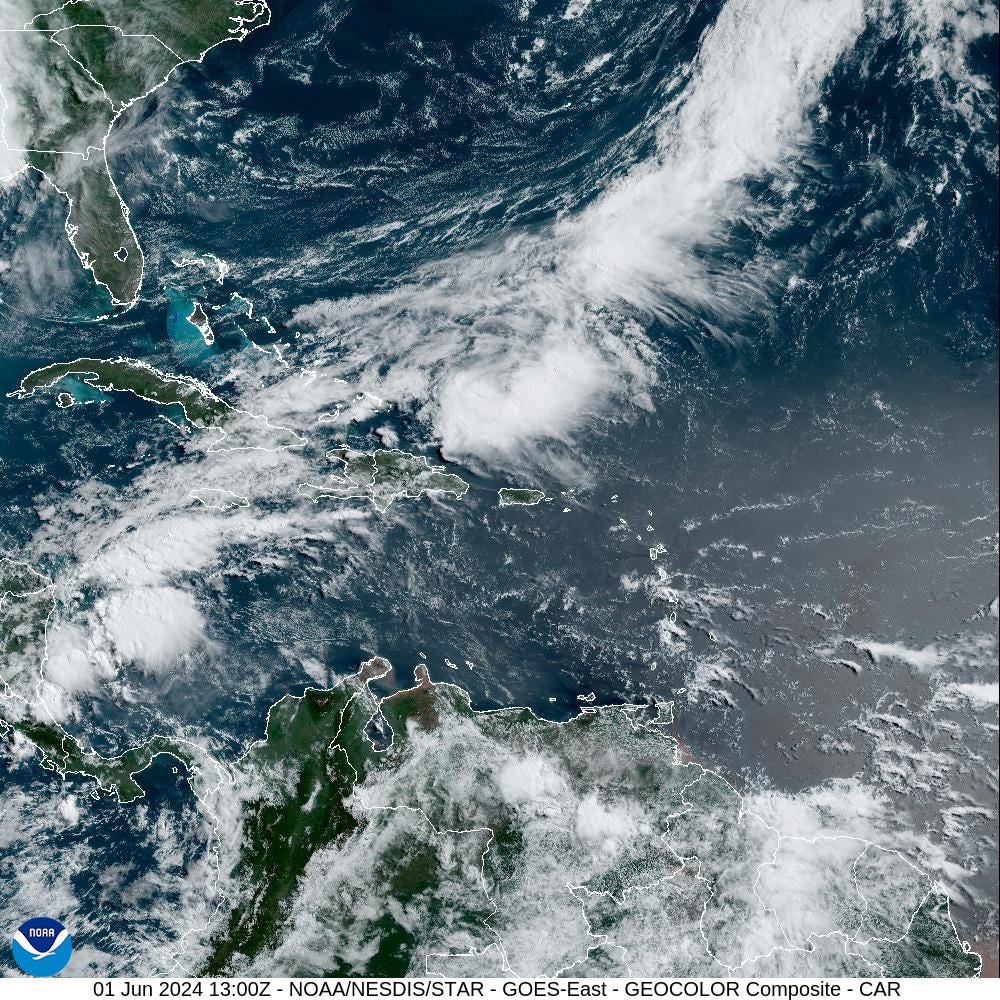
The tail end of any June cold front should be watched for spin-ups and potential tropical development.
GOES-East Hemispheric View | Water Vapor
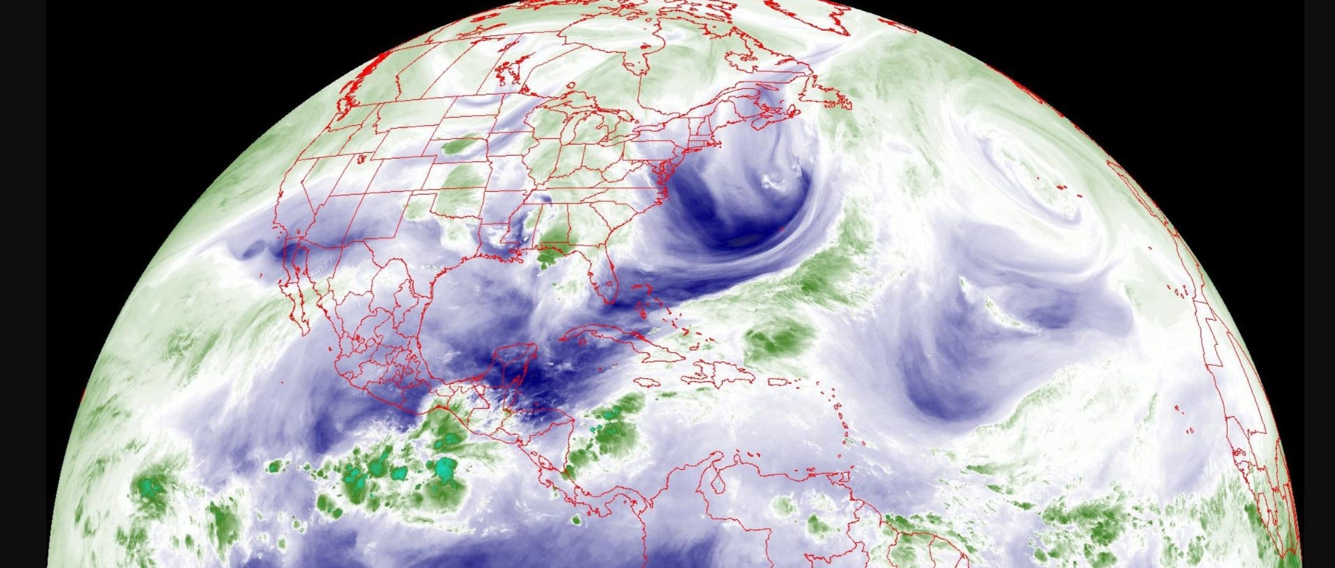
That cold front shows up nicely / prominently across the western Atlantic with a tail digging through south Florida. Dry!
GOES-East Hemispheric View | Infrared
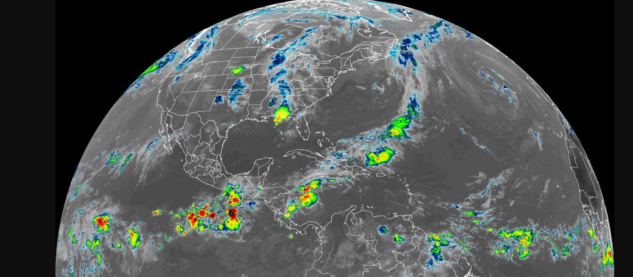
IR is used for showing intensity of convection (thunderstorms). Nothing organized in the Eastern Pacific or Atlantic.
African Dust | Saharan Air Layer (SAL)
Keep reading with a 7-day free trial
Subscribe to Weather Trader to keep reading this post and get 7 days of free access to the full post archives.