


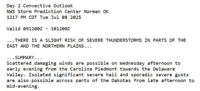
July 8, 2025 Hurricane Season Tuesday
Northern Hemisphere Tropics are dead

2025 Atlantic Hurricane Season [Day 38]. My expectation for this year is 14 named storms, 7 hurricanes, and 3 majors. So far, 3 named storm, 0 hurricanes, and 0 majors.
Tuesday’s Tropical Update
Atlantic Basin: Nothing brewing for next 7-days
Eastern Pacific Basin: The basin has also gone dormant after a fast start
Western Pacific Basin: Activity will return in coming days as monsoon trough remains active
In the News
Article to read from our former leader at NOAA — Admiral Tim Gallaudet — on the future of weather forecasting within context of the Texas flooding tragedy:
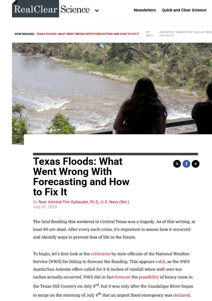
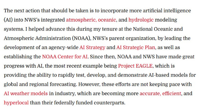
His main thesis is that we should have even better tools for weather forecasting including conventional numerical weather prediction but also A.I. tools. Of course, I agree with all of it, and hope we’ll hear more tomorrow in Dr. Jacobs’ nomination hearing in Senate Commerce. More on that here at Axios, and I’ll summarize tomorrow. I don’t expect any fireworks as this is a collegial committee focused on science, not politics.
Atlantic Water Vapor Forecast Next 8-days
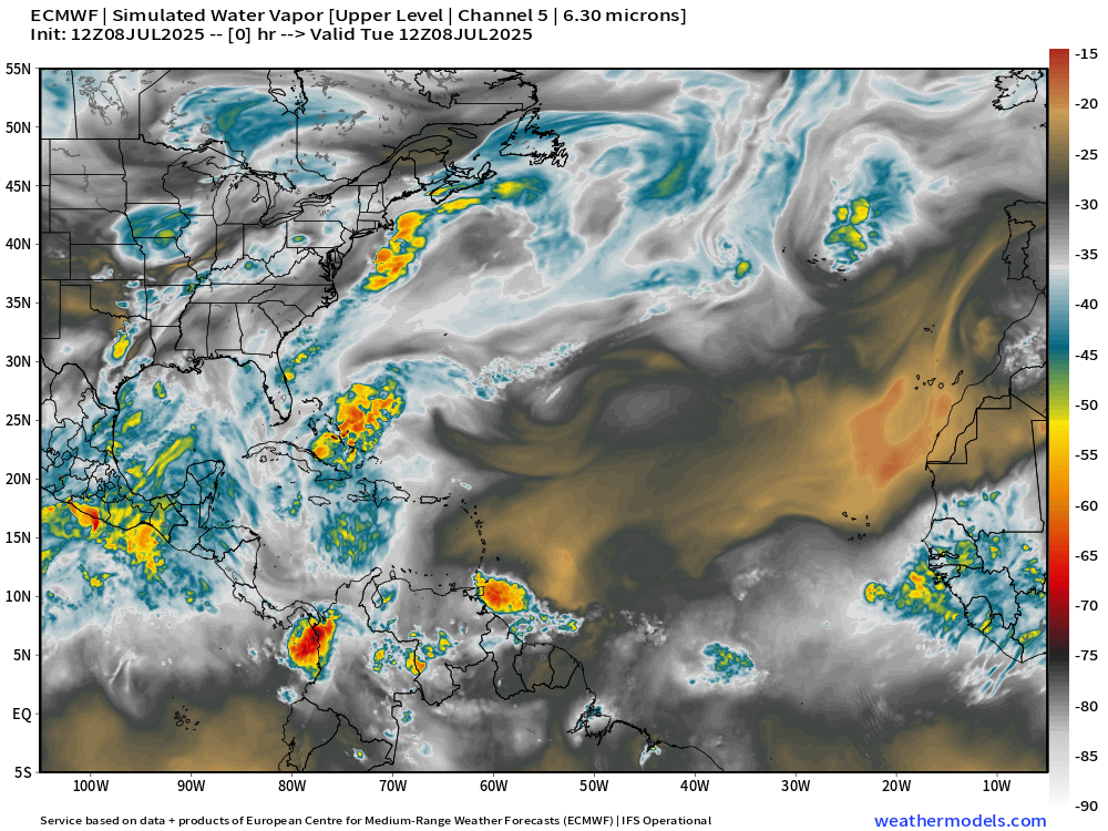
The brown and black are indicators of dry air and troughs from the middle latitudes impinging upon the tropics. ECMWF model simulated water vapor shows well the translation of Saharan Air Layers across the entire Atlantic in a 7-day time frame.
A reprieve in the dust in 7-days with a stronger wave coming off Africa (July 15) might have a better chance of developing.
Day 7: Normalized Anomaly of MSLP across the globe

Day 7: Normalized Anomaly of 500 mb Height across the globe

Both of those maps show ridging and high pressure across the Western Hemisphere and the Atlantic tropics = no way to develop a tropical storm against that brutal background environment —> suppression of convection into mid-July.
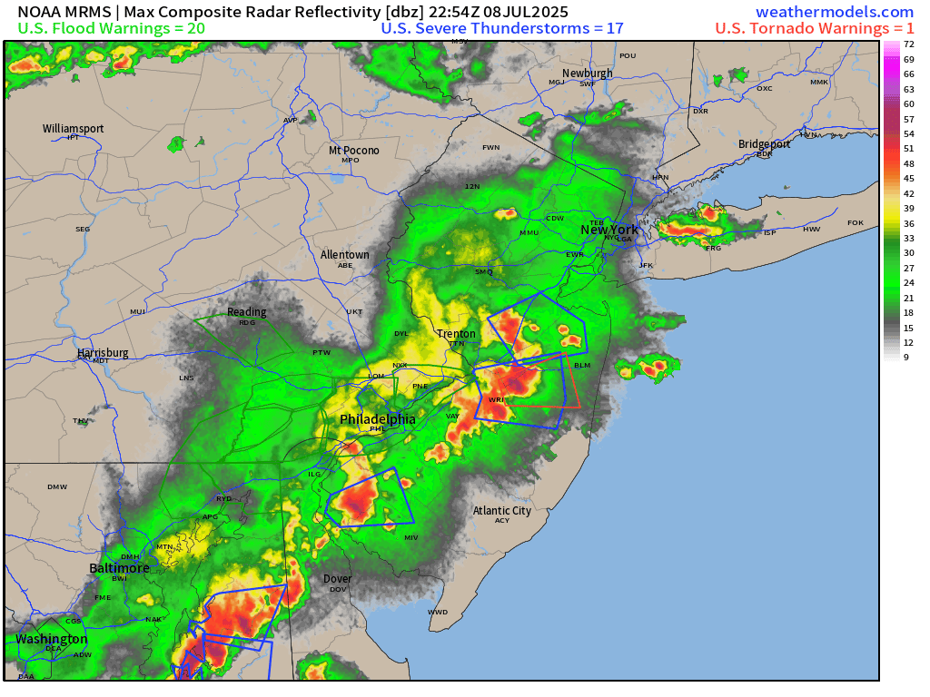
Current Satellite Imagery | United States
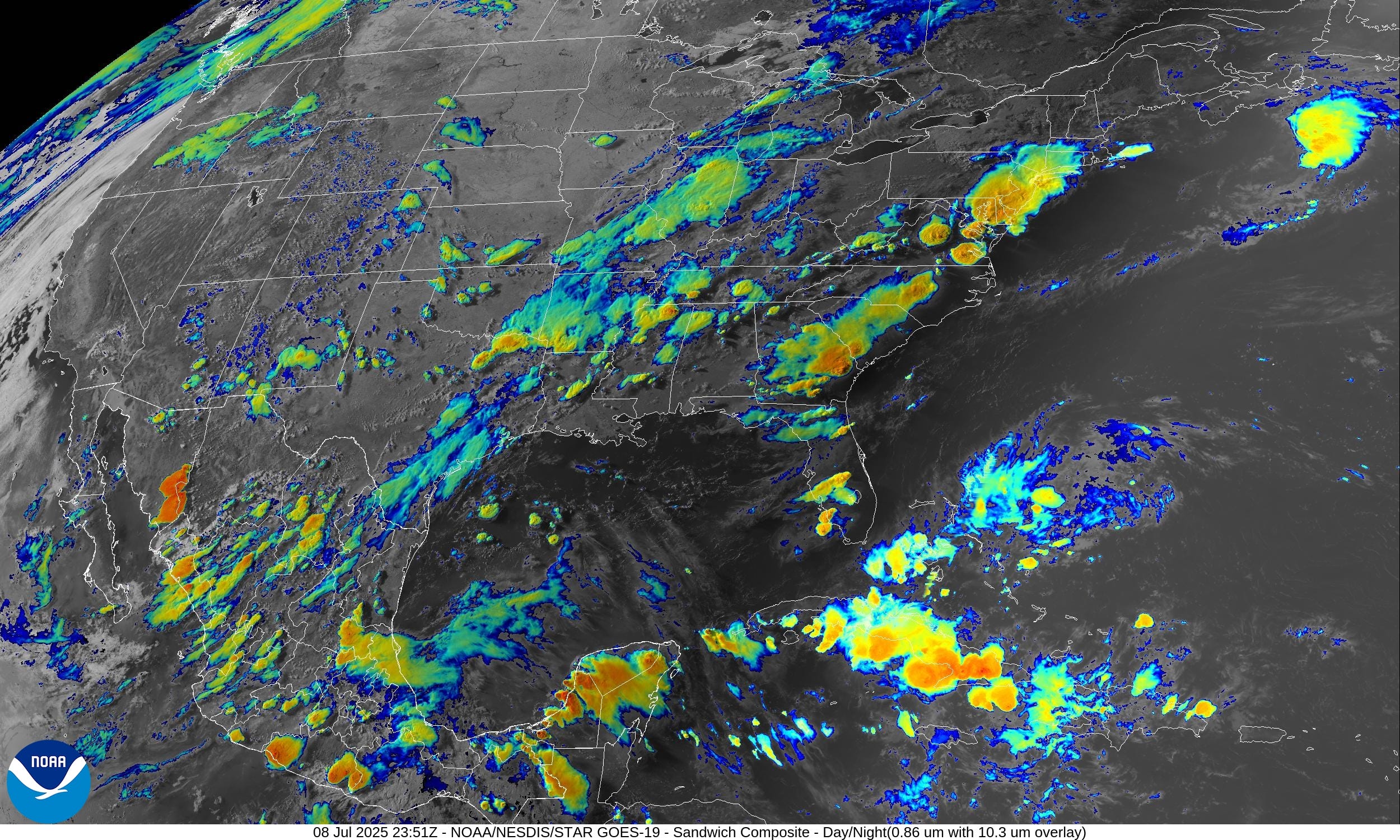
Scattered storms across Texas, the Southeast, and in the Mid-Atlantic including NYC this evening.
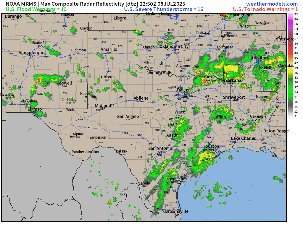
Slow moving = heavy downpours and flooding threats as Texas is drenched for yet another day.
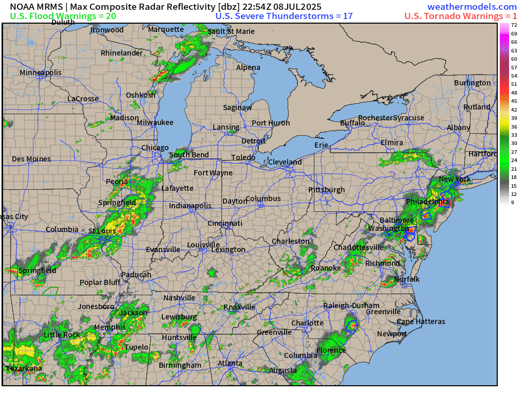
Gusty winds in NYC from passing storms rocked the Big Apple.
Temperatures | 7:00 PM ET

Temperature Anomaly | 7:00 PM ET

Overall, the Lower 48 is 1.9°F above average with storms breaking the summer heat pattern across the south
Lows on Wednesday

Highs for Wednesday

Very hot across the Southeast including Phoenix with 9 million at least 110°F

I’d take 118°F in Phoenix before a slight cool-down to 109°F into next week.

Weather Fronts today at 8 PM | Weather Through Wednesday morning

RRFS-A Radar Simulation Next 18-hours | through 11 AM Wednesday

Storms die down into the overnight hours but the moisture pools remain — as is typically the case for early July.
Precipitable Water Next 18-hours | HRRR 22z
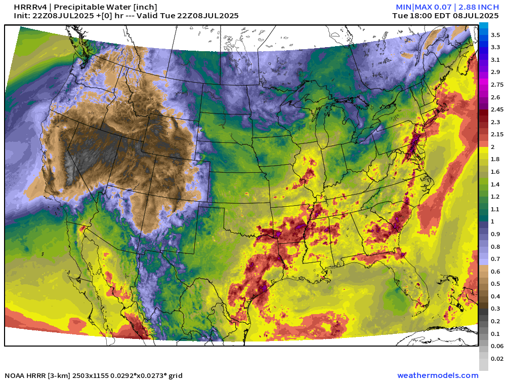
Boatloads of moisture = High PWAT means any storm can immediately downpour several inches of rain within an hour or two.
Weather on Wednesday

Slight chance of severe storms tomorrow across the Mid-Atlantic
NWS Precipitation Next 48-hours


Heavy rain continues across VA/MD/DE and NJ into Wednesday.
NWS WPC Precipitation Next 7-days

ECMWF 12Z | Integrated Vapor Transport | Next 8-days
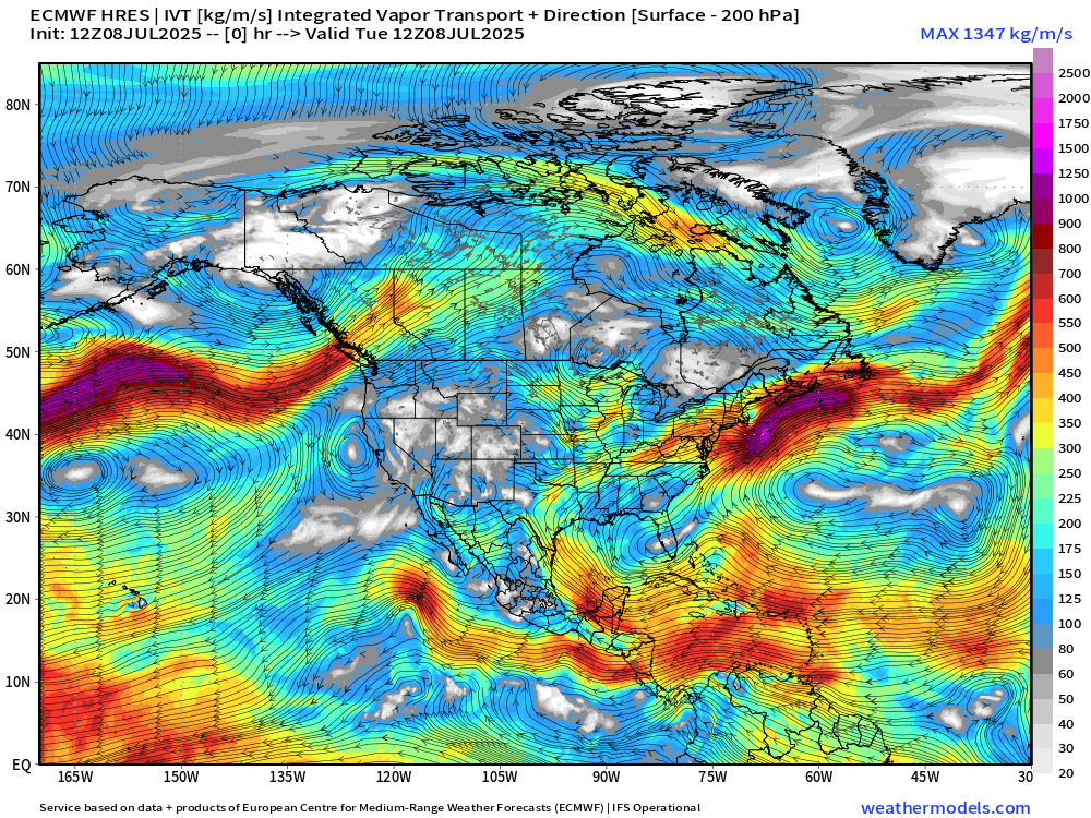
Looks like the Pacific High Pressure is back! Combined with the Bermuda high, this means a steady flow of moisture out of the Caribbean into the center of the U.S. repeating the pattern we saw in late June.
Thank you to readers continuing into this Hurricane Season. My goal is to keep you informed about ongoing extreme weather events inside and outside of the tropics, but also a week (hopefully) heads up on what’s coming. I’ll be using a variety of weather modeling output, some of it may be unfamiliar, but it’s state-of-the-art and industry leading standard.
Next 8-days ECMWF 12z Precipitation and MSLP | Atlantic
Keep reading with a 7-day free trial
Subscribe to Weather Trader to keep reading this post and get 7 days of free access to the full post archives.