


July 7, 2025 Hurricane Season Monday
Seasonal outlook model update shows near-normal Atlantic hurricane activity

2025 Atlantic Hurricane Season [Day 37]. My expectation for this year is 14 named storms, 7 hurricanes, and 3 majors. So far, 3 named storm, 0 hurricanes, and 0 majors.
Monday’s Tropical Update
Atlantic Basin: Tropical Depression Chantal (03L) has become a remnant low over Virginia. NHC not watching any other areas through 7-days.
Eastern Pacific Basin: Invest 96E failed to develop, so Gil will have to wait as the EPAC quiets down for the next several days.
Western Pacific Basin: Typhoon Danas made a surprise landfall on west coast of Taiwan, but has become disrupted before landfalling China as a weaker TS.
Texas deluge

8.5 Trillion gallons overall in Texas over the past week with the remnants of Tropical Storm Barry helping to focus enormous precipitable water stuck over the state within weak steering currents.
The box in the map is Kerr County where Camp Mystic is located. Even higher amounts of rain fell in Hill County to the WNW and NE causing widespread river flooding.
Atlantic Water Vapor Forecast Next 6-days
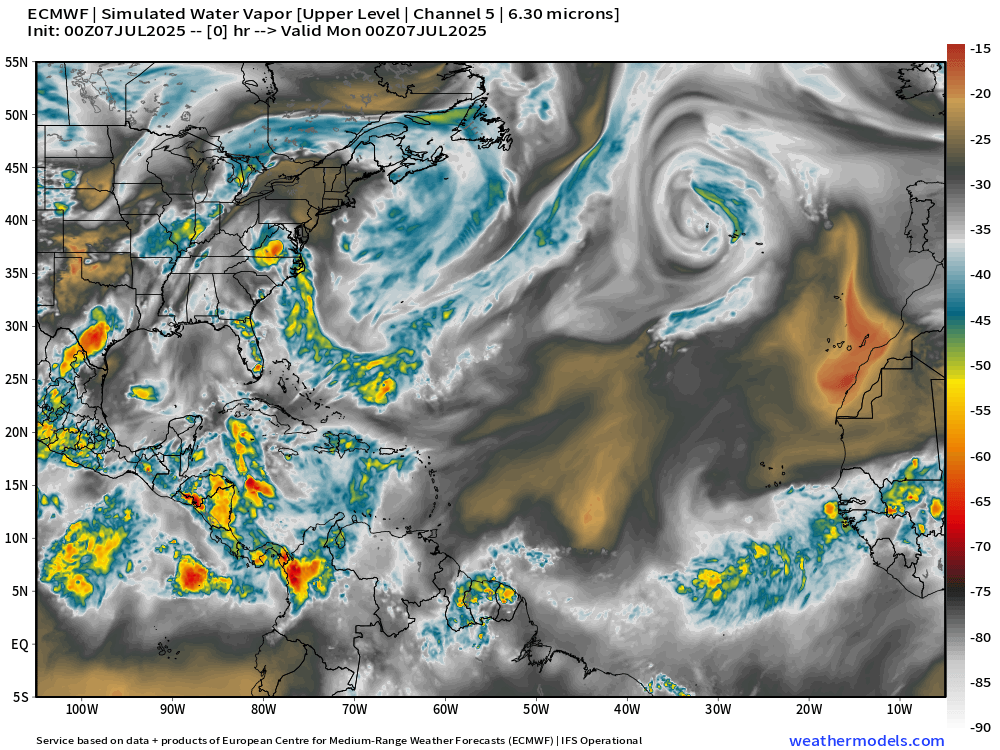
The Atlantic is under the full effects of Saharan Air Layers and any convection will struggle to maintain coherence over the ocean. On top of that, in early July, we have upper-level lows and mid-latitude troughs increasing wind shear and also more dry, cooler air.
Current Satellite Imagery | United States
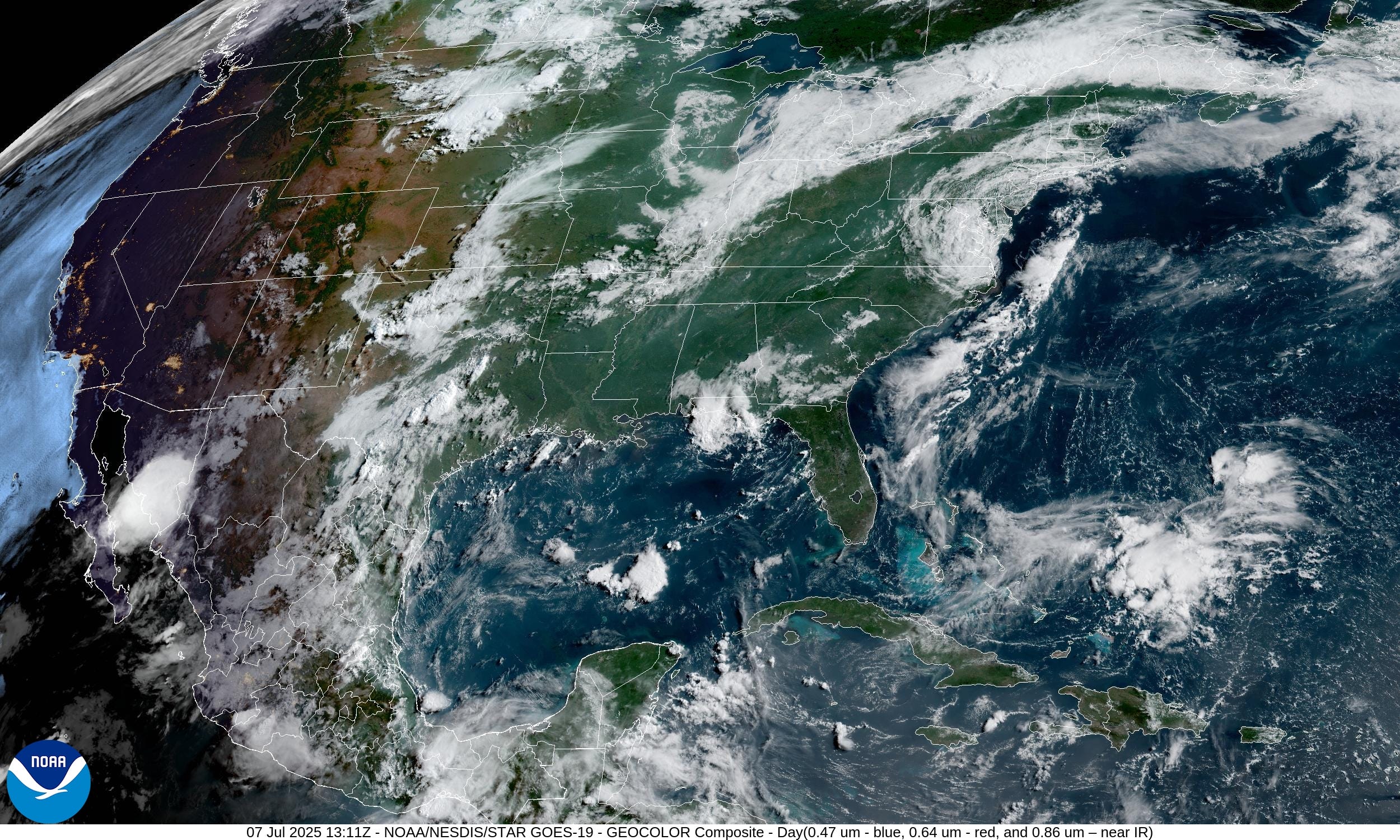
The remnants of Chantal will move north through the Mid-Atlantic and skirt southern New England.
Temperatures | 8:00 AM ET

Temperature Anomaly | 8:00 PM ET

Overall, the Lower 48 is -0.5°F below average.
Highs for Monday

151 million at/above 90°F with upper-90s behind Chantal’s circulation in the Southeast to help the Carolinas quickly dry out. Phoenix back above 110°F
HRRR Radar Simulation Next 18-hours | through 12 AM Tuesday
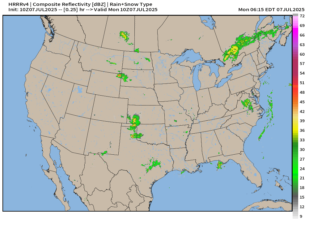
Widespread scattered showers with the heating of the day typical for early July. More organized storms may develop out of the northern Plains with a frontal boundary — enhanced risk of severe weather
Precipitable Water Next 48-hours | HRRR 06z

Rockies dry out but some monsoon moisture tries to poke into the Southwest.
The yellow is nearly 2-inch PWAT and thunderstorms can locally focus / converge higher amounts leading to quick firing storms and heavy downpours.
Weather on Monday

Risk for heavy rain and more flash flooding in Hill Country of Texas. Also, heavy rain from Pittsburgh NE into New York.
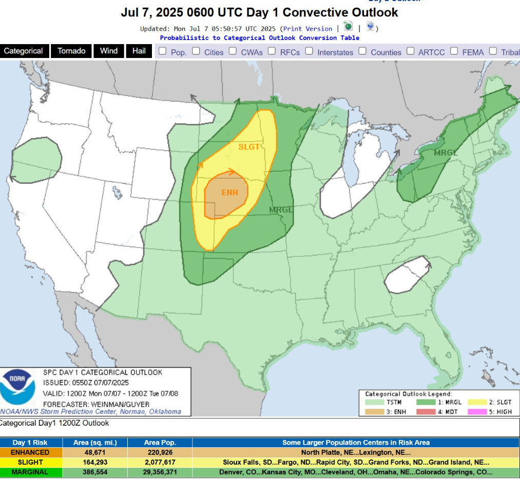
Nebraska could see strong storms with large hail and wind gusts.
NWS Precipitation Next 48-hours


Remnants of Chantal could dump 1-2” across northern Virginia and Maryland into Philadelphia before moving offshore.
NWS WPC Precipitation Next 7-days
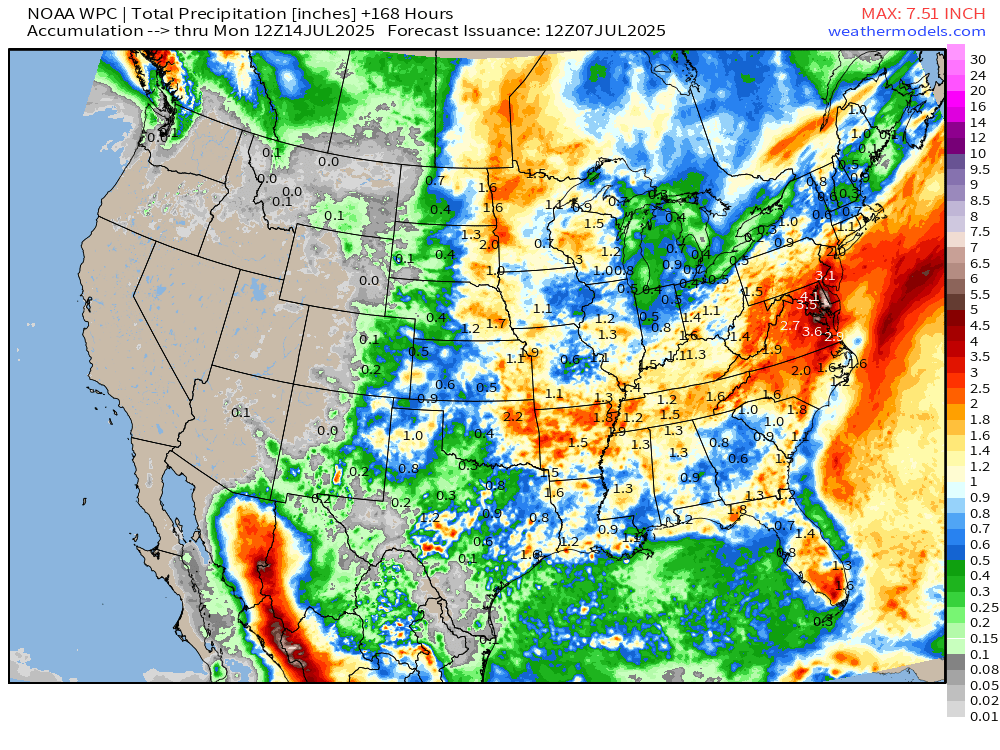
WPC really adds up the rainfall across DelMarVa over next 7-days.

ECMWF 00Z | Integrated Vapor Transport | Next 8-days
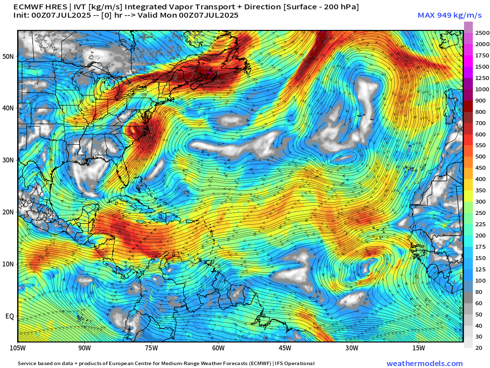
The moisture with Chantal crosses the Atlantic merging with a frontal boundary and extratropical cyclone. The vigor of the trade winds has decreased somewhat across the deep tropics and Caribbean limiting the moisture transport magnitude. This is a very quiet 8-day weather regime.
Thank you to readers continuing into this Hurricane Season. My goal is to keep you informed about ongoing extreme weather events inside and outside of the tropics, but also a week (hopefully) heads up on what’s coming. I’ll be using a variety of weather modeling output, some of it may be unfamiliar, but it’s state-of-the-art and industry leading standard.
Next 10-days of Daily (24-hourly Precipitation | ECMWF 00z
Keep reading with a 7-day free trial
Subscribe to Weather Trader to keep reading this post and get 7 days of free access to the full post archives.