


July 7, 2024 Tropical Update: Beryl Intensifying Until Landfall
Possibility of Category 2

Headlines
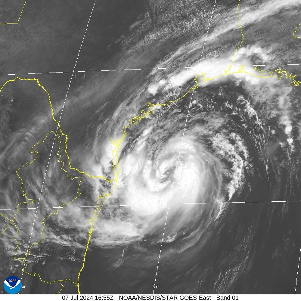
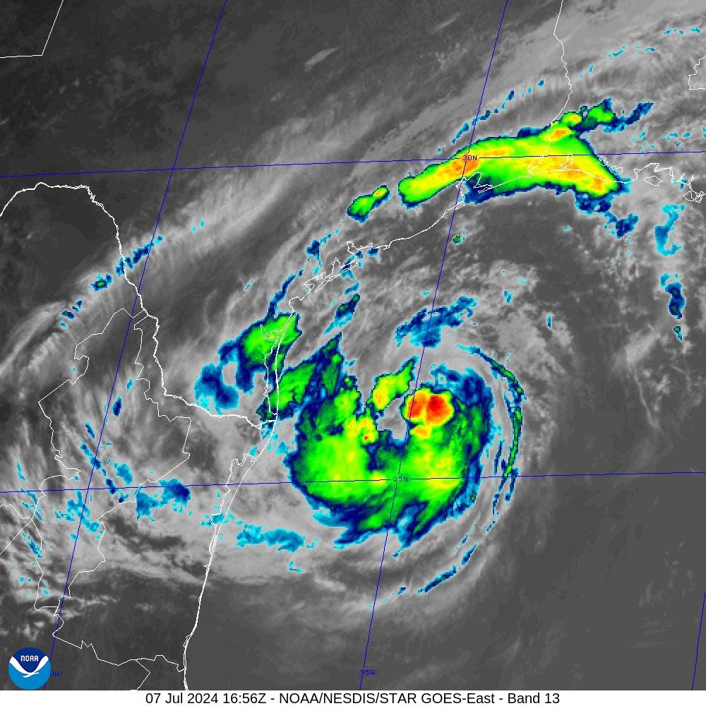
Tropical Storm Beryl (65-mph / 992 mb) looks more like a hurricane with banding around a rather large eye. However, the convection remains sparse as dry air is currently winning out over the showers and thunderstorms. That may be temporary as new storms have fired in the ENE quadrant around 1 PM ET.
Landfall of Hurricane Beryl before 7 AM Monday.
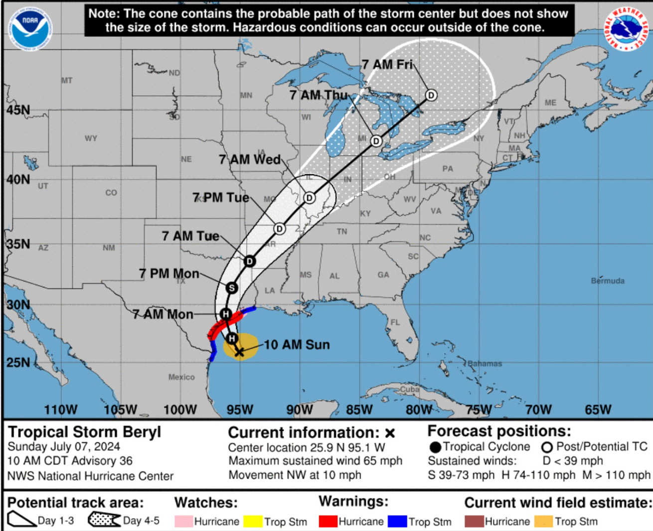
The track forecast from NHC is zeroed in on the Texas coastline just south of Matagorda and well north of Corpus Christi.
Houston will be in the right front quadrant of Beryl with heavy rainfall a major threat. Beryl will head across eastern Texas and likely weaken to a Tropical Depression before it enters SW Arkansas.
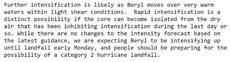
The intensity forecast from NHC shows intensification up until landfall to t least 75-knots (Category 1) but again notes the conservative nature of that forecast at this juncture with potential for one category error.
SSTs at 29°C to 30°C + favorable upper-level winds aligned to help ventilate the anticyclone aloft = rapidly intensify or deepen Beryl. All systems are go / primed for RI prior to landfall, but the environmental dry air could be an inhibiting factor from explosive development.
Texas should prepare for up to a Category 2 hurricane landfall on Monday.
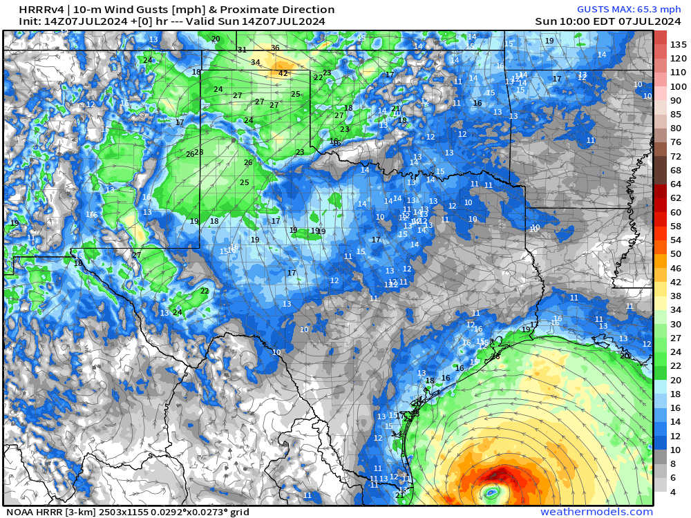
Simulation from HRRR (14z) shows wind gusts > 100 mph rapidly building around the core of Beryl until landfall. The central pressure is in the 970s — indicative of a strong Category 1 or likely Category 2 hurricane. RRFS (12z) is even stronger with 965 mb central pressure — suggesting a 25-mb drop in the next 14-hours before landfall, not too outlandish considering the ideal oceanic conditions.

Forecast Wind Gusts | NWS


Houston in the 50-mph wind gusts range … strong gusts into the 80s mph from Bay City as far north as Livingston.
Rainfall From Beryl

Houston rainfall in the 7-12” range
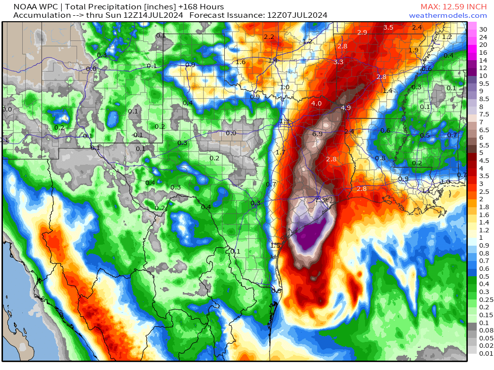
Zoom in on Houston metro

This is not a Harvey level event — but a good soaking with locally torrential rain.
If you find value in these updates, then please consider supporting my R&D efforts going forward by signing up for an annual subscription. Weather Trader turns 1-year old shortly with an archive of nearly 400 blog posts or about 10 cents a piece.
Basin Wide GeoColor Satellite Imagery
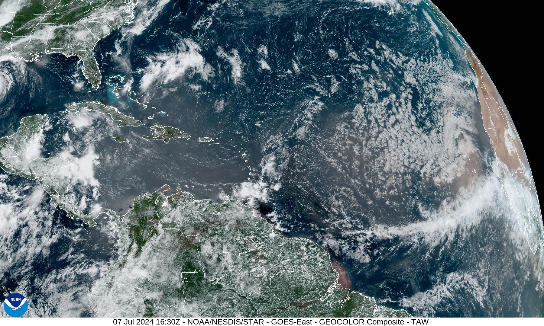
Massive area of dust coming off Africa will continue across the basin in the trade winds.
NASA Dust Forecast | Next 10-days

Next 15-Days EPS Ensemble Tropical Storm Tracks

Ghost town in the rest of the Atlantic aside from Beryl through at least July 22st, but likely until August.
These maps show the ensemble tracks from 51 versions of the ECMWF model — solutions to show uncertainty or variability in medium and longer range forecasts. This does not mean there are 20 tropical storms at the same time.
Eastern Pacific Tropical Weather Outlook
No development expected in the next 7-days, at least, with ensembles showing no development for 15-days.
Western Pacific Tropical Weather Outlook

No development expected in the next 48-hours, but ensembles show some storm centers near the Philippines and South China Sea in 7-days
Thank you to Subscribers and Supporters!
The investment in my research and development will pay off as A.I. enabled weather forecasts become a normal and indispensable part of our weather forecasting enterprise.
Maps sourced from weathermodels.com designed and innovated by yours truly! I actually create all of my content from scratch.