


July 6, 2024 Evening Tropical Update: Beryl Slowly Reorganizes
Hurricane warnings up for Texas coastline

Headlines
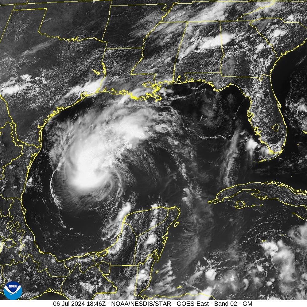
Tropical Storm Beryl has decreased to 60 mph winds (997 mb) due to passage over the Yucatan Peninsula, and obliteration of the inner-core. However, the satellite imagery shows a burst of convection with the center of circulation on the SE edge. It will take time ~24 hours to perhaps see a closed eyewall. Beryl looks much healthier than it did earlier this morning.
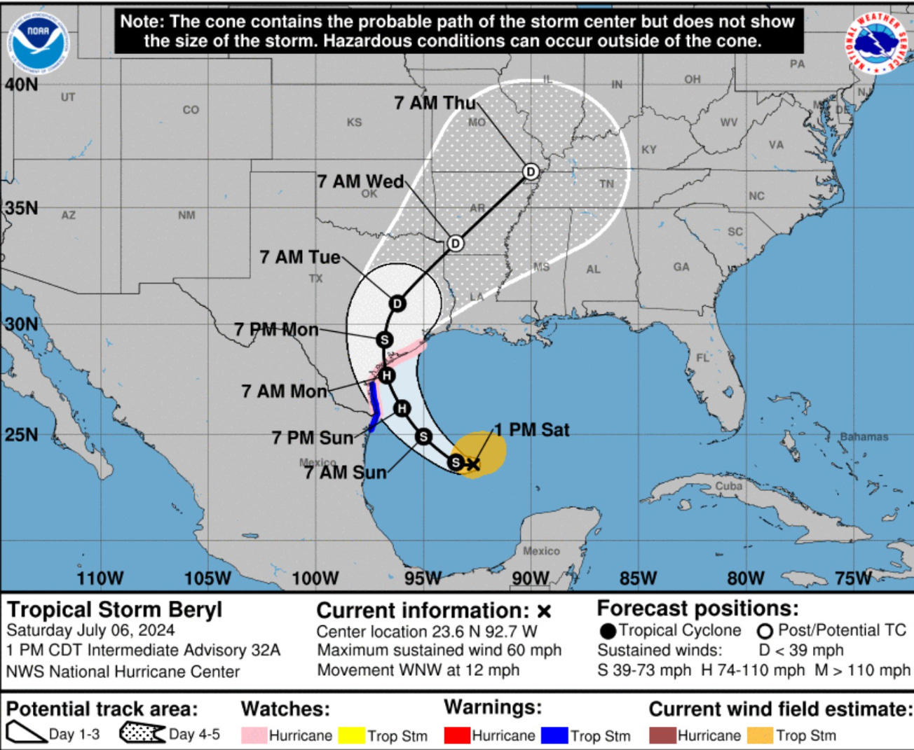
The track forecast from NHC has zeroed in on the Texas coastline now north of Corpus Christi. Houston will be in the right front quadrant of Beryl with heavy rainfall a major threat.
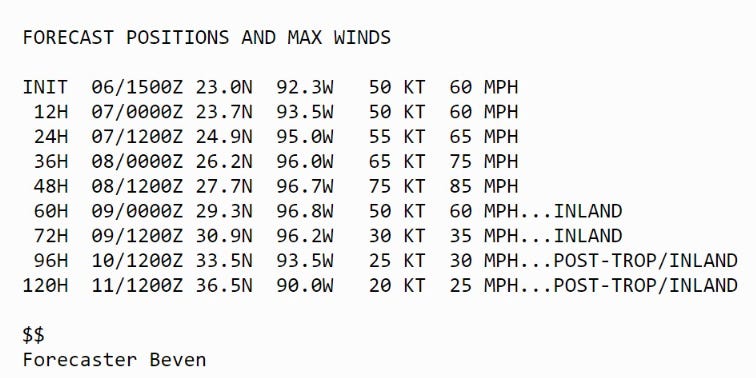
The intensity forecast from NHC shows intensification up until landfall to now at least 75-knots (Category 1) but again notes the conservative nature of that forecast at this juncture with potential for one category error.
SSTs at 29°C to 30°C + favorable upper-level winds aligned to help ventilate the anticyclone aloft = rapidly intensify or deepen Beryl. All systems are go / primed for RI prior to landfall, but the environmental dry air could be an inhibiting factor from explosive development.
Texas should prepare for up to a Category 2 hurricane landfall on Monday.
Rainfall From Beryl
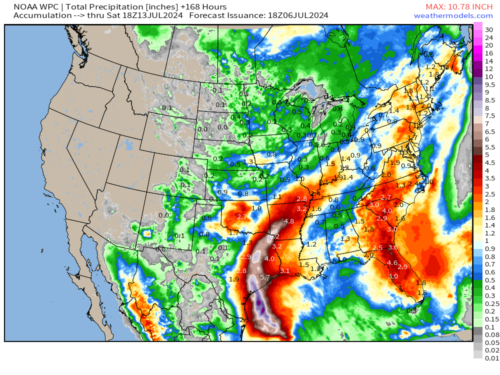
Significant rainfall across the Southeast in the 7-day forecast, as well. Nice to see.

Texas will gladly take this rainfall from Beryl — as the storm will not be stalling or slowing down significantly for flooding problems like the H storm from 2017.
Weather Trader is a reader-supported, daily newsletter. To receive new posts and support our R&D, consider becoming a free or paid subscriber.
Keep reading with a 7-day free trial
Subscribe to Weather Trader to keep reading this post and get 7 days of free access to the full post archives.