


July 5, 2024 Tropical Update: Hurricane Beryl Threatens Texas
Potential for rapid intensification prior to landfall major concern

Headlines
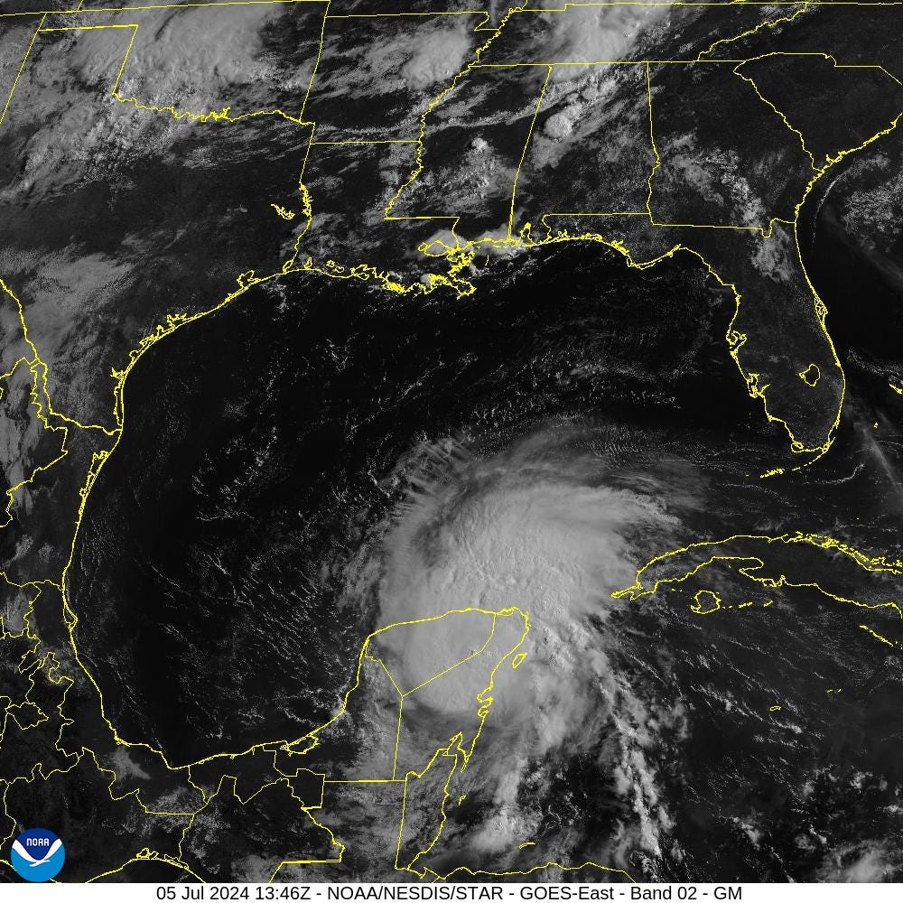
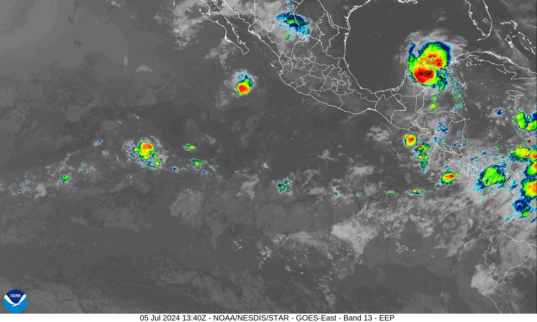
Hurricane Beryl maintains at Category 2 with 100 mph winds [980 mb] as it passes quickly over the Yucatan Peninsula today at 15 mph (WNW) to emerge over the very warm Gulf of Mexico for the weekend.
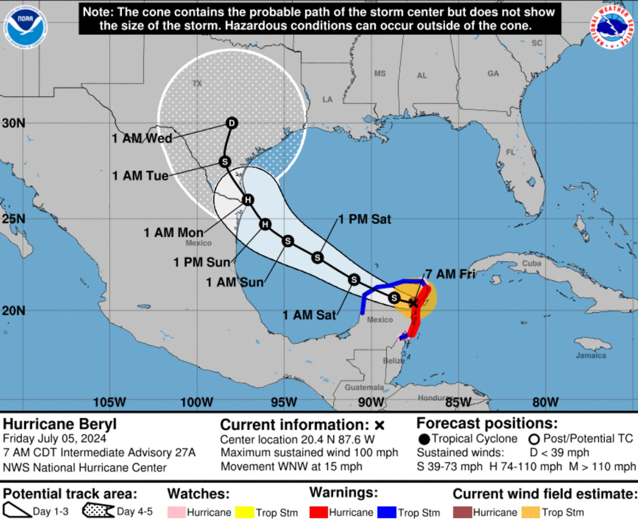
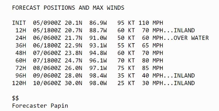
The track forecast from NHC and the vast majority of model guidance shows a WNW and then NW course until landfall late Sunday or early Monday along the Texas coastline. I expect the actual landfall point to move northward up the coast toward Corpus Christi. More intense Beryl = further time over water and potential for rapid intensification.
The intensity forecast from NHC shows intensification up until landfall to at least 75-kntos (Category 1) but that could be conservative considering the resilience of Beryl in the Caribbean against wind shear. Indeed, the configuration of an upper-level trough could assist in an episode of rapid intensification on Sunday. Coastal residents in Texas especially on the north side of the center of circulation should prepare for a major hurricane at least until the threat/risk of RI has abated.
Weather Trader is a reader-supported, daily newsletter. To receive new posts and support our R&D, consider becoming a free or paid subscriber.
Gulf of Mexico Ocean Temperatures

During the afternoon on Sunday, sea surface temperatures exceed 30°C along the shallower shelf along the Texas coastline. There is variability during the day (diurnal cycle) but the overall warmth of the Gulf of Mexico is sufficient for any category of hurricane. The lower boundary condition is not going to be the inhibiting factor in the final intensity outcome, but the upper-level wind shear and anti-cyclonic circulation.
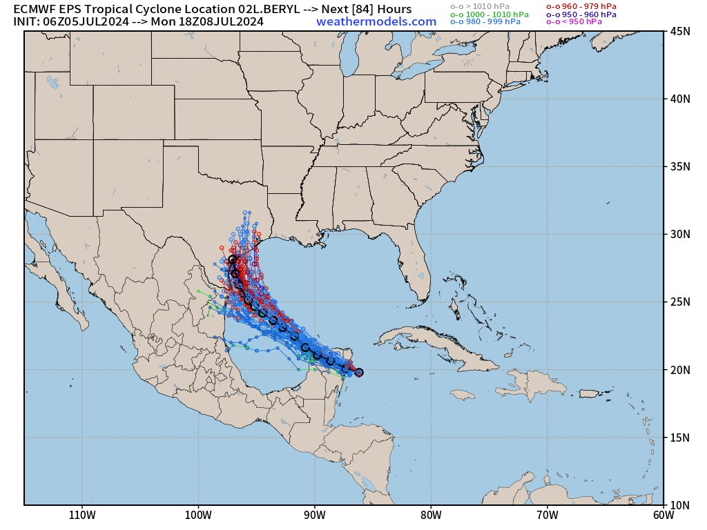
The more intense solutions are those that spend more time over the Gulf of Mexico. Hurricane Beryl is an excellent example of how track and intensity are closely related, and how model bias can influence the track skill.

Basin Wide IR Satellite Imagery
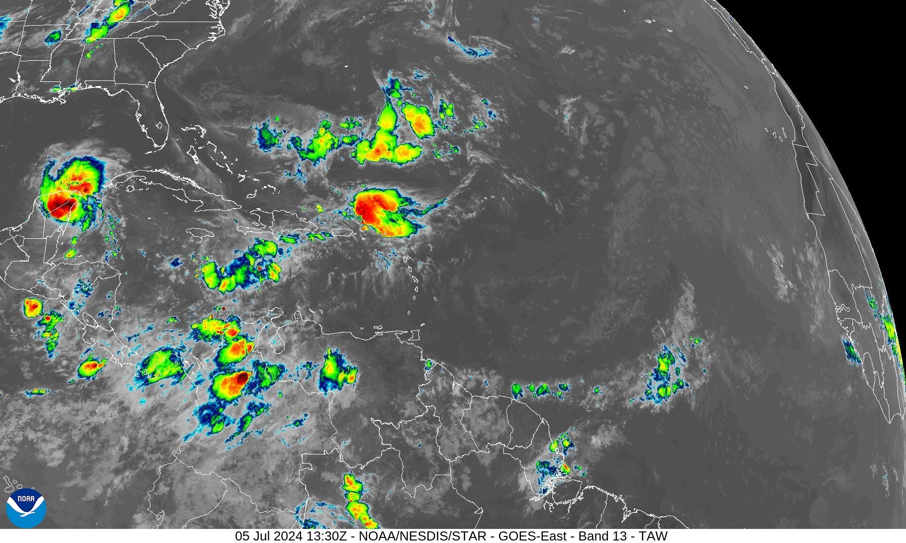
Not expecting anything for the duration of July in the Atlantic. The lack of any convection across the entire basin = doldrums.
Next 15-Days EPS Ensemble Tropical Storm Tracks

After Hurricane Beryl is finally ended likely in Texas or Mexico, no other Atlantic tropical storm activity is expected through mid-July, until the 20th at least. Ghost town for all of July?
These maps show the ensemble tracks from 51 versions of the ECMWF model — solutions to show uncertainty or variability in medium and longer range forecasts. This does not mean there are 20 tropical storms at the same time.
Eastern Pacific Tropical Weather Outlook
Tropical Depression Aletta has come and gone without any fanfare — except for breaking the record streak of no named storms. Not expecting anything more in the next 2-weeks!
Western Pacific Tropical Weather Outlook
No development expected in the next 48-hours.
Thank you to Subscribers and Supporters!
The investment in my research and development will pay off as A.I. enabled weather forecasts become a normal and indispensable part of our weather forecasting enterprise.
Maps sourced from weathermodels.com designed and innovated by yours truly! I actually create all of my content from scratch.
Very helpful information and explanations.