


July 5, 2024 Evening Tropical Update: Hurricane Beryl Emerges into Gulf of Mexico
Major hurricane potential along Texas coast around Corpus Christi

Headlines
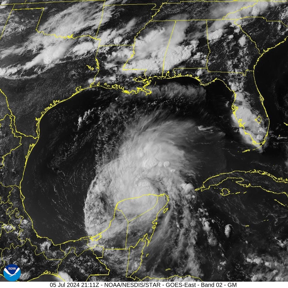
Tropical Storm Beryl has decreased to 65 mph winds (989 mb) due to passage over the Yucatan Peninsula. However, Beryl is now emerging over the warm Gulf of Mexico waters — which will only get warmer/deeper during the next 48-72 hours.
The track forecast from NHC is a bit left (west) of the vast majority of model guidance from 12z. There is a notable adjustment with the 5 pm forecast update for a northward adjustment up the Texas coast just south of Corpus Christi. I expect this trend to continue with more model guidance overnight.
This means landfall will not occur until mid-day on Monday — so additional time over the very warm Gulf of Mexico shelf waters. Prior to mixing by Beryl, the upper layer is well over 30°C in the ECMWF HRES model.

The intensity forecast from NHC shows intensification up until landfall to now at least 80-knots (Category 1) but notes the conservative nature of that forecast at this juncture.
Upper-level winds will be favorable — aligned to help ventilate the anticyclone aloft and rapidly intensify or deepen Beryl. All systems are go / primed for RI prior to landfall.
Texas should prepare for a major hurricane landfall on Monday.
Weather Trader is a reader-supported, daily newsletter. To receive new posts and support our R&D, consider becoming a free or paid subscriber.
Keep reading with a 7-day free trial
Subscribe to Weather Trader to keep reading this post and get 7 days of free access to the full post archives.