


July 31, 2024 Wednesday Tropical Wave Update
Still several days before potential development near Florida

Sadly not much [new] certainty or confidence in the model generated forecasts today.
The tropical wave has made it to the northeast Caribbean in a disorganized state on a WNW track to the Bahamas. Showers and thunderstorms have blossomed — eating away the Saharan (dust) air layer and moistening the atmosphere. Environmental conditions improve in terms of moisture and instability going forward but wind shear and proximity to stronger upper-level winds will make the timing (or even the potential) of tropical cyclone genesis difficult to determine.
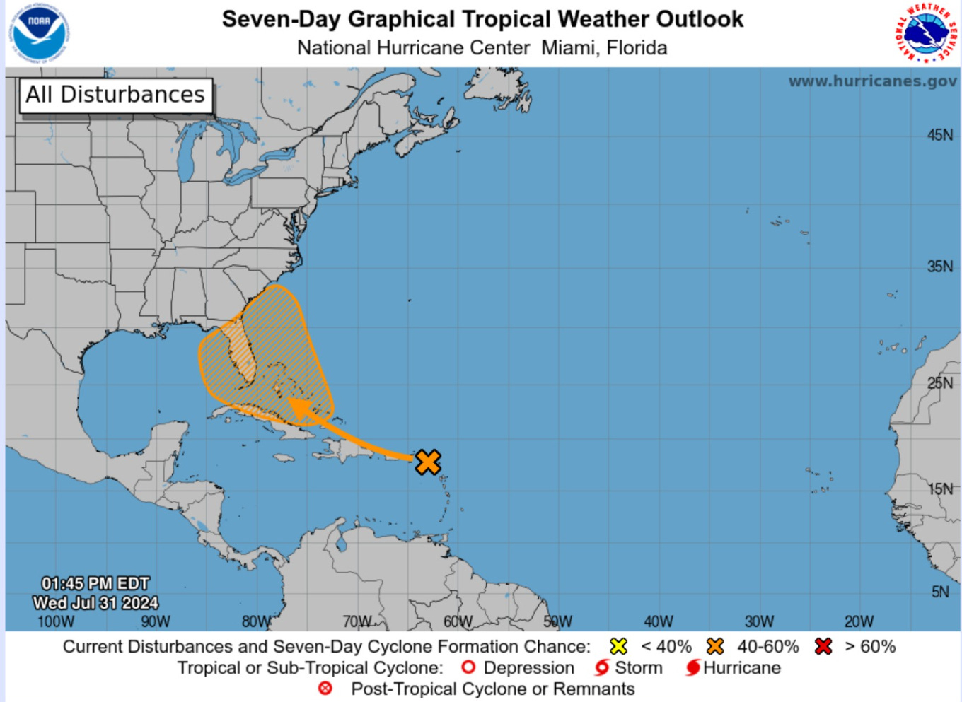
NHC has kept the development chance at 60%. The next name is Debby.
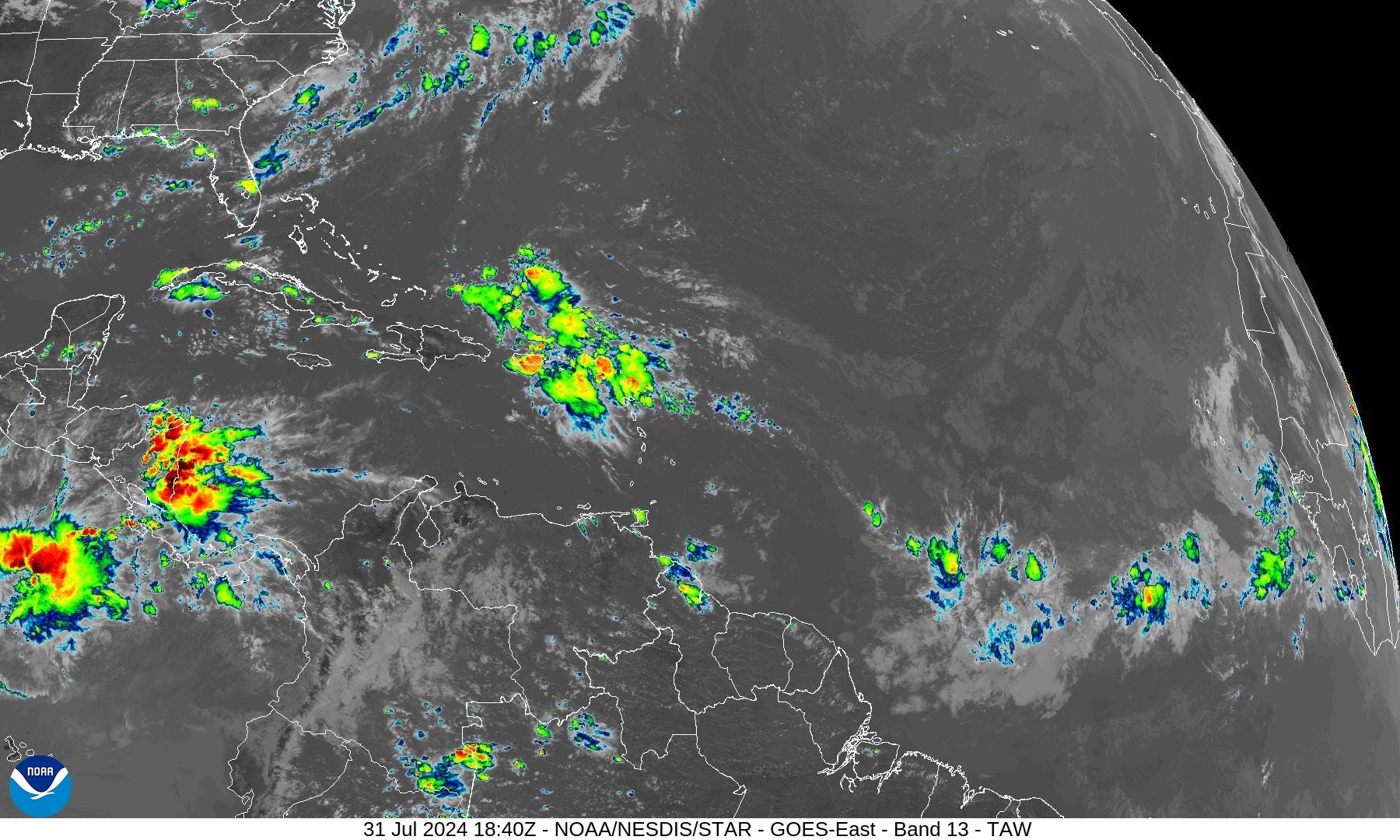
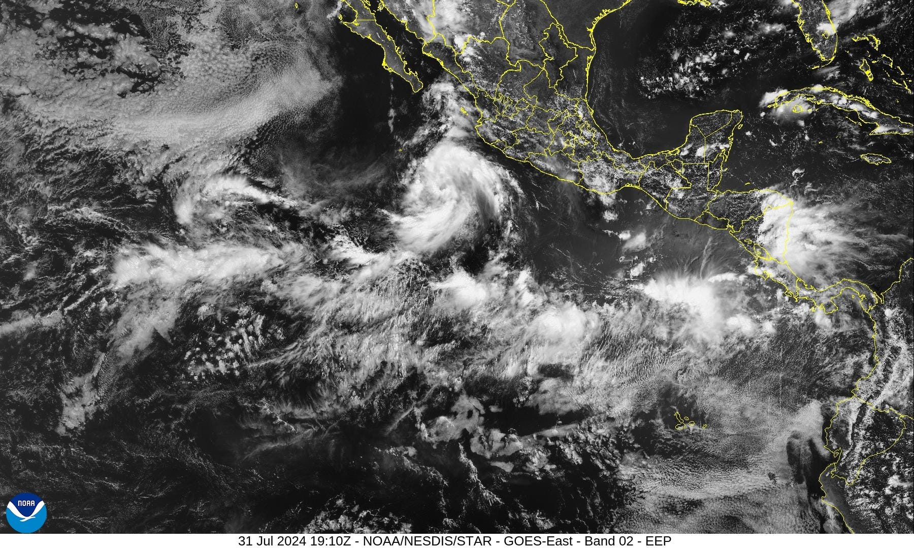
IR Satellite
NHC analyzed (12z) the tropical wave passed through the Lesser Antilles with some showers but still disorganized. The blob of moisture will continue WNW into the Bahamas where environmental conditions will improve — as the system stalls out.
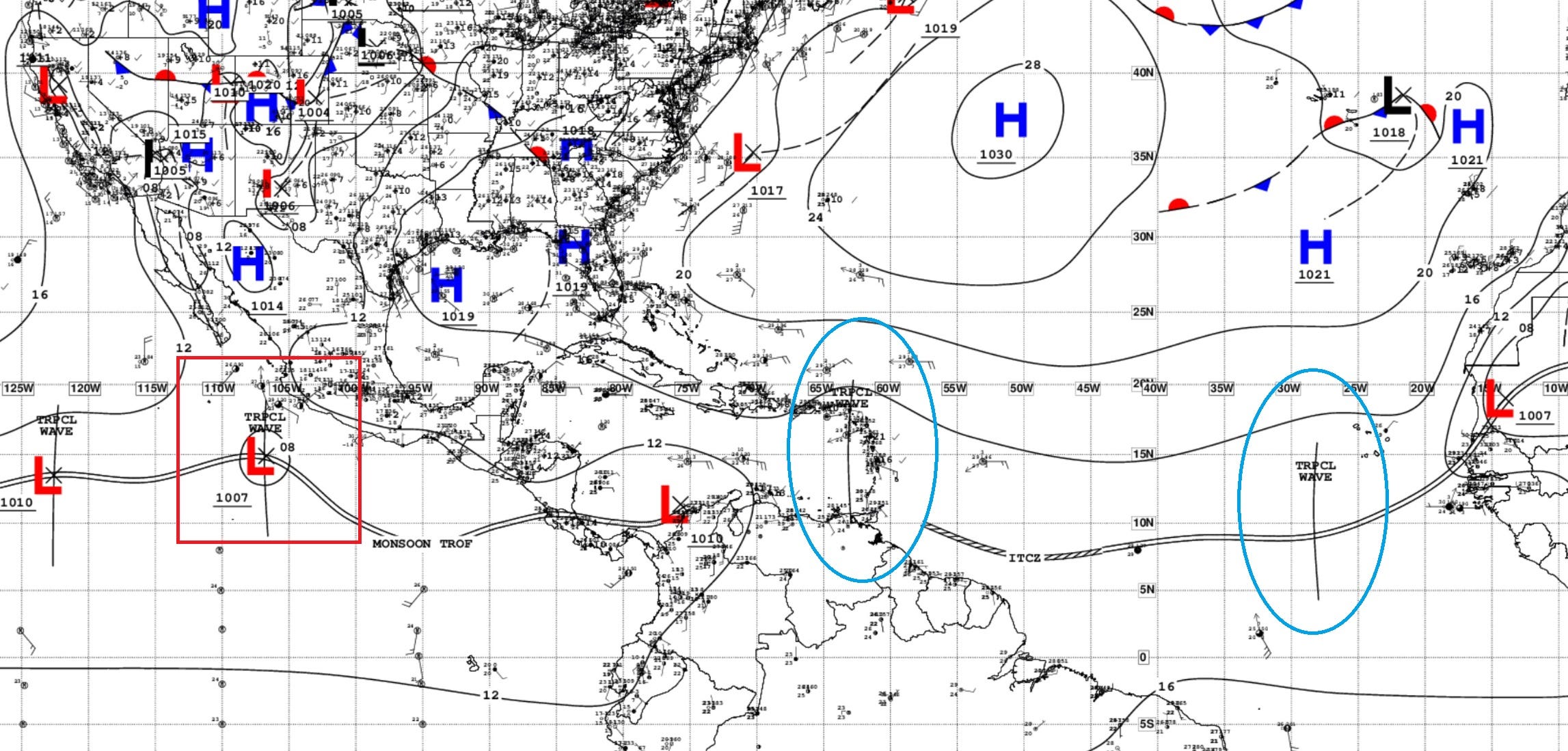
A tropical wave is W of the Cabo Verde islands. Its axis is along 28W from 16N southward, and moving west at 5 to 10 kt. No significant convection is evident near this tropical wave. A well defined tropical wave has entered the eastern Caribbean and is producing a broad area of disorganized shower and thunderstorm activity that is currently affecting the Leeward Islands, the US/UK Virgin Islands and parts of Puerto Rico, including the regional waters. Its axis is now along 62W/63W south of 21N. It is moving west at 15 to 20 kt.
ECMWF 12z HRES Model Solution | Next 10-days

My favorite parameter Integrated Vapor Transport (IVT) shows the WNW track of the tropical wave with moisture along the northern periphery. A major change in the guidance from ECMWF HRES from 00z shows that the wave loops over the Florida panhandle before resuming on its course up the East Coast. This follows the weaker ensembles in the previous cycles.
In the Eastern Pacific, at least 2 hurricanes develop.
GFS 12z HRES Model Solution | Next 10-days

GFS 12z has a similar track / intensity of the tropical wave over the Florida peninsula into the Southeast, a little loop, but then further movement northward instead of heading off the East Coast of the U.S.
So, later this weekend, we can expect “something” to be in the vicinity of Florida, but unsure of the intensity or whether it will have a name. Proximity to land would obviously limit development but still provide a heavy rain risk.
Storm Tracks from the EPS 12z ensembles

All tracks through 10-days:
The out-to-sea solution shown by the ensembles over the past several days has been largely abandoned in the 7-10 day range. Instead, a weak system is left behind to meander over the NE Gulf of Mexico, Florida, and the SW Atlantic.
Obviously, this is a low certainty — low confidence situation. But, the good news is that the main threat would be heavy rain rather than an extreme wind event w/major hurricane landfalls. In other words, it’s a mess.
Active tracks at Day 12:

ECMWF AIFS 06z — Artificial Intelligence modeling

AIFS (06z). The A.I. modeling from ECMWF has also dropped the out-to-sea track through 10-days and instead sits the system over the Florida panhandle at Day 11.
Atlantic Basin GeoColor Satellite Imagery
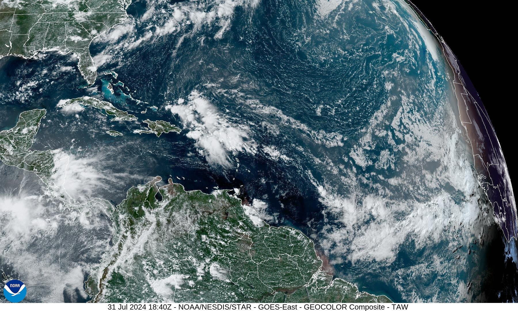
Showers have blossomed with the tropical wave in the northern Caribbean.
Eastern Pacific Tropical Outlook
Tropical Depression 03E south of Mexico is well on its way to becoming TS Carlotta and then likely a hurricane by Friday. Invest 95E is following in her footsteps and should also become a hurricane in 7-days. It would be named Daniel. Neither system will impact land.
Thank you to Subscribers and Supporters!
Maps sourced from weathermodels.com designed and innovated by yours truly! I actually create all of my content from scratch.