


July 30, 2024 Tuesday Tropical Wave Update
Odds increasing for development but environment remains hostile

The tropical wave has made it to 50°W longitude without much shower activity or change in organization. Into this weekend, the wave will reach the Bahamas and find a more moist and unstable environment to fire up showers and thunderstorms. However, wind shear and proximity to U.S. East Coast trough and another TUTT from the east. The squeeze play will elongate the vorticity of the disturbance and work against intensification initially. However, as the system moves NNE over the Western Atlantic, it could take off and intensify according to some ensemble weather model solutions.
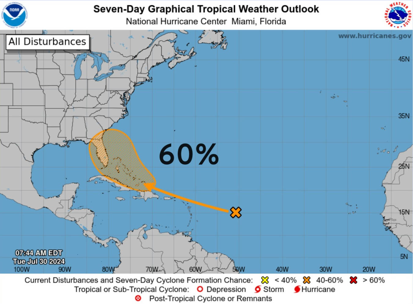
NHC has increased the development to 60%. The next name is Debby.
IR Satellite
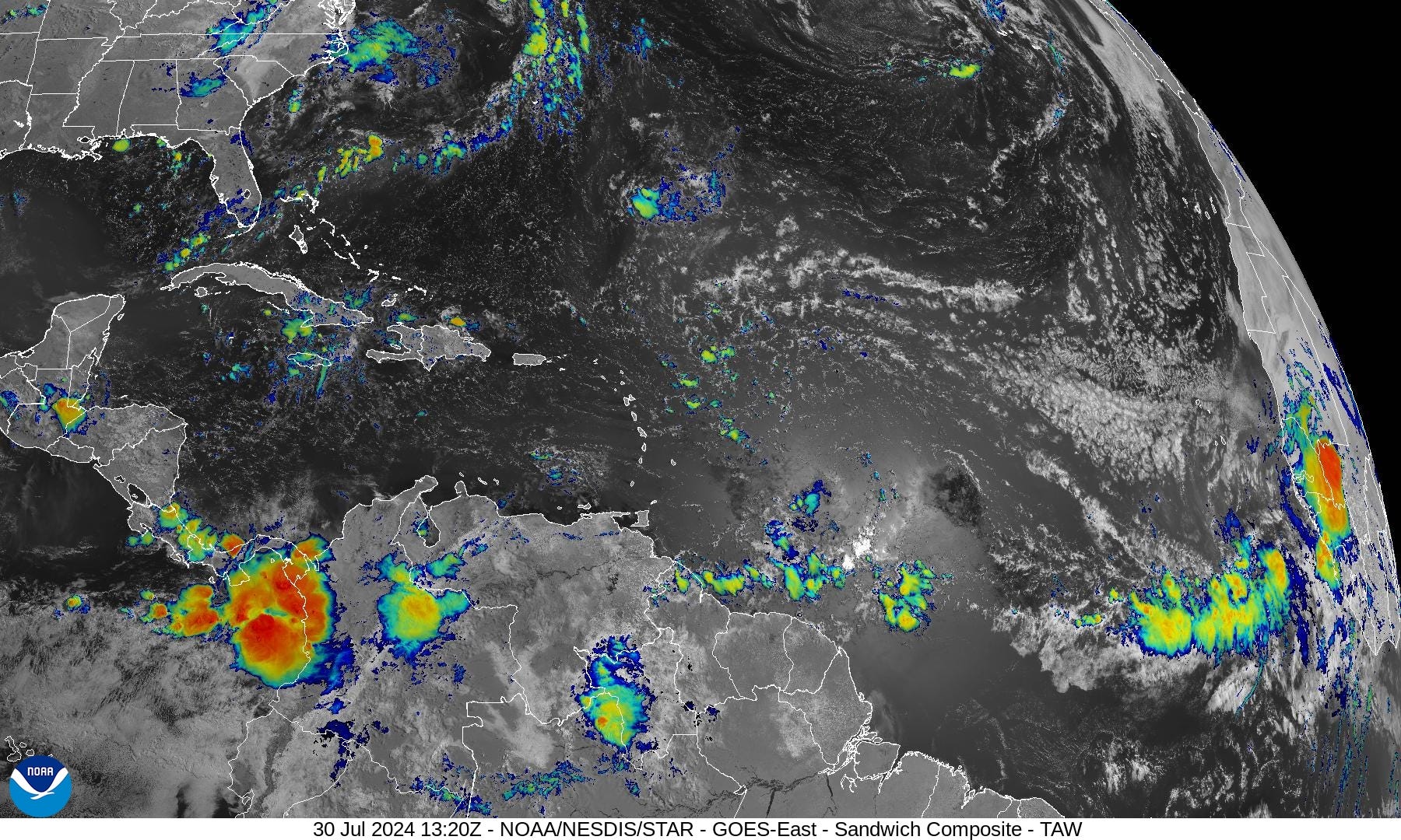
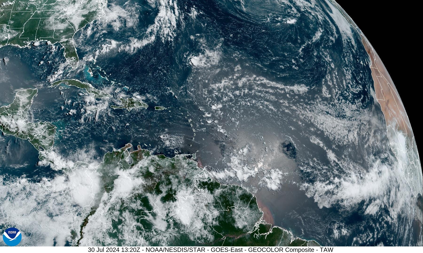
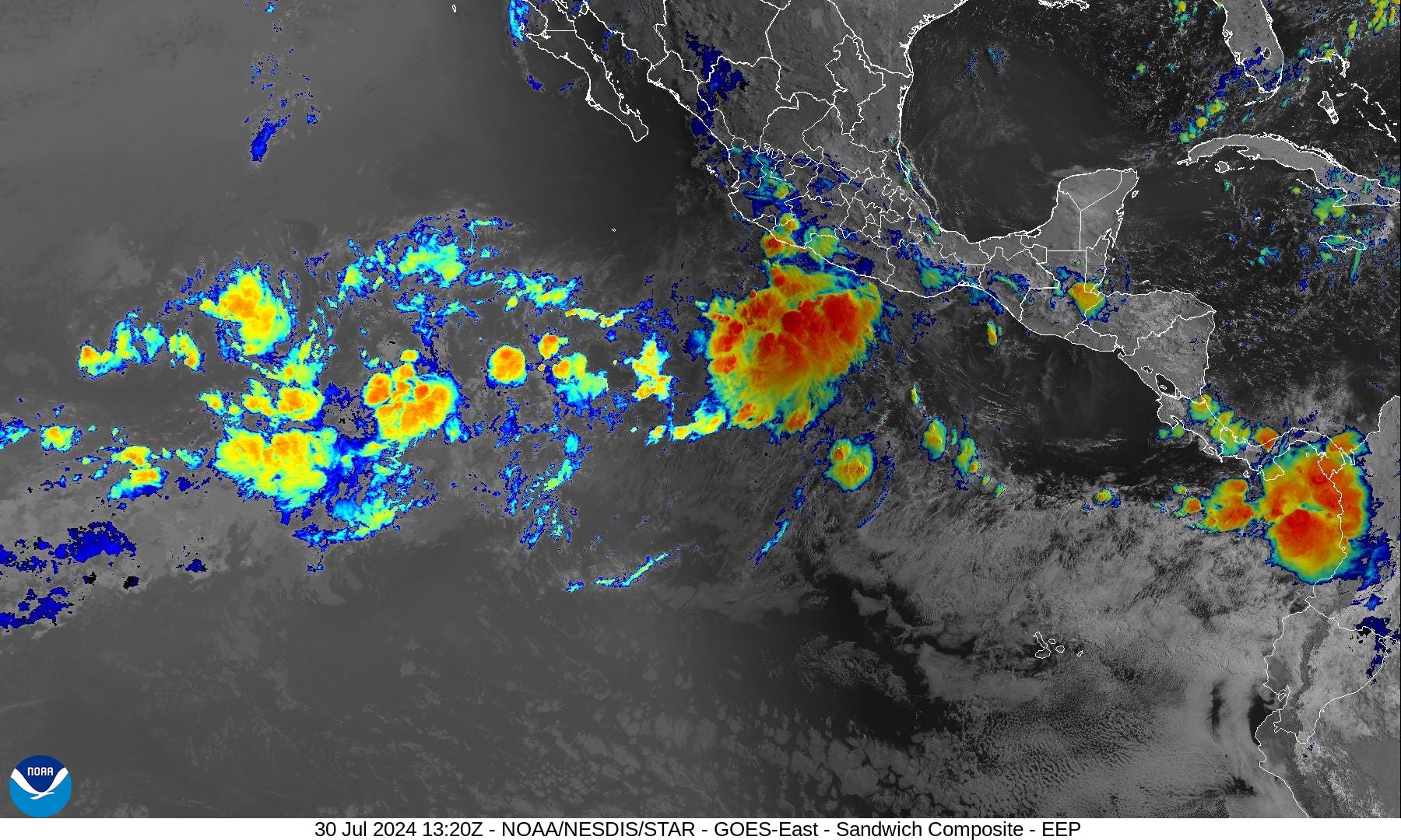
Still little shower activity in the tropics from the Gulf of Mexico into the Caribbean and much of the Main Development Region. Saharan Air Layers have dried out the entire basin over the past 2-weeks post-Beryl.
NHC analyzed (06z) the tropical wave at 50°W but still without any convection.
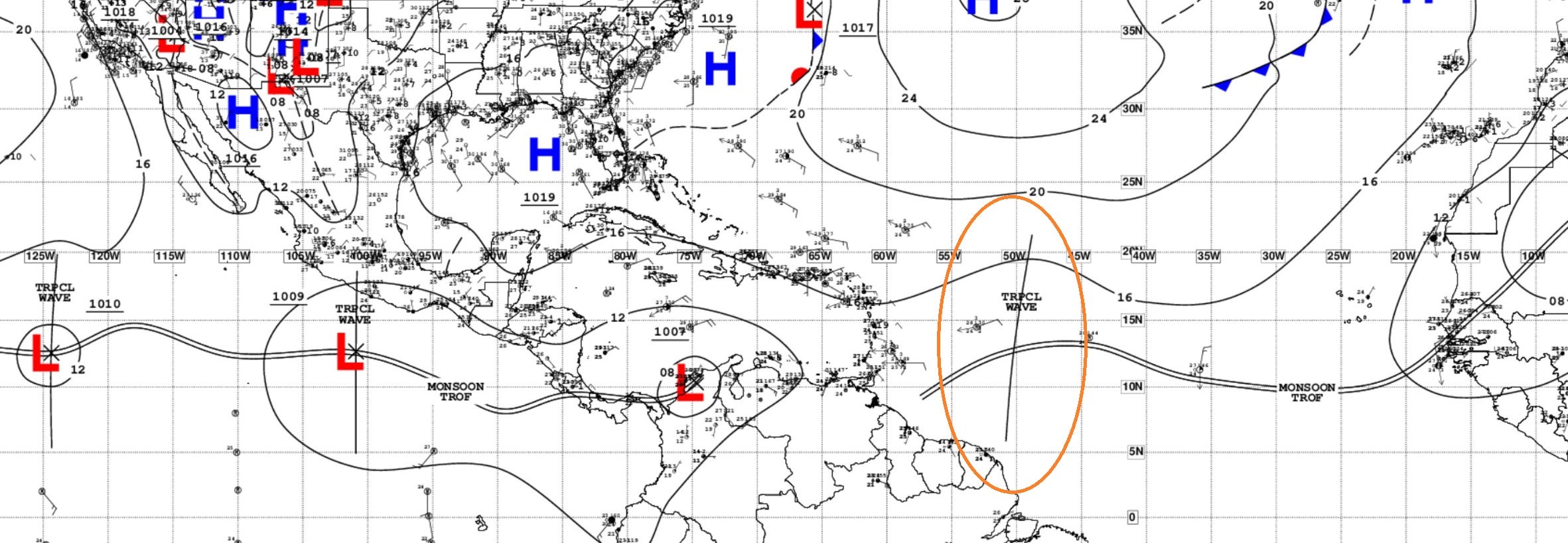
...TROPICAL WAVES... A tropical wave is near 50W, south of 21N, moving westward at 15 kt. No significant convection is noted near this wave axis.
ECMWF 00z HRES Model Solution | 10-days
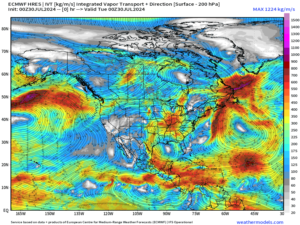
My favorite parameter Integrated Vapor Transport (IVT) shows the WNW track of the tropical wave with moisture along the northern periphery. As the wave approaches the Bahamas, it slows down and perhaps stalls over Florida or the near-coastal waters.
In the Eastern Pacific, at least 2 hurricanes develop.
The simulated water vapor does not show a favorable environment for the tropical wave as a upper-level trough pinwheels just to the east ready to disrupt. This animation through Sunday evening shows the disturbance east of Florida. A long way to go with this system.

Storm Tracks from the EPS 00z ensembles
Active systems at 5-days:

Active systems at 7-days:

All tracks through 10-days:

The uncertainty with ECMWF EPS lies in the intensity off the U.S. East Coast with a recurving track. Many members have a powerful hurricane even at 40°N prior to cross the wall of the Gulf Stream. Ocean temperatures > 28°C extend northward well off the New Jersey coastline.

ECMWF AIFS 00z — Artificial Intelligence modeling

AIFS (00z) using MSLP normalized anomaly: The track of the tropical wave is nicely shown with a stalling/looping just west of Bermuda in 7-10 days. Another tropical wave enters the Caribbean and Gulf of Mexico in the long range > 10-days.
Atlantic Basin GeoColor Satellite Imagery
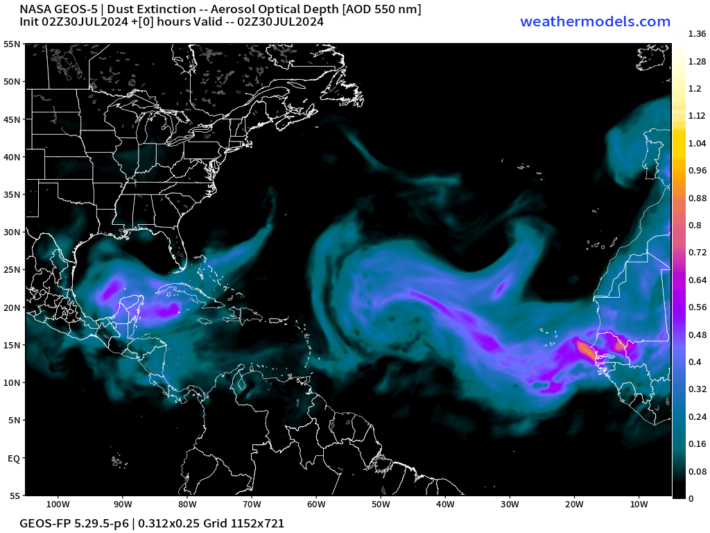
The dust layers are less intense over the next 10-days but still traveling across the Atlantic basin. The Saharan dust season will continue to wane over the next few weeks.
Eastern Pacific Tropical Outlook
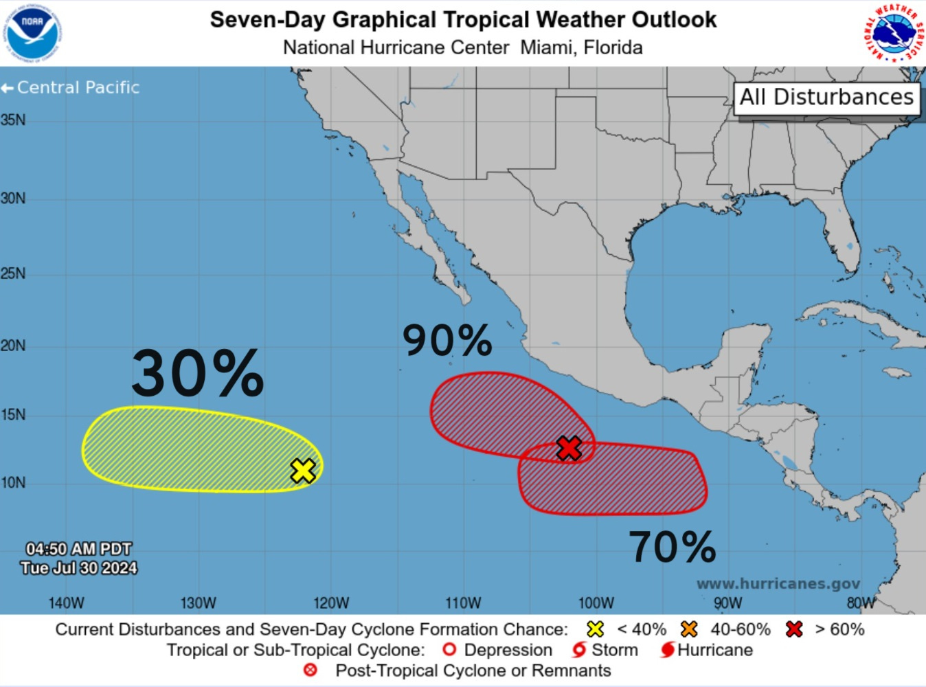
At least 2-hurricanes likely in the Eastern Pacific over the next 7-10 days. They would be named Carlotta and Daniel.

At Day 7 … Carlotta will have gone through its lifecycle with Daniel getting started.
Thank you to Subscribers and Supporters!
Maps sourced from weathermodels.com designed and innovated by yours truly! I actually create all of my content from scratch.