


July 3, 2025 Hurricane Season Thursday Evening Update
60% chance of tropical system (Chantal) along Southeast coast into weekend

2025 Atlantic Hurricane Season [Day 33]. My expectation for this year is 14 named storms, 7 hurricanes, and 3 majors. So far, 2 named storm, 0 hurricanes, and 0 majors.
Thursday Evening Tropical Update + 4th of July Weather
Atlantic Basin: NHC watching the SE US coast for a stalled frontal wave developing into a tropical system this weekend (60%) — moderate chance trending upward. Next name is Chantal.
Western Pacific Basin: Tropical Storm Mun (04W) has strengthened near Typhoon intensity, and another system (Invest 98W) has high chance to become a tropical storm Friday, and perhaps a Typhoon near/over Taiwan.
Current Satellite Imagery | United States
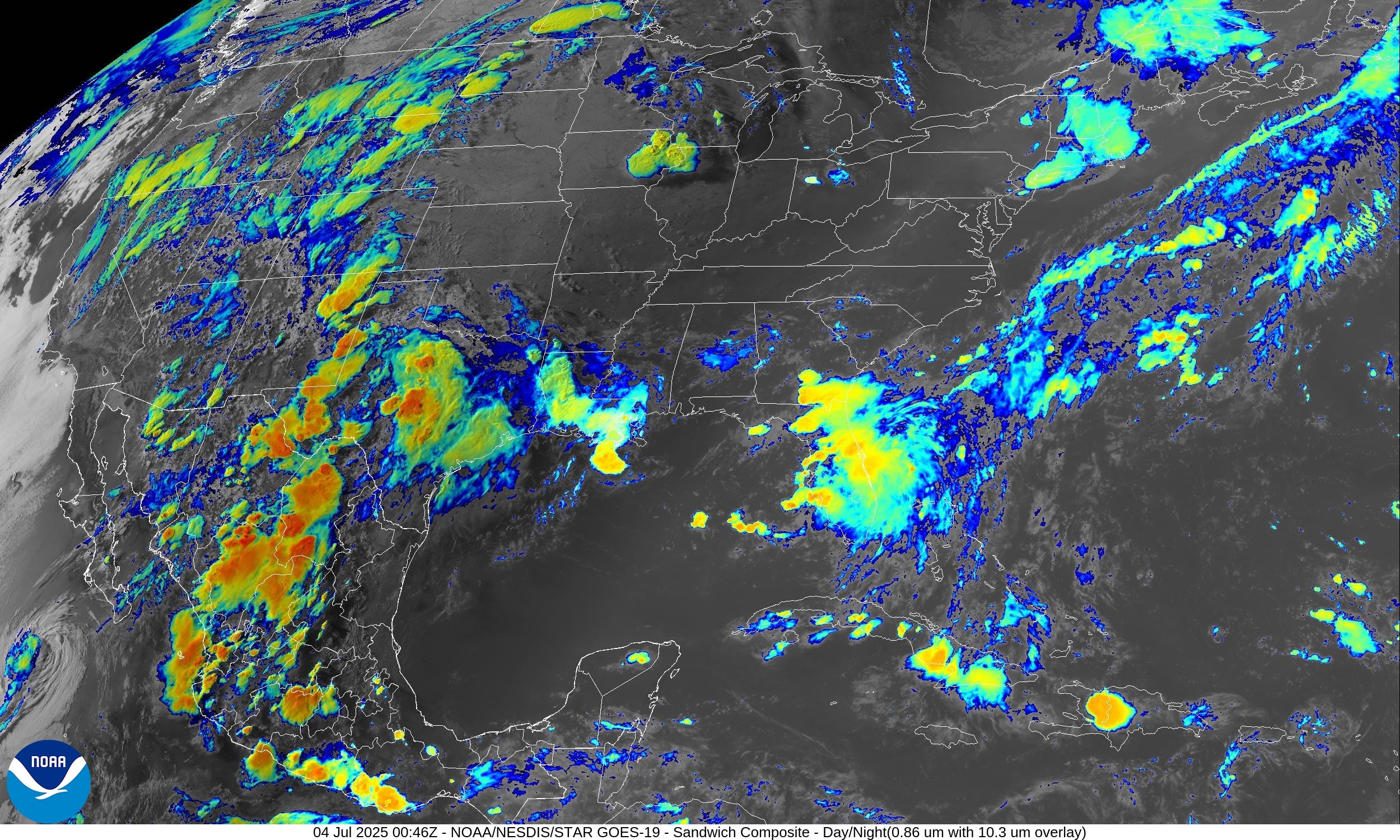
Texas and Florida with heavy showers and storms continuing into the evening. Monsoon moisture across the Southwest and Rockies will decrease into Friday as the main moisture feed moves into the norther Plains.
Temperatures | 8:30 PM ET
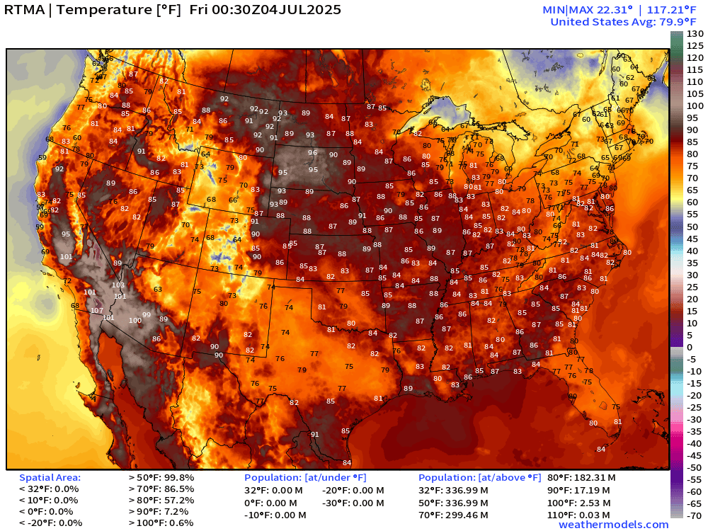
Texas noticeably cooler with the rain and clouds only in the 70s, along with Florida peninsula. Amazing. 60s in New England. Comfortable except for around Phoenix and maybe South Dakota into the 90s.
Temperature Anomaly | 8:30 PM ET
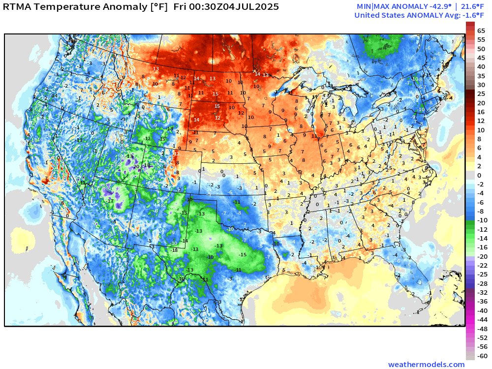
Overall, the Lower 48 is -1.6°F below average with the most warmth still in the northern Plains and Midwest. Nevada, Arizona, and New Mexico are the coolest states compared to normal (green/blue)
Lows for Friday | Fourth of July

Highs on Fourth of July | Friday

120 million at least 90°F on Independence Day.

90s for 4th of July in Minneapolis to Chicago and Detroit … Ohio River Valley but NOT Washington D.C. or NYC or Boston — instead 80s.

Great day for the pool or the beach — maybe a dip in warm-enough Lake Michigan on Friday.
Probability of Rainfall Friday evening | Fireworks

Florida will have the most impactful — wet/stormy weather on Friday but the eastern U.S. is mainly dry.
HRRR 10 PM EDT on Friday | Fireworks Radar and Temperatures

Northeast and Great Lakes look mostly clear as well as Ohio River Valley and Mid-Atlantic. Texas looks mostly fair + Phoenix, and of course, all of California.

Temperatures will cool into the upper-70s and lower 80s by late evening.
HRRR Radar Simulation Next 48-hours | through 2 PM Saturday

Monsoon moisture dies down across Texas on Friday as the focus of the unsettled weather shifts north out of the Southwest into the northern Rockies and Plains.
Watching “tropical system” off the U.S. Southeast Coast with stalled frontal boundary but the moisture/rainfall looks lopsided well offshore through early Saturday.
Weather on Friday | Fourth of July

Widespread scattered showers and storms … but not looking like a washout during the day — instead dependent upon convective/daily heating + pop-up.
NWS Precipitation Next 48-hours

NWS WPC Precipitation Next 7-days

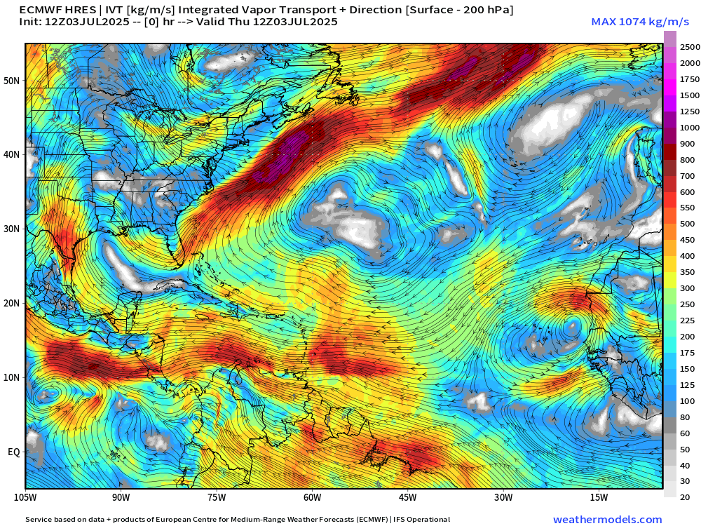
ECMWF 12z | Integrated Vapor Transport | Next 8-days
Something will develop off the U.S. Southeast coast [60%] with probably enough of a circulation to be considered a tropical depression or a storm (Chantal).
The asymmetric system will then be dragged NNE by an approaching trough/front and be taken off the Northeast coast to perhaps enhance rainfall and winds from Mid-Atlantic to New England.
The tropical system will be lopsided under effects of wind shear and its rapid movement NNE, so not a typical looking tropical storm. That will be helpful in limiting the intensification over the otherwise very warm Gulf Stream waters off the East Coast.
Thank you to readers continuing into this Hurricane Season. My goal is to keep you informed about ongoing extreme weather events inside and outside of the tropics, but also a week (hopefully) heads up on what’s coming. I’ll be using a variety of weather modeling output, some of it may be unfamiliar, but it’s state-of-the-art and industry leading standard.
Atlantic Basin Outlook
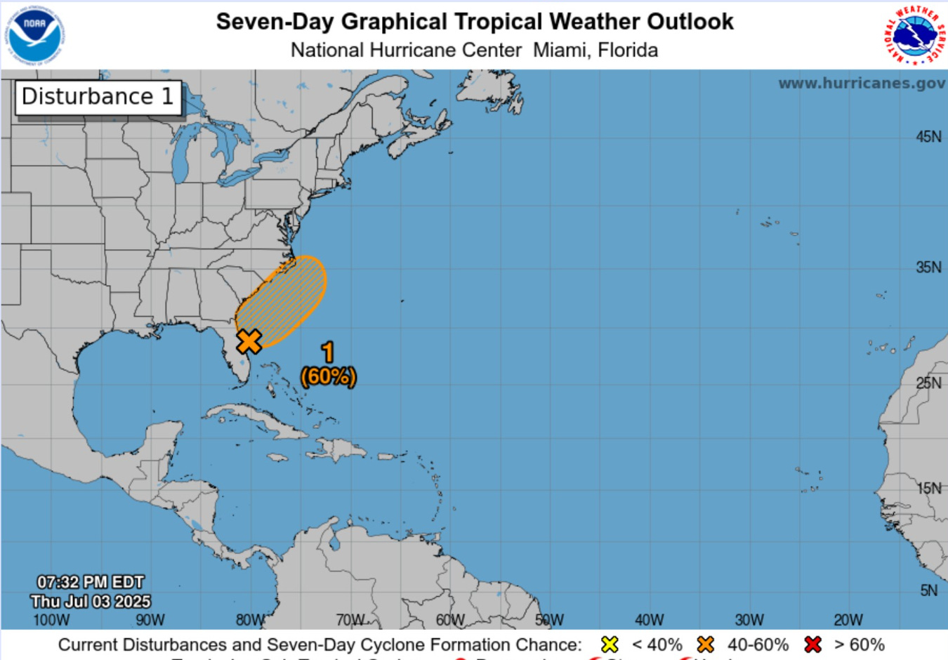
60% chance of development — next 7-days from NHC — focusing on Sat/Sun
ECMWF depiction Saturday afternoon at 18z


Significant circulation around rather weak low pressure (1010 mb) with heavy rain in the NE quadrant. Not going to be pretty, but still windy and wet along the coast!
NEW SUBSCRIBER OR ANNUAL UPGRADE | COUPON (through July 4th)
Keep reading with a 7-day free trial
Subscribe to Weather Trader to keep reading this post and get 7 days of free access to the full post archives.