


July 3, 2025 Hurricane Season Thursday
60% chance of tropical system (Chantal) along Southeast coast into weekend

2025 Atlantic Hurricane Season [Day 33]. My expectation for this year is 14 named storms, 7 hurricanes, and 3 majors. So far, 2 named storm, 0 hurricanes, and 0 majors.
Thursday’s Tropical Update
Atlantic Basin: NHC watching the SE US coast for a potential frontal wave developing into a tropical system this weekend (60%) — moderate chance trending upward. Next name is Chantal.
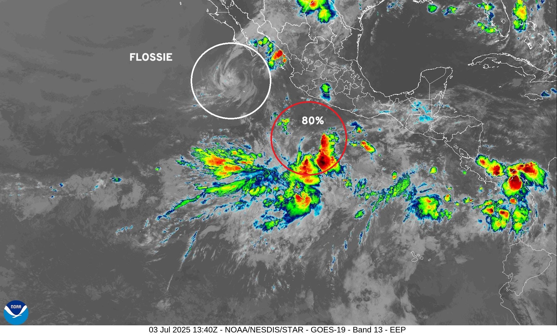
Eastern Pacific Basin: Flossie fell apart. Another system is on the way (Gil) with high chance of development
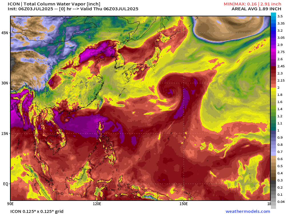
Western Pacific Basin: Tropical Storm Mun (04W) is disorganized ESE of Japan, and another system (Invest 98W) is forecast to become a powerful Typhoon near Taiwan with a looping track.
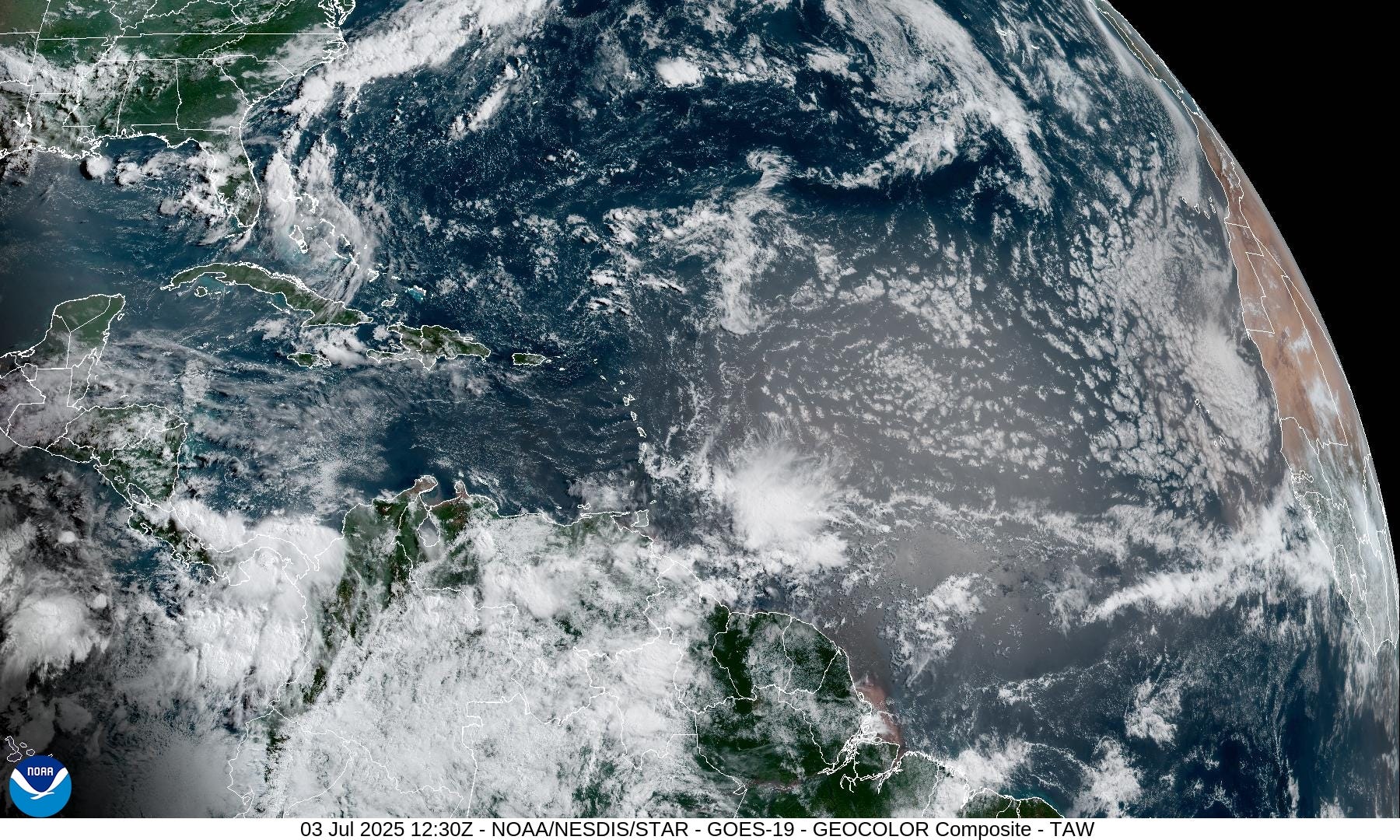
Current Satellite Imagery | United States

Monsoon moisture continues to drench Texas keeping temperatures well below normal. This is definitely not a “heat dome” and instead of 90s and 100s, we’ll be in the 70s and 80s with humidity. Pop-up thunderstorms will fire again across the Southeast into the Rockies.
Watching a stalled frontal boundary across the Southeast enhancing rainfall for Florida, which has become very wet in the past several weeks after a dry spring.

Temperatures | 8:00 AM ET

Temperatures at 8 AM were warming nicely in the 60s and 70s across much of the Lower 48. A bit cooler air filtering into the northern Great Lakes with comfortable 50s.
Temperature Anomaly | 6:30 PM ET
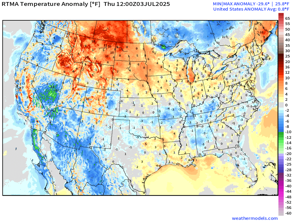
Overall, the Lower 48 is 0.8°F above average with the most warmth still in the northern Rockies. Nevada, Arizona, and New Mexico are the coolest states compared to normal (most blue).
Highs for Thursday

117 million at/above 90°F with South Dakota helping to make up 1.6% of the Lower 48 real-estate at least 100°F. Only 8 Million population total mostly in California, Nevada, and Arizona.
Lows for Friday | Fourth of July

A bit warmer across the central and northern Plains into the low-70s.
Very comfortable 50s and 60s across the Northeast.
Highs on Fourth of July | Friday

90s for 4th of July in Minneapolis to Chicago and Detroit … Ohio River Valley but NOT Washington D.C. or NYC or Boston — instead 80s.

Great day for the pool or the beach — maybe a dip in warm-enough Lake Michigan on Friday.

Probability of Rainfall Friday evening | Fireworks

Florida will have the most impactful — wet/stormy weather on Friday but the eastern U.S. is mainly dry.
HRRR 10 PM ET on Friday | Fireworks

Mother nature with fireworks in the central and northern Plains — perhaps in Florida around Orlando and Tampa, but hopefully calming down after sunset.
Northeast and Great Lakes look mostly clear as well as Ohio River Valley and Mid-Atlantic. Texas looks mostly fair + Phoenix, and of course, all of California.
HRRR Radar Simulation Next 48-hours | through 2 AM Saturday

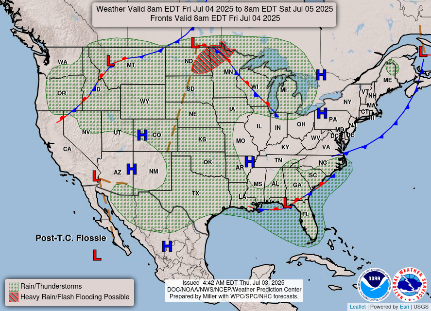
Monsoon moisture dies down across Texas on Friday as the focus of the unsettled weather shifts north out of the Southwest into the northern Rockies and Plains.
Watching “tropical system” off the U.S. Southeast Coast with stalled frontal boundary.
Weather Today

Heavy rain continues across Texas — and more showers and storms along the frontal boundary from the Southeast into New England.
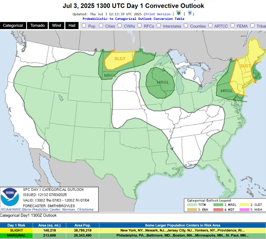
Chance of some severe storms (Slight) across North Dakota and New England.
Weather on Friday | Fourth of July
Widespread scattered showers and storms … but not looking like a washout during the day — instead dependent upon convective/daily heating + pop-up.
NWS Precipitation Next 48-hours

NWS WPC Precipitation Next 7-days

ECMWF 00Z | Integrated Vapor Transport | Next 8-days

Something will develop off the U.S. Southeast coast [60%] with probably enough of a circulation to be considered a tropical depression — if we named Barry (02L) in the southern Bay of Campeche, then this should probably qualify as Chantal.
The system will then be dragged NNE by an approaching trough/front and be taken off the Northeast coast to perhaps enhance rainfall and winds from Mid-Atlantic to New England.
The tropical system will be lopsided under effects of wind shear and its rapid movement NNE, so not a typical looking tropical storm. That will be helpful in limiting the intensification over the otherwise very warm Gulf Stream waters off the East Coast.
Thank you to readers continuing into this Hurricane Season. My goal is to keep you informed about ongoing extreme weather events inside and outside of the tropics, but also a week (hopefully) heads up on what’s coming. I’ll be using a variety of weather modeling output, some of it may be unfamiliar, but it’s state-of-the-art and industry leading standard.
Atlantic Basin Outlook
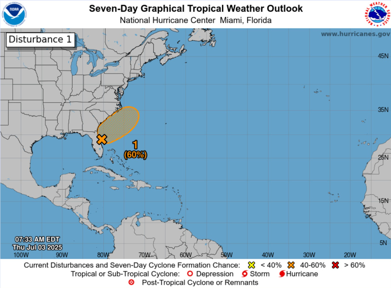
60% chance of development — next 7-days from NHC — focusing on Sat/Sun
ECMWF depiction Saturday morning at 12z


Low pressure + surface circulation and vorticity = should be enough for a tropical depression or storm.
NEW SUBSCRIBER OR ANNUAL UPGRADE | COUPON (through July 4th)
Eastern Atlantic Satellite Image
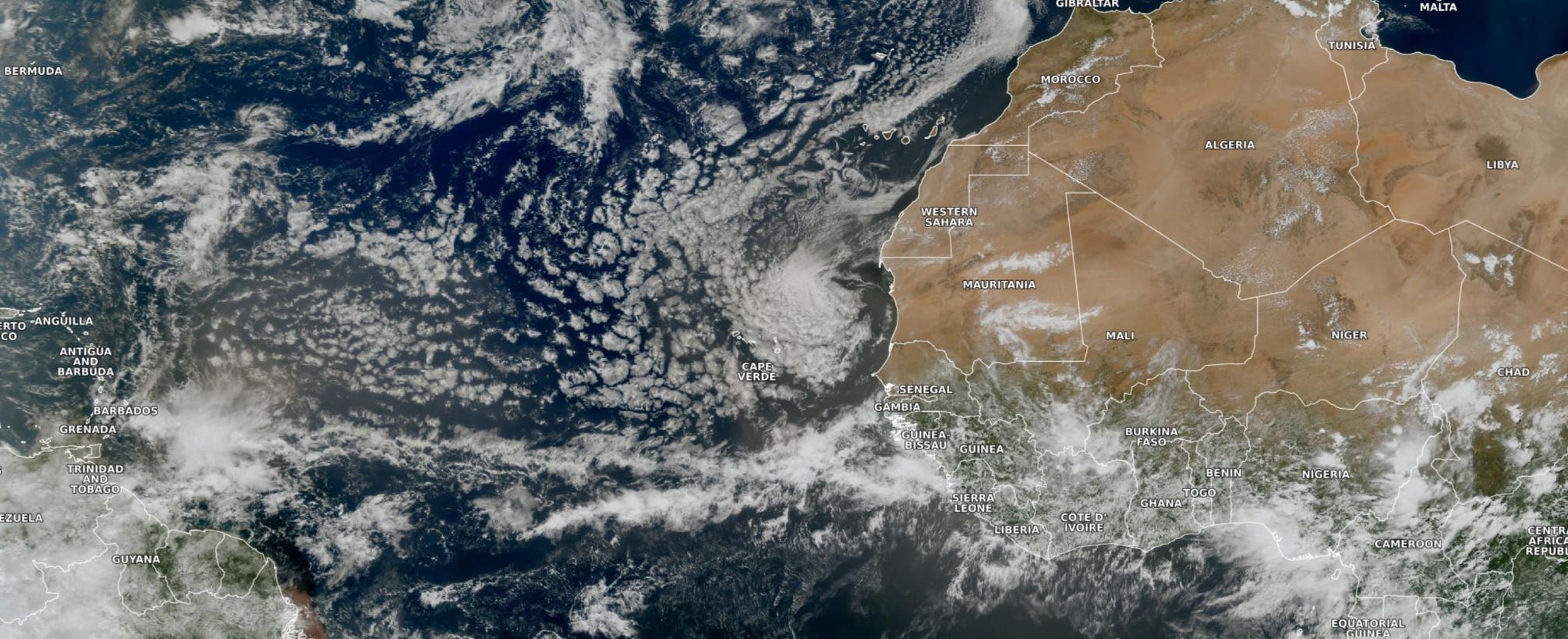
Major dust plume almost to the Lesser Antilles with another one — perhaps bigger — on its heels.
NASA GEOS-5 |00z DUST Aerosol Optical Depth (AOD) | 8-days Forecast
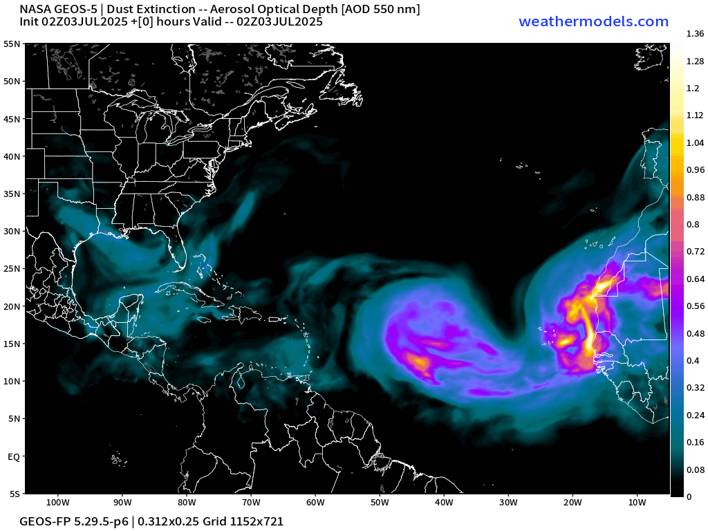
Very active and intense SAL + dust plumes from Africa over the next 8-days with no signs of stopping.
Major reason why the Atlantic MDR can’t get going with organized convection is perpetual plumes of dust from the Sahara. These air layers are warm and stable above the surface and inhibit convection. The plumes circulate clockwise (high pressure) with a major amount of dust heading into the Gulf over the next few days in 2 waves.
Atlantic Ocean Surface Temperatures (SST) | Anomaly


Very warm water for anything tropical to develop across the Gulf of Mexico eastward and across Florida to Bermuda. 28°C water expanding across the western Atlantic off the U.S. East Coast — but this likely a thin layer near the surface (of course) and could mix with much cooler air in the next 2-weeks as the weather pattern across the western Atlantic sees more rain and wind + waves,
Tropical Atlantic Satellite Imagery
Tropical wave nearing Lesser Antilles has some convection — perking up a little bit in early July out there, but nothing like Beryl from last year — which would be still 3-4 weeks away. It’s early out in the main development region (MDR).
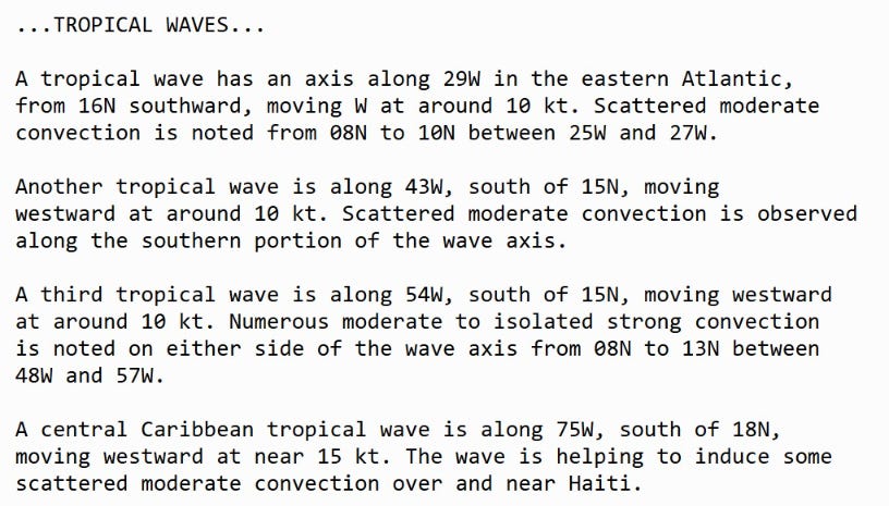
NOAA Tropical Surface Analysis | 06z

Atlantic Tropical Waves = 4 but no development expected from them (at least in the Atlantic). The western most wave could be part of a new system behind Flossie in the coming days.
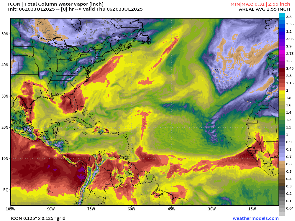
Atlantic Precipitable Water | Next 5 days
Only show in town is the area of low pressure off the Southeast U.S. coast which passes the eye test as a tropical storm.
Atlantic Simulated Water Vapor | Next 6-days

Interesting little swirl south of Bermuda left at the tail end of a passing front (trough) could become a small tropical depression in 5-6 days — short-lived, but still counts!
GFS Vorticity Next 8-days

GFS has stopped producing the “bogus” or false-alarms in the Caribbean and Gulf of Mexico, thankfully.
Also, GFS is on board with the East Coast system.
Medium range ensemble model outlook
These are 51-realizations of the same model with different initial conditions. Each ensemble gets equal ~2% weight in a mean calculation.
ECMWF Ensembles 00z | 15-Days | All storm Tracks

The initial system will be weak with ~1000 mb pressure at minimum through weekend, but then many ensembles become more intense up the coast … with the warm water rather far north, could see more tropical convection / development and lead to a hurricane staying off the East Coast — in some scenarios.
Comparison with AIFS-Ensemble 06z | 7-days off East Coast

AIFS-ENS does have some stronger lows that look to take advantage of warm water + baroclinic or non-tropical invigoration by the midlatitude jet stream + favorable trough interaction.
All 15-days Across Atlantic | AIFS-Ensemble

Otherwise, blank slate across the tropical Atlantic through July 18th.
Eastern Pacific Tropical Update
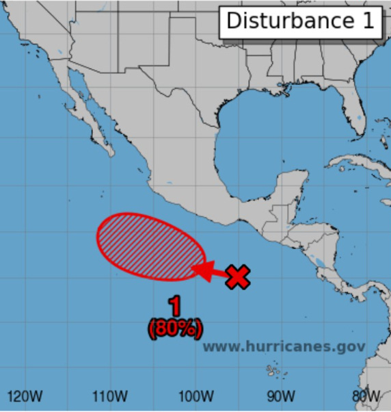
Gil is next as the 7th Named System — as Flossie has almost left us.
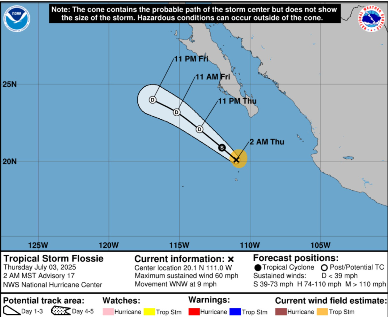
Flossie’s deep convection is gone over the chilly water SSW of Baja California
ECMWF 06z Ensembles | Eastern Pacific
6-Days All Storm Tracks

The next name is Gil — the 7th tropical storm likely within next few days — could become a hurricane briefly as the track is over a bit warmer water untouched by Flossie to the south.
Western Pacific Tropical Update
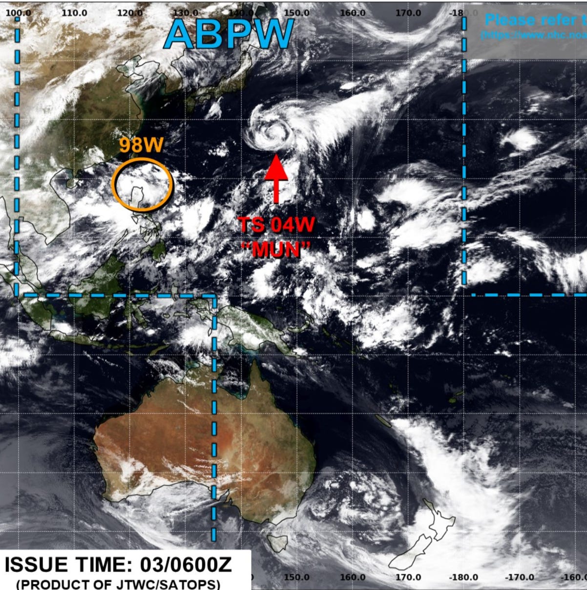
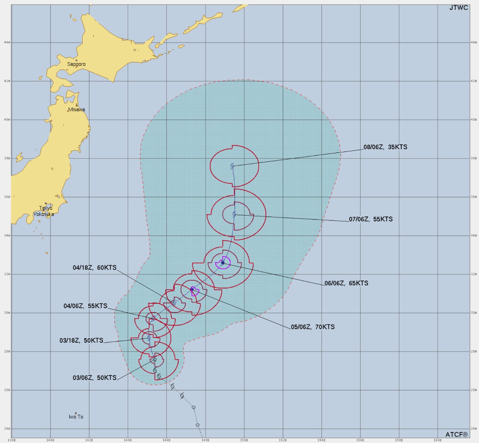
Tropical Storm Mun (04W) now forecast to become a minimal Typhoon well east of Japan.
Precipitable Water Next 5-days
Invest 98W will loop around Taiwan or right over it — but uncertainty about track and intensity.
Interesting to see Invest 98W develop into a Typhoon and impact Taiwan briefly turning into 2 vorticity centers before reforming on the other side of the island.
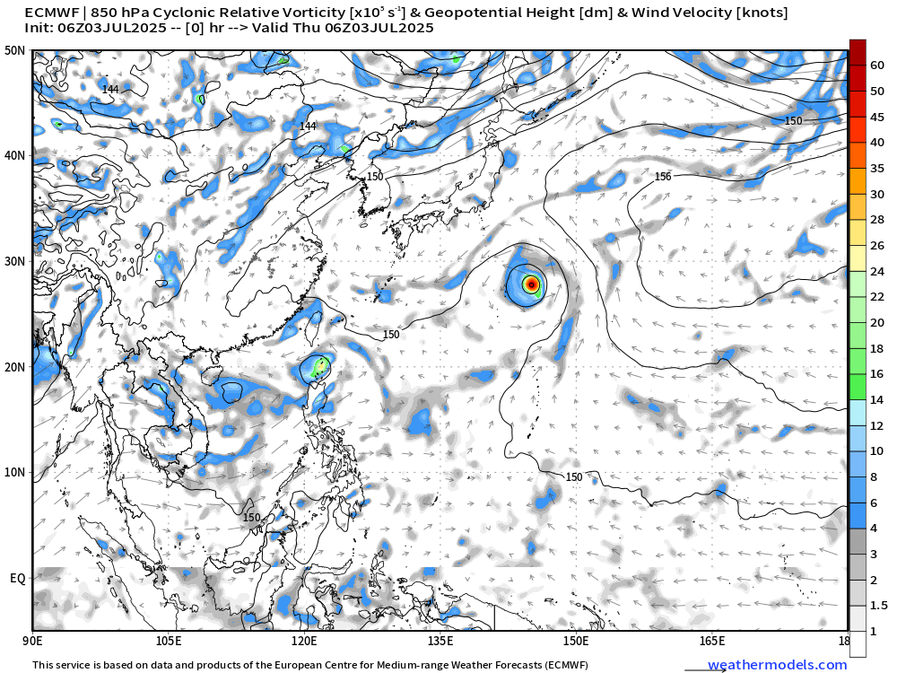
Invest 98W will be closely watched over next 24-hours for likely development with the ensemble tracks showing a looping movement around / near / over Taiwan in the next several days as a Typhoon.
Day 4 Ensembles | Active Storm Tracks

Ryan’s Notes:
June 2025: We use the ECMWF for medium-range prediction because the GFS can’t be trusted due to false-alarm bias, and unrealistic intensification of tropical convection into spurious (ghost) storms. I don’t agree this is a good thing like CNN.
We can look at the GFS every day for weeks and see a modeled tropical storm or hurricane in the Caribbean or Gulf especially after Day 10. However, this is a known bias/false alarm problem with spurious convective — vorticity spin-ups due to the convective parameterization or estimation of vorticity generation due to intense diabatic heating. Perhaps it’s worthwhile to show what will not happen.
Maps sourced from weathermodels.com designed and innovated by yours truly! Please subscribe there for real-time access to the newest maps, charts from all of the weather models including ECMWF.