


July 27, 2024 Saturday Tropical Update
European model suite bullish on development of tropical wave
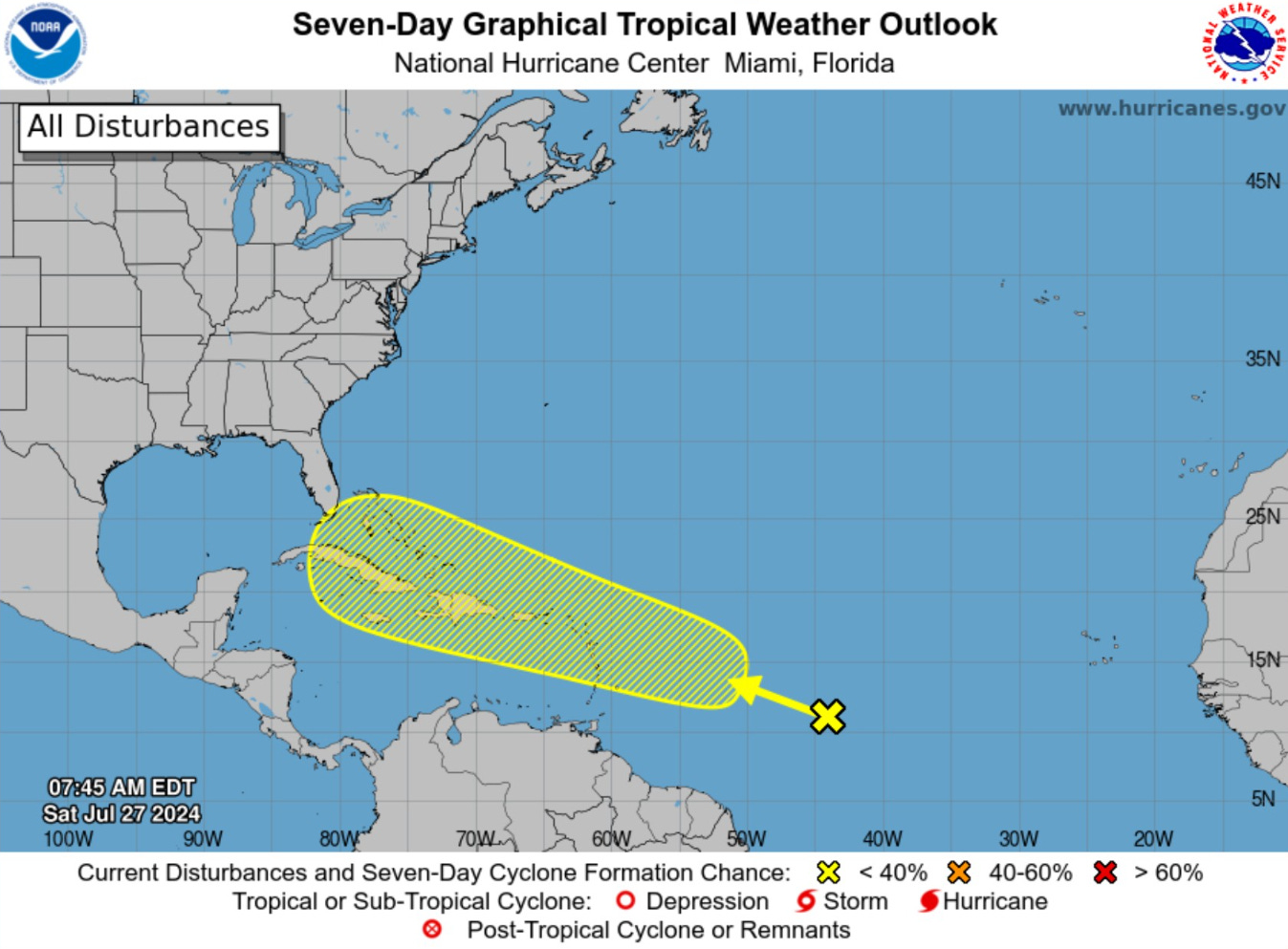
NHC has increased the chance of development of a tropical wave in the Atlantic to 30% in the next 7-days. However, model guidance is split on whether it will become a tropical storm with the European model (ECMWF) ensembles much more insistent than NOAA GFS/GEFS.
When will we know which model output is correct? Trends, my friend. If a particular model increases the ensemble members showing development — or conversely poofs, then we’ll have better confidence. Also, we can look at the Artificial Intelligence (AI) trained models from ECMWF (AIFS) and GraphCast, which are dependent upon the ECMWF IFS analysis. NOAA now runs its own version of GraphCast dependent upon its own GDAS analysis. I will collect forecasts and post some results ASAP.
NHC analyzed (06z) the tropical wave just east of 40°W but without any convection.
SW Atlantic — Bahamas region to watch — if development will occur

ECMWF 00Z HRES has a powerful hurricane off the Southeast Coast in the 8-day time frame. Of course, this is just one ensemble out of 52 total, and uncertainty is high. However, the area in the Bahamas and north of Hispaniola should be watched in the models for environmental conditions favorable/unfavorable for further development. The track thereafter is probably dependent upon the timing and intensity of the system.
Keep reading with a 7-day free trial
Subscribe to Weather Trader to keep reading this post and get 7 days of free access to the full post archives.