


July 25, 2024 Thursday Update
One tropical wave in Atlantic to watch for the next 10-days

1-year anniversary: new/upgrade annual subscriptions (20%) offer through August 1, 2024
Thursday Headlines
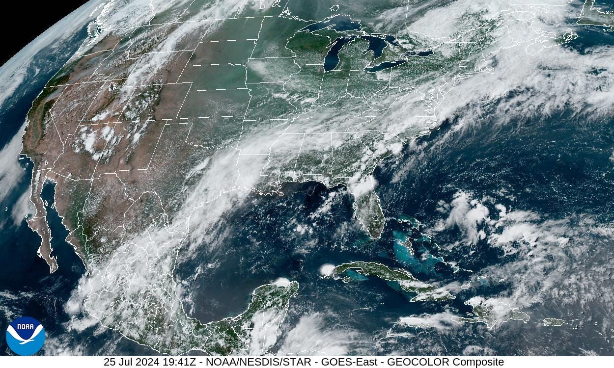
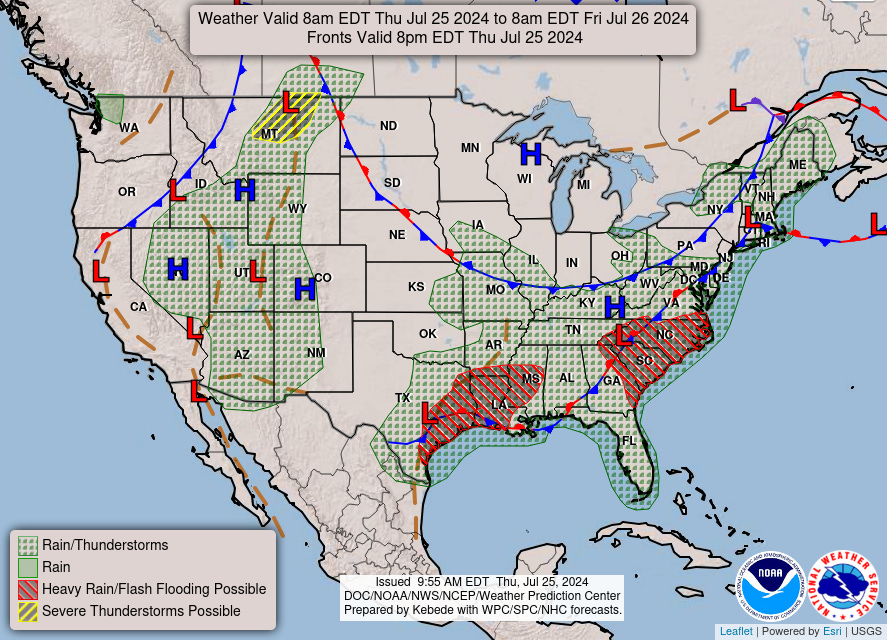
Stationary Front: Broken record with the frontal boundary across the Gulf Coast. A Canadian cold front without much precipitation is hung up in the Ohio Valley with dry and seasonable temperatures in the 80s.
Heaviest rain again across Texas into the Carolinas.
Rainfall over the next 30-hours:

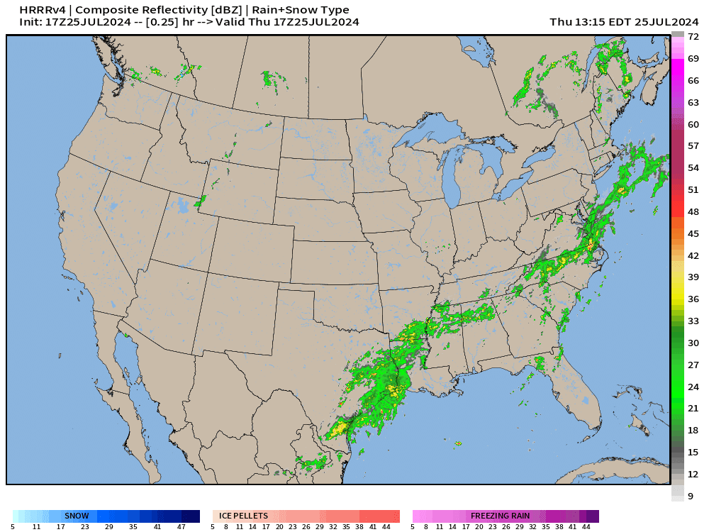
HRRR simulation next 18-hours

Friday High temperatures
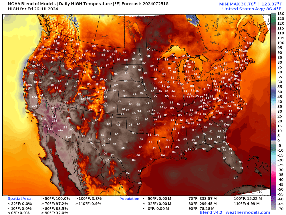
78 Million population at least 90° — with the Southwestern U.S. very hot. Temperatures have been knocked down in the NW and northern Rockies. And, comfortable in the 80s in the Great Lakes.
Atlantic Tropics
There is one tropical wave that bears watching coming across the Atlantic over the next 10-days. However, it will be battling unfavorable environmental conditions including wind shear, Saharan dust (dry layers), and weak instability. The Atlantic is typically hostile until later in August or early September according to climatology.


Keep reading with a 7-day free trial
Subscribe to Weather Trader to keep reading this post and get 7 days of free access to the full post archives.