


July 24, 2020 Tropical Update
Hanna (rapidly) intensifying and may be a powerful hurricane at landfall
Tropical Storm Hanna
Everyone is watching the satellite imagery to see the rapid changes in the structure of Tropical Storm Hanna. Right now at 11 pm ET, on Infrared satellite imagery, the storm is wrapping up an eye and looks poised to rapidly intensify. So, over the next 18-hours how strong can Hanna become?
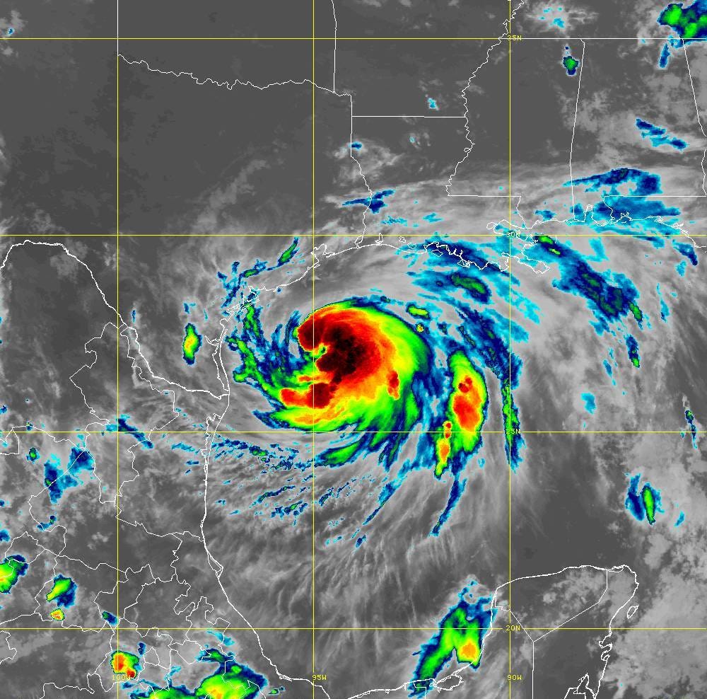
The current intensity is 55-knots at 992 mb. That central pressure is getting close to the hurricane threshold. The 18Z HWRF hurricane model went down to 972 mb at landfall. So that would be about 20 mb / 18 hours and reasonable for a hurricane figuring out its inner-core during initial rapid intensification. I think we will see an intensifying hurricane right up until landfall reminiscent of Harvey but not Category 4. I would go with 975 mb and 80-knots maximum winds.

Down the Road
The number of ensembles is up to at least 20 / 50 that are very problematic — long track Cape Verde major hurricanes. The complication might be land interaction with Hispaniola or Cuba. Too soon to say as the strong tropical wave has yet to begin tropical cyclogenesis in earnest. Suffice it to say by next weekend, we will be very concerned with this storm.
For context, the EPS ensembles do not usually have this strong of a signal e.g. number of developing members into major hurricanes. That ain’t good.

July 24, 2020 12z ensembles from ECMWF EPS (@weathermodels_)