


July 23, 2020 Tropical Update
Hurricane Douglas now Category 4 threatening Hawaii
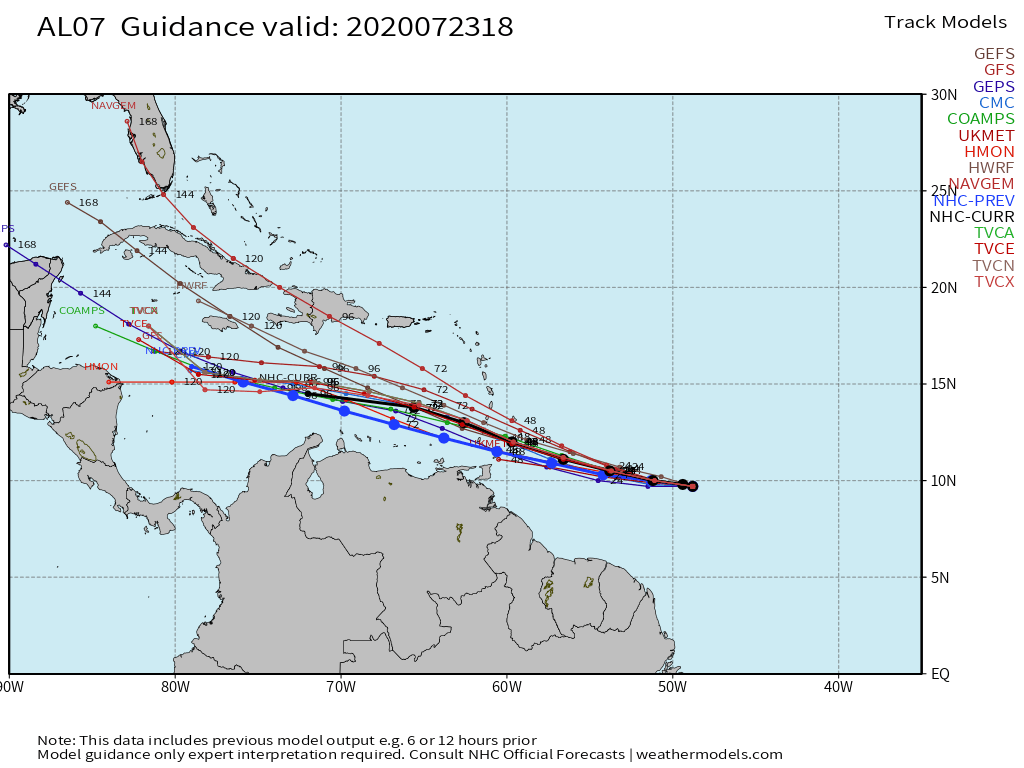
Tropical Storm Gonzalo
has not given up the fight against dry air and has spawned a few thunderstorms near its center. However, the outlook for Gonzalo is dissipation in the hurricane graveyard of the Caribbean Sea in 5-days. It will bear watching next week for regeneration as the general steering currents take the remnants of Gonzalo over the very warm waters south of Jamaica. We don’t want to see anything that spins or has a history of spinning over that high-octane water. Gonzalo model guidance:
Tropical Depression 08L (Hanna)
is still not technically Tropical Storm Hanna but it surely will become the 8th named storm of the 2020 Atlantic hurricane season soon enough. The maximum intensity is now 50-knots prior to landfall in SE Texas on Saturday. But, of course the Gulf of Mexico is very warm and it could become a hurricane. The main threat aside from the winds will be heavy rain (4-6”+) especially along the coast. That’s fine — Texas needs it and tropical systems often provide helpful rains to prevent brutal droughts.
Hurricane Douglas steams into the Central Pacific
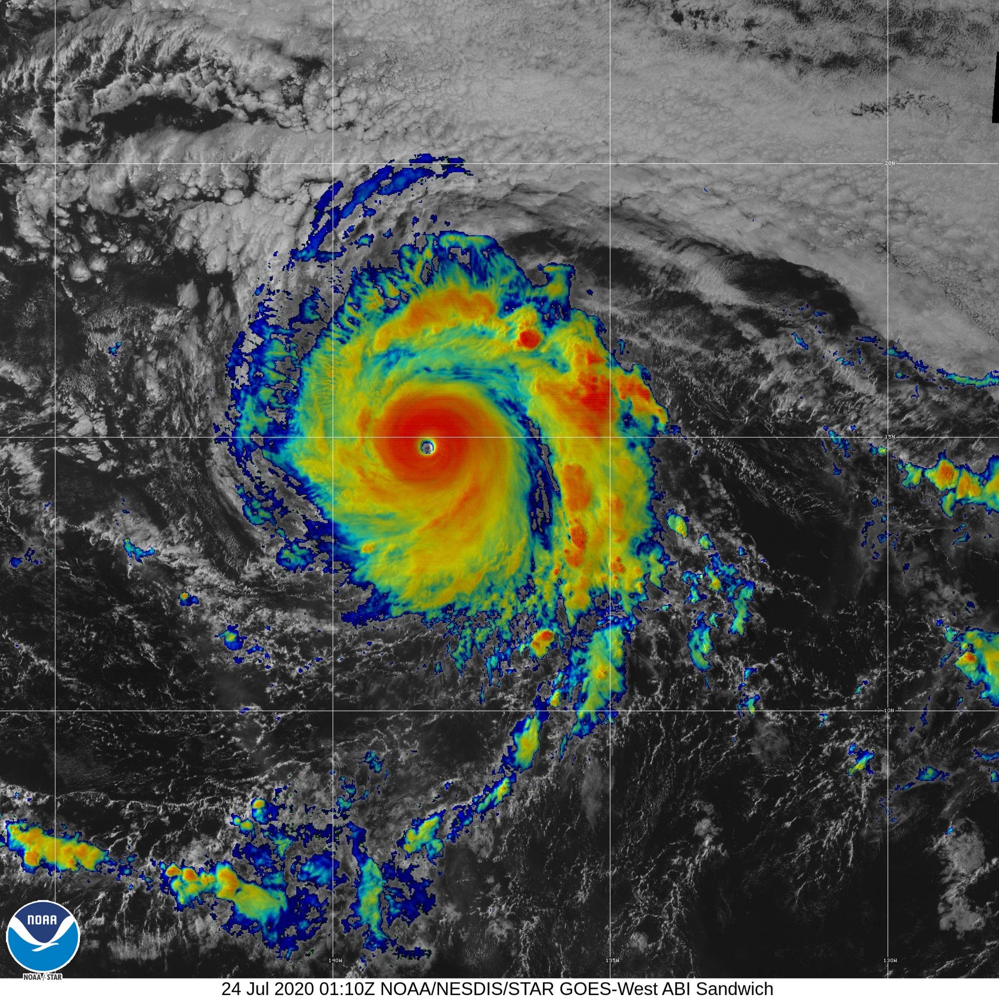
Finally the Eastern Pacific has generated a hurricane and Douglas is now Category 4 (115-knots). To determine intensity out in the open ocean when aircraft recon is unavailable — although with the threat to Hawaii planes will likely fly into Douglas — we use satellite techniques to estimate the maximum sustained winds. The Dvorak technique can be done manually (by a human) or with a trained computer software program. The Automated Dvorak Technique (ADT) from CIMSS is my go-to location to determine the intensity of hurricanes once they have a discernible and trackable eye. http://tropic.ssec.wisc.edu/real-time/adt/odt08E.html
The current raw CI number is 6.1 so that is at least 115-knots and Category 4.
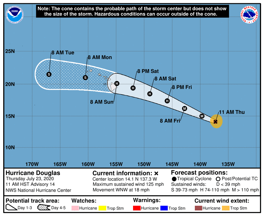
The current NHC forecast has Douglas crossing into the Central Pacific on Friday. The official track takes the storm just north of the Big Island of Hawaii still as a hurricane on Sunday. This is rather concerning.
Down the Road
As I mentioned yesterday, there is a strong tropical wave emerging off the coast of Senegal that is quite impressive and bears watching over the next 5-days. I expect this wave to develop eventually but the open question is how far west it travels before becoming a depression. The worry is that if it does not dissipate (probably won’t) then it will eventually reach an area of very warm ocean water that has favorable atmospheric conditions above it. That might be 5 days from now or 10-days.
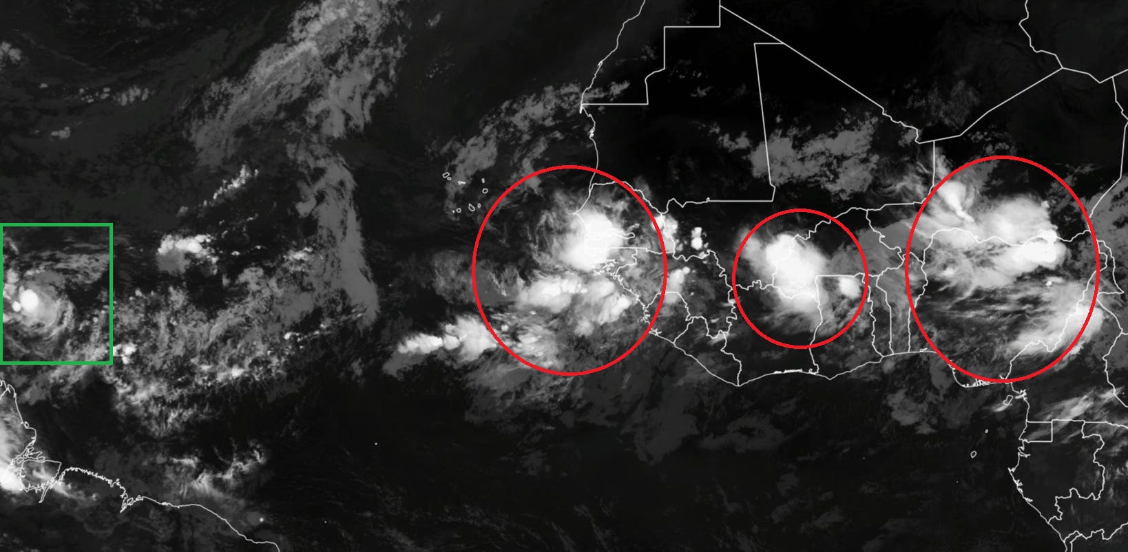
The ensembles are up to 8/51 or 16% showing a major hurricane.
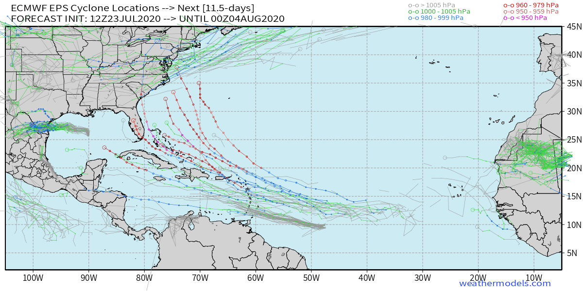
ECMWF ensemble tracks +11.5 days for 12z (July 23, 2020).