


July 2, 2025 Hurricane Season Wednesday
40% chance frontal boundary could spur system along Southeast coast into weekend

2025 Atlantic Hurricane Season [Day 32]. My expectation for this year is 14 named storms, 7 hurricanes, and 3 majors. So far, 2 named storm, 0 hurricanes, and 0 majors.
Wednesday’s Tropical Update
Atlantic Basin: NHC watching the SE US coast for a potential frontal wave developing into a tropical system this weekend (40%) — moderate chance trending upward.
Eastern Pacific Basin: Hurricane Flossie did become a major hurricane but will rapidly weaken to a remnant low on Thursday.
Western Pacific Basin: Tropical Storm Mun (04W) is underway ESE of Japan, and another system (Invest 98W) is forecast to become a powerful Typhoon near Taiwan with a looping track.
Current Satellite Imagery | United States
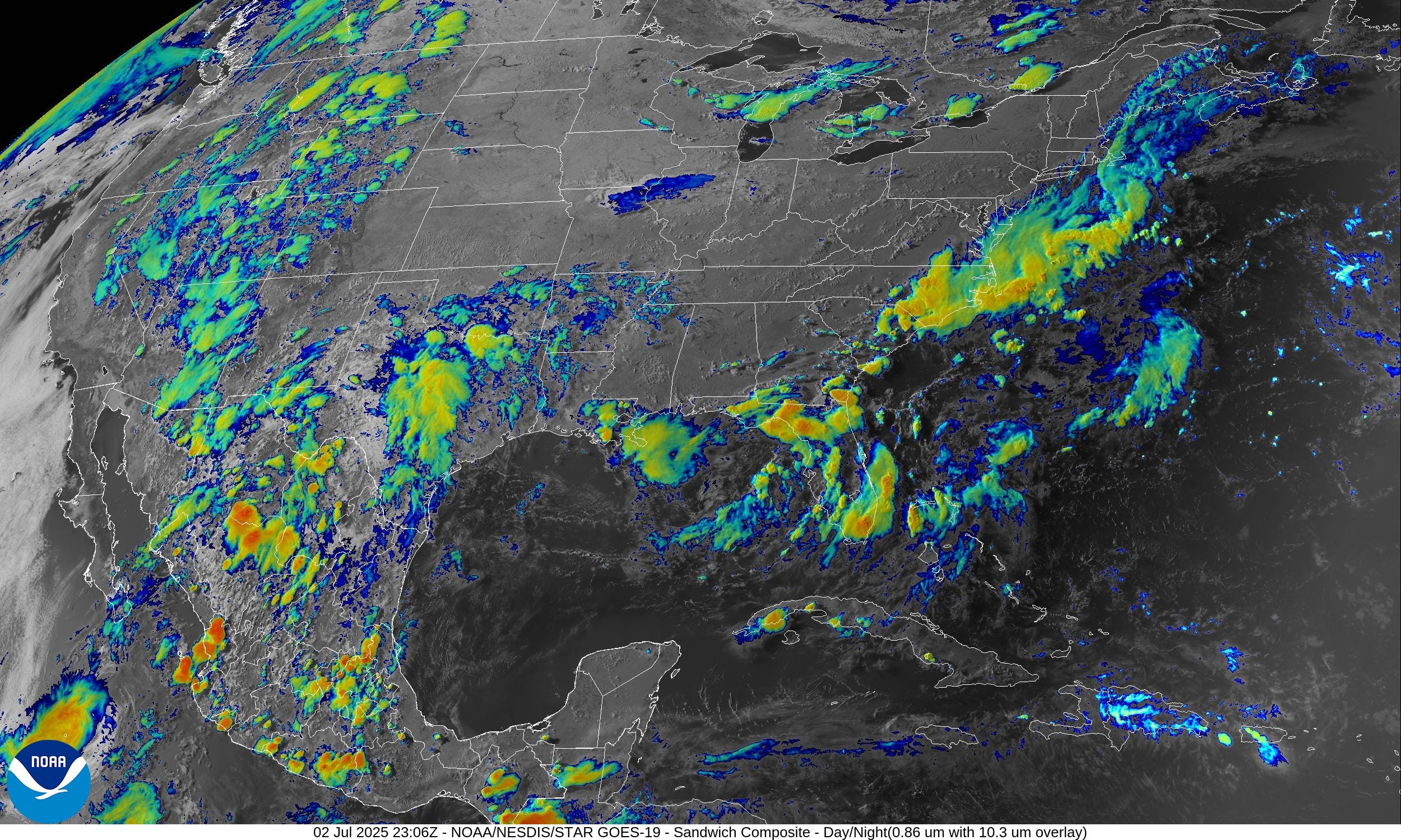
Convection popping up across the Western U.S. into Texas — being drenched — and then into Florida and along the Carolina coastline. The frontal boundary sinking through the Southeast U.S. will stall out and perhaps lead to a tropical depression on the Atlantic side of Florida or Carolinas.
Temperatures | 6:30 PM ET

Clouds and rain kept temperatures in the 70s across west Texas … and Florida is wet and in the lower-80s. Outside of the desert Southwest extreme dry heat, eastern Montana checks in with 100s.
Temperature Anomaly | 6:30 PM ET

Overall, the Lower 48 is 1.2°F above average with the most warmth now in the northern Rockies and into the Great Lakes and Northeast. Nevada under rain showers is 25°F below normal just outside Las Vegas.
Lows for Thursday Morning

60s again look quite popular across the northern half of the Lower 48 — comfortable for July 3rd!
Highs for Thursday

121 million at/above 90°F is an uptick over previous days with the East Coast getting some summer time heat and humidity.
Highs on Fourth of July | Friday

Hottest compared to normal in the upper-Midwest with 90s in Minnesota and nearly 90°F across Northern Michigan. I remember many years needing to wear a heavy sweatshirt to avoid freezing while watching fireworks up in Michigan.
Temperature Anomaly | Highs on Friday

No heat dome or extreme long-lasting heat waves for this first week of July.
Probability of Rainfall Friday evening | Fireworks

Florida might have the worst weather on the 4th with the lingering frontal boundary and developing tropical system.
HRRR Radar Simulation Next 18-hours | through 11 AM Thursday

Nice monsoon moisture across the Western U.S. … and the eastern U.S. mostly clears out until the next iteration of pop-up storms on
Weather on Thursday

Heavy rain in west Texas and New Mexico yet again … with widespread scattered pop-up storms across the Rockies. Florida continues to be drenched.
NWS Precipitation Next 48-hours

NWS WPC Precipitation Next 7-days

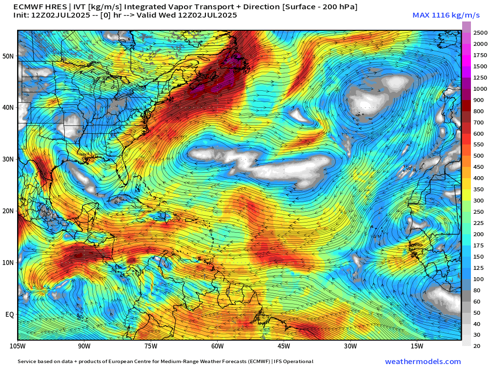
ECMWF 12Z | Integrated Vapor Transport | Next 8-days
Something will develop off the U.S. Southeast coast with probably enough of a circulation to be considered a tropical depression — if we named Barry (02L) in the southern Bay of Campeche, then this should probably qualify as Chantal.
Interestingly, the system maintains a low-pressure center and intensifies off the Northeast coast perhaps just along the Gulf Stream wall to take advantage of warm water, but that is just one scenario.
The most likely outcome is a weak area of low pressure with a lot of rainfall drifting inland across the Carolinas with Florida, SE Georgia, and the rest of the East Coast eventually seeing precipitation impacts.
Thank you to readers continuing into this Hurricane Season. My goal is to keep you informed about ongoing extreme weather events inside and outside of the tropics, but also a week (hopefully) heads up on what’s coming. I’ll be using a variety of weather modeling output, some of it may be unfamiliar, but it’s state-of-the-art and industry leading standard.
Next 8-days MSLP + Precipitation | ECMWF 12z

The tail end of fronts in July are a great place to look for enough instability and disturbance to get a tropical system started — especially when tropical waves are tough to keep alive with all of the dry air and dust across the Main Development Region of the Atlantic.
Atlantic Basin Outlook
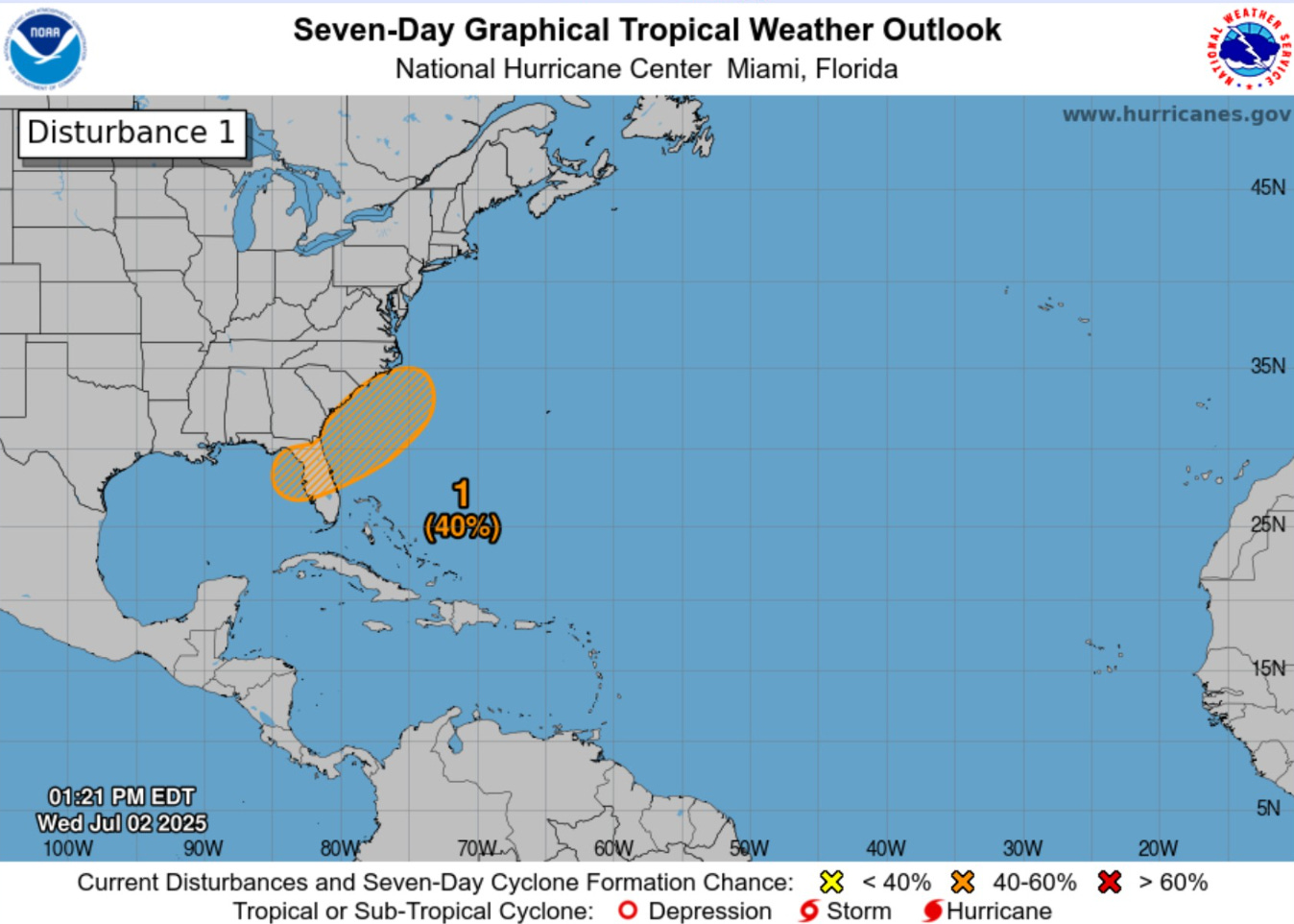
40% chance of development — next 7-days from NHC
Keep reading with a 7-day free trial
Subscribe to Weather Trader to keep reading this post and get 7 days of free access to the full post archives.