


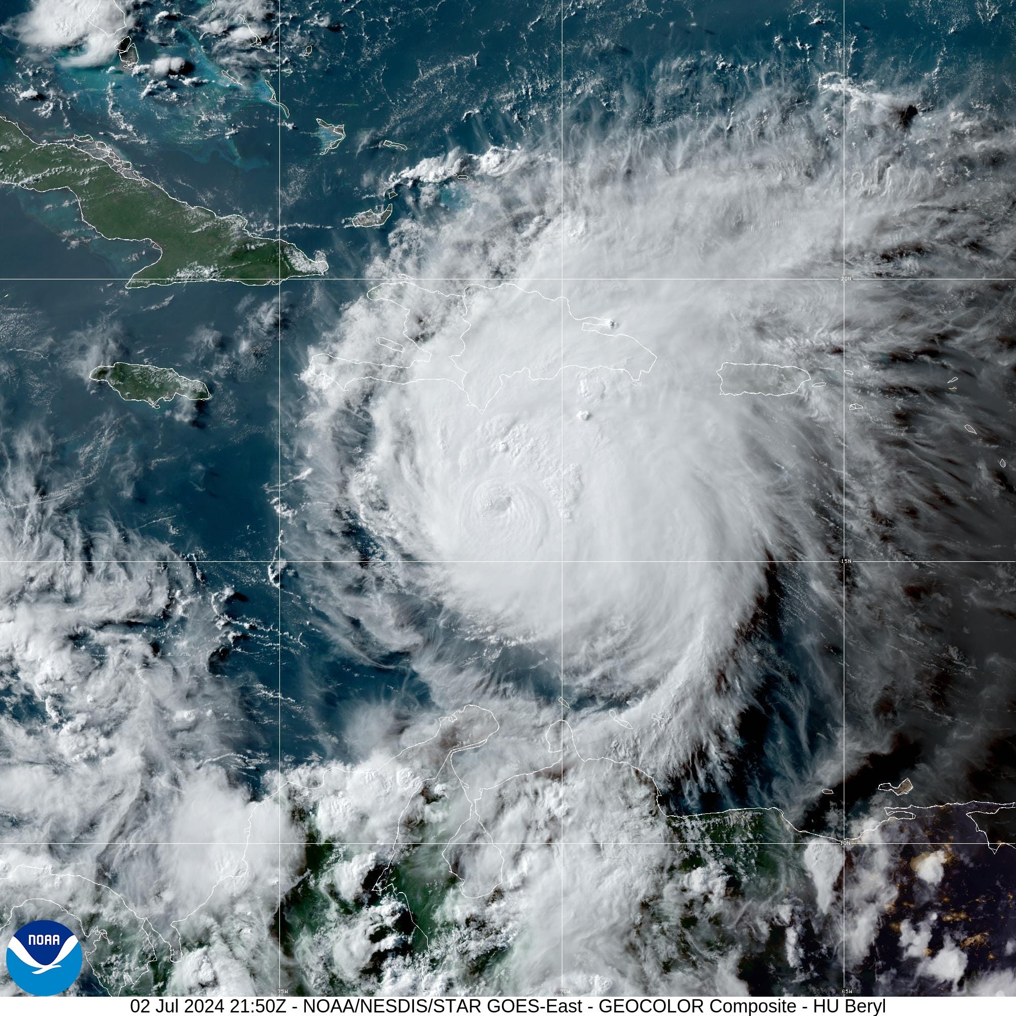
July 2, 2024 Tropical Update: Beryl peaked at Category 5
Jamaica under serious threat of major hurricane conditions

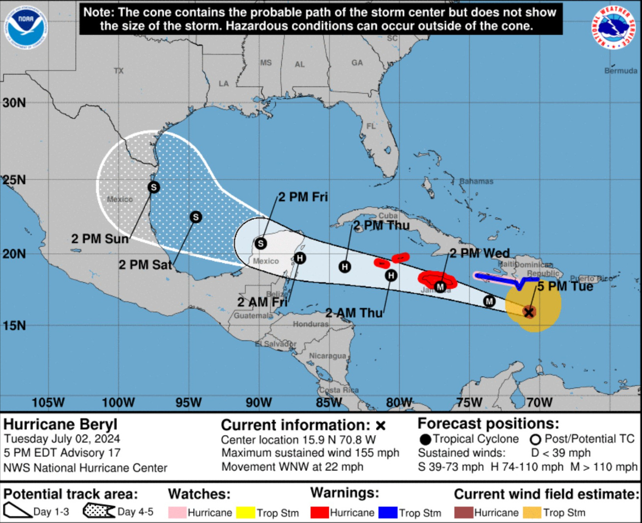
NHC 5-PM Discussion Highlights

The intensity forecast also continues to be uncertain.

The models are in good agreement that Beryl should steadily weaken during the next 60 h due to shear and dry air entrainment, but the models show a slower rate of weakening than previously.

Based on this, the new intensity forecast calls for Beryl to still be a major hurricane when it passes near Jamaica, at or near major hurricane strength when it passes the Cayman Islands, and still be a hurricane when it reaches the Yucatan Peninsula.

This part of the forecast lies near the upper edge of the intensity guidance.

There remains considerable spread in the intensity guidance when Beryl emerges over the Gulf of Mexico, although there is somewhat better agreement that the cyclone will intensify some while crossing the Gulf.

Track Uncertainty

There remains a significant spread in the track guidance when Beryl emerges into the southwestern Gulf of Mexico, due mainly to model differences in the strength and location of a break in the subtropical ridge over the southern
United States.

The GFS shows a more northerly motion during this time, while the ECMWF and UKMET forecast a more westerly motion.

This part of forecast track lies between these extremes near the consensus models and has a higher than normal amount of uncertainty.
Headlines:
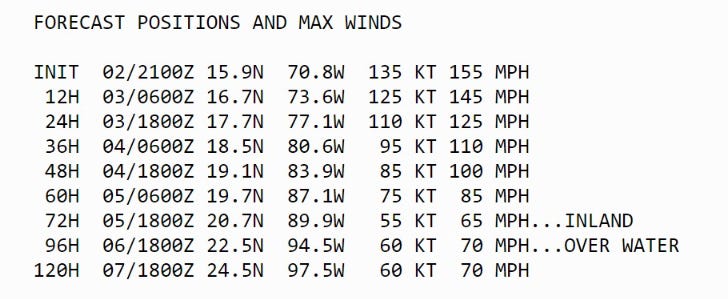
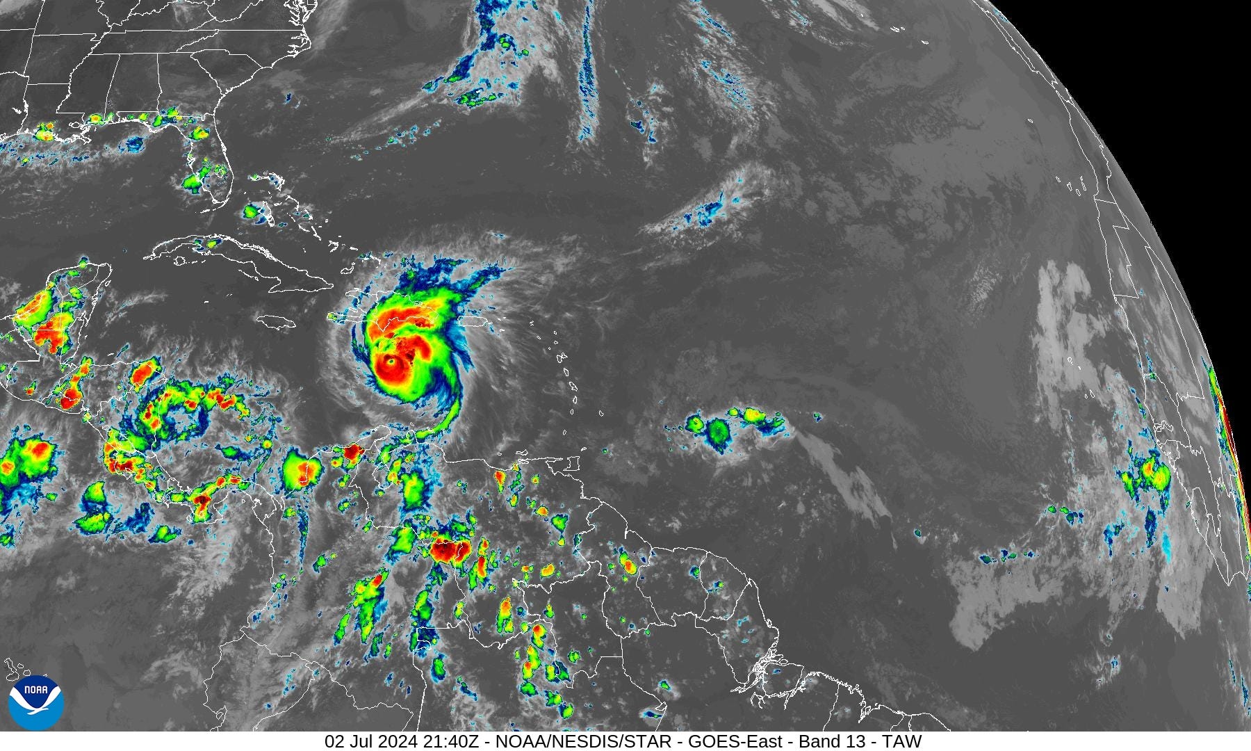
Major Hurricane Beryl into Jamaica as weakening is not occurring quickly even in the face of increasing wind shear. The maximum intensity has weakened to just under Category 5 at 135-knots with central pressure at 943 mb.
The track forecast is more uncertain that usual in the southern Gulf of Mexico with some models showing more northward motion toward Texas. Therefore, while the official NHC track forecast landfalls Mexico on Sunday, this is up for revision in the coming 1-2 days. We must still watch / wait for potential Texas impacts.
Invest 96L behind Beryl is no longer expected to develop with only a 20% chance.
The GFS, GEFS, HWRF, and GEPS show a northward curve in the Day 5-6 range. The HAFS mesoscale models are to the left of the NHC official forecast, which splits down the middle.

There are more than a handful of ECMWF ensembles that indeed curve into the U.S. Gulf coast from Texas to Louisiana. However, this number is about 20% of the total.

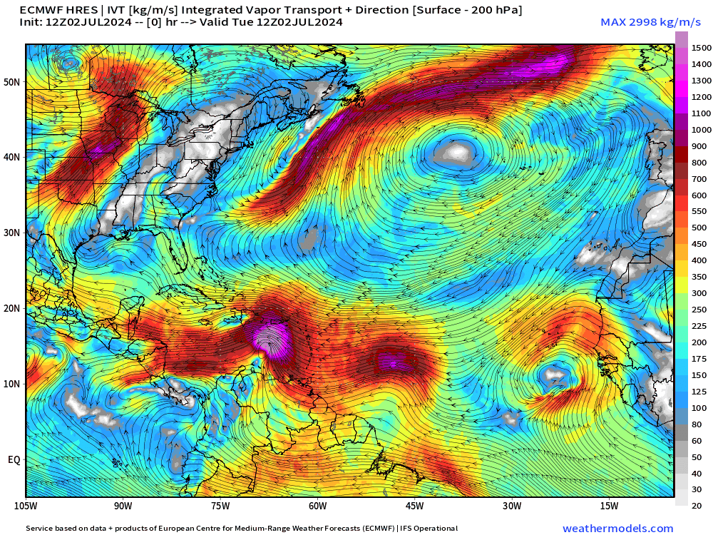
ECMWF 10-day Integrated Vapor Transport Forecast
My favorite animation to show the evolution of tropical features including tropical waves.
The Bermuda high extends into the mid-latitudes — large and in charge — beginning a long period of no activity in the Atlantic.
North Atlantic Sea Surface Temperatures (SST)

Actual SSTs are > 29°C in the Caribbean under Beryl for the duration of its journey into the Yucatan.
Weather Trader is a reader-supported, daily newsletter. To receive new posts and support our R&D, consider becoming a free or paid subscriber.
Basin Wide IR Satellite Imagery
Next 14-Days EPS Ensemble Tropical Storm Tracks
Active TCs at Days 6, 10, 15 [Spaghetti]
After Hurricane Beryl is finally ended likely in Mexico, no other Atlantic tropical storm activity is expected through mid-July, until the 17th at least. Ghost town for July?
Keep reading with a 7-day free trial
Subscribe to Weather Trader to keep reading this post and get 7 days of free access to the full post archives.