


July 18, 2024 Thursday Update: Wet Pattern in South
Stationary front hangs up in the Southeast

Thursday Headlines
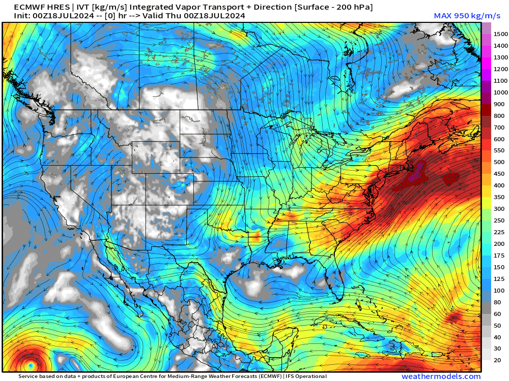
Stationary front stalls out in the Southeast keeping warm, moist tropical Atlantic flow to the south. The Integrated Vapor Transport (IVT) animation for the next 10-days nicely shows the moisture continuously streamed in the SE and some progress into the mid-Atlantic. Otherwise, flow out of Canada =very dry until a pattern shift in 8-10 days.

Thursday high temperatures are comfortable in the Great Lakes, Midwest, into the Ohio Valley and Northeast. Perfect mid-July day for > 200 million Americans who won’t see 90°F today.

High Temperature anomaly shows the green/blue centered upon the Mississippi River.

Atlantic Tropics remain dead through the remainder of July 2024, and now into early August. The ECMWF ensembles show one stray track, but nothing imminent or strong signals of tropical cyclone genesis. Also, very low % chance in the Eastern Pacific for a tropical system in the next 2-weeks. Usually we see the EPAC waking up prior to the Atlantic, so might be looking at another 3-weeks before action picks up.


Keep reading with a 7-day free trial
Subscribe to Weather Trader to keep reading this post and get 7 days of free access to the full post archives.