


July 15, 2024 Monday Update: Dramatic Cool Down
Canadian trough to temper extreme heat

Monday Headlines
Still extremely hot across the Lower 48 abut the heat wave will break from north to south significantly by Wed/Thurs. Gone will be the 90s and 100s replaced with temperatures up to 20°F cooler
Thunderstorm complex through Chicago later this evening
Atlantic Tropics remain dead.
Blend of Models High Temperatures & Weather
Monday July 15

Lower 48 Average: 91.3°F | 254 Million at/above 90°F | 33.0 M at/above 100°F
Kansas going for 110°F with 100s in the Plains, Southwest, Carolinas up to Washington D.C. and up I-95 to Baltimore.
NWS NDFD [human forecasters] going even hotter to 101°F at DCA.

Monday’s Weather
Scattered showers and storms the main threat with a slight threat of severe weather across the Great Lakes.

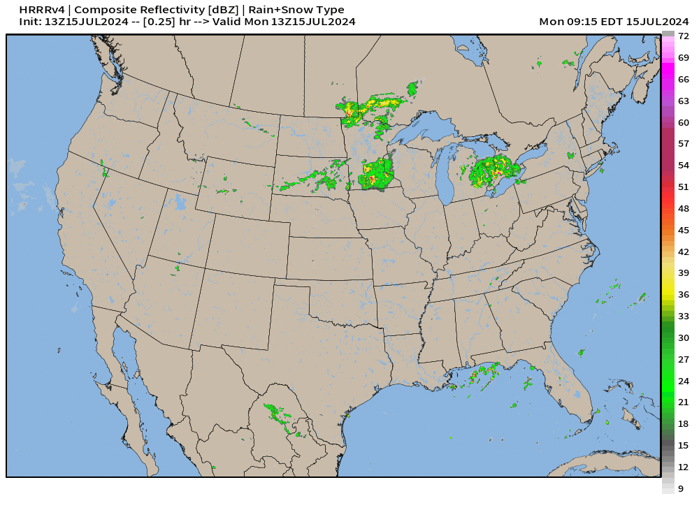
Rainfall next 30-hours
Up to an inch across northern Illinois into Southern Michigan, more in thunderstorm complex into Tuesday morning

HRRR 18-hour Forecast Simulation
Damaging winds possible again in Chicagoland into the overnight hours. Scattered monsoon showers pop up with the heating of the day across the Great Basin.
Ensemble Tropical Storm Tracks Next 15-days

The ECMWF ensemble (00z) model tracks for tropical cyclones are entirely blank for the next 15-days — until July 30 — except for 3 members with weak storms.
That’s about 0% chance of a tropical storm development in 2-weeks, significantly below climatology especially in this forecasted “hyperactive” season. The background environmental conditions remain hostile with wind shear, dry air, dust, and high pressure dominating the Atlantic tropics.
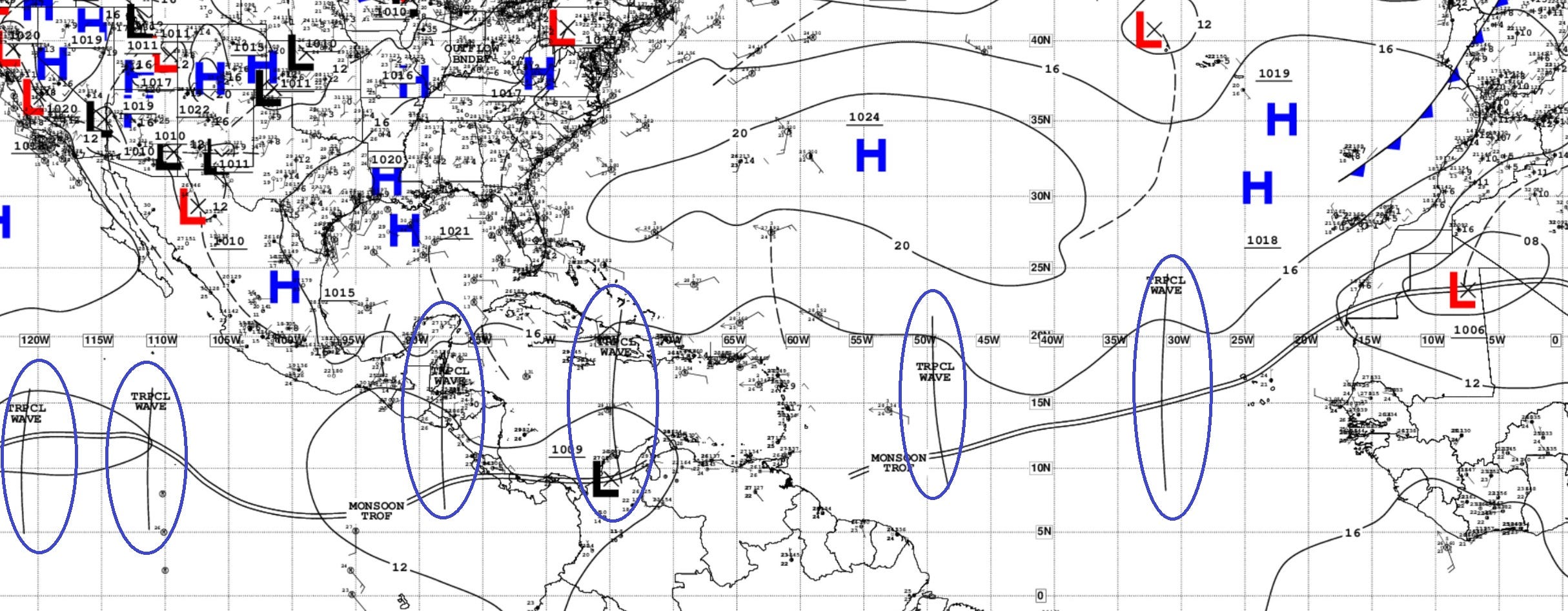
Atlantic Basin Satellite Imagery
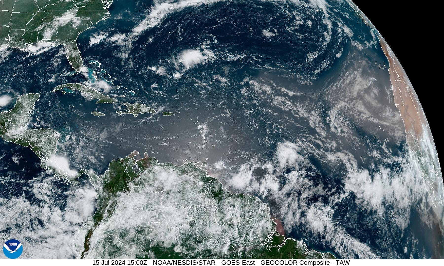
Another quiet day across the Atlantic tropics with dust plumes coming off Africa to squelch any convection.
While there are tropical waves spaced unevenly from the Eastern Pacific to Central Atlantic, nothing brewing.
NASA GEOS5 Dust Forecast | Next 10-days
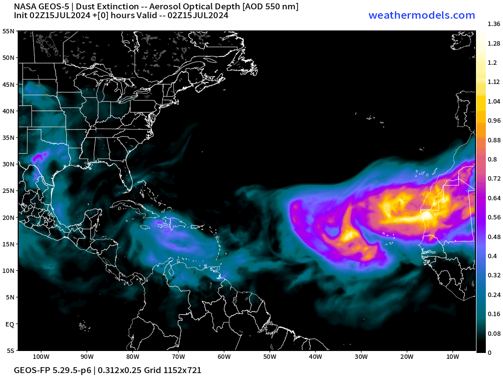
NASA GEOS5 model forecast [next 10-days] shows multiple intense ribbons or plumes crossing the Atlantic.
Next 10-days Upper-Level Weather Pattern | ECMWF AIFS

Excitement about lower-heights = trough over the Great Lakes this week and then centered over the Mississippi River Valley into next week. This is NOT a heat dome and will break the heat wave. Really love this!
NWS WPC 7-Day Precipitation Forecast | Watering Needs

More monsoon moisture into Arizona and New Mexico. Higher rain amounts across the Carolinas and Southeast = very welcome.
Scant rainfall across the Corn Belt unless a thunderstorm dumps a localized inch or two.

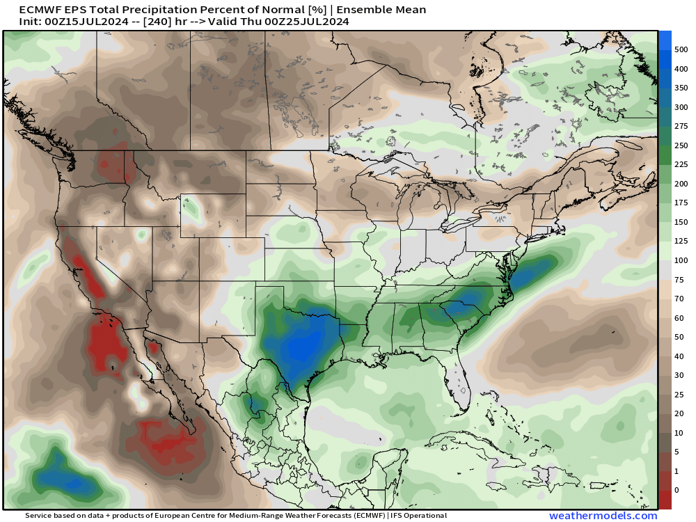
10-Day Precipitation and Anomaly (%)

Weekly Temperature Anomaly
EPS Week 1: July 15-21, 2024

Exceptional heat centered upon Western Canada, where it mostly stays until the end of July. The Great Basin and Rockies will be much above normal with ridging.
Boise, Idaho looks very hot:

Chicago, Illinois looks very comfortable

EPS Week 2: July 22-28, 2024

Significant “cool anomaly” for Week 2 centered upon the Red River Valley including OKC and Dallas. Instead of 100s, we’ll see 80s and 90s.
Thank you to Subscribers and Supporters!
Maps sourced from weathermodels.com designed and innovated by yours truly! I actually create all of my content from scratch.