


July 14, 2025 Hurricane Season Monday
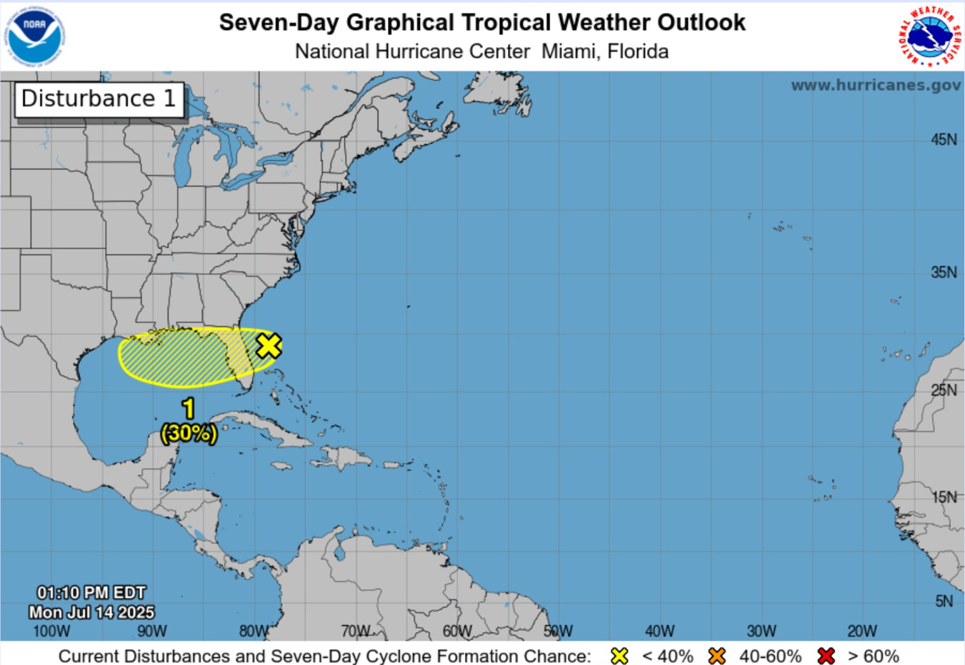
Low chance of tropical storm development along Gulf coast (30%)

2025 Atlantic Hurricane Season [Day 44]. My expectation for this year is 14 named storms, 7 hurricanes, and 3 majors. So far, 3 named storm, 0 hurricanes, and 0 majors.
Monday’s Tropical Update
Atlantic Basin: Still low chance of system along Gulf coast (30%) but likely to be disorganized
Eastern Pacific Basin: The basin has shut down until further notice.
Western Pacific Basin: A stronger monsoon gyre system likely by end of week near Taiwan
Current Satellite Imagery | United States
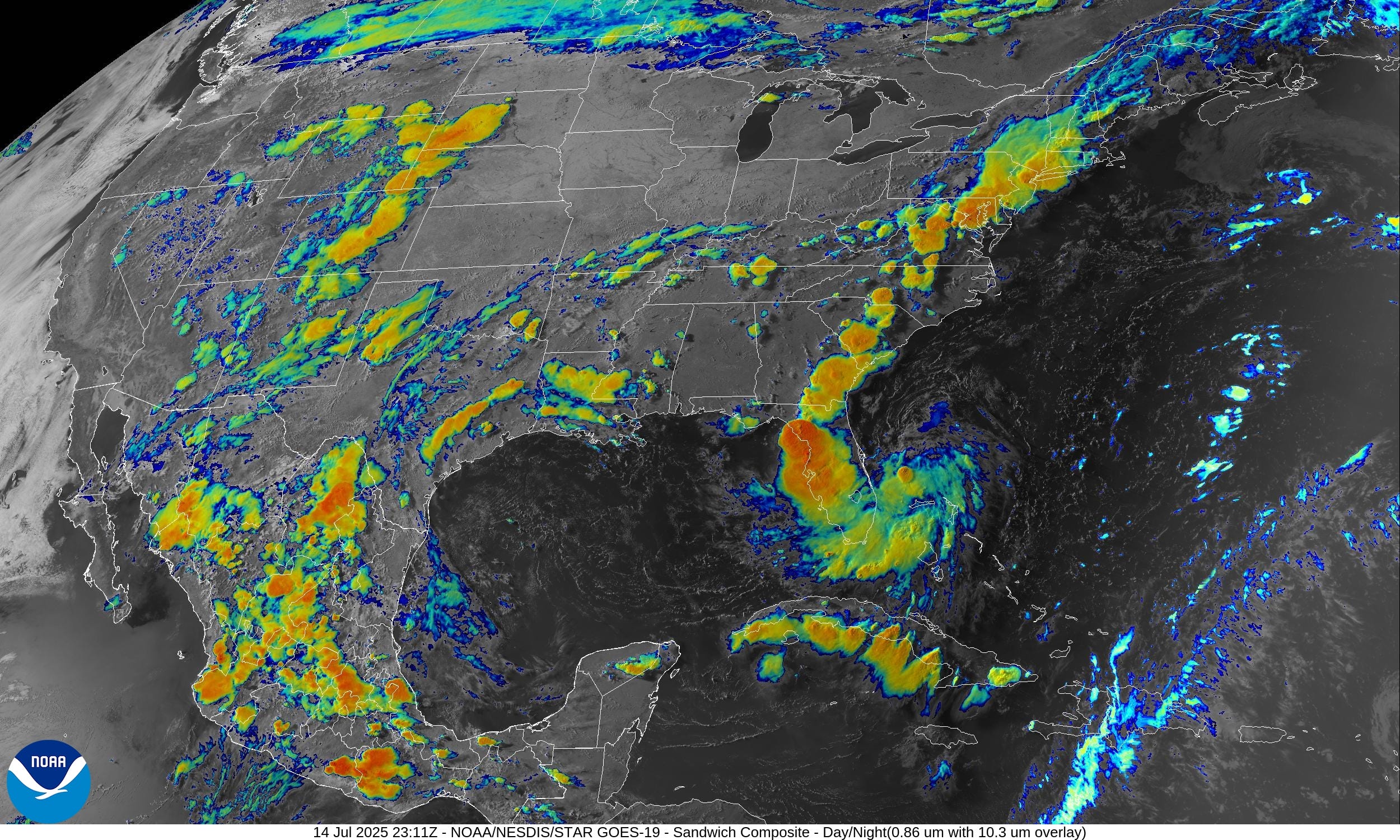
The system off of Florida looks impressive on this satellite imagery with a curved band of convection through Florida. Currently 30% chance of further tropical development in the coming days.
Current Radar
Florida needs the rain.
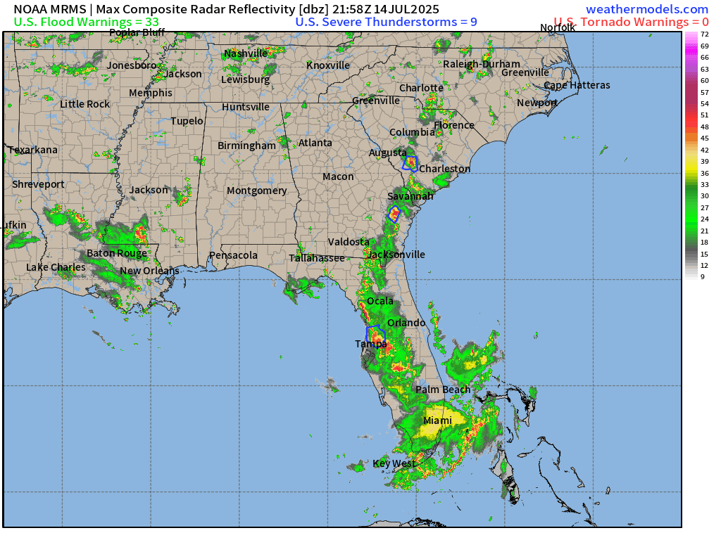
Boatloads of rain in NYC and Washington D.C.
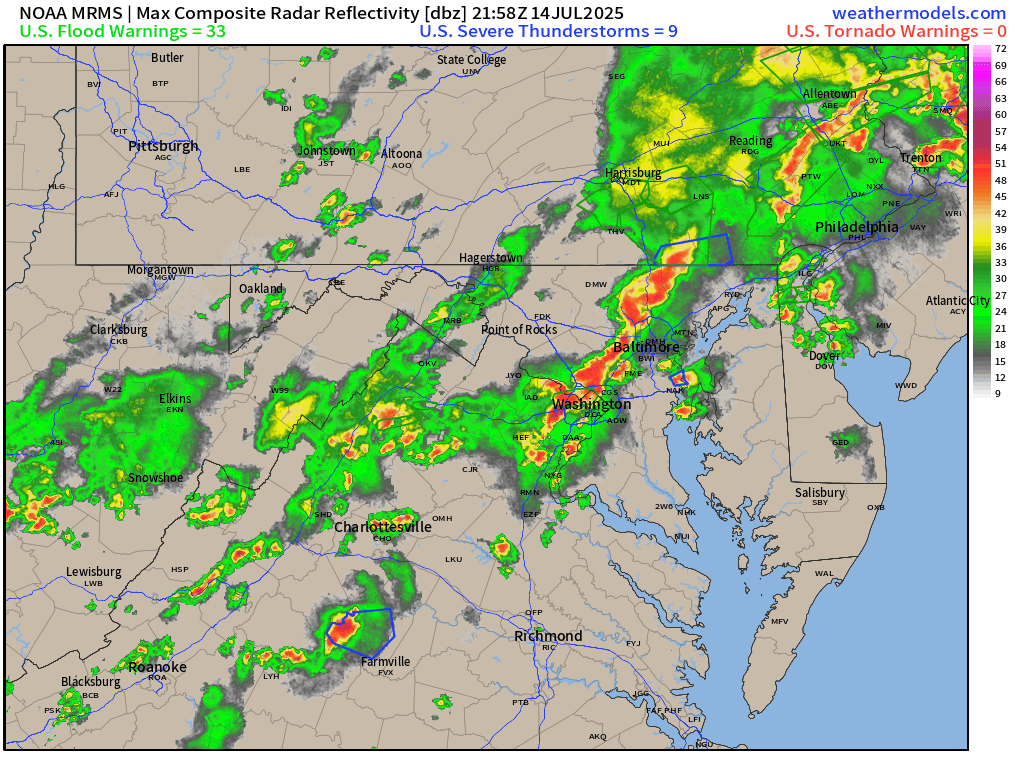

Frontal boundary moving through Ohio River Valley into the Mid-Atlantic and Northeast helping to direct the tropical moisture up I-95 corridor. Current weather:
Temperatures | 6:15 PM ET

Temperature Anomaly | 6:15 PM ET

Overall, the Lower 48 is 2.2°F above average
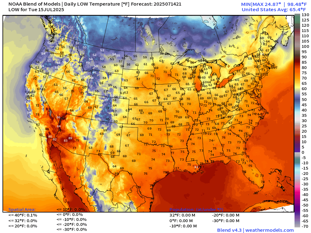
Lows Tuesday morning
Highs for Tuesday

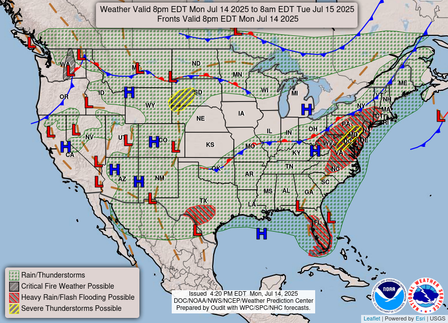
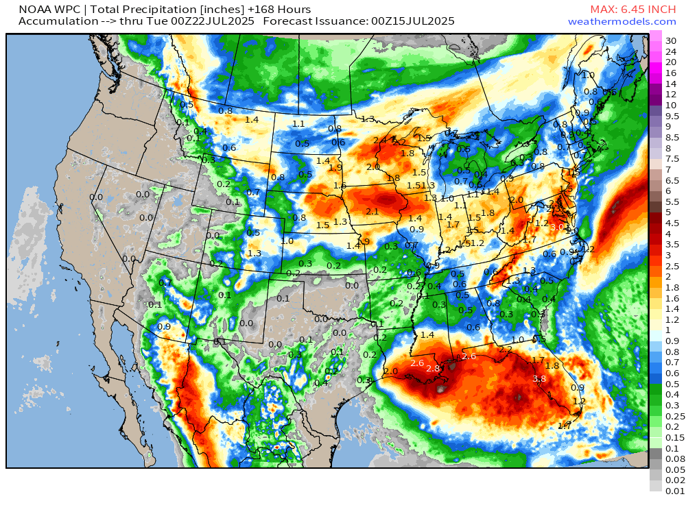
NWS Precipitation Next 48-hours

Tropical disturbance (Invest 93L)

NWS WPC Precipitation Next 7-days
Height Anomaly | AIFS 12z | Next 8-days
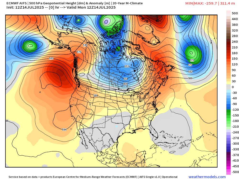
The main trough at 500 mb sets up over Hudson Bay helping to direct cooler air out of Canadian Arctic into the northern U.S.
Weekly Temperature Anomaly | ECMWF 12z Ensembles


Note the blue and green on the weekly maps — as an Arctic blast infiltrates the upper-Midwest and Northern Rockies. Yes, cold and some snow in mid-July. This is not the signal you’d expect for a “heat dome” or climate fueled summer.
Thank you to readers continuing into this Hurricane Season. My goal is to keep you informed about ongoing extreme weather events inside and outside of the tropics, but also a week (hopefully) heads up on what’s coming. I’ll be using a variety of weather modeling output, some of it may be unfamiliar, but it’s state-of-the-art and industry leading standard.
Atlantic Basin Outlook
Keep reading with a 7-day free trial
Subscribe to Weather Trader to keep reading this post and get 7 days of free access to the full post archives.