


July 13, 2025 Hurricane Season Sunday
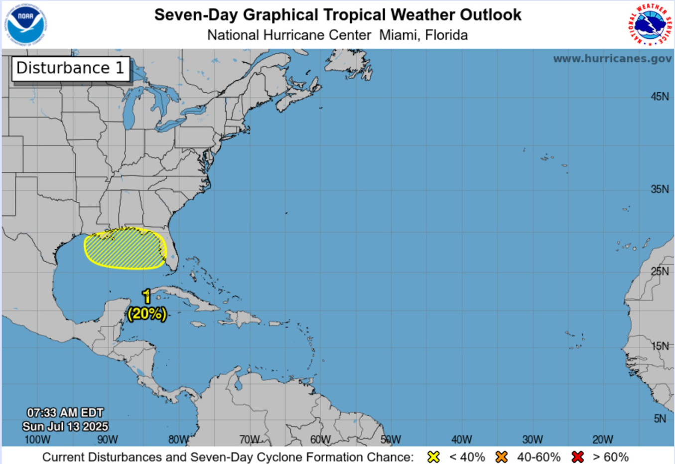
Outside chance of system (20%) in northern Gulf but rest of tropics very quiet

2025 Atlantic Hurricane Season [Day 43]. My expectation for this year is 14 named storms, 7 hurricanes, and 3 majors. So far, 3 named storm, 0 hurricanes, and 0 majors.
Sunday’s Tropical Update
Atlantic Basin: Outside chance of system along Gulf coast (20%) later this coming week with limited model support
Eastern Pacific Basin: The basin has also gone completely dormant with ensembles blank through 2-weeks.
Western Pacific Basin: TS Nari (06W) and a Subtropical Depression (07W) continue northward around Japan.
Current Satellite Imagery | United States
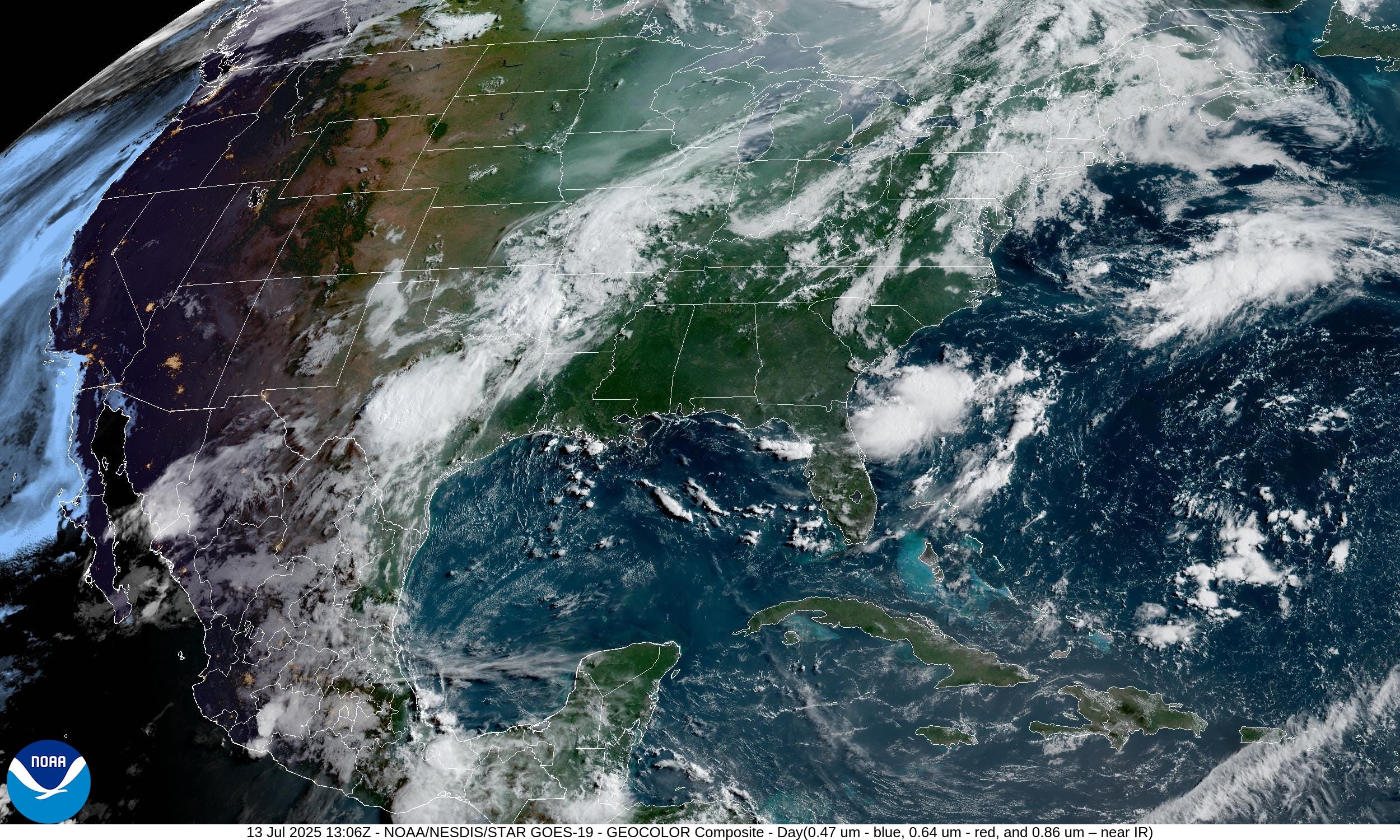
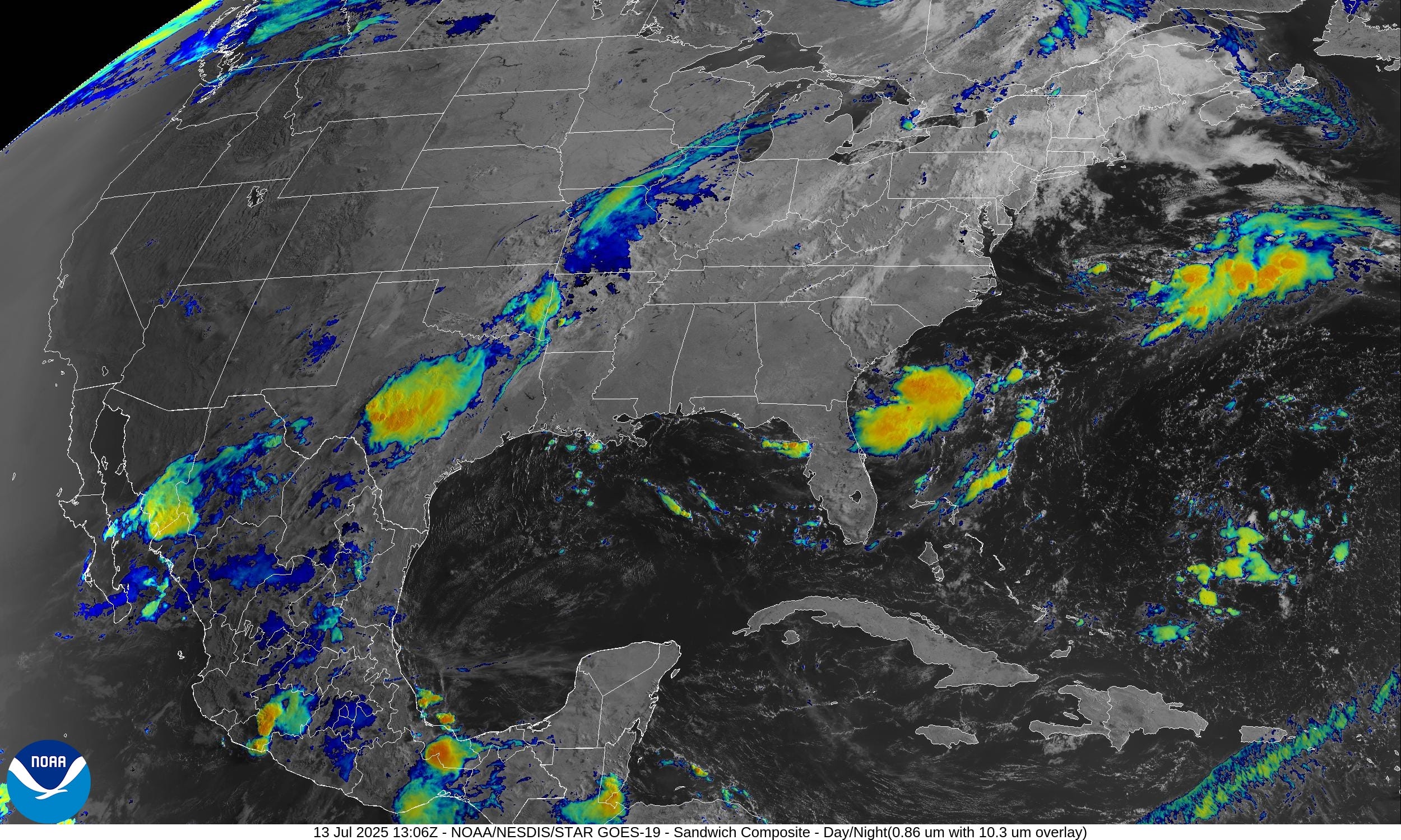
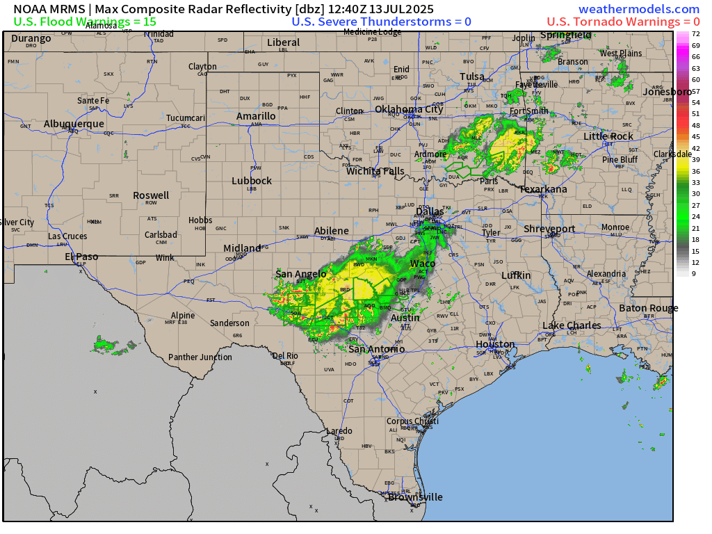
Ongoing showers and storms in Texas Hill County — yet again — with a convective cluster rather stationary between San Angelo and San Antonio.
Current Radar
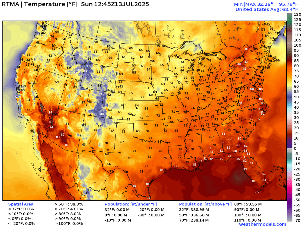
Temperatures | 8:45 AM ET
Temperature Anomaly | 8:45 AM ET

Overall, the Lower 48 is 1.2°F above average
Highs for Sunday

90s down to 129 million across the Lower 48 but overall average high is 89°F
Lows Monday morning

Highs for Monday
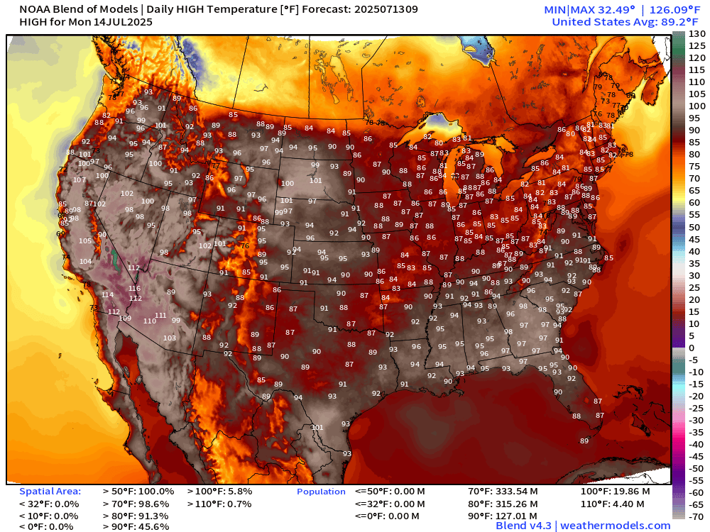
Hotter than usual across the Southeast in the mid-90s and continued very hot across the Southwest with 20 million at/above 100°F
Integrated Vapor Transport Next 8-Days
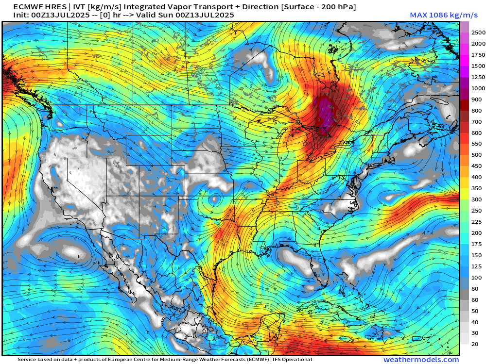
A persistent atmospheric river out of the Caribbean heads into the Western Gulf of Mexico and then rotates northward through Texas around an extension of the Bermuda High and subtropical ridge.
Troughs out of the Northwest and Canada continue to impinge upon the northern Rockies and the Great Lakes. This pattern has been in place since mid-June without budging.
Tropical disturbance crosses the Florida peninsula from east to west and has a 20% chance of developing into a TS according to NHC. ECMWF 00z was not a buyer.
NWS Precipitation Next 48-hours

Tropical disturbance
More rainfall — welcome for Florida.

NWS WPC Precipitation Next 7-days

“Arctic Blast”
Nice to look at the “winter” maps again in mid-July to see the progress of multiple Arctic polar vortex (tropospheric) vorticity centers aloft — able to steer cooler polar air southward into Canada and the Lower 48.
The ability of polar air to dent the Lower 48 air in mid-July is rare and is mostly reflected in cooler overnight temperatures.
Height Anomaly | AIFS 06z | Next 8-days
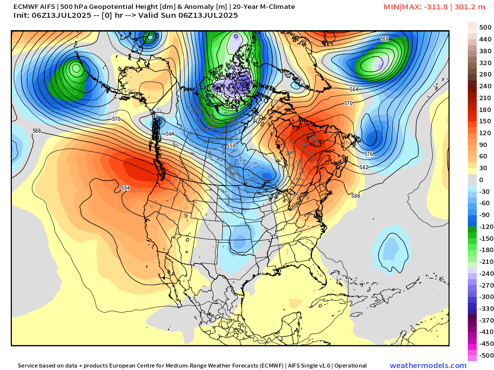
The main trough at 500 mb sets up over Hudson Bay helping to direct cooler air out of Canadian Arctic into the northern U.S.
Weekly Temperature Anomaly | ECMWF 00z Ensembles


Note the blue and green on the weekly maps — as an Arctic blast infiltrates the upper-Midwest and Northern Rockies. Yes, cold and some snow in mid-July. This is not the signal you’d expect for a “heat dome” or climate fueled summer.
Thank you to readers continuing into this Hurricane Season. My goal is to keep you informed about ongoing extreme weather events inside and outside of the tropics, but also a week (hopefully) heads up on what’s coming. I’ll be using a variety of weather modeling output, some of it may be unfamiliar, but it’s state-of-the-art and industry leading standard.
Atlantic Basin Outlook
Keep reading with a 7-day free trial
Subscribe to Weather Trader to keep reading this post and get 7 days of free access to the full post archives.