


July 11, 2025 Hurricane Season Friday
Tropics remain quiet in the Atlantic for the next 1-2 weeks

2025 Atlantic Hurricane Season [Day 41]. My expectation for this year is 14 named storms, 7 hurricanes, and 3 majors. So far, 3 named storm, 0 hurricanes, and 0 majors.
Friday’s Tropical Update
Atlantic Basin: Nothing brewing for next 7-days, or 2-weeks from Ensembles
Eastern Pacific Basin: The basin has also gone completely dormant with ensembles blank through 2-weeks.
Western Pacific Basin: A new tropical storm has formed but won’t affect land.
Current Satellite Imagery | United States
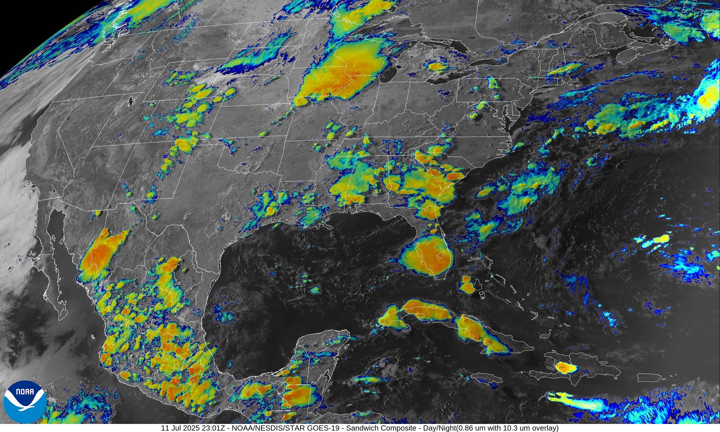
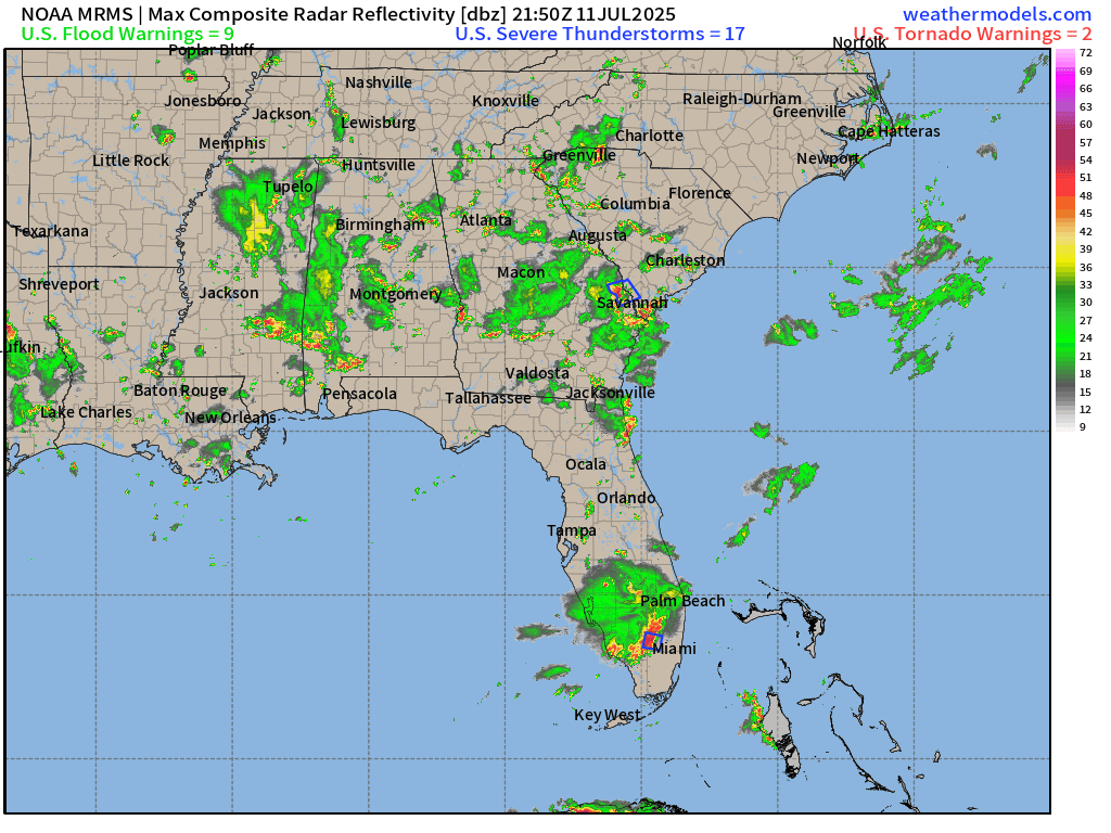
Scattered showers and storms — typical summer day across the Southeast.
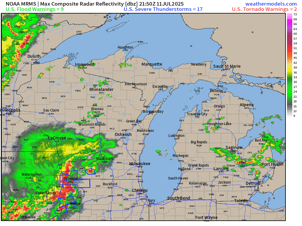
Impressive severe weather - thunderstorm complex with damaging winds heading toward Chicago and then Southern Michigan.

Temperatures | 6:45 PM ET

Temperature Anomaly | 6:45 PM ET

Overall, the Lower 48 is 0.2°F above average
Lows Saturday morning

Chilly in the northern Rockies. 60s and 70s across the central and eastern U.S.
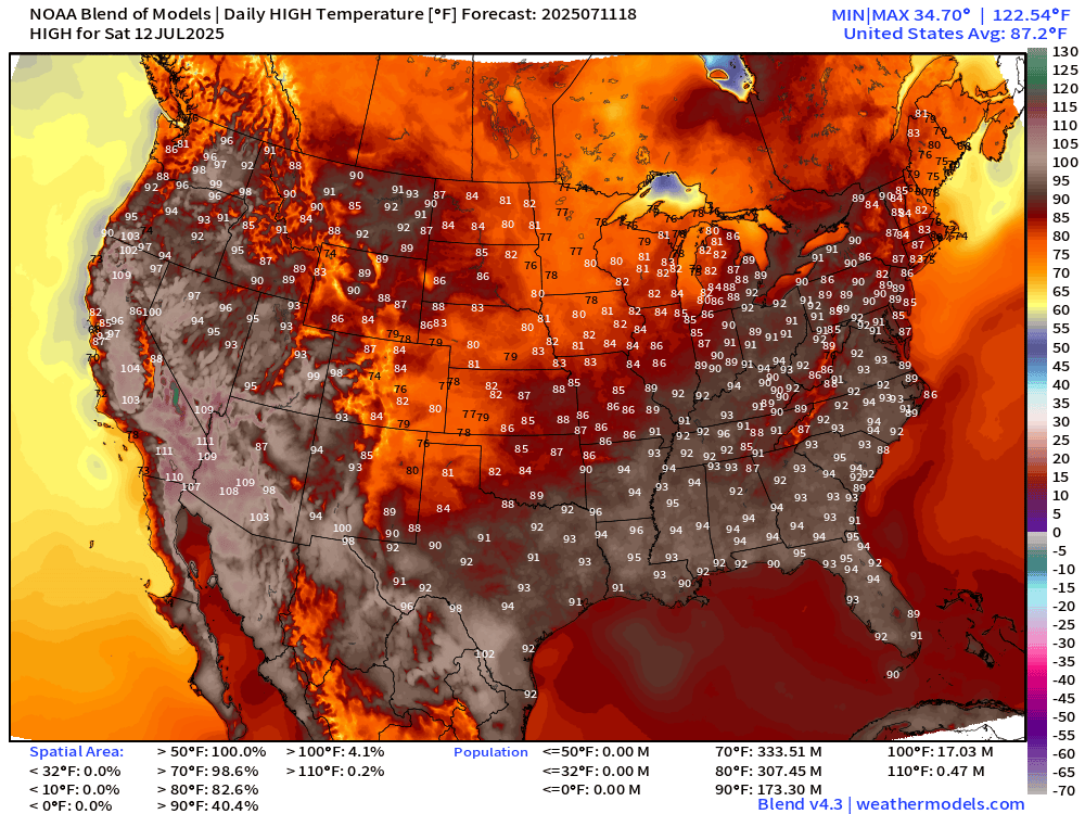
Highs for Saturday

HOT for 175 million at/above 90°F and 17M at least 100°F. Almost 90% of the United States population is at least 80°F for high temperatures = summer in America.
High Temperatures Next 8-days through Sunday July 20
NWS Precipitation Next 48-hours

NWS WPC Precipitation Next 7-days

HUGE rainfall totals across Florida, and the moisture feed out of the Gulf of Mexico dumps at least 2-inches in the central U.S.
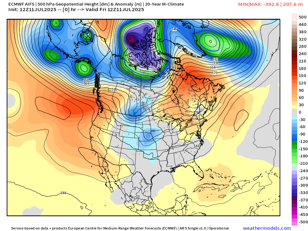
Arctic Blast

Chilly Arctic air associated with a very intense trough in the Canadian polar region will be dragged southward into the northern Rockies and Great Lakes.
The prevalence of Canadian troughs is so far the message of the 2025 Summer with trend toward cooler weather remaining wet and unsettled.
Height Anomaly | AIFS 12z | Next 10-days
Weekly Temperature Anomaly | ECMWF 12z Ensembles


Note the blue and green on the weekly maps — as an Arctic blast infiltrates the upper-Midwest and Northern Rockies. Yes, cold and some snow in mid-July. This is not the signal you’d expect for a “heat dome” or climate fueled summer.
Thank you to readers continuing into this Hurricane Season. My goal is to keep you informed about ongoing extreme weather events inside and outside of the tropics, but also a week (hopefully) heads up on what’s coming. I’ll be using a variety of weather modeling output, some of it may be unfamiliar, but it’s state-of-the-art and industry leading standard.
Keep reading with a 7-day free trial
Subscribe to Weather Trader to keep reading this post and get 7 days of free access to the full post archives.