


July 11, 2024 Thursday Weather Update
Extreme heat continues across much of the Lower 48 until next week

Thursday Headlines
Extreme summertime heat will spread across the Lower 48 for the next week before some relief from a Canadian cold front / trough middle of next week.
Tropical disturbance along the Southeast U.S. coast unlikely to develop into a named storm (10%) but provide boatloads of rainfall for Carolinas into mid-Atlantic over next 3-days
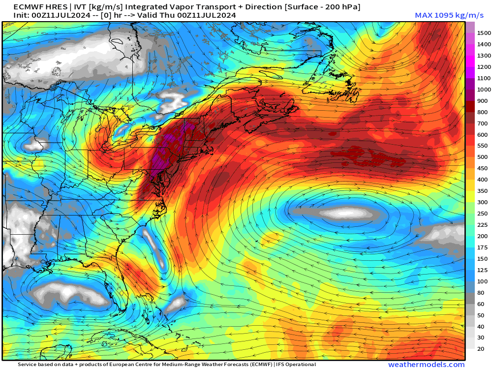
Monstrous ridge (500 hPa heights > 630 dm) over the Western Atlantic off the East Coast. The circulation around the ridge is actually creating a massive anticyclonic atmospheric river!

Integrated Vapor Transport (my favorite weather parameter along with precipitable water) shows well the combination of the tropical disturbance blocked by the over-ocean heat-dome or mega-ridge w/clockwise circulation. Very cool.

Blend of Models High Temperatures Next 8-days
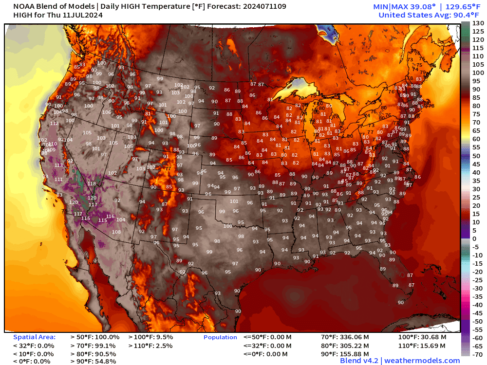
100s expected across the Plains into Nashville and Atlanta by early next week. Washington D.C. also another chance at 100°F.
Lower 48 average temperatures pushing 93°F (!)
9:45 AM ET Temperatures

Dry air has settled across much of the Lower 48 with moderate temperatures mainly in the 70s with lower-80s along the East Coast.
Thursday High Temperatures & Weather

Lower 48 Average: 90.4°F | 152 Million at/above 90°F | 30.5 M at/above 100°F
Heavy Rainfall over the next 48-hours from Tropical Disturbance off East Coast
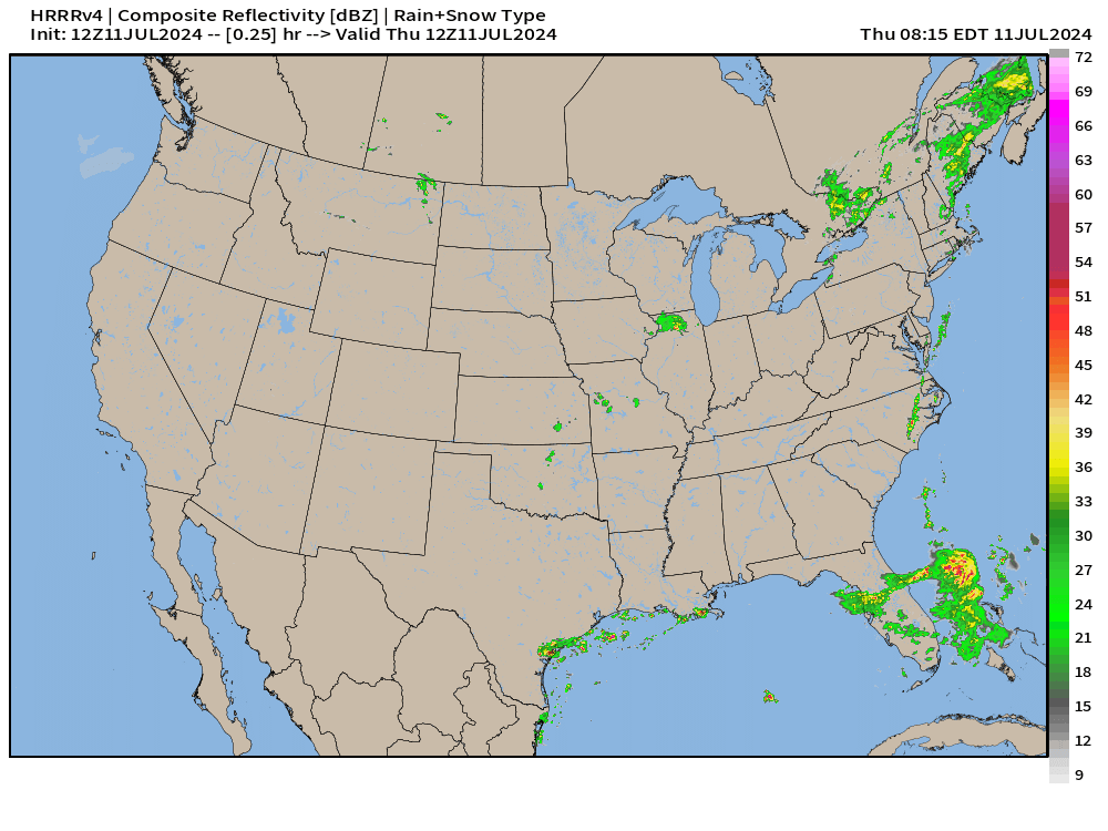
Up to 4-inches in North Carolina over the next 72-hours.

Welcome rainfall and cloud cover from the tropical moisture plume

Ensemble Tropical Storm Tracks Next 15-days
Keep reading with a 7-day free trial
Subscribe to Weather Trader to keep reading this post and get 7 days of free access to the full post archives.