


July 1, 2025 Hurricane Season Tuesday
Frontal boundary across Florida could spur tropical development into weekend

2025 Atlantic Hurricane Season [Day 31]. My expectation for this year is 14 named storms, 7 hurricanes, and 3 majors. So far, 2 named storm, 0 hurricanes, and 0 majors.
Tuesday’s Tropical Update
Atlantic Basin: NHC watching the Gulf coast and SE coast for a potential frontal wave developing into a tropical system this weekend (30%)
Eastern Pacific Basin: Hurricane Flossie may become a major (Category 3) in next 12-hours prior to rapidly weakening over cooler water later Wednesday.
Western Pacific Basin: TD 04W is underway ESE of Japan, but another system (Invest 98W) is forecast to become a powerful Typhoon near Taiwan.
Current Satellite Imagery | United States
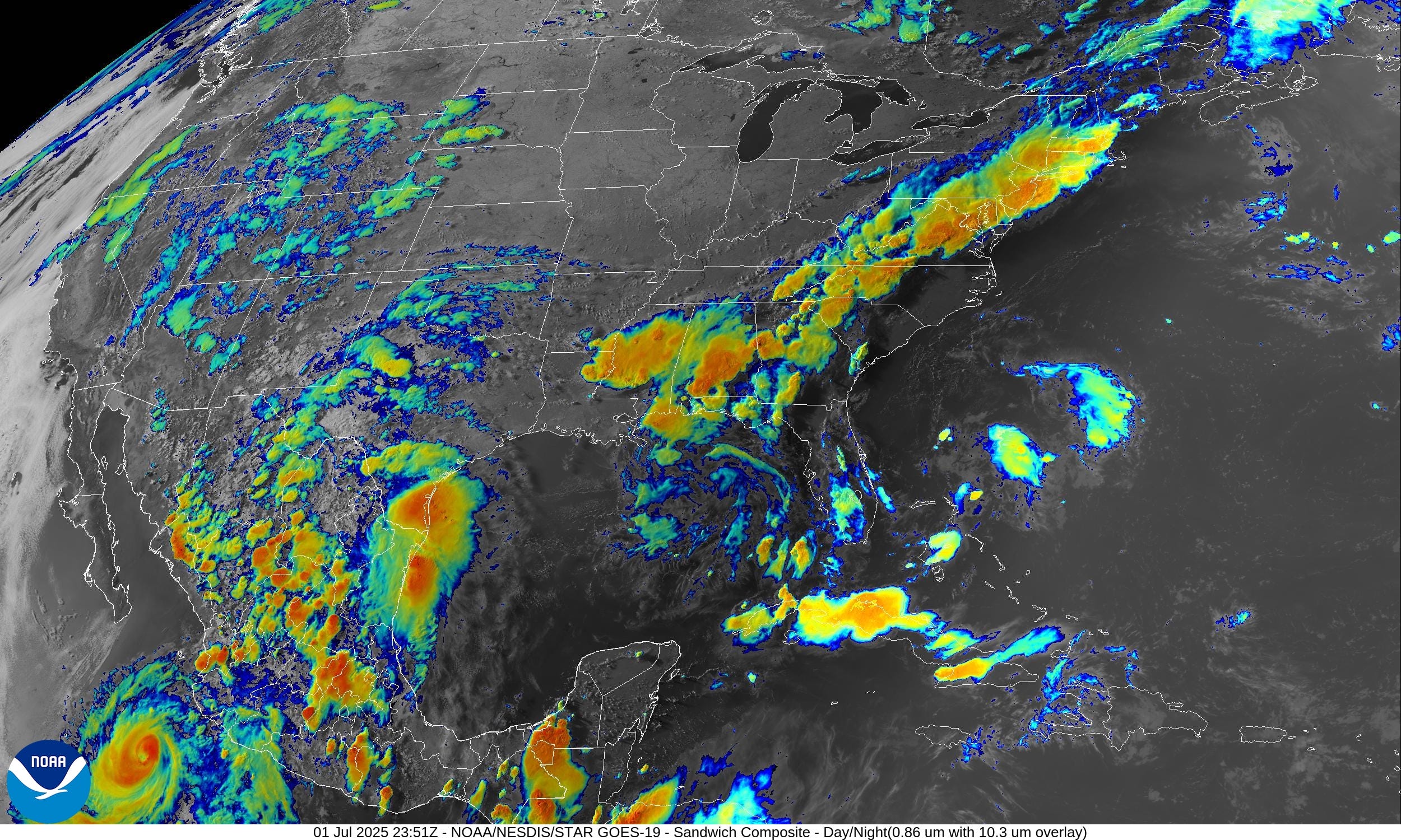
Hurricane Flossie is in the left corner (110 mph winds) and pop-up convection with monsoonal flow — assisted by the circulation around Flossie — is bubbling up in Mexico, Texas, and even into the Southwest including around Las Vegas.
Frontal boundary is draped from New England through Mid-Atlantic and into the Southeast. We will watch this boundary become stationary and perhaps focus the development of a tropical system in 5-7 days.
Temperatures | 7:30 PM ET

Clouds and showers have knocked down temperatures east of the Mississippi. Only 47 million at/above 90°F across the rest of the Lower 48. However, almost 5 million of those are at least 110°F including Phoenix.
Temperature Anomaly | 7:30 PM ET

Overall, the Lower 48 is 1.1°F above average with the most warmth in the Pacific NW and northern Rockies. Rain/clouds cooling off western Texas and New Mexico.
Lows for Wednesday Morning

60s look quite popular across the northern half of the Lower 48 — comfortable for July 2nd!
Highs for Wednesday

76 million at/above 90°F isn’t remarkable for early July. This is a wet/unsettled pattern that favors mild temperatures — no heat dome!
Weather This Evening

Showers and storms will fizzle into the overnight hours as the CAPE is used up. Heaviest rain in the Mid-Atlantic with slower moving frontal boundary storms embedded within a moist SW flow.
HRRR Radar Simulation Next 18-hours | through 11 AM Wednesday
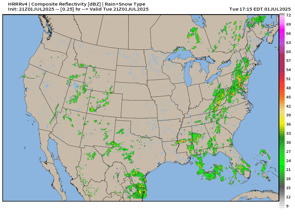
Weather on Wednesday

Heavy rain and storms in the Southwest on Wednesday with monsoon moisture tempering the heat.
NWS Precipitation Next 24-hours


Next 48-hours across Arizona | Rain and Storms

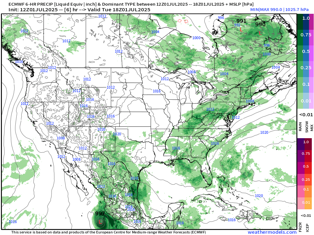
NWS WPC Precipitation Next 7-days

Tail end of a frontal boundary stalls out over the Gulf Coast focusing heavy rain for days. An area of low pressure could also develop leading to even more rain across the FL peninsula.
ECMWF 12Z | Integrated Vapor Transport | Next 8-days
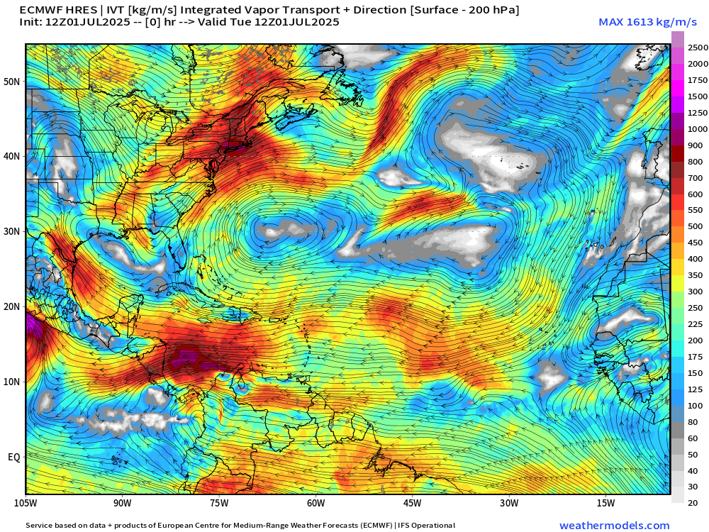
While the tail end of the frontal boundary takes a while to start circulating, there is a mid-level cyclonic swirl that could translate to the surface over the very warm Gulf Stream waters off the U.S. Southeast coast around Sunday time frame (with ECMWF 12z).
Note, another little low may spin (similar to Andrea) out of the tail end of trough passing through the mid-latitude Atlantic.
These non-traditional tropical storm formation routes are typical in early part of the season. As the Atlantic subtropics are abnormally warm, stationary fronts or cut-off troughs find favorable environment for further development.
Thank you to readers continuing into this Hurricane Season. My goal is to keep you informed about ongoing extreme weather events inside and outside of the tropics, but also a week (hopefully) heads up on what’s coming. I’ll be using a variety of weather modeling output, some of it may be unfamiliar, but it’s state-of-the-art and industry leading standard.
Next 8-days MSLP + Precipitation | ECMWF 12z
Flossie quickly decays over cooler water west of Baja California.
The system off the SE Coast is not well organized in the ECMWF 12z cycle. However some ensembles are more interesting. 30% looks about right for development chance.
Atlantic Basin Outlook

30% chance of development — next 7-days from NHC
Keep reading with a 7-day free trial
Subscribe to Weather Trader to keep reading this post and get 7 days of free access to the full post archives.