


July 1, 2024 Tropical Update: Monster Hurricane Beryl
Beryl nearing Category 5 in the Caribbean

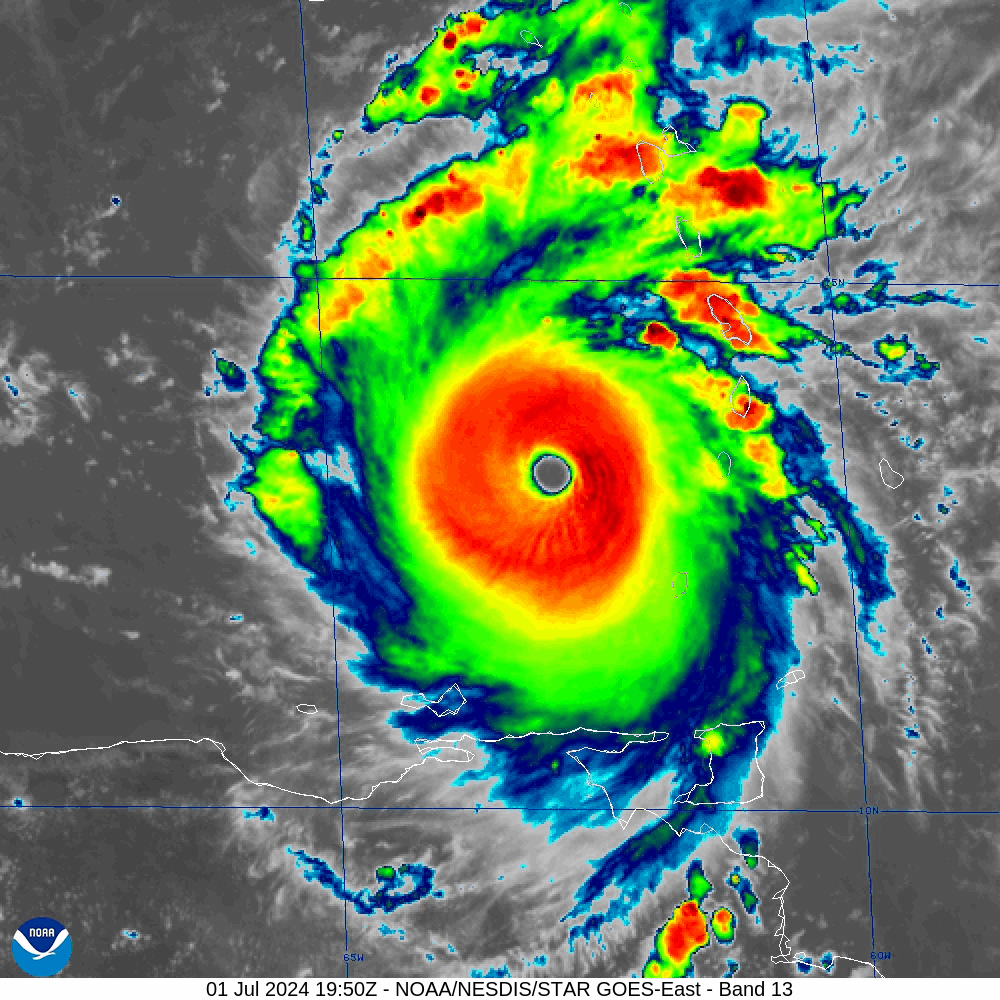
Apex of Hurricane development in early July in the Caribbean: Hurricane Beryl as a high-end Category 4 — on way to potentially Category 5 (this update will be out before NHC 5 pm advisory) with a warm, clear eye and symmetric convective canopy. Hard to find a better example of axisymmetric structure.
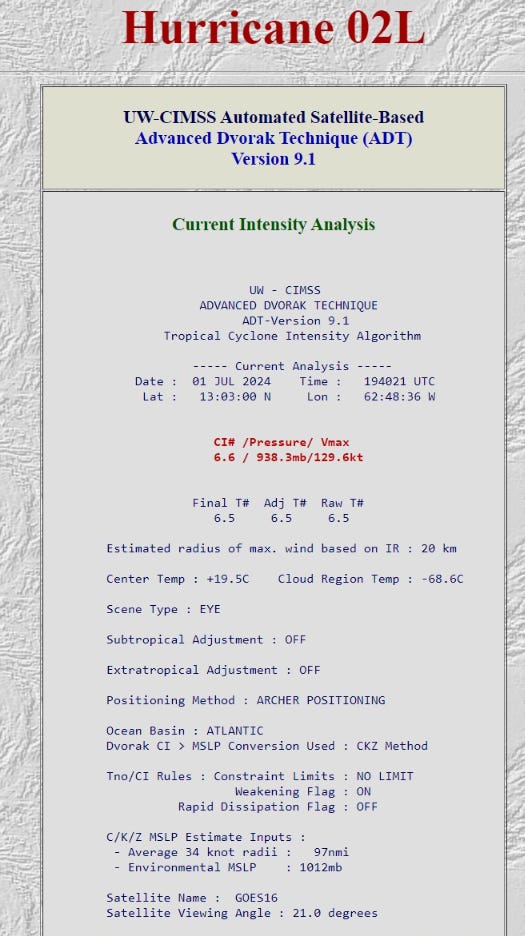
Advanced Dvorak Technique (ADT) values have been very close to the aircraft recon upon which they are partly trained with T 6.5 = 125 knots maintained for several hours now, as Beryl enters a sort-of annular state.
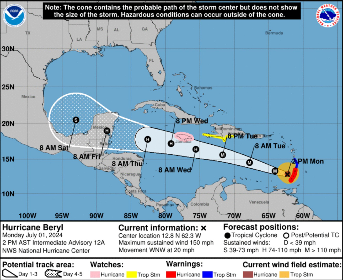
The hurricane should be near Jamaica at slightly less than major intensity by early Wednesday before heading west to Yucatan Peninsula of Mexico. Note, the Saturday Day 5 position is in the southern Gulf of Mexico at Tropical Storm strength at about 20°N latitude. That graticule is the key to watch going forward with model and NHC forecasts: any rightward deviation to the north would be incrementally more threatening to Texas Gulf Coast and allow more of Beryl to remain over the very, very warm waters of the NW Caribbean.
Weather Trader is a reader-supported, daily newsletter. To receive new posts and support our R&D, consider becoming a free or paid subscriber.
USA Impacts down the road?

We still can’t completely rule out the possibility of this northward bend in the Gulf of Mexico with some models (HWRF) and some ensembles showing that solution.
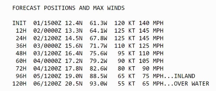
Indeed, the ECMWF EPS shows a significant minority (~15 / 51) with a recurvature scenario into Texas or even Louisiana. That’s still a 25% to 33% chance. The NHC forecast does not currently extend past Day 5, but the coordinated position on the Day 7 WPC map surface prognostication suggests a [slight] northward jaunt.
Keep reading with a 7-day free trial
Subscribe to Weather Trader to keep reading this post and get 7 days of free access to the full post archives.